The best hikes from bus stations around Santa Clara-A-Velha
4.4
(157)
485
hikers
9
hikes
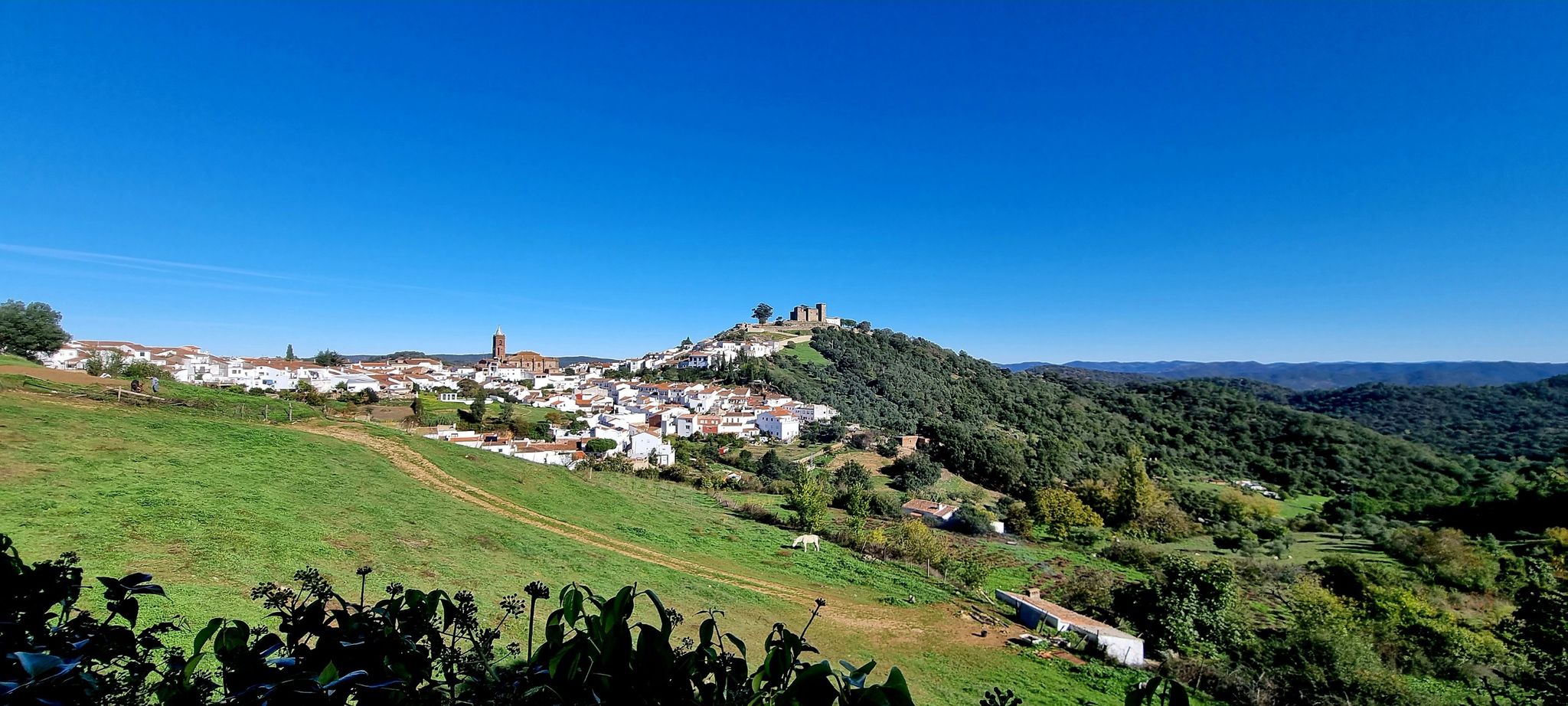
Bus station hiking trails around Santa Clara-A-Velha offer access to the diverse landscapes of Portugal's Alentejo region. The area is characterized by green hills, river valleys, and the expansive Santa Clara Dam and its reservoir. The Mira River flows through the region, contributing to fertile riverine lands and varied vegetation including cork oak trees, orange groves, and mimosas. This natural setting provides a tranquil environment for outdoor activities.
Best bus station hiking trails around Santa Clara-A-Velha
- The most popular bus station hiking route is Santa Clara Dam – Santa Clara River Beach loop from Santa Clara-a-Velha, a 6.2 miles (10.0 km) moderate trail that takes 2 hours 46 minutes to complete. This route offers views of the dam and reservoir.
- Another top favourite among local hikers is River in Santa Clara loop from Santa Clara-a-Velha, a moderate 8.1 miles (13.0 km) path. This trail explores the riverine landscapes and surrounding hills, with an elevation gain of over 230 meters.
- Local hikers also love the Ponte D. Maria – River in Santa Clara loop from Santa Clara-a-Velha, a 3.1 miles (5.1 km) trail leading through river scenery, often completed in about 1 hour 22 minutes.
- Hiking around Santa Clara-A-Velha is defined by green hills, river valleys, and the Santa Clara Dam and Reservoir. The network offers options for both easy and moderate ability levels, with 9 trails available.
- The routes in Santa Clara-A-Velha are highly rated by the komoot community with an average score of 4.4 stars from more than 130 reviews. More than 450 hikers have used komoot to explore Santa Clara-A-Velha's varied terrain.
Last updated: July 24, 2026
4.5
(35)
111
hikers
9.98km
02:53
220m
220m
Moderate hike. Good fitness required. Easily-accessible paths. Suitable for all skill levels.
5.0
(3)
15
hikers
13.0km
03:36
230m
230m
Moderate hike. Good fitness required. Easily-accessible paths. Suitable for all skill levels.
4.2
(5)
6
hikers
Easy hike. Great for any fitness level. Easily-accessible paths. Suitable for all skill levels.
Get access to more routes and recommendations from other explorers.
Sign up for free
Already have an account?
Our route recommendations are based on thousands of hikes, rides, and runs completed by other people on komoot.
Start today with a free account
Your next adventure awaits.
Login or Signup
Popular around Santa Clara-A-Velha
Other adventures around Santa Clara-A-Velha

Tips from the Community

River beach with support, next to the dam wall and close to the dam hotel.👍
0
0
Very pleasant space for a rest and/or snack. There is drinkable and very fresh water.👍
0
0
The D. Maria Bridge, also known as Ponte Velha and mistakenly as Ponte Romana, consists of the ruins of a historic bridge over the Mira River, located in the village of Santa Clara-a-Velha, Municipality of Odemira, in Portugal. It was probably built in 1822, although it may have replaced an older structure, as Santa Clara-a-Velha has been a traditional crossing point of the Mira River since Roman times. Still in the 19th century, it began to suffer from serious conservation problems, eventually collapsing partially in the 20th century. It was classified as a Property of Municipal Interest in 2006.
1
0
The Ribeira de Santa Clara (also locally referred to as the initial stretch of the Mira river) in Santa Clara-a-Velha, Odemira, is the heart of one of the most serene regions of the Alentejo interior, dominated by the imposing Santa Clara Reservoir. With a water surface covering approximately 1986 hectares, it is one of the largest reservoirs in Europe, offering ideal conditions for swimming, water sports, and fishing.
0
0

The Mira River is the soul of this region, feeding it through an ingenious system of canals that distribute its water throughout the landscape. Despite being shaped by human hands, the reservoir of the Santa Clara dam dazzles with its natural beauty. From the top of the enormous dam wall, the view over this immense lake is breathtaking, and, on the banks, the river beach, one of the best in the Alentejo, invites you to take a refreshing dip.
5
0

Here you can enjoy your drinking water and take a rest in the shade.
3
0

Nice Tourism office that can by a bivouac place for cyclists. Cycling center with lots of information.
1
0
Frequently Asked Questions
How many bus station hiking trails are available in Santa Clara-A-Velha?
There are 9 hiking routes accessible from bus stations around Santa Clara-A-Velha. These trails offer a range of experiences, from easy strolls to more moderate adventures.
What do other hikers say about the trails around Santa Clara-A-Velha?
The trails in this region are highly rated by the komoot community, with an average score of 4.4 stars from over 130 reviews. Hikers often praise the serene natural beauty, the tranquil atmosphere, and the well-marked paths that make navigation straightforward.
When is the best time of year to hike from the bus station in Santa Clara-A-Velha?
The best time to hike in Santa Clara-A-Velha is generally outside the summer months. Due to high temperatures, it's advisable to avoid hiking during summer. Spring and autumn offer pleasant weather for exploring the region's green hills and river valleys.
Are there easy hiking options accessible from the bus station?
Yes, there are 3 easy hiking routes available from bus stations. One excellent option is the Ponte D. Maria – River in Santa Clara loop from Santa Clara-a-Velha, which is just over 5 km long and takes less than 1.5 hours to complete.
Are there circular routes starting from the bus station?
Yes, many of the routes accessible from bus stations in Santa Clara-A-Velha are circular. For example, the popular Santa Clara Dam – Santa Clara River Beach loop from Santa Clara-a-Velha is a moderate 10 km circular trail offering scenic views of the dam and reservoir.
What natural features or landmarks can I expect to see on these bus station hikes?
You'll encounter diverse landscapes, including the expansive Santa Clara Dam and its reservoir, the unique Mira River (one of Europe's few north-flowing rivers), and verdant hills dotted with ancient cork oak trees. The region is also known for its orange groves, fig and olive trees, and is a good spot for birdwatching, with the azure winged magpie being a common sight.
Are there opportunities for wild swimming or water activities near the bus station trails?
Yes, the Santa Clara Dam reservoir offers opportunities for water activities. The Alento River Crossing (Rio Mira) and the Santa Clara River Beach are highly-rated spots for swimming and sunbathing on the reservoir's banks, easily accessible from some of the hiking routes.
Are there any viewpoints along the bus station hiking trails?
Absolutely. Many trails offer stunning vistas, particularly over the Santa Clara Dam and its reservoir. The View of the Santa Clara Dam and Gravel Roads highlight is a prime example, providing breathtaking panoramic views of the water and surrounding landscape.
What kind of landscapes will I encounter on these hikes?
The landscape is characterized by its green hills and river valleys, showcasing varied vegetation including orange groves, fig and olive trees, mimosas, willow, watercress, and water lilies. You'll also spot conspicuous and often ancient cork oak trees dotting the countryside, offering a tranquil and picturesque hiking experience.
How long do the bus station hikes typically take?
The duration of the hikes varies. Easy routes, like the Ponte D. Maria – River in Santa Clara loop, can take less than 1.5 hours. Moderate trails, such as the River in Santa Clara loop from Santa Clara-a-Velha (13 km), typically require around 3.5 to 4 hours to complete.
Can I bring my dog on these bus station trails?
Many trails in the Santa Clara-A-Velha region are suitable for dogs, allowing you to enjoy the natural beauty with your canine companion. However, it's always recommended to keep dogs on a leash and be mindful of local regulations, especially around protected areas or agricultural land.
Most popular routes around Santa Clara-A-Velha
Most popular attractions around Santa Clara-A-Velha

Get inspired with the komoot mobile app


Explore more
Browse the best Hikes in other regions.
