The best traffic-free bike rides around The Municipal District of Newcastle West
4.1
(11)
524
riders
18
rides
No traffic road cycling routes around The Municipal District of Newcastle West are set within a bowl-shaped valley, through which the River Arra flows, contributing to the region's scenic landscape. The area features extensive greenways, notably the Limerick Greenway, which offers smooth, traffic-free paths. Cyclists encounter varied terrain, including views of the Rooskagh Hills, Limerick Plains, and the Golden Vale, with some routes presenting significant elevation gains. The landscape is characterized by a mix of open fields, woodlands like Tullig Wood, and historical railway infrastructure.
Best no traffic road cycling routes around The Municipal District of Newcastle West
- The most popular no traffic road cycling route is Barnagh Tunnel – Desmond Hall loop from Newcastle West, a 49.1 miles (79.0 km) trail that takes 3 hours 13 minutes to complete. This moderate route includes the historic Barnagh Tunnel and offers expansive views across multiple counties.
- Another top favourite among local road cyclists is Ardagh Station – Desmond Hall loop from Newcastle West, a moderate 36.6 miles (58.9 km) path. This route features significant elevation gain and passes by historical sites like Desmond Hall.
- Local road cyclists also love the Listowel Castle loop from Feale, an 18.8 miles (30.3 km) trail leading through the scenic countryside, often completed in about 1 hour 12 minutes.
- Road cycling around The Municipal District of Newcastle West is defined by greenways, river valleys, and rolling hills. The network offers options for various ability levels, from easy, flat sections to more challenging routes with notable climbs.
- The routes in The Municipal District of Newcastle West are highly rated by the komoot community with an average score of 4.7 stars from 8 reviews. More than 450 road cyclists have used komoot to explore The Municipal District of Newcastle West's varied terrain.
Last updated: November 9, 2026
140km
06:19
1,470m
1,470m
Hard road ride. Very good fitness required. Mostly well-paved surfaces and easy to ride.
5.0
(1)
84
riders
79.1km
03:16
460m
460m
Moderate road ride. Good fitness required. Mostly well-paved surfaces and easy to ride.

4.0
(3)
30
riders
31.3km
01:17
140m
140m
Easy road ride. Mostly well-paved surfaces and easy to ride.
8
riders
Hard road ride. Very good fitness required. Some segments of this route may be unpaved and difficult to ride.
3
riders
57.2km
02:38
470m
470m
Moderate road ride. Good fitness required. Mostly well-paved surfaces and easy to ride.
Get access to more routes and recommendations from other explorers.
Already have an account?
Our route recommendations are based on thousands of hikes, rides, and runs completed by other people on komoot.
Start today with a free account
Your next adventure awaits.
Popular around The Municipal District of Newcastle West

Other adventures around The Municipal District of Newcastle West


Tips from the Community

The Foynes Walk is a nice twisty trail through mixed woodland on the southern banks of the River Shannon. This viewpoint overlooks the estuary, which is a busy seaport, watch the container ships as well as the pleasure craft sailing past.
0
0

The Limerick Greenway Trail is a 40 km (25 mile) multi-user trail between Limerick and Kerry on old railway paths. It's well maintained and surfaced making it easy walking and suitable for bikes, buggies and wheelchairs.
0
0

A lovely small multi-use park that offers an array of amenities for all ages, and ideal for quiet walks and cycling. There's an 18-hole Pitch & Putt golf course, children’s playground, tennis courts, rugby and football pitches.
0
0
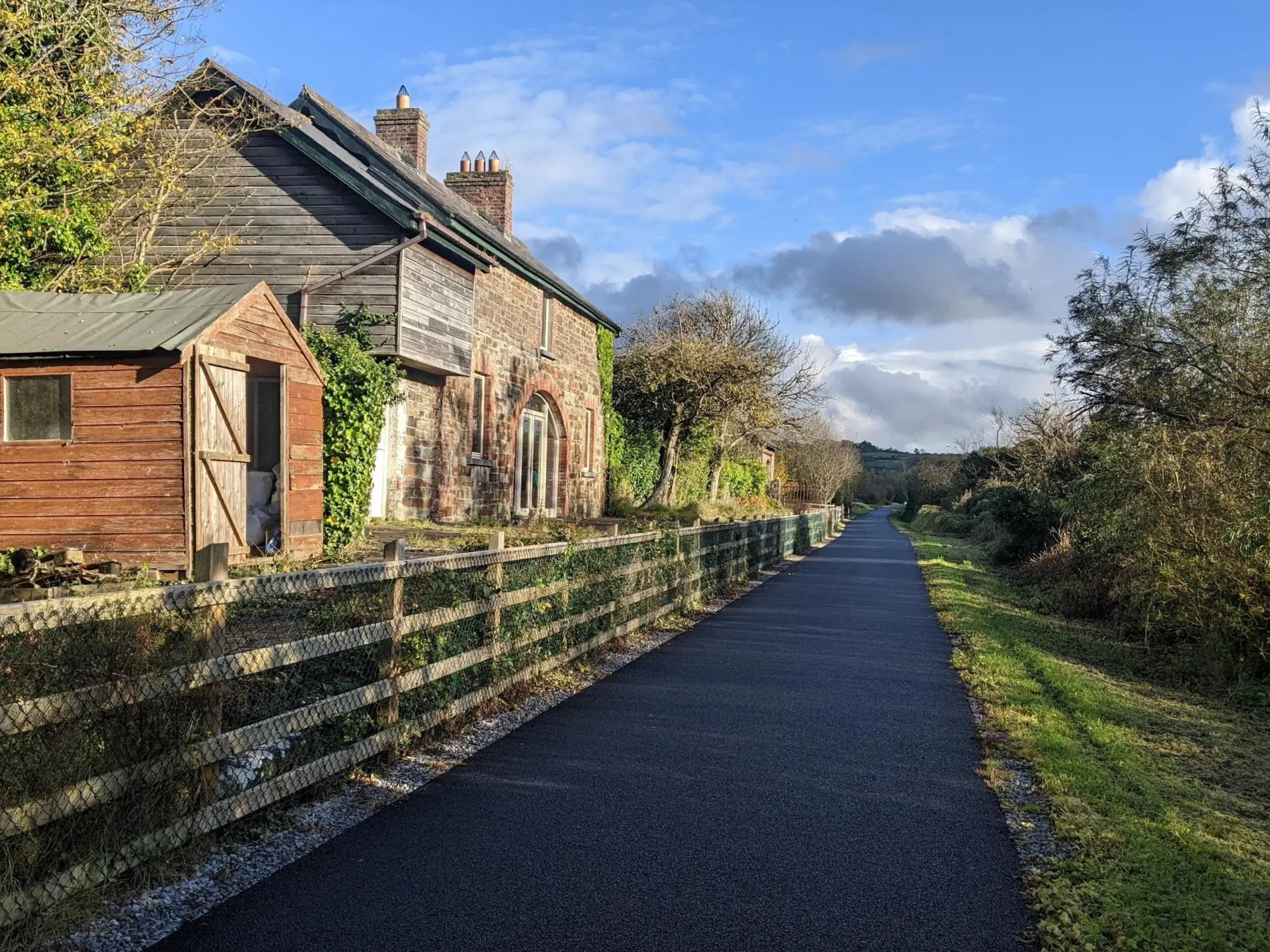
Opened in 1867, it served as a station along the Limerick to Tralee railway line for the next 155 years. It was eventually closed to passenger trains in 1963 and laid derelict until the station house was restored in 2021 as part of the Greenway project.
1
0

The striking remains of Castle Liscarroll tower over the village and surrounding countryside. Over the years it has stood witness to much bloodshed, including The Battle of Liscarroll in 1642 which saw over 600 people killed. Note that the monument is for external viewing only, internal access is not permitted.
1
0

The Limerick Greenway offers a seamless, traffic-free experience for cyclists, walkers, and joggers, tracing the path of the historic Limerick to Kerry railway line. This section links Templeglantine with Barnagh by passing through cuttings and embankments and under two stone bridges. There's a great picnic spot en route offering fabulous views of the Limerick countryside.
1
0
The Limerick Greenway follows the historic Limerick to Kerry railway line, providing a smooth traffic-free experience for cyclists, walkers and joggers. This section links the town of Abbeyfeale with the village of Templeglantine. You'll pass the restored station at Devon Road, once serving a local creamery and cut through the beautiful forest of Tullig Wood. The Greenway then flattens out as it runs parallel to the River Allaghaun.
0
0
Frequently Asked Questions
How many no traffic road cycling routes are available in The Municipal District of Newcastle West?
There are over 20 dedicated no traffic road cycling routes in The Municipal District of Newcastle West, catering to various skill levels. You'll find a good mix of easy, moderate, and challenging rides to explore.
What historical sites or natural features can I see along these no traffic road cycling routes?
Many routes offer glimpses of the region's rich history and natural beauty. For instance, the Barnagh Tunnel – Desmond Hall loop from Newcastle West passes by the historic Desmond Hall. The Limerick Greenway, a key traffic-free path, features the impressive Barnagh Station, Tunnel and Viewing Area, and sections like Abbeyfeale to Templeglantine run through Tullig Wood. You can also enjoy views of the River Arra and the expansive Limerick Plains.
Are there any scenic viewpoints on the car-free cycling routes?
Yes, the region offers several scenic viewpoints. The Barnagh Station, Tunnel and Viewing Area on the Limerick Greenway provides expansive views across Counties Clare, Cork, and Kerry, as well as the Limerick Plains and the Golden Vale. The Rooskagh Hills are also visible from certain sections of the Greenway, adding to the picturesque landscape.
What do other road cyclists enjoy the most about no traffic road cycling in The Municipal District of Newcastle West?
The area is highly rated by the komoot community, with an average score of 4.7 stars. Reviewers often praise the peaceful, traffic-free nature of the routes, especially the Limerick Greenway, and the beautiful, varied landscapes that make for a truly enjoyable cycling experience.
Where can I find parking for these no traffic road cycling trails?
Parking is generally available at key access points for the Limerick Greenway and other routes. For example, Newcastle West itself offers parking options, and there are designated parking areas at various trailheads along the Greenway, such as at Barnagh Station and Rathkeale, making it convenient to start your ride.
Is public transport available to access these routes?
While direct public transport specifically for cyclists to all trailheads might be limited, Newcastle West is a central hub in the district. You can research local bus services that connect to Newcastle West or other towns along the Limerick Greenway, which might allow for access to certain sections of the traffic-free routes.
Are there family-friendly no traffic road cycling routes?
Absolutely. The Limerick Greenway is particularly well-suited for families due to its entirely traffic-free nature and smooth surface. Sections like Newcastle West to Rathkeale or Barnagh to Newcastle West offer easy, safe riding for all ages. The Demesne Park in Newcastle West also provides a lovely setting for shorter, relaxed rides.
Are there routes suitable for beginners or those looking for an easy ride?
Yes, there are several easy no traffic road cycling routes. The Limerick Greenway offers many gentle, flat sections perfect for beginners. For example, the Listowel Castle loop from Feale is rated as easy, providing a pleasant ride without significant elevation challenges.
Are there more challenging no traffic road cycling routes for experienced cyclists?
While the focus is on no traffic, some routes incorporate more challenging elements. For instance, the Ballyseedy Woods – Picnic shelter with river view loop from Harnett's Devon Cross Filling Station is rated as difficult, featuring significant elevation gain. Other moderate routes like the Barnagh Tunnel – Desmond Hall loop from Newcastle West offer longer distances and some climbing, providing a good workout.
Can I find loop routes for no traffic road cycling?
Yes, many of the no traffic road cycling options are designed as loops, allowing you to start and finish in the same location. Examples include the Barnagh Tunnel – Desmond Hall loop from Newcastle West and the Ardagh Station – Desmond Hall loop from Newcastle West, providing convenient circular journeys.
Are there any cafes or places to stop for refreshments along these routes?
Yes, especially along the Limerick Greenway, you'll find various towns and villages that offer cafes, pubs, and shops where you can stop for refreshments. Newcastle West itself has numerous options, and smaller settlements along the Greenway often have local establishments catering to cyclists.
Are dogs allowed on the no traffic road cycling routes, especially the Limerick Greenway?
Generally, dogs are welcome on the Limerick Greenway, but they must be kept on a leash at all times. It's always a good idea to check specific local regulations or signage for any particular section you plan to cycle, especially regarding waste disposal.
Most popular routes around The Municipal District of Newcastle West
Most popular attractions around The Municipal District of Newcastle West

Get inspired with the komoot mobile app


Explore more
Browse the best Road cycling routes in other regions.
