The best traffic-free bike rides in Mark Twain National Forest
5.0
(2)
75
riders
3
rides
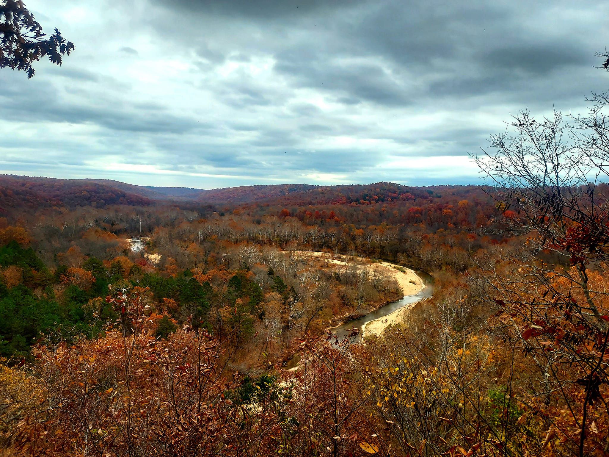
No traffic touring cycling routes in Mark Twain National Forest traverse a landscape characterized by the ancient Ozark Highlands, featuring rolling hills, extensive woodlands, and numerous springs and rivers. The forest offers a mix of paved and gravel roads, along with multi-use trails, suitable for various cycling preferences. This region is known for its diverse natural features, including glade ecosystems and unique geological formations. Touring cyclists can explore routes that wind through dense forests and along scenic waterways.
Best no…
Last updated: May 11, 2026
7
riders
29.1km
01:48
210m
210m
Moderate bike ride. Good fitness required. Mostly paved surfaces. Suitable for all skill levels.
8
riders
32.8km
02:51
70m
70m
Moderate bike ride. Good fitness required. Mostly paved surfaces. Suitable for all skill levels.

Sign up for free
6
riders
52.9km
04:44
150m
150m
Moderate bike ride. Good fitness required. Mostly paved surfaces. Suitable for all skill levels.
17
riders
65.8km
05:56
120m
120m
Hard bike ride. Very good fitness required. Mostly paved surfaces. Suitable for all skill levels.
5.0
(1)
3
riders
35.5km
02:24
230m
230m
Cycle the 22.1-mile Hominy Creek Trail to Twin Lakes Recreation Area, a moderate route through Columbia's tree-lined creek scenery.
Our route recommendations are based on thousands of hikes, rides, and runs completed by other people on komoot.
Start today with a free account
Your next adventure awaits.
Login or Signup
Popular around Mark Twain National Forest
Other adventures in Mark Twain National Forest

Tips from the Community

This small village was named after early settler Luther D. Hart, who sold land to the Missouri–Kansas–Texas Railroad in the late 1800s. The trail runs near downtown, where you’ll spot historic buildings like the 1897 Samuel E. Hackman Building. While in-town options are limited, the Claysville Store—about 4 miles east—offers homemade meals and restrooms on weekends. Hartsburg also borders the Hart Creek Conservation Area, adding natural beauty to this quiet stretch of trail.
0
0
A charming self‑serve stand just off the trail offering cold drinks, ice cream, jams, jellies, farm‑fresh eggs, and sunflower seeds for feeding birds. Operated on the honor system—just drop in a few small bills and enjoy a sweet, unexpected trailside pause.
0
0
Bonne Femme Creek—French for “good woman”—is a tributary of the Missouri River and part of the Three Creeks watershed, an area known for karst formations and clear flowing springs. This serene creek crossing offers a tranquil moment in the ride, with shaded banks and peaceful water views.
0
0

Right on the Katy Trail at mile 163.5, Cooper’s Landing offers camping, snacks, and bike repair. Great spot to rest, grab food, and enjoy Missouri River views.
0
0
Stop near mile marker 163 on the Katy Trail to see Boathenge—a circle of upright fiberglass boats arranged like Stonehenge on the Missouri River floodplain. Built in the 1990s, it’s easy to spot near Cooper’s Landing.
0
0
Flat Branch Park is where the MKT Trail starts. It’s an easy, mostly flat crushed-limestone path through shady green space that links to the Katy Trail.
2
0
Enjoy a smooth, paved 3.3‑mile ride along Grindstone Creek Trail through mixed woods and creekside views. Quiet and family-friendly—with benches, restrooms, and even a bike repair station at the trailhead.
0
0

'Fishing Lake' is part of 'Twin Lakes Recreation Area' and, as the name indicates, is mainly used for fishing. Besides that, there is a nice and short trail leading around the lake, which includes picnic areas.
0
0
Frequently Asked Questions
How many no-traffic touring cycling routes are available in Mark Twain National Forest?
Currently, there are several dedicated no-traffic touring cycling routes featured in Mark Twain National Forest. These routes offer a range of distances and experiences, focusing on scenic and peaceful rides away from vehicular traffic.
What kind of terrain can I expect on no-traffic touring cycling routes in Mark Twain National Forest?
The Mark Twain National Forest, situated in the ancient Ozark Highlands, features varied terrain. While some routes might include gently rolling hills, many of the no-traffic touring routes are designed to be accessible. You can expect a mix of paved and gravel surfaces, often following scenic ridge tops or river valleys. For example, the Hartsburg – Boathenge loop from Hartsburg offers a moderate ride with manageable elevation changes.
Are there any family-friendly no-traffic touring cycling routes?
Yes, several routes are suitable for families looking for a peaceful cycling experience. Routes like the Hartsburg – Boathenge loop from Hartsburg are generally moderate and offer a good distance for a family outing without significant traffic concerns. Always check the route details for specific difficulty and length to ensure it matches your family's capabilities.
Can I bring my dog on these touring cycling routes?
While the Mark Twain National Forest generally welcomes dogs on trails, it's crucial to check specific regulations for each route or trail section. Dogs should always be kept on a leash to protect wildlife and ensure the safety of other users. Always practice Leave No Trace principles, including packing out all waste.
What natural features or landmarks can I see along the no-traffic touring cycling routes?
The Mark Twain National Forest is rich in natural beauty. Along various routes, you might encounter large springs, rivers, and unique geological formations. Notable attractions in the wider area include Greer Springs Recreation Area, the Eleven Point River, and various scenic overlooks. While specific routes may not pass directly by all these, they offer a glimpse into the region's character.
Are there any circular no-traffic touring cycling routes?
Yes, many of the no-traffic touring cycling routes in Mark Twain National Forest are designed as loops, allowing you to start and end at the same point. Examples include the 4 water loop from RTS-M Student Parking and the Providence Access loop from Hartsburg, which are excellent for a day trip without needing shuttle arrangements.
What is the best time of year to go touring cycling in Mark Twain National Forest?
Spring and fall are generally considered the best times for touring cycling in Mark Twain National Forest. Spring brings abundant wildflowers and mild temperatures, while fall offers stunning foliage. Summers can be hot and humid, and winters can be cold with potential for snow or ice, making cycling less comfortable. Always check local weather conditions before heading out.
What do other touring cyclists enjoy most about the no-traffic routes in Mark Twain National Forest?
The komoot community highly rates the touring cycling experience in Mark Twain National Forest, with an average score of 5.0 stars. Reviewers often praise the tranquility of the routes, the beautiful natural scenery, and the opportunity to explore the forest away from vehicular traffic. The well-maintained paths and diverse landscapes are frequently highlighted as key attractions.
Are there any long-distance no-traffic touring options?
While many routes are suitable for day trips, the region's extensive network of trails and roads, including sections of the Ozark Trail, offers potential for longer, multi-day bikepacking options that integrate gravel and singletrack sections. For a longer, dedicated no-traffic touring experience, consider combining several routes or exploring the longer loops available, such as the Hartsburg – Boathenge loop from North Jefferson, which covers over 65 kilometers.
Where can I find parking and access points for these routes?
Access points and parking availability vary by route. Many routes, especially those starting near towns or designated recreation areas, will have clear parking facilities. For instance, the 4 water loop from RTS-M Student Parking indicates a specific parking area. Always check the detailed route information on komoot for precise starting locations and parking recommendations before your trip.
Are there any routes that pass by water features or rivers?
Yes, the Mark Twain National Forest is known for its numerous springs and rivers. Routes like the 4 water loop from RTS-M Student Parking are designed to highlight the region's aquatic beauty. The forest is home to over 350 miles of perennial streams, including the Big Piney River and Current River, offering scenic views and opportunities to enjoy the water.
Most popular routes in Mark Twain National Forest
Most popular attractions in Mark Twain National Forest

Get inspired with the komoot mobile app


Explore more
Browse the best Cycling routes in other regions.
