The best traffic-free bike rides in Tonto National Forest
4.6
(11)
691
riders
82
rides
No traffic touring cycling routes in Tonto National Forest traverse a diverse landscape, transitioning from the Sonoran Desert's saguaro cacti and rugged mountains to cooler, high-altitude pine forests. The region features prominent ranges like the Superstition Mountains and Four Peaks, alongside the Salt and Verde Rivers and several man-made lakes. Touring cyclists can expect varied terrain, including desert vistas, canyons, and areas near significant water bodies.
Best no traffic touring cycling routes in Tonto National Forest
- The most popular no…
Last updated: August 3, 2026
13
riders
47.5km
03:55
1,060m
1,060m
Hard bike ride. Very good fitness required. Mostly paved surfaces. Suitable for all skill levels.
11
riders
19.5km
01:44
150m
150m
Moderate bike ride. Good fitness required. Mostly paved surfaces. Suitable for all skill levels.

Sign up for free
6
riders
Easy bike ride. Great for any fitness level. Mostly paved surfaces. Suitable for all skill levels.
5
riders
Hard bike ride. Great for any fitness level. You may need to push your bike for some segments of this route.
8
riders
6.22km
00:33
40m
40m
Easy bike ride. Great for any fitness level. Mostly paved surfaces. Suitable for all skill levels.
Get access to more routes and recommendations from other explorers.
Sign up for free
Already have an account?
Our route recommendations are based on thousands of hikes, rides, and runs completed by other people on komoot.
Start today with a free account
Your next adventure awaits.
Login or Signup
Popular around Tonto National Forest

Bikepack in America's southwest – deserts, cacti and Anasazi culture

Grand Enchantment Trail — Slot canyons, spruce peaks & desert solitude

Arizona Trail — A beautiful 800-mile struggle

The Arizona Trail — From Mexico to Utah in 43 days

Highline National Recreation Trail – The High Road around the Mogollon Rim
Riding the red rock desert from Phoenix, Arizona

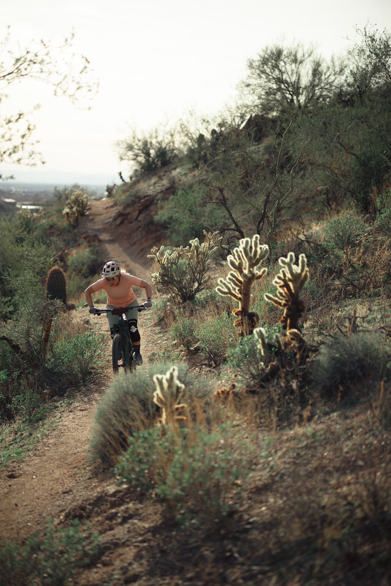
MTB in cactus country – technical delicacies around Phoenix
Traffic-free bike rides in Tonto National Forest

Traffic-free bike rides in Tonto National Forest
Other adventures in Tonto National Forest


Tips from the Community

Blevins Trail in Usery Mountain Regional Park near Mesa, Arizona, is a popular spot for gravel cycling thanks to its well-groomed, mostly flat terrain and scenic desert views. The 3.1-mile loop features crushed gravel and sand surfaces, making it ideal for beginner to intermediate riders. Cyclists can enjoy wide-open views of Pass Mountain and the Superstitions while weaving through classic Sonoran Desert landscape. The trail connects to others like Moon Rock and Cat Peaks, offering options to extend your ride. Accessible year-round, it’s best ridden in cooler months.
0
0

This 320-acre park doesn't get its name from an unlucky traveler, but rather a legendary gold mine that is said to be lost somewhere in the surrounding mountains. You can stay overnight at the campground or just visit for the day on the many trails that access the surrounding Superstition Wilderness, and who knows, maybe you'll stumble on the fabled gold mine!
0
0
The natural wonder that is Balanced Rock is one of the most photographed locations in the McDowell Preserve. You'll need to keep an eye out for other trail users, which makes this a great place to stop and have a water/snack break before continuing your ride.
0
0

Moon Rock Trail is a hiking and mountain biking trail but one of the easier gravel rides, being smooth with packed dirt, being described as "flowing easy singletrack" and tral with great scenery and round smooth "moon rocks" all around this landscape.
0
0

At 5,204 feet, Humboldt Mountain is just under a mile in the sky. The route to the top is a mostly paved (with some dirt and gravel sections) forest road that people drive, bike, run, and hike up. The road is mostly exposed to the sun and is a pretty steady grade the entire way. The views from the top are great, and you have the opportunity to check out some old ruins and tanks along the way.
0
0
The natural wonder that is Balanced Rock is one of the most photographed locations in the McDowell Preserve. You'll need to keep an eye out for other trail users, which makes this a great place to stop and have a water/snack break before continuing your ride.
0
0

Balanced Rock gets its name from the apparent effortless balance it maintains. This location provides an ideal opportunity for creative photography, allowing you to capture images that make you appear incredibly strong as you hold up the rock.
0
0
Both kid and pet friendly, Balanced Rock is one of the main attractions in the McDowell Sonoran Preserve. There is a massive rock balancing (hence the name) on a smooth rock base.
0
0
Frequently Asked Questions
How many no traffic touring cycling routes are available in Tonto National Forest?
Tonto National Forest offers a wide selection of no traffic touring cycling routes, with over 70 options available. These routes cater to various skill levels, ensuring there's something for everyone.
What is the best time of year for touring cycling in Tonto National Forest?
The best time for touring cycling in Tonto National Forest is generally during the cooler months, from late fall through early spring (October to April). During these periods, temperatures are more moderate, making desert rides enjoyable. Summer can be extremely hot, especially at lower elevations, so early morning rides are essential if cycling during this season. Higher elevations offer cooler temperatures in summer but may have snow in winter.
What natural features can I expect to see while touring cycling in Tonto National Forest?
Tonto National Forest boasts incredible natural diversity. You'll cycle through the iconic Sonoran Desert with its towering saguaro cacti and rugged mountains, and at higher elevations, experience cooler pine forests. Key features include the dramatic Mogollon Rim, the Superstition Mountains, and scenic lakes like Roosevelt Lake. Many routes offer expansive desert vistas and views of prominent peaks.
Are there family-friendly no traffic touring cycling routes in Tonto National Forest?
Yes, there are several easy, family-friendly routes. For instance, the Lost Dutchman State Park loop from KVIT-FM (Apache Junction) is an easy 6.2 km (3.9 mi) route with minimal elevation gain, perfect for a relaxed family outing. These routes often feature paved or well-maintained surfaces.
What is the general difficulty level of no traffic touring cycling routes here?
The no traffic touring cycling routes in Tonto National Forest offer a range of difficulties. You'll find approximately 31 easy routes, 33 moderate routes, and 14 difficult routes. This variety allows cyclists to choose paths that match their experience and fitness levels, from gentle desert loops to more challenging climbs.
Are there any historical or cultural attractions near the touring cycling routes?
Yes, Tonto National Forest and its surroundings offer several historical and cultural attractions. You can visit Tonto National Monument to see ancient cliff dwellings, or explore Goldfield Ghost Town for a glimpse into an 1890s mining town. While not directly on a cycling route, these sites are within the region and provide interesting diversions.
What kind of terrain should I expect on these routes?
The terrain varies significantly across Tonto National Forest. Lower elevation routes often feature paved roads or well-maintained gravel paths through the Sonoran Desert. As you gain elevation, you might encounter more rugged, unpaved sections, especially on routes that traverse mountain foothills. Always be prepared for varying surfaces and carry appropriate tires and repair kits.
What do other touring cyclists enjoy most about the no traffic routes in Tonto National Forest?
The komoot community highly rates the touring cycling experience in Tonto National Forest, with an average score of 4.6 out of 5 stars. Reviewers often praise the stunning desert landscapes, the quiet and car-free nature of the routes, and the diverse scenery that transitions from saguaro-filled desert to cooler pine forests.
Are there any circular touring cycling routes in Tonto National Forest?
Yes, many of the no traffic touring cycling routes in Tonto National Forest are circular, allowing you to start and end at the same point. Examples include the challenging Humboldt Mountain loop from Wildcat Hill and the moderate Chuckwagon Trail – View of Tonto National Forest loop from Bootlegger Tank.
What safety considerations should I keep in mind when touring cycling in Tonto National Forest?
Safety is paramount. Always carry plenty of water, especially in warmer months, and a basic repair kit. Be aware of wildlife, including snakes and scorpions. Some routes may have limited cell service. Cyclists should yield to horseback riders and hikers, and remember that bicycles are not permitted in designated Wilderness areas. Always check weather conditions before heading out.
Are dogs allowed on the no traffic touring cycling routes?
Dogs are generally allowed on trails within Tonto National Forest, but they must be kept on a leash. Always check specific trail regulations before you go, as some areas or parks within the forest might have different rules. Ensure your dog is accustomed to the terrain and weather conditions, and carry extra water for them.
What should I know about parking for these routes?
Parking is typically available at trailheads or designated recreation sites throughout Tonto National Forest. Some areas may require a Tonto Pass or other recreation passes, which can often be purchased at visitor centers or local vendors. Always check for signage at your chosen starting point regarding parking fees or restrictions.
Most popular routes in Tonto National Forest
Most popular attractions in Tonto National Forest

Get inspired with the komoot mobile app


