The best hikes from bus stations around Gatineau
4.6
(299)
4,876
hikers
47
hikes
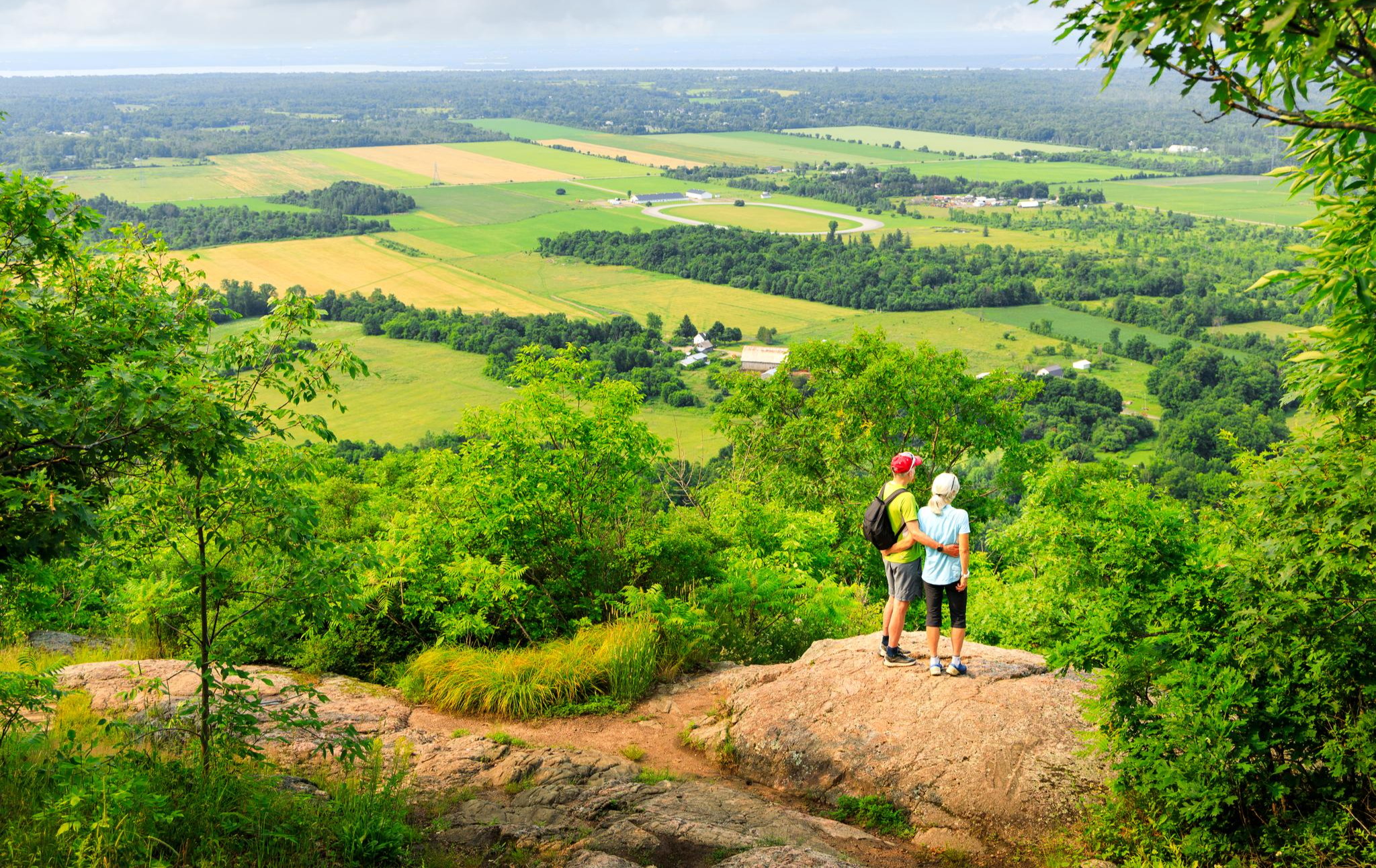
Bus station hiking trails around Gatineau offer access to the expansive Gatineau Park and the diverse natural features of the Vallée-de-la-Gatineau region. The area is characterized by a varied landscape, including the Eardley Escarpment, which provides panoramic views, and numerous lakes and rivers. Trails navigate through dense woodlands, past unique natural features like Pink Lake, and along river valleys. This region provides a range of terrain suitable for various hiking experiences.
Best bus station hiking trails around Gatineau
- The most…
Last updated: November 9, 2026
5.0
(1)
11
hikers
2.90km
00:44
10m
10m
Easy hike. Easily walkable paths.
6
hikers
7.05km
01:51
60m
60m
Easy hike. Easily walkable paths.

4
hikers
5.83km
01:35
80m
80m
Easy hike. Easily walkable paths.
6.10km
01:35
40m
40m
Easy hike. Easily walkable paths.
22.0km
05:44
180m
120m
Hard hike. Very good fitness required. Easily walkable paths.
Get access to more routes and recommendations from other explorers.
Already have an account?
Our route recommendations are based on thousands of hikes, rides, and runs completed by other people on komoot.
Start today with a free account
Your next adventure awaits.


Tips from the Community

Rivière du Lièvre is the main feature here, with long stretches of water broken up by faster-flowing rapids near the dam. It’s a really nice river to walk beside because the scenery changes quite a bit as you go, from calmer sections to noisier, more powerful water. There are a few good spots along the bank to stop for a better look, especially around the rapids.
0
0
Sentier Armand-Daddy-Lacelle follows the Rivière du Lièvre for about 2.5 kilometres, with the water never far away as you make your way through the park. One of the nicest sections runs beside the rapids and dam, where the river feels much more energetic than the calmer stretches upstream. The trail is easy to follow and makes a lovely riverside walk without taking you far from Buckingham.
0
0
Parc Armand-Daddy-Lacelle sits beside the Rivière du Lièvre in the Buckingham sector of Gatineau, with easy access to the riverside trail from the park. The nicest part is how quickly you reach the water, with rapids and the dam just downstream adding plenty of movement to the view. It’s a simple local park, but a good place to start or finish a walk along this stretch of the river.
0
0

Pointe Ramsay is a peaceful riverside pause along the Voie Verte Chelsea. The old rail corridor slips through greenery beside the Gatineau River. It’s a lovely stretch to slow down, listen to the water, and enjoy nice a pocket of nature.
1
0

The Jaseur Universal Trail is a short and accessible loop that begins from the main entrance to the park. It features a flat, compact and well-surfaced trail, making it an ideal round for people with strollers, wheelchairs or mobility scooters. There are two boardwalks like this one on the loop, as well as a small bridge.
0
0
Jaseur Universal Trail is a 1.6-kilometer (1-mi) loop that begins from the main 500 Samuel-Edey Street entrance. It's a level and well-surfaced trail that's designed to be accessible to all, including those with strollers, wheelchairs and mobility scooters. There is a surprising range of ecosystems within the loop, including wetlands, cedar groves and hardwood forest.
0
0

The Gatineau River flows through the Gatineau Valley before joining the Ottawa River, and is a major waterway in western Quebec. For centuries, it has been an important transportation route for Indigenous peoples and later played a significant role in the area’s logging industry, helping to shape the development of communities along its banks. Today, its forested shoreline, clear waters, and abundant wildlife make it a popular destination for paddling, fishing, and other outdoor recreation.
0
0
Voie Verte Chelsea is a relatively flat gravel multi-use trail that follows a former railway corridor along the Gatineau River. Stretching roughly 22 kilometres, it’s a picturesque and popular route for walking, cycling and running, with beautiful views of the river, and is a great way to connect to neighbourhoods and community destinations across the municipality.
0
0
Frequently Asked Questions
How many bus-accessible hiking trails are there in Gatineau?
Gatineau offers a wide selection of hiking trails accessible by bus, with over 45 routes available. These range from easy strolls to more moderate adventures, making it convenient to explore the region's natural beauty without a car.
Are there easy or family-friendly hikes accessible by bus in Gatineau?
Yes, many of the bus-accessible trails in Gatineau are suitable for families and beginners. For example, the Confederation Building Ottawa – Valiants Memorial loop from Ottawa offers an easy experience. The region, particularly Gatineau Park, features numerous trails designed for various fitness levels, ensuring a pleasant outing for everyone.
Can I find challenging bus-accessible hikes in Gatineau?
While many bus-accessible routes are moderate, the broader Gatineau Park area offers more challenging trails like Champlain, King Mountain, and Luskville Falls. These often involve steeper inclines and rugged terrain. You can find moderate bus-accessible routes such as the Pink Lake – Pink Lake Lookout loop from De La Galène/Du Quartz, which provides a good workout with rewarding views.
Are there any circular routes I can access by bus?
Yes, several bus-accessible routes in Gatineau are circular, allowing you to start and end at the same point. The Pink Lake – Pink Lake Lookout loop from De La Galène/Du Quartz is a great example of a moderate circular hike. Another option is the Two-Faced Rock loop from Hull—Aylmer, which is an easy circular route.
What kind of natural features or viewpoints can I expect on these trails?
Gatineau's bus-accessible trails offer diverse natural features and stunning viewpoints. You can experience the unique turquoise-green waters of Pink Lake, often viewed from the Pink Lake Lookout. The Eardley Escarpment within Gatineau Park also provides breathtaking panoramic views, including iconic spots like Champlain Lookout and Étienne Brûlé Lookout, offering vistas of the Ottawa River and surrounding areas.
Are there any trails with waterfalls accessible by bus?
While specific bus routes to all waterfall trails can vary, the Gatineau region is home to several beautiful waterfalls. Luskville Falls is known for its steep incline and beauty, especially in spring. Bridal Veil Falls can be accessed via the Lauriault Trail. The Vallée-de-la-Gatineau also features Quinn Falls, Roland Falls, and Red Falls, which offer accompanying nature trails.
Are dogs allowed on bus-accessible trails in Gatineau?
Dog policies vary by trail and specific areas within Gatineau Park. For instance, dogs are generally not permitted on the Pink Lake trail due to conservation efforts. It's always best to check the specific trail regulations or the Gatineau Park website before heading out with your pet.
What are some interesting historical sites or attractions near these bus-accessible trails?
The region around Gatineau's bus-accessible trails is rich in history and attractions. You can visit the Parliament Hill (Centre Block and Peace Tower) in Ottawa, which is accessible via bus. Within Gatineau Park, the Mackenzie King Estate, former home of a Canadian prime minister, offers historical insights and gardens. The Carbide Willson Ruins, an old fertilizer plant, also provide a unique historical point of interest along a 3.4 km trail.
What is the best time of year to hike these bus-accessible trails?
Gatineau's bus-accessible trails are enjoyable year-round, with each season offering a unique experience. Spring brings lush greenery and flowing waterfalls, while summer is ideal for long days on the trail. Autumn showcases spectacular fall foliage, making it a popular time for hikers. Winter offers opportunities for snowshoeing and cross-country skiing on designated trails.
What do other hikers say about the bus-accessible trails in Gatineau?
The bus-accessible trails in Gatineau are highly rated by the komoot community, with an average score of 4.6 stars. Reviewers often praise the accessibility, the diverse landscapes, and the well-maintained paths that make exploring Gatineau Park and its surroundings a rewarding experience for all skill levels.
Are there any trails that offer views of the Ottawa River or city?
Yes, several viewpoints within Gatineau Park, accessible from various trails, offer stunning vistas of the Ottawa River and the cities of Gatineau and Ottawa. Champlain Lookout, Huron Lookout, and Étienne Brûlé Lookout are particularly renowned for their panoramic views. Mont King also provides expansive views of the urban landscape and surrounding natural beauty.
Where can I find information about bus schedules to these trailheads?
For detailed and up-to-date information on bus schedules and routes that serve trailheads in Gatineau, it is best to consult the official website of the Société de transport de l'Outaouais (STO) or the Ottawa-Gatineau public transit authority. This will ensure you have the most accurate information for planning your trip.
Most popular routes around Gatineau
Most popular attractions around Gatineau

Get inspired with the komoot mobile app


Explore more
Browse the best Hikes in other regions.
