The best hikes from bus stations in Northeastern Connecticut Planning Region
4.3
(30)
371
hikers
4
hikes
Bus station hiking trails in Northeastern Connecticut Planning Region traverse a landscape characterized by rolling hills, dense woodlands, and extensive state forests. The region's terrain, shaped by glacial activity, features a mix of gentle paths and more rugged forest tracks. Hikers can explore diverse ecosystems within its preserved woodlands, which cover a significant portion of the area. Trails often follow scenic rivers and former railway lines, offering varied natural beauty.
Best bus station hiking trails in Northeastern Connecticut Planning Region
…Last updated: July 22, 2026
5
hikers
Easy hike. Great for any fitness level. Easily-accessible paths. Suitable for all skill levels.
1
hikers
9.86km
02:40
130m
130m
Moderate hike. Good fitness required. Easily-accessible paths. Suitable for all skill levels.

Sign up for free
1
hikers
3.74km
01:00
30m
30m
Easy hike. Great for any fitness level. Easily-accessible paths. Suitable for all skill levels.
1
hikers
7.79km
02:08
130m
130m
Moderate hike. Good fitness required. Easily-accessible paths. Suitable for all skill levels.
Our route recommendations are based on thousands of hikes, rides, and runs completed by other people on komoot.
Start today with a free account
Your next adventure awaits.
Login or Signup
Popular around Northeastern Connecticut Planning Region

Other adventures in Northeastern Connecticut Planning Region

Tips from the Community

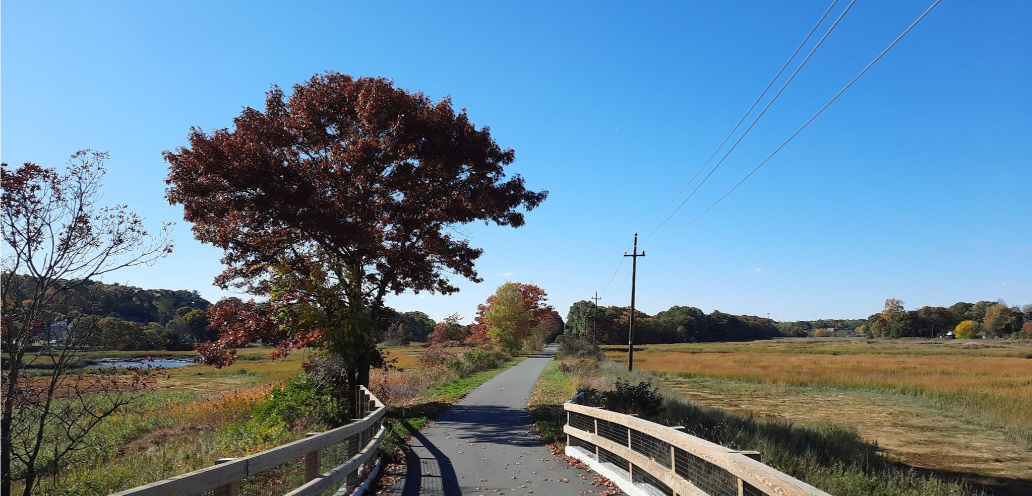
The Quinebaug Valley Rail Trail is another rail-to-trail project that is just short of six miles long, running from Danielson to Davis Forest. This section at Danielson is a good asphalt shared-use trail. It also forms part of the obviously much longer East Coast Greenway (ECG).
0
0
The Quinebaug Valley Rail Trail is another rail-to-trail project that is just short of six miles long, running from Danielson to Davis Forest. This section at Danielson is a good asphalt shared-use trail. It also forms part of the obviously much longer East Coast Greenway (ECG).
0
0
Frequently Asked Questions
How many bus-accessible hiking trails are available in Northeastern Connecticut Planning Region?
There are 3 bus-accessible hiking trails in the Northeastern Connecticut Planning Region featured in this guide. These routes offer convenient access to the region's natural beauty directly from public transport stops.
Are there any easy hiking trails accessible by bus in Northeastern Connecticut?
Yes, there are two easy routes perfect for a relaxed outing. Consider the Quinebaug Valley Rail Trail – Quinebaug Valley Rail Trail loop from Danielson, which is 6.9 km long, or the shorter Horsebarn Hill loop from University of Connecticut, spanning 3.3 km.
What kind of landscapes can I expect on bus-accessible hikes in Northeastern Connecticut?
Northeastern Connecticut, known as the "Quiet Corner," features rolling hills, dense woodlands, and extensive state forests. You'll encounter diverse ecosystems with oak, maple, and birch trees, often shaped by glacial activity. Many trails follow scenic rivers or former railway lines, offering picturesque views.
Are there any circular routes available from bus stations?
Yes, all three routes in this guide are circular. You can enjoy a full loop on the Quinebaug Valley Rail Trail – Quinebaug Valley Rail Trail loop from Danielson, the Horsebarn Hill loop from University of Connecticut, or the Bioretention Basin – Mirror Lake loop from University of Connecticut.
What can I see along the bus-accessible hiking trails in this region?
Along these trails, you can explore various points of interest. Near Danielson, you might encounter the Danielson Main Street & Broad Street Historic District or sections of the The Trestle Trail. The region also features natural highlights like the Cargill Falls Reservoir and the scenic Acme Pond Waterfall.
Are the bus-accessible trails in Northeastern Connecticut suitable for families?
Yes, the two easy routes are generally suitable for families. The Quinebaug Valley Rail Trail loop from Danielson and the Horsebarn Hill loop from University of Connecticut offer manageable distances and terrain for a family outing.
What is the best time of year to hike these bus-accessible trails?
Northeastern Connecticut is beautiful year-round. Spring brings lush greenery, while summer offers warm weather for hiking. Fall is particularly stunning with vibrant foliage, making it a popular time to visit. Even winter hiking can be rewarding, with serene, snow-covered landscapes.
What do other hikers enjoy most about hiking in Northeastern Connecticut Planning Region?
The komoot community rates the hiking experience in this region highly, with an average score of 4.3 stars. Reviewers often praise the peaceful, preserved natural beauty of the "Quiet Corner," the diverse woodlands, and the well-maintained trails that offer a serene escape.
Are there any trails that follow old railway lines?
Yes, the Quinebaug Valley Rail Trail loop from Danielson utilizes a former railway line, offering a relatively flat and scenic path. The broader region is also home to the Air Line & Hop River State Park Trail, another popular route following old railway corridors.
Can I find any waterfalls or water features on these bus-accessible routes?
While specific waterfalls directly on the bus-accessible routes might vary, the region is rich with water features. You can find the scenic Acme Pond Waterfall and the Cargill Falls Reservoir within the broader area, offering beautiful natural sights.
What is the longest bus-accessible hike in this guide?
The longest bus-accessible hike featured is the Bioretention Basin – Mirror Lake loop from University of Connecticut, which covers a distance of 9.9 km and is rated as moderate difficulty.
Most popular routes in Northeastern Connecticut Planning Region
Most popular attractions in Northeastern Connecticut Planning Region

Get inspired with the komoot mobile app


Didn’t find what you were looking for?
Check out more Hikes throughout Northeastern Connecticut Planning Region below and find the perfect route in your destination.
Explore more
Browse the best Hikes in other regions.
