The best traffic-free bike rides around Aguilar
4.5
(4)
66
riders
10
rides
Gravel biking around Aguilar, Colorado, offers routes through the Apishapa River Valley, set against the backdrop of the Spanish Peaks. The region features varied terrain, from valley floors to routes approaching higher elevations, with geological formations like dikes and arches. Proximity to the Highway of Legends Scenic Byway and the San Isabel National Forest provides access to extensive unpaved roads. These routes navigate a landscape characterized by dry, sunny conditions and rugged natural features.
Best no traffic gravel bike trails…
Last updated: August 17, 2026
5.0
(1)
11
riders
76.9km
05:38
1,030m
1,030m
Hard gravel ride. Very good fitness required. Mostly paved surfaces. Suitable for all skill levels.
5.0
(1)
11
riders
72.3km
05:20
1,010m
1,010m
Hard gravel ride. Very good fitness required. Mostly paved surfaces. Suitable for all skill levels.

Sign up for free
4.0
(1)
6
riders
42.3km
03:10
560m
560m
Hard gravel ride. Very good fitness required. Mostly paved surfaces. Suitable for all skill levels.
4
riders
Hard gravel ride. Very good fitness required. You may need to push your bike for some segments of this route.
3
riders
30.8km
02:15
220m
220m
Hard gravel ride. Good fitness required. You may need to push your bike for some segments of this route.
Get access to more routes and recommendations from other explorers.
Sign up for free
Already have an account?
Our route recommendations are based on thousands of hikes, rides, and runs completed by other people on komoot.
Start today with a free account
Your next adventure awaits.
Login or Signup
Popular around Aguilar

Traffic-free bike rides around Aguilar De Campoo

Traffic-free bike rides around Salinas De Pisuerga

Traffic-free bike rides around Embalse de Aguilar

Traffic-free bike rides in Espacio Natural De Las Tuerces

Traffic-free bike rides around Pomar De Valdivia

Traffic-free bike rides around Brañosera

Traffic-free bike rides around Barruelo De Santullán

Traffic-free bike rides in Paisaje Protegido De Covalagua
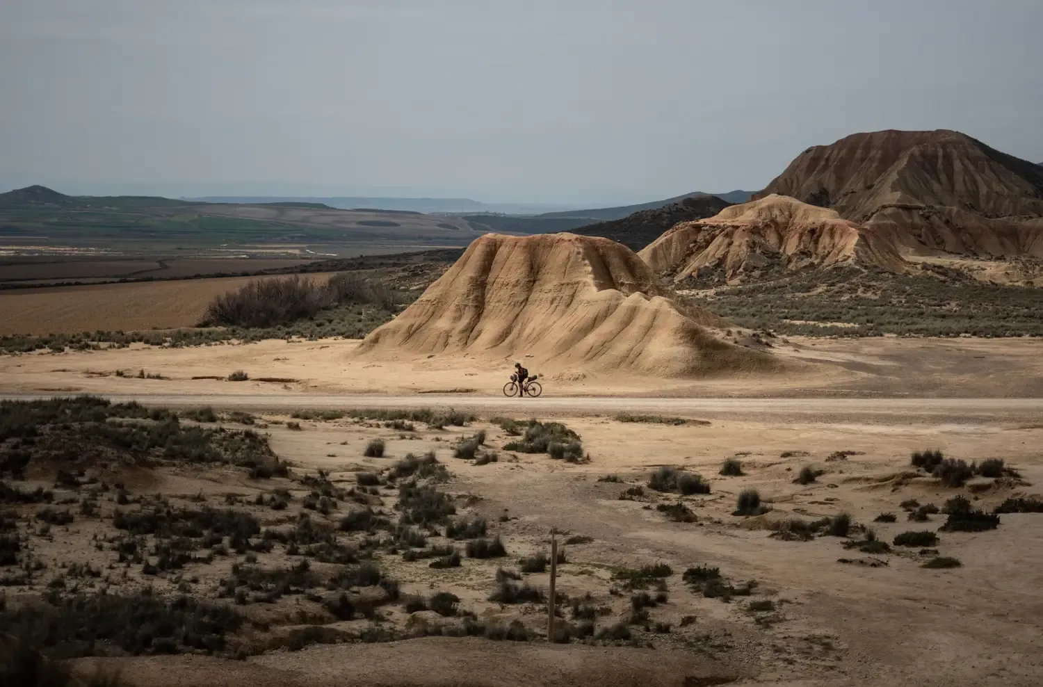
9 mountain biking routes in undiscovered Spain

Traffic-free bike rides around Aguilar
Other adventures around Aguilar

Tips from the Community

Beautiful wooden suspension bridge of Cervera de Pisuerga.
0
0

It is a small bridge that crosses the waters of the Rubagón river. On one side there is a clearing with information panels. A perfect spot for a short stop on your route.
0
0


In the Plaza de España, the nerve centre of the town.
1
0
The amount of water this river carries is always surprising.
1
0

Stage 2. Cervera de Pisuerga/Alar del Rey 72 kilometers. 920 positive meters. The second day has common sections with the previous stage and a small road connection. The first kilometers are known and it is a mental help to overcome the Peña Umoma slope from Vado in the opposite direction. The exit from Cervera through the old town is comfortable and pleasant. And almost without pedaling we enter Vado, connect with the red milestones and begin the cycling adventure through the fields of the Valdeados plain. In reality, only the last kilometer is hard, we overcome the panoramic hill and stop at the La Estación viewpoint, always contemplating the magnificent rocky backdrop of the Curavacas peak in the background. In Dehesa de Montejo, the Perazancas de Ojeda alternative detour leaves and a new route begins through the towns and rural landscapes of La Ojeda. The rural road has a good surface and without stopping we reach Colmenares de Ojeda. The entrance to the church of San Fructuoso is fantastic, it has three arches with a cross vault and a Romanesque portico. The jewel is a baptismal font from the 12th century kept inside, one of the best of the Palencia Romanesque, it is a sandstone rock font carved with high reliefs of religious scenes and ceremonies. The towns are small, people barely appear on the streets, and it is surprising to find so much artistic wealth in each rural center. The path does not have slopes as hard as the previous day, it is still a constant ups and downs through holm oak mountains, fallow lands and agricultural meadows but without slopes of five per hour. The valley of the Fuente de los Moros stream is delicious, the bicycles glide over the crops to Pisón de Ojeda. The church of San Pelayo dominates the town's plain from a hill, preserving the Romanesque apse from the 13th century. And then comes the hardest slope of the day, although it has a lot of uncomfortable gravel, it is short and immediately a new plateau appears with views and the descent to Montoto de Ojeda. The church is also on the hill of the town and we went straight up, shortcutting the milestones of the Natural Trail. The best part of the temple is the apse, from the 12th century, inside it has capitals and wall paintings. The portico is Cistercian from the 13th century, it is a temple that has more content than meets the eye. The route continues along the gravel road, jumps over the mountain through a plain of crops and descends to Perazancas de Ojeda. The parish church has a beautiful Romanesque doorway with three archivolts on carved capitals, from the 12th century. And at the exit of the town is the hermitage of San Pelayo, with interesting mural paintings from the 12th century and a portico with a semicircular arch on Mozarabic capitals, a valuable artistic complex declared a National Monument in 1931. The red milestone posts continue towards the connection with the Coal Route of Cok and Cozuelos de Ojeda, returning directly towards Alar del Rey. The route leaves the Nature Trail for now and continues along the road towards Olmos de Ojeda. Before arriving, pass by the Monastery of Santa Eufemia, former residence of kings, princes and nobles, it is one of the most valuable monumental complexes of the Palencia Romanesque, it was declared a Historic-Artistic Monument in 1931 and can be visited on weekends. The price of the visit is four euros per person. In Olmos de Ojeda the red indications appear again and shortly after the Payo de Ojeda variant appears. The town is on a hill along a lonely rural road of bowling alleys and boulders. The church is outside the hamlet, it has a walk of acacias and a beautiful doorway composed of a pointed arch and an archivolt, inside it houses a Romanesque baptismal font with carved ornaments. The route returns along the same path to the Olmos de Ojeda intersection and turns to the right to visit the last enclaves of the gravel journey through the Romanesque of Palencia. The first town is Moarves de Ojeda, which has one of the most precious jewels of the Palencia rural Romanesque in the façade of the church of San Juan Bautista, declared a Historic-Artistic Monument in 1931. The entrance has an elegant portico with five semicircular archivolts on capitals decorated with great detail and artistic level. The cake goes to the upper frieze, presided over by a Pantocrator surrounded by the tetramorphs and the twelve apostles, a marvel of Romanesque sculpture that especially attracts attention being in a small town in the Palencia wasteland. The attraction may also be due to the reddish color of the stone or the careful details of the sculptures. Inside it has a Romanesque baptismal font.
0
0
The visit to the neighborhoods of San Pedro and Santa María is worth it for the heritage and landscapes but it has a price on the legs, you have to climb Monte de la Ruya again to connect with the main itinerary and overcome the infernal slope that We saw before the detour, which also has a trap because after a short descent there is another similar section to a hill, the prize is fantastic views of the Palentina Mountain. The road enters the meadows and mountains of La Ojeda again and there is a fun stretch, climbing the GPS average for several kilometers until Dehesa de Montejo, where the detour for the Perazancas variant comes out on the left. The route continues to the right, crosses the Cervera de Pisuerga road and climbs the slope of Peña Umoma to a hill that finally marks the entrance to the Pisuerga valley through the beautiful valley of Valdeados. The descent ends in Vado, it is noon, time for a snack but there is no bar or grocery store. Cervera is three kilometers away but it is the place where we plan to finish the stage and we decided to continue and spend the afternoon with the energy bars. The path continues along the charming bank of the Pisuerga River, favorable terrain, river landscape, good climate and change of environment. On the route there are yellow arrows of the Camino Olvidado or Camino de la Montaña, a Camino de Santiago very popular in the 12th and 13th centuries, starting from Bilbao, running along the southern slope of the Cantabrian Mountains and connecting with the Camino Francés in El Bierzo. In Barcenilla de Pisuerga, the milestones of the Natural Trail cross the Pisuerga River via a pedestrian walkway and change course, beginning the climb through the Mudá valley until the connection with the GR-1. The climb begins in Rueda de Pisuerga, the route passes by the church of San Cristóbal, which preserves the Romanesque doorway from the 12th century, and continues through Vallespinoso de Cervera to San Cebrián de Mudá, a town with a mining tradition and the last town on the Natural Trail of the Palentine Romanesque. In the square there are some wagons from the mining era, when the Cok Coal Route was the main economic channel of the valley. The church of San Cornelio and San Cipriano is on a hill, is Romanesque from the 13th century and was declared a Site of Cultural Interest in 1993. The climb to the Historical Trail passes through the European Bison Interpretation Center, runs through a mountain oak grove and ends at a small hill below the imposing Valdecebollas (2,143 m), entrance to the La Pernía valley and the upper Pisuerga. The views are stunning. The end of the stage is Cervera de Pisuerga, with accommodation, camping and complete services. The final stretch to complete a great day of gravel cycling continues through the Castillería valley and at the Estalaya crossroads, where the climb to the Verdeña Fossil Forest is, a path leaves on the left that leads to Vañes off the road. In this section it is important to have the track downloaded because there are no milestones on the route. You must continue along the road for about 500 meters towards Cervera and at the fork of the road take a detour to the left towards Rabanal de los Caballeros and Valdasornín. The rest of the way follows the road that goes down to the urban complex of Cervera de Pisuerga.
0
0

Puente Mayor over the Pisuerga River is of medieval origin. We can see the small islands in the river and the castle hill.
2
0
Frequently Asked Questions
How many no-traffic gravel bike trails are available around Aguilar?
There are 4 dedicated no-traffic gravel bike trails listed in this guide for the Aguilar area. These routes offer a challenging and rewarding experience away from vehicular traffic.
What is the best time of year for gravel biking in Aguilar?
The dry, exhilarating climate of the Apishapa River Valley means many days are suitable for riding. However, routes that ascend to higher elevations, such as those approaching Cordova Pass, can be snow-blocked from mid-November until late May. For the most consistent access to all trails, late spring through early autumn is ideal.
Are there any easy or family-friendly no-traffic gravel bike trails near Aguilar?
The routes featured in this guide are generally rated as 'difficult' due to their length and elevation gain. For example, the Salinas de Pisuerga Bridge – Hermitage of Santa Cecilia loop from Mave covers over 76 km with more than 1000 meters of climbing. While the region offers stunning scenery, beginners or families with young children might find these specific trails quite challenging.
What kind of terrain can I expect on these no-traffic gravel trails around Aguilar?
You can expect diverse and rugged terrain, ranging from valley floors in the Apishapa River Valley to ascents towards mountain passes with the dramatic backdrop of the Spanish Peaks. The area is also known for unique geological features like dikes and crags, offering a varied riding experience.
Are there any loop trails for gravel biking around Aguilar?
Yes, all the no-traffic gravel bike trails featured in this guide are designed as loops, allowing you to start and finish at the same point. For instance, the Salinas de Pisuerga Bridge – Aguilar Reservoir loop from Aguilar de Campoo is a 50 km circular route.
What are the typical distances and durations of these no-traffic gravel bike trails?
The trails vary significantly in length and duration. You'll find routes like the Cervera de Pisuerga – Salinas de Pisuerga Bridge loop from Cervera de Pisuerga at approximately 40 km, taking around 3 hours. Longer routes, such as the Collegiate Church of San Miguel – Salinas de Pisuerga Bridge loop from Aguilar de Campoo, can be up to 66 km and take over 5 hours to complete.
What can I see along the no-traffic gravel bike trails near Aguilar?
The region offers a wealth of natural and historical attractions. You can explore fascinating geological formations and caves, such as the Horadada Tunnel. Keep an eye out for natural monuments like Peña Mesa and the scenic Covalagua Waterfall, often found along or near these routes.
Are there any unique geological features to explore while gravel biking near Aguilar?
Absolutely. Aguilar is known for its distinctive geology. You might encounter formations like 'The Hogback' and the Apishapa Crag, which are exposed dikes. A particularly unusual sight is the Apishapa Arch, a short tunnel carved directly through a magmatic dike. For more on the region's natural wonders, you can visit Atlas Obscura.
Is parking available for gravel bike trails in Aguilar?
While specific parking areas for each trail are not detailed, Aguilar serves as a gateway to the Spanish Peaks and is situated along the Highway of Legends. As a starting point for many outdoor activities, you can generally find parking within or near the towns where these loop trails begin, such as Aguilar de Campoo or Cervera de Pisuerga.
What do other gravel bikers enjoy most about gravel biking in Aguilar?
The komoot community highly rates the gravel biking experience in Aguilar, with an average score of 5.0 stars. Riders often praise the stunning natural landscapes, the challenging yet rewarding terrain, and the opportunity to explore the rugged beauty of southern Colorado away from traffic.
Are there any accommodations or amenities near the gravel bike trails in Aguilar?
Aguilar, as the 'Gateway to the Spanish Peaks,' offers basic amenities. While specific cafes or pubs directly on the trails are rare, you can find local services, accommodation, and places to refuel in Aguilar itself or in nearby towns like Walsenburg and Trinidad, which are also along the Highway of Legends Scenic Byway.
Can I access these no-traffic gravel trails using public transport?
Public transport options directly to the trailheads in this rural area are generally limited. It is recommended to plan for personal vehicle transport to reach the starting points of these gravel bike routes.
Most popular routes around Aguilar
Most popular attractions around Aguilar

Get inspired with the komoot mobile app


Didn’t find what you were looking for?
Check out more Gravel rides throughout Aguilar below and find the perfect route in your destination.
Explore more
Browse the best Gravel rides in other regions.
