The best traffic-free bike rides around Waalwijk
4.6
(304)
5,494
riders
122
rides
Touring cycling around Waalwijk offers diverse landscapes, from extensive drift sand areas to wetlands and riverine paths. The region is characterized by its flat terrain, making it ideal for no traffic touring cycling routes, with minimal elevation changes. Cyclists can explore natural features such as the Loonse en Drunense Duinen National Park, the Moerputten nature reserve, and routes along the Bergsche Maas river. These varied environments provide a compelling setting for outdoor activities on two wheels.
Best no traffic touring…
Last updated: May 26, 2026
4.7
(121)
870
riders
21.8km
01:14
30m
30m
Easy bike ride. Great for any fitness level. Mostly paved surfaces. Suitable for all skill levels.
4.7
(25)
2,473
riders
40.3km
03:10
50m
50m
Moderate bike ride. Good fitness required. Mostly paved surfaces. Suitable for all skill levels.

Sign up for free
4.6
(26)
157
riders
16.7km
00:57
20m
20m
Easy bike ride. Great for any fitness level. Mostly paved surfaces. Suitable for all skill levels.
4.9
(12)
94
riders
Moderate bike ride. Good fitness required. Mostly paved surfaces. Suitable for all skill levels.
4.1
(12)
106
riders
Easy bike ride. Great for any fitness level. Mostly paved surfaces. Suitable for all skill levels.
Get access to more routes and recommendations from other explorers.
Sign up for free
Already have an account?
Our route recommendations are based on thousands of hikes, rides, and runs completed by other people on komoot.
Start today with a free account
Your next adventure awaits.
Login or Signup



Tips from the Community

A bit of a desert area, loose sand, but easy to walk on
1
0

Around a small farm in the middle of the dunes, hundreds of Scottish soldiers gathered at the end of 1944. Apparently, this was an important location. But why exactly? A bustling bustle On the morning of Saturday, November 4, 1944, Hoeve De Klinkert was the heart of a whole host of activities. The café initially served as the headquarters of the 152nd Brigade, whose three battalions were tasked with liberating the western part of the present-day municipality of Heusden. But one of those battalions, the 5th Seaforth Highlanders, also temporarily set up its headquarters there. Equally important was the arrival around noon of all sorts of heavy trucks that barely fit on the narrow forest roads. The Engineers They carried bridging equipment. Once the first phase of Operation Guy Fawkes was successful and Scottish foot soldiers, the infantry, had reached the other side of the canal, bridges had to be constructed as quickly as possible so that tanks, guns, and all other equipment could follow. For this purpose, the Allies used so-called Bailey bridges, named after the English engineer Donald Bailey. Such a bridge consisted of separate parts that could be assembled into various configurations. A typical 25-meter Bailey bridge could be assembled by 40 men in three hours. Usually, the job took longer. Hard Work That afternoon, the first sections of a Class 40 bridge were assembled at De Klinkert. This designation indicates that the bridge can carry up to 40 tons. The colossus was built by the 280th Field Company, a unit of approximately 250 men. All their vehicles, more than fifty of them, were parked around the farm. As soon as the infantry established a bridgehead over the Drainage Canal from 's-Hertogenbosch to Drongelen at the end of the afternoon, their work at Duinweg began. Further on, other units built three more Bailey bridges that night. It was now 7:30 and pitch black. To keep the enemy from being any the wiser, only a few lamps were used by the engineers. First, a bulldozer removes a section of the dike to lower the bridge. Only then does construction itself begin. It takes until the next morning before the bridge can be used by traffic. Sweaty but satisfied, Major Clayton's men watch the first tanks disappear in the dawn twilight towards Drunen, over the new bridge, codenamed Wheat.
0
0

From the cycle path from Giersbergen to the Rustende Jager the sand dunes are clearly visible. Many unpaved footpaths and MTB routes also lead here.
0
0
Busy in the dunes Hundreds of Scottish soldiers gather around a small farm in the middle of the dunes at the end of 1944. Apparently this is an important place. But why exactly? A real hustle and bustle On the morning of Saturday 4 November 1944, Hoeve De Klinkert forms the heart of a range of activities. To start with, the café serves as the headquarters of the 152nd Brigade, which must liberate the western part of the current municipality of Heusden with its three battalions. But one of those battalions, the 5th Seaforth Highlanders, has also temporarily set up its headquarters there. At least as important is the arrival around noon of all kinds of heavy trucks that just fit on the narrow forest roads. The engineers They have bridge-building material with them. When the first phase of Operation Guy Fawkes is successful and Scottish foot soldiers, the infantry, are on the other side of the Channel, bridges must be built as quickly as possible so that tanks, guns and all other equipment can follow. For this purpose, the Allies used so-called Bailey bridges, named after the English engineer Donald Bailey. Such a bridge consisted of separate parts that could be put together in different compositions. An average Bailey bridge of 25 meters could be assembled by 40 men in three hours. Usually the job took longer. Hard work That afternoon, the first parts of a Class 40 bridge are assembled at De Klinkert. This designation indicates that the bridge can carry up to 40 tons. The colossus is built by the 280th Field Company. This is a unit of approximately 250 men. All their vehicles, and there are more than fifty of them, are parked around the farm. As soon as the infantry has a bridgehead over the drainage canal from 's-Hertogenbosch to Drongelen at the end of the afternoon, their work at the Duinweg begins. Further on, other units build three more Bailey bridges that night. It is now half past seven and pitch dark. In order not to make the enemy any wiser, only a few lamps are at the engineers' side. First, a bulldozer removes a section of the dike so that the bridge is a bit lower. Then the construction itself begins. It is not until the next morning that the bridge can be used by traffic. Sweaty, but satisfied, Major Clayton's men watch the first tanks disappear in the morning twilight in the direction of Drunen, over the new bridge, codenamed Wheat.
1
0

Fortified town Woudrichem, or Woerkum, as the residents call it, is the only town of the Biesboschlinie. In the 9th century, a market place was created on a riverbank. Today, this is where the Hoogstraat and the Molenstraat intersect. This place is still the heart of the fortified town. Historical context: History Woudrichem is strategically located at the confluence of the Maas and Waal, at the intersection of 3 provinces. The Land van Altena, to which Woudrichem belongs, belonged to the County of Holland from 1322. It was not until 1815 that it was incorporated into the new province of North Brabant. Woudrichem was granted city rights in 1356. In that year, the count's river toll from Niemandsvriend van Sliedrecht was also moved to Woudrichem. A few years later, the town also received fishing rights and flourished. The Martinuskerk and city walls date from this period. In 1420, the toll was moved to Gorinchem. This event, the St. Elizabeth's flood of 1421 and the many military conflicts in which the town was involved due to its location, caused the decline of the town. The many sieges have left their mark on Woerkum. In 1573, the Geuzen set fire to the town. They considered it indefensible. A new city wall was then built, which protected a smaller area than the old city wall had done. This city wall is the fortress wall that still encloses the center. In 1814, Woudrichem became part of the New Dutch Waterline. From that time on, no more building was allowed in the surrounding land. It was not until 1955 that the fortress was closed and new residential areas were built around the town. The historic city center is a protected cityscape. Source: https://biesboschlinie.com/zien-doen/bezichten/woudrichem/
5
0
Woudrichem is a tiny old fortified town in the northernmost point of North Brabant, where the rivers Maas and Waal meet. Pass through the city gates and you will be taken back in time by the charm of the town.
5
0
The Veense corn mill is still very much alive. The mill is in motion almost every day, and at the bottom of the mill there is a cozy mill shop where the home-made artisanal mill products such as flour, bread and baking mixes are in great demand. ‘Assie draait, issie open’ is the slogan of the miller! Brief history This round stone tower mill was built in 1838 for Willem and Reinier Ambrosius, as a successor to a 16th century wooden post mill. A map from 1798 shows that it stood on the same spot. The mill was built by master carpenter and millwright T.C. Snels from Waalwijk and mason J. Verkuijl from Veen, for the sum of eight thousand guilders and was equipped with two pairs of millstones. The construction took only thirteen weeks, and the stones for the hull were transported by barge over the Maas. In 1924, the Ambrosius miller family emigrated to South Africa and the mill came into the hands of the Van Ballegooijen family, who continued the business. Want to know more? Click through to https://molensheusdenenaltena.nl/de-hoop/ Visit options: Saturday from 10 a.m. to 6 p.m., and otherwise when the sails are turning (almost daily). The mill is closed on Sundays.
6
0
Coming from the south on the N267, you will see the red steel monument KUNST on a concrete base before the Heusden bridge. The numbers 1904-1991 have been cast into the concrete in the base. There is also a plaque that states: REMEMBRANCE OF 87 YEARS OF STEEL BRIDGES IN HEUSDEN Historical interpretation: In the context of the Maasmond works, 'De Groote Brug' was built over the Bergsche Maas in Heusden, with the main aim of opening up the Land van Altena. The bridge was opened to traffic on 1 March 1904. The bridge was a riveted truss bridge made of steel profiles. When the Germans invaded our country on 10 May 1940, the bridge was blown up by Dutch soldiers the next morning at 5.30 am to slow down the German advance. The crossing was made for a while by ferry. The bridge was repaired on site and put back into use in March 1941. When the Germans withdrew from the Langstraat to the Land van Altena, the bridge was blown up again by the German Sprengcommando in the night of 4 to 5 November 1944 at 3:45 in the morning. After the war, the bridge was repaired and the wooden road surface was replaced by a concrete one. The bridge was put back into use in February 1947 and remained so until 1989. Around 1980, the bridge appeared to be technically outdated, too narrow for traffic and had too low a clearance. A new concrete cable-stayed bridge was laid next to the old one and put into use in 1989. The old bridge was removed in 1991, sold to Suriname for ƒ1,-, never collected and demolished in 1996. As a reminder, part of the bridge construction has been preserved as a monument. Source https://heusden.nieuws.nl/nieuws/monumenten-in-heusden-monument-bij-heusdense-brug
6
0
Frequently Asked Questions
How many no-traffic touring cycling routes are available around Waalwijk?
There are over 120 dedicated no-traffic touring cycling routes around Waalwijk, offering a wide variety of options for exploring the region's landscapes. Most of these routes, 88 to be precise, are classified as easy, making them accessible for many cyclists.
What is the best time of year to enjoy no-traffic touring cycling in Waalwijk?
The spring and autumn months offer ideal temperatures for touring cycling in Waalwijk. Late summer is also particularly beautiful, as the heathlands in areas like the Loonse en Drunense Duinen National Park transform into a vibrant purple spectacle. While cycling is possible year-round, these seasons provide the most comfortable conditions and stunning scenery.
What do other touring cyclists appreciate most about the no-traffic routes in Waalwijk?
The no-traffic touring routes around Waalwijk are highly rated by the komoot community, with an average score of 4.46 stars from over 300 reviews. Cyclists often praise the serene, car-free paths through diverse natural landscapes, such as the expansive sand dunes and quiet polders, and the well-maintained cycling infrastructure.
Are there easy no-traffic touring routes suitable for beginners or families?
Yes, a significant number of the no-traffic touring routes around Waalwijk are classified as easy, with 88 routes specifically designed for a relaxed cycling experience. These routes often feature flat terrain and well-paved paths, making them ideal for beginners and families. An example is the Drongelens Canal loop from Waalwijk, which offers a gentle ride along the water.
Can I find longer, more challenging no-traffic touring routes in the Waalwijk area?
While many routes are easy, there are also 27 moderate and 5 difficult no-traffic touring routes for those seeking a longer or more challenging ride. These routes might cover greater distances or include varied terrain. For a moderate option, consider the Woudrichem Fortress Town – Woudrichem Historic Centre loop from Waspik, which offers a substantial distance and scenic views.
What natural features or landmarks can I expect to see on these no-traffic cycling routes?
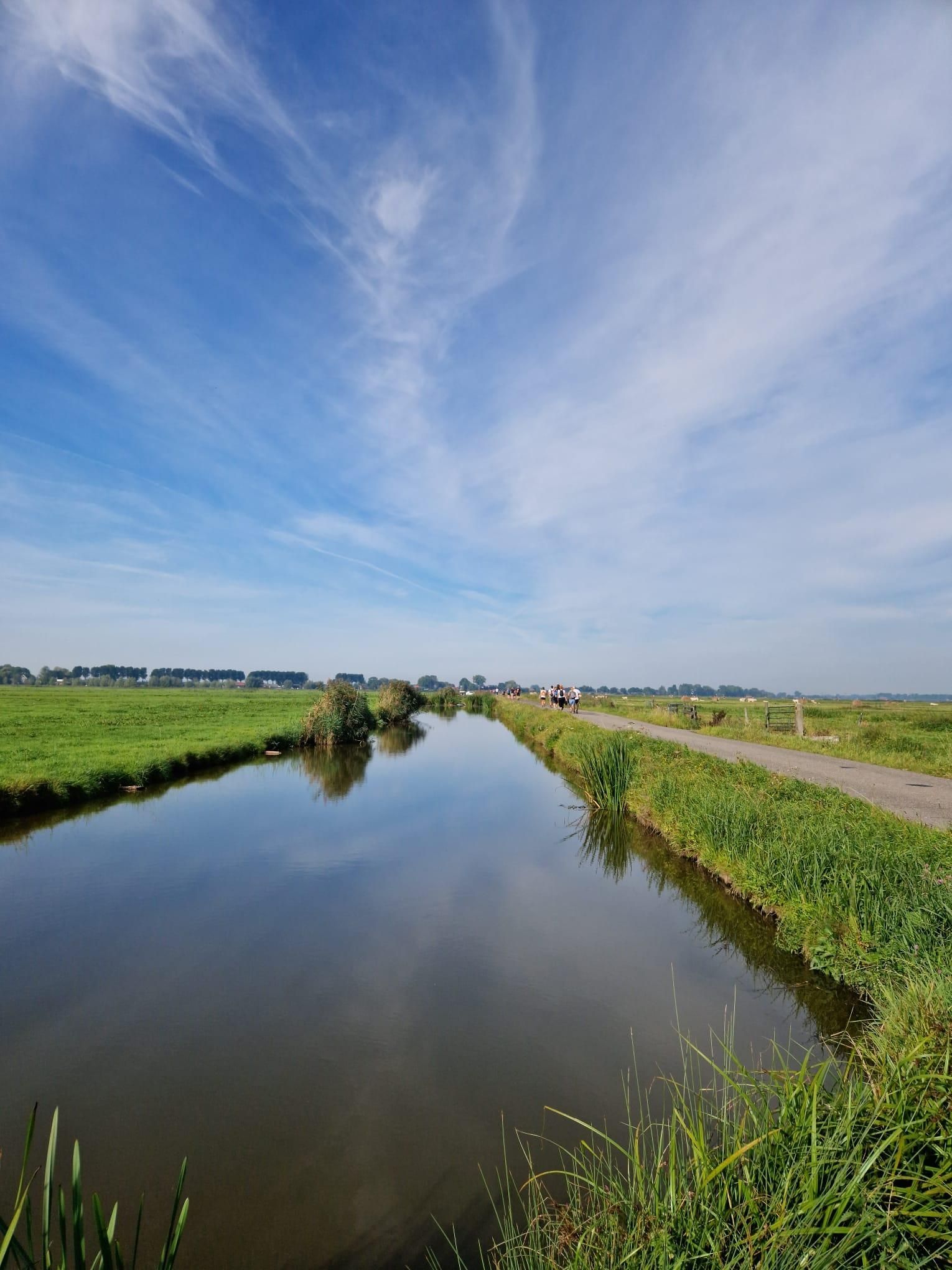
The no-traffic routes in Waalwijk offer a rich variety of natural features and landmarks. You can cycle through the unique drift sands, heathlands, and forests of the Loonse en Drunense Duinen National Park, often called the 'Brabant Sahara'. Other highlights include the tranquil wetlands of the Moerputten nature reserve with its historic bridge, and scenic paths along the Bergsche Maas river. Specific points of interest include the Roestelberg Sand Dunes and the Kaatsheuvel Ice Rink Pond.
Are there circular no-traffic touring routes available?
Yes, many of the no-traffic touring routes around Waalwijk are designed as circular loops, allowing you to start and end at the same point without retracing your steps. An excellent example is the Giersbergen Village – The Resting Hunter loop from Waalwijk, which takes you through picturesque landscapes and charming villages.
Are there any routes that pass through the Loonse en Drunense Duinen National Park?
Absolutely. The Loonse en Drunense Duinen National Park is a central feature for no-traffic cycling in the region. Routes like the Kaatsheuvel Ice Rink Pond – Kaatsheuvelse Ice Rink Lake loop from Waalwijk often skirt or enter the park, allowing you to experience its unique sand dunes, heathlands, and forests on dedicated cycling paths.
Can I bring my dog on these no-traffic cycling routes?
Many natural areas around Waalwijk, including parts of the Loonse en Drunense Duinen National Park, are dog-friendly, often with specific rules regarding leashing. While komoot routes themselves don't specify dog-friendliness, the car-free nature of these touring paths makes them generally safer for cycling with a leashed dog. Always check local regulations for specific nature reserves before you go.
Are there viewpoints or scenic spots along the no-traffic routes?
Yes, the region offers several scenic viewpoints along its quiet cycling routes. You can find stunning vistas over the drift sands in the Loonse en Drunense Duinen, tranquil river views along the Bergsche Maas, and picturesque polder landscapes. The Leikeven and Galgenven viewpoint is a notable spot to enjoy the natural surroundings.
What kind of terrain can I expect on the no-traffic touring routes around Waalwijk?
The terrain on no-traffic touring routes around Waalwijk is quite varied, ranging from the unique drift sands and heathlands of the Loonse en Drunense Duinen to the flat, open polder landscapes and paths along river dikes. Most routes feature well-maintained, paved cycle paths, ensuring a smooth and enjoyable touring experience, even when passing through natural reserves.
Most popular attractions around Waalwijk

Get inspired with the komoot mobile app


Explore more
Browse the best Cycling routes in other regions.
