The best traffic-free bike rides around Haelen
4.4
(631)
17,299
riders
203
rides
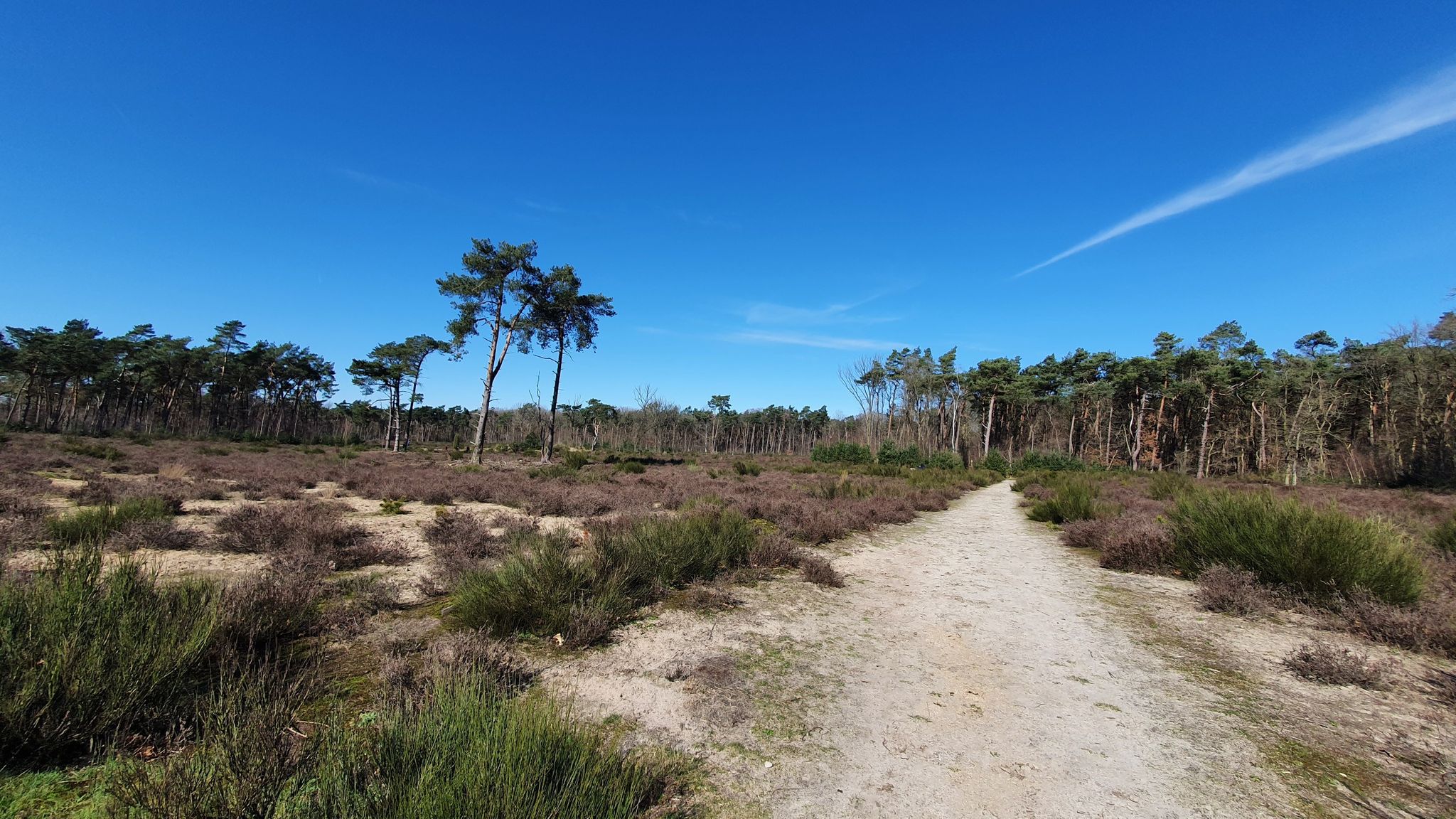
No traffic road cycling routes around Haelen offer a diverse landscape for cyclists, featuring both flat sections and "higher sandy grounds" near the Leudal area. The region provides scenic routes along river landscapes, including views of the Maas (Meuse) river. Cyclists can explore natural environments through areas like the Leudal nature reserve and the Dubbroek nature area. Many routes are characterized by well-paved surfaces and benefit from Limburg's developed cycling infrastructure.
Best no traffic road cycling routes around Haelen
- The…
Last updated: August 3, 2026
5.0
(6)
70
riders
70.1km
02:55
100m
100m
Moderate road ride. Good fitness required. Some segments of this route may be unpaved and difficult to ride.
5.0
(1)
55
riders
80.8km
03:46
150m
150m
Moderate road ride. Good fitness required. Some segments of this route may be unpaved and difficult to ride.

Sign up for free
3.0
(1)
55
riders
73.3km
03:31
110m
110m
Moderate road ride. Good fitness required. Some segments of this route may be unpaved and difficult to ride.
5.0
(2)
36
riders
50.9km
02:09
70m
70m
Moderate road ride. Good fitness required. Mostly well-paved surfaces and easy to ride.
5.0
(1)
31
riders
Moderate road ride. Good fitness required. Mostly well-paved surfaces and easy to ride.
Get access to more routes and recommendations from other explorers.
Sign up for free
Already have an account?
Our route recommendations are based on thousands of hikes, rides, and runs completed by other people on komoot.
Start today with a free account
Your next adventure awaits.
Login or Signup

Other adventures around Haelen

Tips from the Community

It's always interesting to observe how the ships pass through the lock.
0
0

Interesting for a small photo shoot
0
0

The dam has been around for 100 years
1
0
Linne is located close to the Maas lakes, the weir and the locks
1
0

KanaalwegOost is a relatively short but characteristic connecting road in the municipality of Roermond, Limburg. It runs along the eastern side of the water between the Maasplassen lakes and the Lateraalkanaal (Lateral Canal) towards Linne and Buggenum. This road not only serves a practical purpose for local traffic and provides access to surrounding areas, but thanks to its waterfront location, it is also a popular route for recreational cycling and hiking in the water-rich landscape around the Meuse River. KanaalwegOost is located on the eastern edge of the village of DeWeerd and the Maasplassen lakes. According to geographical data, the road is approximately 1.1 km long and includes several sections that are functionally part of the local road network in Roermond. Along the road, besides water features such as the Noorderplas lake and the Lateraalkanaal, there are also agricultural plots, nature strips, and rural areas. In terms of accessibility, KanaalwegOost connects to national and regional routes. It is used by local residents as well as day cyclists who want to explore the largely flat Maasland region on paved roads with views of water, lakes, and nature. Recreational cycling and walking routes that follow this road are included in various route apps and maps. For example, a walking route around the Noorderplas lake begins or passes through here and covers a distance of approximately 5.7 km. KaalwegOost was not originally an urban street, but a functional connecting road that has served for decades as access to the water zones, agricultural land, and several industrial estates on the east side of Roermond. The road is characterized by a relatively wide carriageway without heavy urban traffic and is supported by a mix of local, recreational, and logistics traffic focused on nearby water access points and businesses. In the past, there have also been plans to utilize KanaalwegOost in broader regional infrastructure projects. One example was a proposal to extend or lower the canal dam along the Lateraalkanaal, possibly including the construction of a cycle path, with the aim of combining recreation and flood management. This project was proposed by the local government, Rijkswaterstaat, and the province, but in 2025, an environmental permit for dam-related work, including a cycle path near KanaalwegOost, was ultimately withdrawn at the request of the initiator. In terms of recreational use, KanaalwegOost is a popular component of various cycling and walking routes around the Maasplassen lakes. These routes are often described in walking and cycling platforms, with KanaalwegOost serving as a link between the village center of Roermond, the water features, and surrounding waterside paths. A popular route from the region starts from this road towards surrounding nature reserves and villages such as Neer and is part of a roughly 19km cycle route. Cyclists describe KanaalwegOost as a relatively straight and open road with good asphalt and unobstructed views of the lakes and the Lateral Canal, with relatively little traffic on weekdays. Some descriptions mention that the area can be somewhat busier on weekends due to recreational traffic, and that there is no dedicated cycle path along the road, requiring extra attention from cyclists and motorists. The road also provides access to hiking trails around the Noorderplas, one of the most important lakes in the Maasplassen region. From the shoreline and paths around KanaalwegOost, hikers can enjoy the watery landscape, bird sounds, open fields, and the sunset over the lake.
0
0

Beautiful trail, enjoyed every moment.
0
0

The path is now open again for cyclists.
2
0
Frequently Asked Questions
How many traffic-free road cycling routes are available around Haelen?
There are over 180 traffic-free road cycling routes around Haelen, offering a wide variety of options for different skill levels. You'll find routes ranging from easy to moderate difficulty.
What kind of terrain can I expect on the traffic-free road cycling routes near Haelen?
The Haelen area offers a diverse cycling landscape. While much of the Netherlands is flat, you'll find routes with both predominantly flat sections and some 'higher sandy grounds,' particularly near the Leudal area. Many routes also feature scenic riverine views along the Maas and its tributaries, all on well-paved surfaces.
Are there routes suitable for beginners or families looking for easy, traffic-free rides?
Yes, Haelen offers a good selection of easy, traffic-free road cycling routes. There are over 40 easy routes available. For example, the Bridge Over the Deurne Canal – Gravel Path Along Deurne Canal loop from Neer is an easy option, covering about 43 km with minimal elevation gain.
What do other cyclists say about the traffic-free road cycling routes in Haelen?
The komoot community rates the road cycling routes around Haelen highly, with an average score of 4.0 out of 5 stars. Cyclists often praise the well-maintained paths, the peaceful natural reserves like Leudal and Dubbroek, and the varied scenery that includes river landscapes and historical sights.
Are the traffic-free road cycling routes around Haelen typically circular?
Yes, many of the traffic-free road cycling routes around Haelen are designed as circular loops, allowing you to start and end your ride at the same point without retracing your steps. An example is the Dubbroek Nature Reserve – Klingenberg Park loop from Neer.
What is the typical length of a traffic-free road cycling route in the Haelen area?
The lengths of traffic-free road cycling routes vary significantly. You can find shorter rides around 40-50 km, such as the Dubbroek Nature Reserve – Klingenberg Park loop from Neer (approx. 51 km), up to longer tours exceeding 90 km, like the View of Roermond – Maasplassen Near Linne loop from Swalmen.
What natural features and landmarks can I see along the traffic-free road cycling routes?
The routes often pass through beautiful natural areas like the Leudal and Dubbroek nature reserves. You can also enjoy riverine scenery along the Maas and its tributaries. Notable landmarks include the picturesque Thorn, the little white town, and historical sites such as Kasteel Aldenghoor. Some routes even offer views of the Roermond Market Square.
Are there any cafes or places to stop for refreshments along the routes?
Yes, many routes are designed to pass through or near villages and towns where you can find cafes and restaurants. For instance, you might encounter places like De Bos Inn, which is a popular stop for cyclists.
Where can I find parking for these traffic-free road cycling routes in Haelen?
While specific parking details for each route vary, Haelen and surrounding towns generally offer public parking facilities. Many routes start from easily accessible locations, and you can often find parking near the suggested starting points in villages like Roggel, Swalmen, or Neer.
What is the best time of year for traffic-free road cycling in Haelen?
The spring, summer, and early autumn months (roughly April to October) generally offer the most pleasant conditions for road cycling in Haelen. During these periods, the weather is typically mild, and the natural landscapes are at their most vibrant, making for an enjoyable experience.
Are there any routes that feature views of the Maas river?
Yes, several routes in the Haelen area incorporate stunning views of the Maas (Meuse) river and its floodplains. The View of Thorn – Meuse River near Wessem loop from Swalmen is a great example, offering scenic stretches along the river and passing by the charming white town of Thorn.
Most popular attractions around Haelen

Get inspired with the komoot mobile app


Explore more
Browse the best Road cycling routes in other regions.
