The best traffic-free bike rides around Saint-Jean-De-Bournay
4.0
(1)
14
riders
5
rides
Gravel biking around Saint-Jean-De-Bournay offers routes through verdant countryside, forests, and tranquil bodies of water. The region is characterized by gentle hills and valleys, providing varied terrain suitable for gravel bikes. Riders can explore paths around serene ponds like Étang de Montjoux and Étang du Marais, often with distant views of mountains on clear days. These no traffic gravel bike trails provide opportunities for exploration away from paved roads.
Best no traffic gravel bike trails around Saint-Jean-De-Bournay
- The most popular no traffic gravel bike trail is Saint Bonnet Pond – Étang de Chalignieu loop from Villefontaine, a 27.7 miles (44.6 km) difficult trail that takes 2 hours 48 minutes to complete. This route navigates through the countryside, passing by local ponds.
- Another top favourite among local gravel bikers is View of Lyon – Vers le col de Bel Air loop from Diémoz, a difficult 36.4 miles (58.6 km) path. This route offers views and traverses the region's varied hills and valleys.
- Local gravel bikers also love the Gravel loop from Saint-Agnin-sur-Bion, a 7.0 miles (11.3 km) trail leading through the local countryside, often completed in about 48 minutes.
- Gravel biking around Saint-Jean-De-Bournay is defined by verdant countryside, forests, and serene ponds. The network offers options for different ability levels, from easy loops to more challenging routes with greater elevation gain.
- The routes in Saint-Jean-De-Bournay are highly rated by the komoot community with an average score of 4.0 stars from over 1 review. More than 8 gravel bikers have used komoot to explore Saint-Jean-De-Bournay's varied terrain.
Last updated: May 24, 2026
4
riders
44.6km
02:49
470m
470m
Hard gravel ride. Very good fitness required. Mostly paved surfaces. Suitable for all skill levels.
3
riders
58.6km
04:01
990m
990m
Hard gravel ride. Very good fitness required. You may need to push your bike for some segments of this route.

Sign up for free
3
riders
40.1km
02:58
530m
530m
Hard gravel ride. Very good fitness required. Mostly paved surfaces. Suitable for all skill levels.
3
riders
56.4km
03:46
730m
730m
Hard gravel ride. Very good fitness required. Mostly paved surfaces. Suitable for all skill levels.
4.0
(1)
1
riders
11.3km
00:49
140m
140m
Easy gravel ride. Great for any fitness level. Mostly paved surfaces. Suitable for all skill levels.
Our route recommendations are based on thousands of hikes, rides, and runs completed by other people on komoot.
Start today with a free account
Your next adventure awaits.
Login or Signup
Popular around Saint-Jean-De-Bournay

Tips from the Community

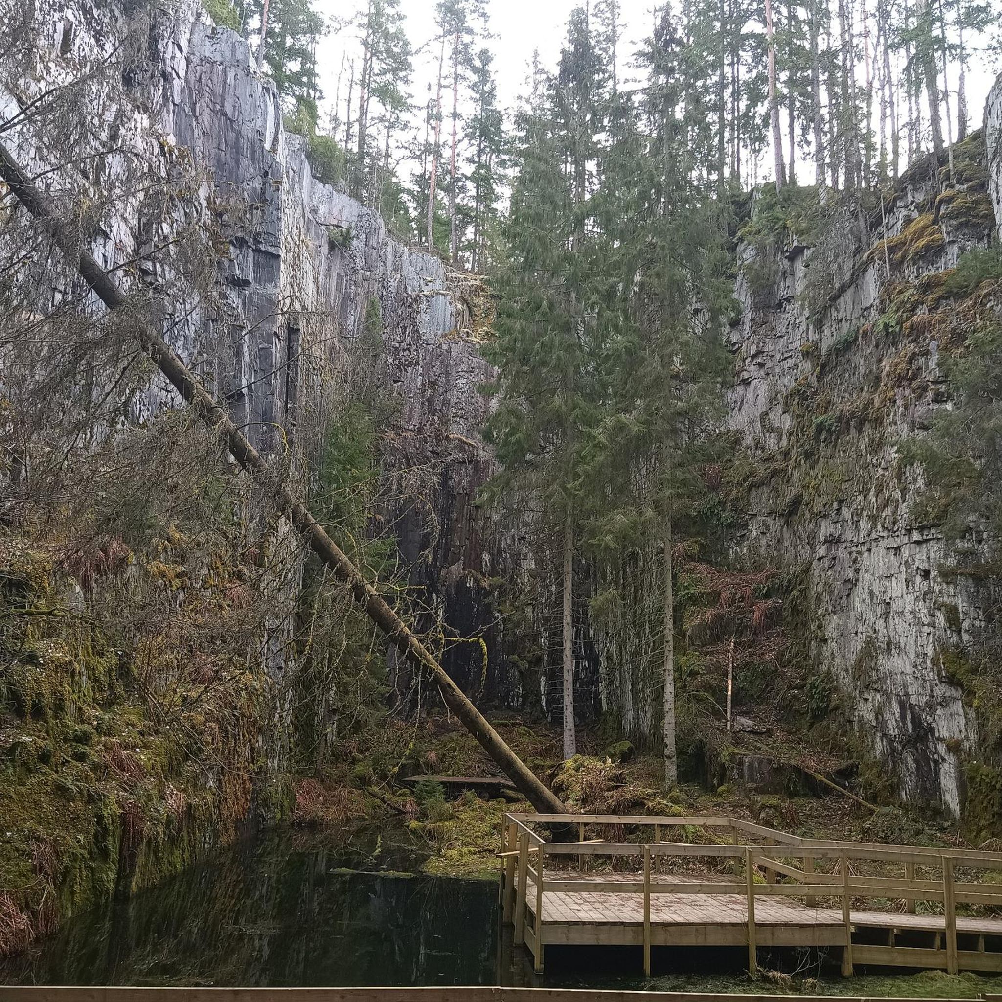
Several caves set up at the bottom of a very steep slope
0
0

The small sacred monument that the biker encounters here is designed somewhat differently than many other wayside crosses. The most common material is wood or stone, but here, metal has been used. The longitudinal beam is unusually long, so that it rises above the fields, visible from afar. The two ends of the crossbeam and the upper end of the longitudinal beam are adorned with an additional decorative element. But regardless of material and design, all crosses have one thing in common: For the faithful observer, they are a sign of the death of Jesus Christ, but at the same time, they always point beyond that to the resurrection.
0
0
maybe even a hundred years old
0
0

I really like this pass, I have done it several times, it is not slow but effective, especially on a certain side where there is a firecracker xD
0
0

Located between Meyrieux-les-étangs and Saint-Jean de Bournay in the northwest of the Isère department, the Etang de Montjoux is located at an altitude of 400m and covers an area of 14 hectares. Source: Isère Tourism
1
0

Padded mist on this February afternoon in the Cold Lands.
0
0
Road with good surface, little traffic.
0
0
View towards Artas from the Charantonnay road.
1
0
Frequently Asked Questions
How many no-traffic gravel bike trails are available around Saint-Jean-De-Bournay?
There are several dedicated no-traffic gravel bike trails around Saint-Jean-De-Bournay, offering a variety of experiences. This guide features 4 distinct routes, ranging from easy to difficult, ensuring options for different skill levels.
What is the best time of year for gravel biking in Saint-Jean-De-Bournay?
The region around Saint-Jean-De-Bournay is beautiful for gravel biking from spring through autumn. Spring offers lush greenery and blooming landscapes, while autumn provides vibrant colors. Summers are generally pleasant, but it's always wise to check local weather forecasts. Winter riding is possible, but some paths might be muddy or require more robust gear.
Are there any easy, car-free gravel routes suitable for beginners or families?
Yes, for an easier, car-free experience, consider the Gravel loop from Saint-Agnin-sur-Bion. This route is 11.3 km long with a gentle elevation gain, making it ideal for those new to gravel biking or looking for a relaxed ride through the countryside and valleys of Northern Isère.
What kind of scenery can I expect on these no-traffic gravel trails?
The no-traffic gravel trails around Saint-Jean-De-Bournay offer diverse and picturesque scenery. You'll ride through verdant countryside, peaceful forests, and past tranquil bodies of water like the Étang du Marais. Many routes provide 'jolis paysages' (pretty landscapes) and on clear days, you might even catch distant views of Mont Blanc and the Alps from elevated points.
Are there any challenging no-traffic gravel bike routes in the area?
Absolutely. For those seeking a more challenging ride, the View of Lyon – Vers le col de Bel Air loop from Diémoz offers a significant test. This route spans nearly 59 km with almost 1000 meters of elevation gain, providing a demanding yet rewarding experience on quiet paths.
What attractions or landmarks can I see along the gravel bike trails?
Many trails pass by or near interesting points. You might encounter historical sites like Bonnevaux Castle, nestled in the Bonnevaux Forest, or natural features such as the serene Étang du Marais, a large carp pond perfect for a peaceful stop. The region also features charming churches and viewpoints like the Orientation table at the summit of Chèzeneuve.
How long are the no-traffic gravel bike trails around Saint-Jean-De-Bournay?
The lengths of the no-traffic gravel bike trails vary to suit different preferences. You can find shorter loops, such as the 11.3 km Gravel loop from Saint-Agnin-sur-Bion, or longer, more challenging rides like the 58.6 km View of Lyon – Vers le col de Bel Air loop from Diémoz. There are options for quick outings and full-day adventures.
What do other gravel bikers say about the trails in Saint-Jean-De-Bournay?
The komoot community highly rates the gravel biking experience in this area, with an average score of 4.0 stars. Riders often praise the tranquility of the routes, the beautiful natural landscapes, and the opportunity to explore away from traffic, especially appreciating the mix of forests, ponds, and rolling hills.
Are there any circular no-traffic gravel routes available?
Yes, many of the no-traffic gravel routes in the area are designed as circular loops, allowing you to start and finish at the same point. An example is the Route de Beausoleil loop from Sainte-Anne-sur-Gervonde, which offers a moderate 15.7 km ride through pleasant countryside.
Where can I park when accessing these quiet gravel trails?
Given the rural nature of the Saint-Jean-De-Bournay region, parking is generally available in or near the villages where many of these trails begin. Look for public parking areas in towns like Saint-Agnin-sur-Bion, Diémoz, or Sainte-Anne-sur-Gervonde, which serve as common starting points for these routes.
What kind of gear is recommended for gravel biking in Saint-Jean-De-Bournay?
For gravel biking in Saint-Jean-De-Bournay, a gravel-specific bike or a hardtail mountain bike is ideal due to the varied terrain, which can include compacted dirt, loose gravel, and some paved sections. Comfortable cycling apparel, a helmet, water, and basic repair tools are essential. Depending on the season, consider layers for changing weather and mudguards if riding in wetter conditions.
Can I find cafes or places to stop for refreshments along the quiet gravel routes?
While many of the routes are designed to be away from heavy traffic, they often pass through or near small villages. These villages may offer local cafes, bakeries, or small shops where you can stop for refreshments. It's always a good idea to plan your route and check for amenities beforehand, especially on longer rides, and carry sufficient water and snacks.
Most popular routes around Saint-Jean-De-Bournay
Most popular attractions around Saint-Jean-De-Bournay

Get inspired with the komoot mobile app


Explore more
Browse the best Gravel rides in other regions.
