The best traffic-free bike rides around Riedisheim
4.6
(24)
108
riders
49
rides
Gravel biking around Riedisheim offers a diverse landscape characterized by rolling hills, extensive forests like the Forêt du Tannenwald and Hardt Forest, and significant waterways such as the Canal du Rhône au Rhin. The region, part of the Sundgau, provides a mix of quiet back roads, forest trails, and varied terrain including white roads and grass paths across fields. This environment is ideal for no traffic gravel bike trails, allowing riders to explore natural features and scenic viewpoints overlooking the…
Last updated: October 6, 2026
4.5
(6)
22
riders
70.9km
04:18
580m
580m
Hard gravel ride. Very good fitness required. Mostly paved surfaces. Suitable for all skill levels.
4.7
(6)
15
riders
Moderate gravel ride. Good fitness required. Mostly paved surfaces. Suitable for all skill levels.

12
riders
32.4km
02:21
120m
120m
Moderate gravel ride. Good fitness required. Mostly paved surfaces. Suitable for all skill levels.
5
riders
47.1km
03:12
460m
460m
Hard gravel ride. Very good fitness required. Mostly paved surfaces. Suitable for all skill levels.
6
riders
71.8km
04:21
90m
90m
Moderate gravel ride. Good fitness required. Mostly paved surfaces. Suitable for all skill levels.
Get access to more routes and recommendations from other explorers.
Already have an account?
Our route recommendations are based on thousands of hikes, rides, and runs completed by other people on komoot.

Tips from the Community

Nice shaded path along the Rhône au Rhin canal
0
0

Anyone who wants to know more about this should visit this page: https://sundgaufront.pharmafix.com/index.php/interaktive-frontkarte
1
0

sights again and again towards Cernay
0
0

Interesting and worthwhile change along the way
0
0
Interesting and worthwhile change along the way
0
0

The oldest surviving mention of Lutterbach dates back to 735. It already had a church at that time. The village was dependent on the Murbach Abbey. From the beginning of the 14th century until the French Revolution, Lutterbach belonged to the Cistercian monastery of Lützel.
0
0

The World War I Bunker Trail in Burnhaupt-le-Bas On the Bunker Trail, you can discover World War I fortifications built by the German army. After the fighting in the summer and autumn of 1914, the front in Upper Alsace stabilized on the Cernay-Dannemarie line. The municipal district of Burnhaupt-le-Bas remained on the German side. In December 1914 and January 1915, French offensives in this sector regularly clashed with the German lines. Numerous bunkers, command posts, and artillery posts. The tour can be done by mountain bike or on foot (hiking boots).
0
0

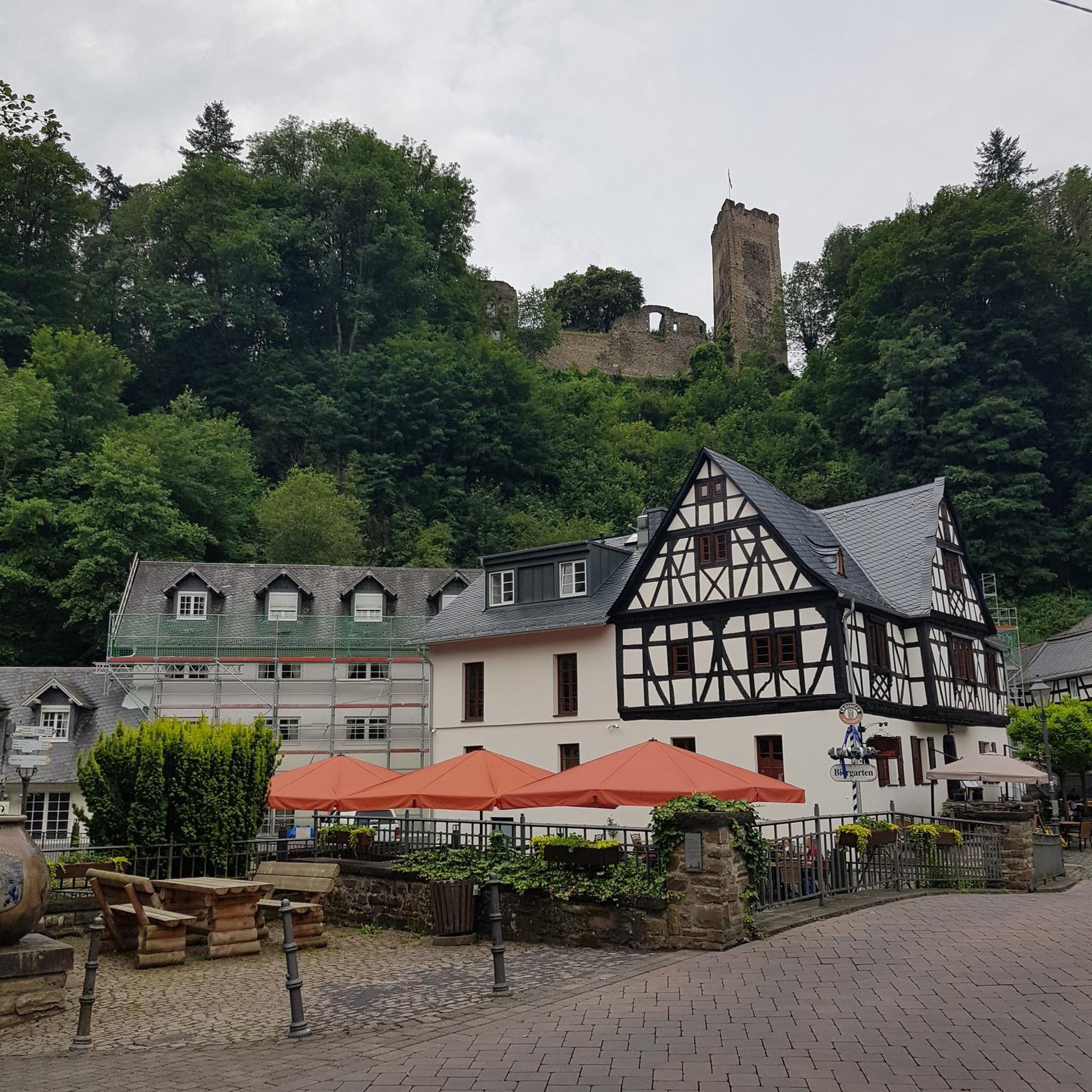
The castle fits nicely into the panorama. But I didn't go there.
0
0
Frequently Asked Questions
How many traffic-free gravel bike trails can I find around Riedisheim?
There are over 50 dedicated traffic-free gravel bike trails around Riedisheim, offering a wide range of experiences from easy rides to more challenging routes. This guide focuses specifically on those routes designed to keep you away from vehicular traffic.
Are there easy, traffic-free gravel bike trails suitable for beginners or families in Riedisheim?
Yes, Riedisheim offers several easy, traffic-free gravel bike trails perfect for beginners or families. For example, the Blue drawbridge Zillisheim – Brunstatt lock loop from Mulhouse-Ville is an easy route that follows the Canal du Rhône au Rhin, providing a flat and scenic ride away from cars. The region's canal paths are generally excellent for relaxed, traffic-free cycling.
What kind of landscapes can I expect on traffic-free gravel bike trails near Riedisheim?
The traffic-free gravel bike trails near Riedisheim offer a diverse range of landscapes. You'll encounter urban green spaces, rolling hills, extensive forests like the Hardt Forest, and scenic paths along waterways such as the Canal du Rhône au Rhin. The Sundgau region, in particular, features a mix of meadows, fields, and forest trails, often on quiet back roads or white gravel paths.
Are there any notable attractions or viewpoints along the traffic-free gravel bike routes?
Absolutely. Many routes offer opportunities to see interesting sights. You can cycle past the impressive Niffer Lock on the Rhône-Rhin Canal or the Zillisheim Drawbridge and Lock No. 35. The 'collines du Horst' (Horst hills) also provide picturesque viewpoints overlooking Mulhouse, the Vosges mountains, and even Germany's Black Forest, accessible via quiet paths.
Can I find circular traffic-free gravel bike routes around Riedisheim?
Yes, many of the traffic-free gravel bike routes around Riedisheim are designed as loops, allowing you to start and end at the same point without retracing your steps. An example is the Nice trailhead – Small lake with island loop from Mulhouse-Ville, which offers a substantial circular ride through varied terrain.
What is the best time of year for gravel biking on traffic-free trails in Riedisheim?
The best time for gravel biking in Riedisheim is generally from spring through autumn (April to October). During these months, the weather is typically mild, and the trails are in good condition. The diverse landscapes, from forests to fields, are particularly beautiful in spring with blooming flora and in autumn with vibrant foliage. Winter riding is possible, but some paths might be muddy or icy.
Are there options for parking near the trailheads of traffic-free gravel bike routes?
Yes, many trailheads for gravel bike routes around Riedisheim offer convenient parking options. While specific parking details vary by route, areas around Mulhouse-Ville, Bruebach, and other starting points often have designated parking. It's always recommended to check the individual route details on komoot for the most accurate parking information.
What do other gravel bikers enjoy most about the traffic-free trails in Riedisheim?
The komoot community highly rates the gravel biking experience in Riedisheim, with an average score of 4.46 stars. Reviewers often praise the region's quiet, well-maintained paths, the diverse scenery ranging from canal-side routes to forest trails, and the overall sense of tranquility away from traffic. The blend of natural beauty and accessible routes is frequently highlighted.
Are the traffic-free gravel bike trails in Riedisheim suitable for dogs?
Many of the traffic-free gravel paths and forest trails around Riedisheim are suitable for dogs, especially those that traverse natural areas like the Hardt Forest or the 'collines du Horst'. However, it's important to keep dogs on a leash, especially in nature reserves like the Petite Camargue Alsacienne, and to be mindful of other trail users and local regulations regarding pets. Always carry water for your dog.
Can I access these traffic-free gravel bike trails using public transport?
Riedisheim and its surrounding areas are well-connected, making it possible to access many trailheads via public transport. Mulhouse-Ville, a common starting point for several routes, is a major hub. You can often reach starting points by train or bus, though it's advisable to check local public transport schedules and bike carriage policies beforehand to plan your journey effectively.
What are the typical distances and durations for traffic-free gravel bike tours in this region?
The traffic-free gravel bike tours around Riedisheim vary significantly in distance and duration. You can find routes ranging from shorter, easy rides of around 30 km taking a couple of hours, such as the Blue drawbridge Zillisheim – Brunstatt lock loop, to longer, more challenging tours exceeding 40 km that can take 3-4 hours or more, like the Nice trailhead – Small lake with island loop from Mulhouse-Ville. This variety allows you to choose a route that fits your fitness level and available time.
Most popular attractions around Riedisheim

Get inspired with the komoot mobile app


Explore more
Browse the best Gravel rides in other regions.
