The best traffic-free bike rides around Erro
4.7
(9)
54
riders
9
rides
No Traffic gravel bike trails around Erro offer a network of routes through the scenic Navarra Pyrenees. The region is characterized by diverse unpaved roads, forest paths, and rural landscapes, providing varied terrain for gravel biking. These routes often wind through dense forests and alongside valleys, connecting natural features. The area's topography includes significant elevation gains, making it suitable for challenging gravel rides.
Best no traffic gravel bike trails around Erro
- The most popular no traffic gravel bike trail is…
Last updated: November 2, 2026
4.5
(2)
15
riders
37.3km
02:31
680m
680m
Hard gravel ride. Very good fitness required. Mostly paved surfaces.
5.0
(1)
7
riders
60.4km
04:30
1,380m
1,380m
Hard gravel ride. Very good fitness required. Mostly paved surfaces.

5.0
(2)
4
riders
39.1km
03:03
890m
890m
Hard gravel ride. Very good fitness required. Mostly paved surfaces.
5.0
(1)
8
riders
63.3km
03:59
1,000m
1,000m
Hard gravel ride. Very good fitness required. Mostly paved surfaces.
5.0
(4)
7
riders
33.6km
02:42
940m
940m
Hard gravel ride. Very good fitness required. You may need to push your bike for some segments of this route.
Get access to more routes and recommendations from other explorers.
Already have an account?
Our route recommendations are based on thousands of hikes, rides, and runs completed by other people on komoot.
Start today with a free account
Your next adventure awaits.



Tips from the Community

Reaching Roncesvalles meant the luxury of sleeping in a real bed at the famous pilgrim hostel (albergue de peregrinos). Marking the end of the legendary first stage of the Camino Francés from Saint-Jean-Pied-de-Port into Spain, this impressive, well-organized facility is wonderfully run by Dutch volunteers. Since there is no grocery store in Roncesvalles itself, a necessary 5 km round-trip walk was required to stock up, loading down my backpack with enough supplies for 5 breakfasts, 7 lunches, and 5 dinners for the demanding days ahead.
2
0
At the foot of the Pyrenees on the Spanish side of the border, Roncesvalles is one of the most iconic and historic stops on the entire Camino de Santiago. Famous for its magnificent 13th-century Royal Colegiata of Saint Mary, this small hamlet has welcomed weary pilgrims and hikers for centuries after their demanding trek over the mountain pass from Saint-Jean-Pied-de-Port. Beyond its rich medieval history and legendary link to the Song of Roland, Roncesvalles offers essential comforts for travelers today, including pilgrim hostels, warm meals, and a deeply atmospheric sanctuary where you can rest, reflect, and prepare for the road ahead.
2
0

Orreaga-Roncesvalles preserves the memory of heroic songs, ancient paths, and exhausted pilgrims on the way to Compostela. Kings who built hospitals, churches, monasteries, and chapels, innkeepers for whom welcoming strangers was and is sacred, and the love for their Holy Virgin, their brotherhood, and their pilgrims and their many crosses. Since the 10th century, Roncesvalles has been a place where pilgrims on the Camino de Santiago to Santiago de Compostela can rest after their arduous ascent. Santa María de Roncesvalles is above all a place for spirituality and pilgrimage. Pilgrim masses, pilgrimages, Brotherhood of Nuestra Señora. At the 1057m high Puerto Roncesvalles pass, Augustinians founded the Colegiata de Roncesvalles abbey in 1130. As early as 778, a battle took place here between the Franks under Charlemagne and the Basques. The warrior Roland was killed, and the Song of Roland was created.
0
0

It's the first road sign indicating the distance to Santiago. It's worth a photo.
0
0

Even if you don't plan or have the ability to walk the entire Camino Frances, the stage that reaches Roncesvalles is a must for the beauty of the landscapes and the evocative atmosphere it offers, especially when—descending from the Ibañeta Pass—the boundless Spanish landscape suddenly opens up before your eyes in the golden light of sunset. It's a magical moment, ideally shared with other pilgrims and then enhanced with a visit to the Collegiate Church. The stamp on the Credencial is also beautiful.
1
0

Don't miss a visit to the Pilgrims' Hospital and the Collegiate Church of Santa María. Also, learn about the history of Roncesvalles, as it's very interesting.
0
0
It is a very pleasant straight of slides... by car... because by bike you notice them in your legs.
0
0
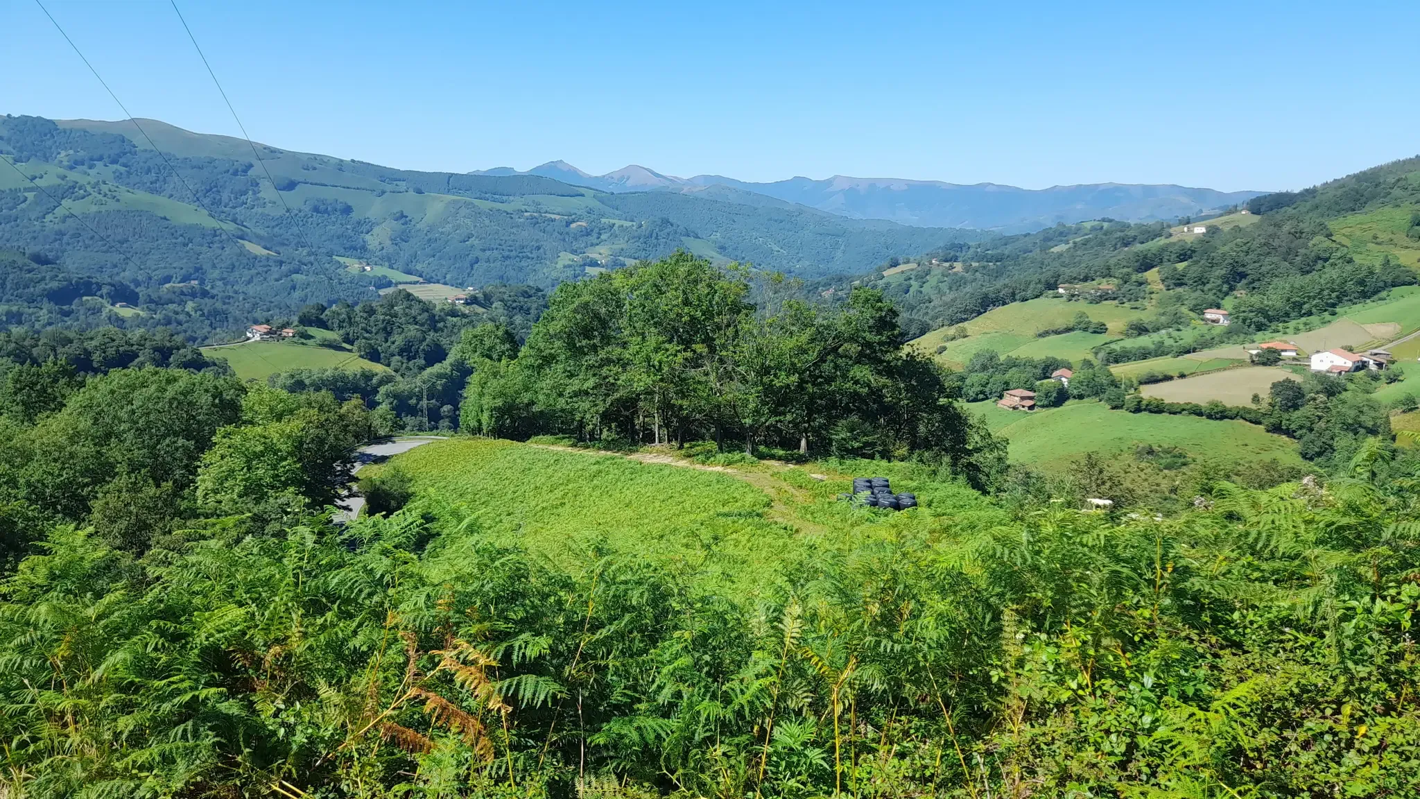
One of the most inhospitable and spectacular mountain passes in the eastern Pyrenees, with several slopes, all of them very difficult. The landscape is wild and wonderful. You can breathe absolute tranquility and you can dedicate yourself exclusively to enjoying the views, the horses, the sheep, the cows and the suffering on the bike. The summit is on the border with Spain, although there is no road that crosses the border, so the pass runs entirely in France. I have climbed it on 2 of its slopes. The first time I climbed it on the slope that crosses the Col d'Orgambide, on the D428 road, which starts from Estérençuby. The first 3 km are very easy, until you cross the detour to go up to Artaburu, where the road begins to have slopes of more than 10%. From there, to the summit, the climb is very hard, around 9%, on a very rough and bumpy road, with a lot of humidity and crossing a wonderful beech forest. Once you reach the top of the Col d'Orgambide, you turn right and continue climbing for another half kilometre with a gradient of 11%. There comes a small descent, to face the last 3 kms, the first 2 very hard with several 13% gradients. The last kilometre is very easy and has panoramic views that are simply wonderful. The second time I climbed it on the side that starts from Arneguy and Ondarolle. This side is harder than the previous one, with a central section that is hellish, being 6 kms at an average of 10%, and a very hard km at 12% and 18% gradients!!! The final part is more gentle. You cross the Croix de Thibault in the penultimate kilometre of the climb. The final kilometre is very gentle and with beautiful and exciting panoramic views.
1
0
Frequently Asked Questions
How many no-traffic gravel bike trails are available in Erro?
Erro offers a selection of 5 dedicated no-traffic gravel bike trails, perfect for those seeking serene and car-free cycling adventures. These routes are designed to immerse you in the region's natural beauty without vehicle interference.
What is the typical difficulty level for gravel biking in Erro?
The no-traffic gravel bike trails in Erro are generally considered difficult. They often feature significant elevation changes and varied terrain, making them suitable for experienced gravel bikers looking for a challenging ride. For example, the Forest Path Near Roncesvalles loop from Aurizberri covers over 40 km with more than 700 meters of ascent.
What is the best season for gravel biking in Erro?
While Erro can be enjoyed year-round, the spring and autumn months typically offer the most pleasant conditions for gravel biking. The weather is milder, and the natural landscapes are particularly vibrant. Summer can be warm, and winter may bring snow or colder temperatures, especially at higher elevations in the Pyrenees foothills.
Are there any circular no-traffic gravel bike routes in Erro?
Yes, many of the no-traffic gravel bike trails in Erro are designed as circular routes, allowing you to start and end at the same point. An excellent example is the Urrobi Valley – Hórreo de Lusarreta loop from Oroz-Betelu, which offers a rewarding circular journey through the scenic valley.
What kind of natural attractions can I expect to see along the trails?
Erro's no-traffic gravel trails wind through diverse natural environments, offering glimpses of the region's unique features. You might encounter natural monuments like the Roland Fountain or the intriguing Arrikulunka, the "dancing stone". The routes also traverse mountain passes such as Ibañeta Pass, providing stunning views of the surrounding Pyrenean landscape.
Is parking available near the starting points of these gravel trails?
Parking availability varies by starting point, but many villages and towns in the Erro region, such as Aurizberri or Oroz-Betelu, offer public parking options suitable for accessing the trails. It's advisable to check specific route details on komoot for recommended parking locations near your chosen starting point.
Are there any longer, more challenging no-traffic gravel routes for experienced riders?
Absolutely. For those seeking a significant challenge, the Forest Path Near Roncesvalles loop from Aurizberri stands out. This route extends over 60 km with more than 1300 meters of elevation gain, providing an epic and traffic-free gravel biking experience through the rugged terrain of Erro.
What do other gravel bikers enjoy most about the trails in Erro?
The komoot community highly rates the gravel biking experience in Erro, with an average score of 4.7 stars. Reviewers often praise the tranquility and natural beauty of the car-free paths, the challenging climbs, and the immersive feeling of riding through the Pyrenean foothills. The sense of adventure and escape from traffic are frequently highlighted.
Can I access these gravel trails using public transport?
Public transport options to the more remote starting points in Erro can be limited. While some larger towns might have bus connections, reaching specific trailheads often requires personal transport. Planning your journey in advance and checking local bus schedules for the Navarra region is recommended if you plan to rely on public transport.
Are there any cafes or refreshment stops along the no-traffic gravel routes?
Given the 'no-traffic' nature of these trails, many routes venture into more remote areas where amenities are scarce. While some routes might pass through small villages with local establishments, it's generally recommended to carry sufficient water and snacks. Always check the route details for any specific points of interest or towns along the way where you might find refreshments.
What are the winter conditions like for gravel biking in Erro?
Winter gravel biking in Erro can be challenging. Higher elevations, especially closer to the Pyrenees, may experience snow and ice, making some trails impassable or requiring specialized equipment. Lower sections might be wet and muddy. It's crucial to check local weather forecasts and trail conditions before heading out during the colder months.
Are there any family-friendly no-traffic gravel bike options in Erro?
While the listed no-traffic gravel trails in Erro are rated as 'difficult' due to their length and elevation, families with older, experienced children who are comfortable with challenging terrain might find them rewarding. For younger children or less experienced riders, it's best to look for shorter, flatter sections or consider other guides focused on easier routes, as these specific trails demand a good level of fitness and skill.
What makes Erro a unique destination for no-traffic gravel biking?
Erro stands out for its pristine, car-free gravel paths that wind through the foothills of the Navarra Pyrenees. The region offers a unique blend of challenging ascents, rewarding descents, and deep immersion in nature, far from the hustle and bustle of roads. It's an emerging destination for gravel enthusiasts seeking untouched landscapes and a true sense of outdoor adventure.
Are there any routes that offer particularly scenic viewpoints?
Many routes in Erro provide breathtaking views, especially as you gain elevation. The Roncesvalles – Trail to Col de Bentarte loop from Orreaga / Roncesvalles, for instance, takes you through areas with panoramic vistas of the Pyrenees. Keep an eye out for highlights like Collado de Bentartea, which are known for their stunning outlooks.
Most popular attractions around Erro

Get inspired with the komoot mobile app


Explore more
Browse the best Gravel rides in other regions.
