The best traffic-free bike rides around Bovey Tracey
4.4
(104)
1,162
riders
29
rides
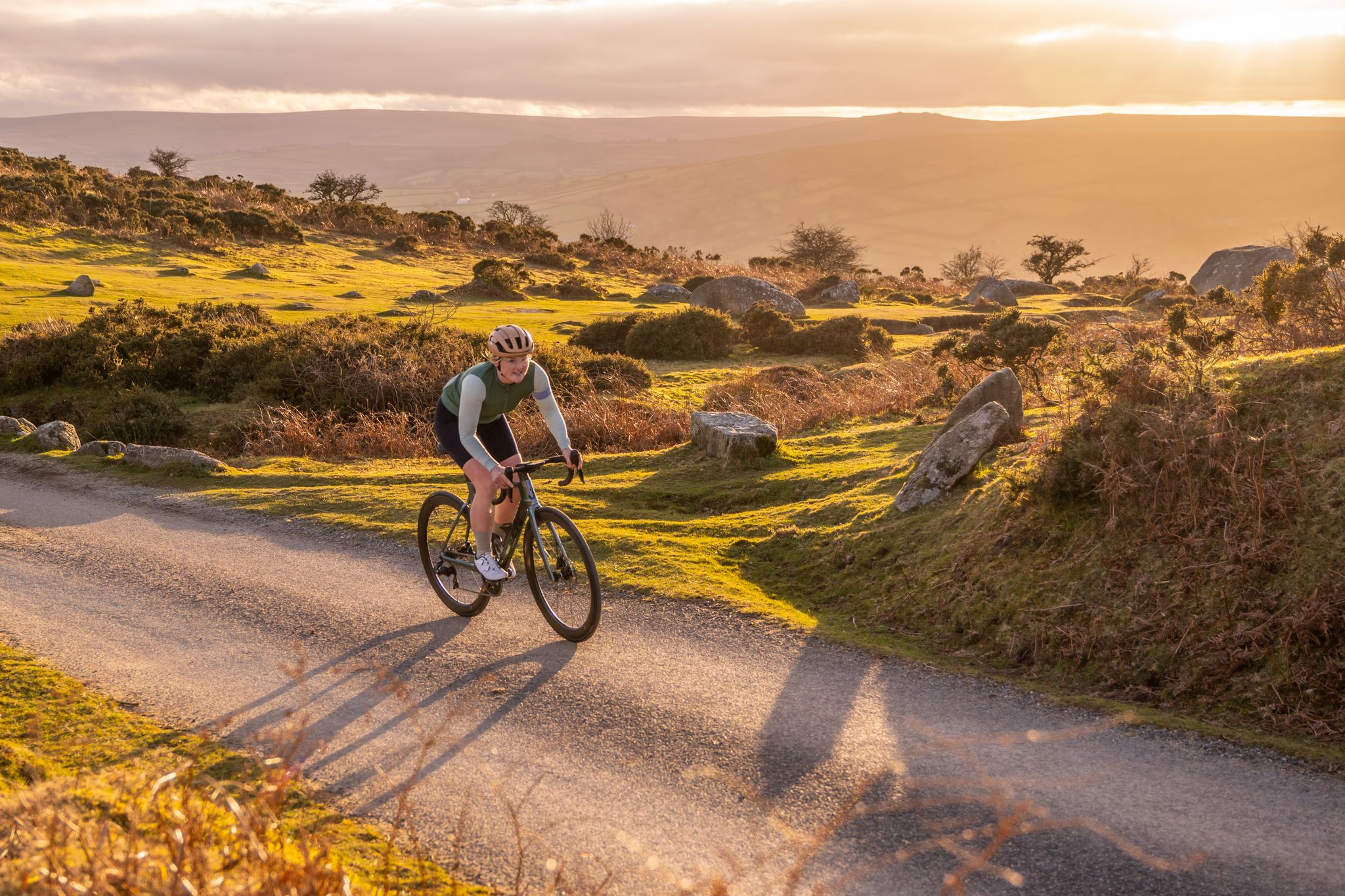
No traffic touring cycling routes around Bovey Tracey are located at the eastern edge of Dartmoor National Park, providing access to diverse landscapes. The area is characterized by expansive moorland, ancient woodlands, and river valleys, with the River Bovey meandering through the local terrain. This geography offers a mix of flat, traffic-free paths and more challenging routes with varied elevation.
Best no traffic touring cycling routes around Bovey Tracey
- The most popular no traffic touring cycling route is Old Crane…
Last updated: May 19, 2026
4.7
(20)
181
riders
Easy bike ride. Great for any fitness level. Mostly paved surfaces. Suitable for all skill levels.
4.7
(21)
163
riders
25.3km
01:28
110m
110m
Easy bike ride. Great for any fitness level. Mostly paved surfaces. Suitable for all skill levels.

Sign up for free
4.5
(4)
29
riders
44.8km
03:14
820m
820m
Hard bike ride. Very good fitness required. Mostly paved surfaces. Suitable for all skill levels.
2.0
(2)
37
riders
10.7km
00:47
90m
90m
Easy bike ride. Great for any fitness level. Mostly paved surfaces. Suitable for all skill levels.
5.0
(2)
24
riders
39.0km
02:43
500m
500m
Hard bike ride. Very good fitness required. Mostly paved surfaces. Suitable for all skill levels.
Get access to more routes and recommendations from other explorers.
Sign up for free
Already have an account?
Our route recommendations are based on thousands of hikes, rides, and runs completed by other people on komoot.
Start today with a free account
Your next adventure awaits.
Login or Signup
Other adventures around Bovey Tracey

Tips from the Community

A mixture of asphalt and gravel paths. But being an old railway line, a gentle incline towards Moretonhampstead.
0
0


Excellent food and some lovely ales! Friendly & inviting.
0
0
Fabulous Trail! A 7 mile (11km) mainly traffic-free route from Bovey Tracey to Moretonhampstead follows the dismantled railway line through the National Trust Parke Estate and past the beautiful picturesque village of Lustleigh.
0
0

The Old Bovey Railway Line, also known as the Bovey Tracey to Moretonhampstead railway, was a branch line in Devon, England, that served the towns of Bovey Tracey and Moretonhampstead. The railway was opened in the mid-19th century, specifically in 1866, to facilitate the transportation of goods and passengers in this rural area. The line played a vital role in the local economy, enabling the transport of agricultural products, minerals, and other goods. It was particularly significant for the granite industry, as the region is known for its granite quarries. The railway line was eventually closed to passenger traffic in the mid-20th century, with the last freight services ceasing in the 1970s. Today, parts of the old railway line have been repurposed as walking and cycling paths, allowing visitors to explore the scenic countryside while enjoying the history of the railway. The route offers a glimpse into the region's rural heritage and is popular with outdoor enthusiasts. If you're interested in railway history or simply enjoy walking in beautiful landscapes, the Old Bovey Railway Line provides a lovely opportunity to connect with both.
0
0

another opportunity to remember why you are on the cycle path
0
0
lsington manor is recorded in the doomsday book of 1086 and was one of six mediaeval manors in the parish in the 13th century. it was held from the Beaumonts earls of Devon by their tenants. the Dynim's records show the Dynem's were benefactors of St. Michael's church and founders of a chantry in the north concept of the church. the blocked up doorway of the transcept laid out to the manor garden when the last lord Dynham died in 1501 here. John Ford and Emily bought two of these three parts and his son George a further one. It is George who is thought to have rebuilt the house into its characteristic Elizabeth and e-shaped style. one of George's sons was John Ford, a well-known dramatist by the 17th century. during the ownership of sir Henry ford MP for Tiverton, his estate was again fragmented. Records show that by 1829 a manor house was in two ownerships. The central range of the building had disappeared and the two wings were little more than cottages. By the mid-19th century. these were being used for agricultural storage in 1852. description of the manor describes it as "the remains of a mouldering mansion went fast and venerable which form a very pleasing object from the precinct of the church, the tourists and ponder on the dim prestige of the Harris million and bracketed and bayed all over. they're all that there left is a miscuit and phantom of the past" In 1871. part of the site was sold to the vicar and churchwardens of Islington to provide plans for the current school. Many of the original dress stones from the manor house can be seen around the village where they're being reused in buildings and walls.
0
0

Frequently Asked Questions
How many no-traffic touring cycling routes are available around Bovey Tracey?
There are over 30 dedicated no-traffic touring cycling routes around Bovey Tracey, catering to various skill levels. This includes 9 easy routes, 5 moderate, and 16 more challenging options for those seeking a longer adventure.
Are there any easy, family-friendly traffic-free cycling routes near Bovey Tracey?
Yes, the area is excellent for family cycling. The Café 3 Sixty – Wray Valley Trail loop is an easy, mostly traffic-free option that utilizes the Wray Valley Trail, perfect for a relaxed ride. Another great choice is the Stover Trail, which connects Bovey Tracey to Newton Abbot and passes through Stover Country Park, offering a flat, multi-use path suitable for all ages.
What kind of natural features can I expect to see along the no-traffic cycling routes?
The routes around Bovey Tracey offer diverse natural beauty. You can expect to cycle alongside the tranquil River Bovey, through ancient woodlands, and near picturesque reservoir landscapes like those found on the Tottiford Reservoir – Kennick Reservoir loop. Dartmoor National Park's dramatic granite tors, such as Haytor Rocks and Hound Tor, are also within reach, offering panoramic views.
Are there any circular no-traffic bike routes available?
Yes, many of the no-traffic routes are designed as loops. For example, the Old Crane at Ventiford Basin – Cafe 3 Sixty loop offers a pleasant circular ride. The broader Dartmoor Way, while not entirely traffic-free, incorporates many quiet lanes and dedicated sections, forming a 95-mile circular route around the National Park, with Bovey Tracey as a key gateway.
Can I find cafes or pubs along the traffic-free cycling paths?
Absolutely. The Wray Valley Trail, for instance, passes near the National Trust Parke Estate, which often has facilities. The Stover Trail leads to Stover Country Park, where you can find amenities. Many routes will take you through or near villages where cafes and pubs are readily available for refreshments. The Old Crane at Ventiford Basin – Town Quay Bridge loop is another route that offers opportunities for stops.
What is the best time of year for traffic-free cycling in Bovey Tracey?
Spring and autumn generally offer the most pleasant conditions for cycling, with milder temperatures and beautiful scenery as the landscape changes. Summer is also popular, but trails can be busier. Winter cycling is possible, but be prepared for potentially wet and muddy conditions, especially on unpaved sections, and shorter daylight hours.
Are there any specific points of interest along the Wray Valley Trail?
The Wray Valley Trail, a largely traffic-free route, follows a disused railway line and offers several points of interest. It passes through the beautiful National Trust Parke Estate and near the picturesque village of Lustleigh, known for its charm. You'll also enjoy scenic views of the River Bovey and surrounding woodlands.
Where can I park my car when accessing the no-traffic cycling routes?
Bovey Tracey offers various parking options. For routes like the Wray Valley Trail, you can often find parking near the National Trust Parke Estate. For the Stover Trail, parking is available at Stover Country Park. Many routes starting directly from Bovey Tracey will have access to town car parks. Always check local signage for specific parking regulations and fees.
What do other touring cyclists enjoy most about cycling in Bovey Tracey?
The area is highly rated by the komoot community, with an average score of 4.38 stars. Reviewers often praise the quiet, scenic routes, the variety of terrain from gentle riverside paths to more challenging climbs, and the stunning natural beauty of Dartmoor National Park. The accessibility of traffic-free trails like the Wray Valley and Stover Trails is also frequently highlighted.
Are there any opportunities for wild swimming near the cycling trails?
While specific designated wild swimming spots directly adjacent to the traffic-free cycling trails are not widely advertised, the River Bovey meanders through the area and offers tranquil spots. However, always exercise caution, check local conditions, and be aware of private land or environmental restrictions before attempting any wild swimming.
Are there any challenging no-traffic routes for experienced touring cyclists?
While dedicated 'no-traffic' routes tend to be easier, the region offers challenging rides that incorporate quiet lanes and traffic-free sections. For instance, the Wray Valley Trail – Wray Valley Trail loop, despite its name, is a longer, more difficult route with significant elevation gain, offering a substantial challenge for experienced riders exploring the wider area around the Wray Valley.
Most popular routes around Bovey Tracey
Most popular attractions around Bovey Tracey

Get inspired with the komoot mobile app


Explore more
Browse the best Cycling routes in other regions.
