The best traffic-free bike rides around Hamme
4.5
(91)
1,586
riders
45
rides
No traffic touring cycling routes around Hamme are primarily characterized by their connection to the Scheldt River and the surrounding flat, water-rich landscapes of East Flanders, Belgium. The region features expansive polders and areas where the Durme and Schelde rivers converge, offering a diverse natural setting. While generally flat, some routes include slight elevation changes, making the terrain accessible for various fitness levels.
Best no traffic touring cycling routes around Hamme
- The most popular no traffic touring cycling route is…
Last updated: May 11, 2026
4.8
(32)
214
riders
57.3km
03:16
100m
100m
Moderate bike ride. Good fitness required. Mostly paved surfaces. Suitable for all skill levels.
5.0
(2)
360
riders
51.0km
03:22
150m
150m
Moderate bike ride. Good fitness required. Mostly paved surfaces. Suitable for all skill levels.

Sign up for free
4.0
(1)
84
riders
56.4km
03:44
70m
70m
Moderate bike ride. Good fitness required. Mostly paved surfaces. Suitable for all skill levels.
4.6
(7)
52
riders
33.4km
01:59
90m
90m
Easy bike ride. Great for any fitness level. Mostly paved surfaces. Suitable for all skill levels.
31
riders
Easy bike ride. Great for any fitness level. Mostly paved surfaces. Suitable for all skill levels.
Get access to more routes and recommendations from other explorers.
Sign up for free
Already have an account?
Our route recommendations are based on thousands of hikes, rides, and runs completed by other people on komoot.
Start today with a free account
Your next adventure awaits.
Login or Signup


Other adventures around Hamme

Tips from the Community

The largest flood plain in Flanders lies in the Polders of Kruibeke along the Scheldt River. Don't worry, flooding only happens a few times a year. Every other day of the year, you can walk, cycle, play, or fish carefree: it's all possible in the Polders of Kruibeke. The paths lead you through a diverse landscape of mudflats and salt marshes, alder swamp forests, and meadow bird habitats. Don't forget your binoculars for wildlife spotting. It's definitely worth a visit!
3
0


The Donkmeer in Overmere is not just a picturesque body of water; it is a silent witness to centuries of labor and human perseverance. This area was once a vast peatland, where peat – dried peat used as fuel – was extracted by hand. This peat extraction shaped the landscape: deep pits were created where the peat had been removed, and these later filled with water, creating the Donkmeer. On the shore of the lake stands the bronze Turfstekerstandbeeld (Peat Cutter Statue), a powerful tribute to the men who performed this work. The statue, made by Michel Peleman, depicts a peat cutter in action – bent over his work, with simple clothing and tools. It is a reminder of a time when peat was the main means of heating, and when workers performed heavy manual labor day in and day out for meager wages. While they lived in simple huts around the lake, their bosses made fortunes from the peat trade.
6
0
The Donkmeer in Berlare is one of the largest lakes in Flanders and forms the beating heart of a versatile nature and recreation area. Originating from old peat extraction pits, the lake stretches over 86 hectares, of which approximately 30% is protected nature reserve. The area offers a beautiful backdrop of Scheldt nature, with fields, forests, marshes and a rich biodiversity. The Donkmeer is also a popular spot for birdwatchers, with numerous rare bird species residing in and around the water. Along the banks you will find cozy restaurants, including restaurants known for their eel dishes.
6
0
The Bareldonkkapel, also known as the Chapel of Our Lady of Seven Sorrows, is a historical and spiritual gem in Berlare, situated on the southwestern slope of Kapelleberg, a sand dune near Donkmeer lake. The chapel dates back to at least the early 14th century, as evidenced by glazed Flemish floor tiles found under the choir in 1959. Around the chapel is a ambulatory with seven wooden chapels, symbolizing the seven sorrows of Mary. In 1935, this devotional route was enhanced with the construction of an impressive Calvary, featuring life-size statues by Ghent artist Aloïs De Beule, depicting the Passion of Christ.
5
0
Beautiful, long unpaved avenue, where you tunnel through the green foliage.
6
0

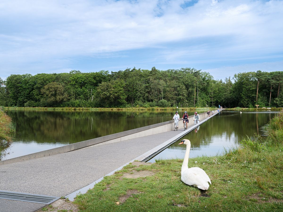
most beautiful bridge in the world. Enough!
1
0
Frequently Asked Questions
How many no-traffic touring cycling routes are available around Hamme?
There are over 45 dedicated no-traffic touring cycling routes around Hamme. The majority of these, about 30, are classified as easy, making them accessible for various fitness levels.
What makes Hamme a good destination for no-traffic touring cycling?
Hamme is ideally situated within the Scheldeland region, offering extensive car-free paths along the Scheldt and Durme rivers. The area is known for its well-developed cycling infrastructure, including signposted routes and a cycle node network, ensuring a smooth and scenic experience away from traffic.
Are the no-traffic touring routes around Hamme generally easy or challenging?
The terrain around Hamme is predominantly flat, making most no-traffic touring routes accessible and generally easy. While some routes might have slight elevation changes, they are suitable for a wide range of cyclists. For example, the "Go with the flow cycling route" is a moderate option with minimal elevation.
Can I find circular no-traffic touring routes in Hamme?
Yes, many no-traffic touring routes around Hamme are designed as loops, allowing you to start and end at the same point. An example is the "Driegoten Ferry and Riverside – Path Along the Scheldt River loop from Hamme", which offers a scenic circular journey.
What natural features or landmarks can I expect to see on no-traffic touring routes near Hamme?
You'll encounter diverse landscapes, including the meandering Scheldt and Durme rivers, polders, and green spaces. Notable natural features include the Peat Pits of Berlare Broek, an old Scheldt meander, and the picturesque Schelde Bend at Sint-Amands. The region's 'water rich area' provides many scenic views.
Are there any specific points of interest along these car-free cycling routes?
Absolutely. Cyclists can discover various points of interest, such as the modern Mira Bridge and the historic Temse Scheldt Bridge. Park Kerkwijck in Hamme also offers a tranquil green oasis with a pond and gardens, easily accessible by bike.
Is it possible to combine cycling with public transport in Hamme?
Flanders, including Hamme, has a well-integrated public transport system. While specific details for bike transport vary, the extensive cycle node network makes it easy to connect different routes, potentially reducing the need for long-distance public transport with your bike. Check local transport provider websites for current bike policies.
Where can I park my car when starting a no-traffic touring cycling route in Hamme?
Hamme offers various parking options. For instance, Park Kerkwijck, a central green space, has bicycle parking facilities at its main entrance, suggesting nearby car parking might also be available for those starting their rides there. Look for designated parking areas in the town center or near popular route access points.
What is the best time of year to enjoy no-traffic touring cycling in Hamme?
The spring and summer months (April to September) generally offer the most pleasant weather for touring cycling in Hamme, with milder temperatures and longer daylight hours. However, the region's well-maintained paths are enjoyable throughout much of the year, with autumn providing beautiful foliage.
Are there family-friendly no-traffic touring cycling routes in Hamme?
Given the generally flat terrain and the abundance of easy, car-free paths, Hamme is very suitable for family cycling. Routes along the riverbanks are particularly safe and enjoyable for all ages. The "Path Along the Scheldt River – Temse Scheldt Bridge loop from Hamme" is a moderate option that families with some cycling experience might enjoy.
What do other touring cyclists enjoy the most about touring cycling in Hamme?
The area is highly rated by the komoot community, with an average score of 4.4 stars from over 120 ratings. Reviewers often praise the peaceful, car-free nature of the routes, the scenic river views, and the excellent cycling infrastructure that makes navigation straightforward and enjoyable.
Can I find routes that feature river crossings by ferry?
Yes, a unique aspect of cycling in the Scheldeland region is the opportunity to use free river ferries to cross the Scheldt, adding an adventurous element to your journey. Routes like the "Driegoten Ferry and Riverside – Path Along the Scheldt River loop from Hamme" incorporate these charming crossings.
Most popular attractions around Hamme

Get inspired with the komoot mobile app


Explore more
Browse the best Cycling routes in other regions.
