The best traffic-free bike rides around Sesto Calende
4.4
(768)
17,433
riders
30
rides
No traffic road cycling routes around Sesto Calende are situated at the southern end of Lake Maggiore, where the Ticino River begins its flow. The region features a diverse landscape, including the shores of Lake Maggiore, the Ticino River valley, and the surrounding hills. Cyclists can expect routes along riverfronts and lakesides, with some paths extending into the Ticino Valley Regional Park, characterized by forests and varied terrain. The area offers a mix of flat, well-paved surfaces and routes with…
Last updated: July 28, 2026
4.9
(10)
19
riders
22.2km
00:58
200m
200m
Easy road ride. Great for any fitness level. Mostly well-paved surfaces and easy to ride.
4.0
(2)
10
riders
36.5km
01:35
290m
290m
Easy road ride. Great for any fitness level. Mostly well-paved surfaces and easy to ride.

Sign up for free
1
riders
179km
07:12
590m
590m
Hard road ride. Very good fitness required. Mostly well-paved surfaces and easy to ride.
4.0
(1)
93
riders
34.5km
01:37
240m
240m
Moderate road ride. Great for any fitness level. Some segments of this route may be unpaved and difficult to ride.
5.0
(1)
32
riders
49.8km
02:14
470m
470m
Moderate road ride. Good fitness required. Mostly well-paved surfaces and easy to ride.
Get access to more routes and recommendations from other explorers.
Sign up for free
Already have an account?
Our route recommendations are based on thousands of hikes, rides, and runs completed by other people on komoot.
Start today with a free account
Your next adventure awaits.
Login or Signup
Popular around Sesto Calende

Other adventures around Sesto Calende

Tips from the Community

The Monument to the jet of the Cameri Air Base is an installation located at the entrance of the military airport (headquarters of FACO F-35 Leonardo and NATO base Juragentium). The square is characterized by the presence of a historic F-104 Starfighter fighter-bomber with "Tiger" Clipper livery. Cameri Airport (NO) boasts a long Komoot tradition, having been founded in 1910 as one of the first flight schools in Italy Facebook. At the base, there is also an outdoor museum area with historic aircraft, and sometimes guided tours or open days of the Aeronautica Militare are planned.
0
0

L'Alzaia del Naviglio di Bereguardo is the historic towpath, today transformed into a splendid cycle-pedestrian path of about 19 kilometers, which runs along the artificial canal of the same name. It connects Castelletto di Abbiategrasso (where the canal originates, branching off from the Naviglio Grande) to the municipality of Bereguardo, finally flowing into the Ticino river. Built in the 15th century at the behest of the Dukes of Milan (the Visconti first, then the Sforza), the canal served as a fundamental commercial route (particularly for salt and cheeses) to connect the city to the Po river and the sea.
1
0
The unique name "Panperduto" derives mainly from the local dialect and ancient stories related to river navigation before the construction of the dam. In the past, commercial barges carrying goods or stones often collided with the rapids and rocky riverbeds of this stretch of the river, ending up capsizing and losing their entire cargo. This meant the loss of the entire day's work and the earnings needed to buy food, hence the saying "we lost the bread" (hence Panperduto).
0
0
La Diga del Panperduto (or rather, the Dighe del Panperduto) is one of Lombardy's most important and fascinating hydraulic junctions, located on the Ticino river in the municipality of Somma Lombardo, in the province of Varese. This monumental complex of hydraulic engineering dates back to the late 19th century (inaugurated in 1884) and mainly serves to divert the waters of the Ticino to feed two fundamental artificial canals: Villoresi Canal: used for irrigation purposes, guaranteeing water for over 100,000 hectares of agricultural land in the Po Valley. Industrial Canal: fundamental for the production of hydroelectric energy through various power plants in the area.
0
0
The Naviglio di Bereguardo is a historic artificial canal in Lombardy, 18.85 kilometers long, which originates from the Naviglio Grande in Castelletto di Abbiategrasso and ends in Bereguardo, a short distance from the Ticino river.
1
0

Ferry available (also with bicycle)
1
0


excellent road to avoid the big road, the Salitone di Golasecca, a few cars and a few potholes, but nothing too dangerous
0
0
Frequently Asked Questions
How many traffic-free road cycling routes are available around Sesto Calende?
There are over 30 traffic-free road cycling routes around Sesto Calende, offering a variety of distances and difficulties. You'll find options ranging from easy lakeside spins to more challenging loops through the Ticino Valley Regional Park.
What is the best time of year for traffic-free road cycling in Sesto Calende?
The region around Sesto Calende, with its mild climate, is generally pleasant for cycling from spring through autumn. Spring (April-May) offers lush greenery and blooming landscapes, while autumn (September-October) provides comfortable temperatures and beautiful fall colors. Summer can be warm, but routes along the lakes and rivers often benefit from refreshing breezes.
Are there easy traffic-free road cycling routes suitable for beginners or families in Sesto Calende?
Yes, Sesto Calende offers several easy traffic-free road cycling routes perfect for beginners and families. Many routes follow the flat terrain along the Ticino River or around Lake Comabbio, providing safe and scenic rides. A great option is the Ticino River Towpath – Ticino Riverside Road loop from Sesto Calende, which is mostly flat and offers beautiful river views.
Can I find challenging traffic-free road cycling routes for experienced riders?
Absolutely. For experienced road cyclists seeking a challenge, routes like the Grand Tour of Ticino Park offer significant distances and some elevation gain, showcasing diverse river scenery and connecting Sesto Calende with other towns. Another challenging option is the Luino town centre and lakeside – Madonna dei Ciclisti Shrine loop from Taino Angera, which includes over 1000m of climbing.
Are there any circular traffic-free road cycling routes around Sesto Calende?
Yes, many of the traffic-free road cycling routes in the Sesto Calende area are designed as loops, allowing you to start and end in the same location. For example, the Ticino Riverside Road – Panperduto Dam loop from Sesto Calende offers a moderate circular tour along the river, incorporating a notable hydraulic landmark.
What natural attractions can I see along the traffic-free road cycling routes?
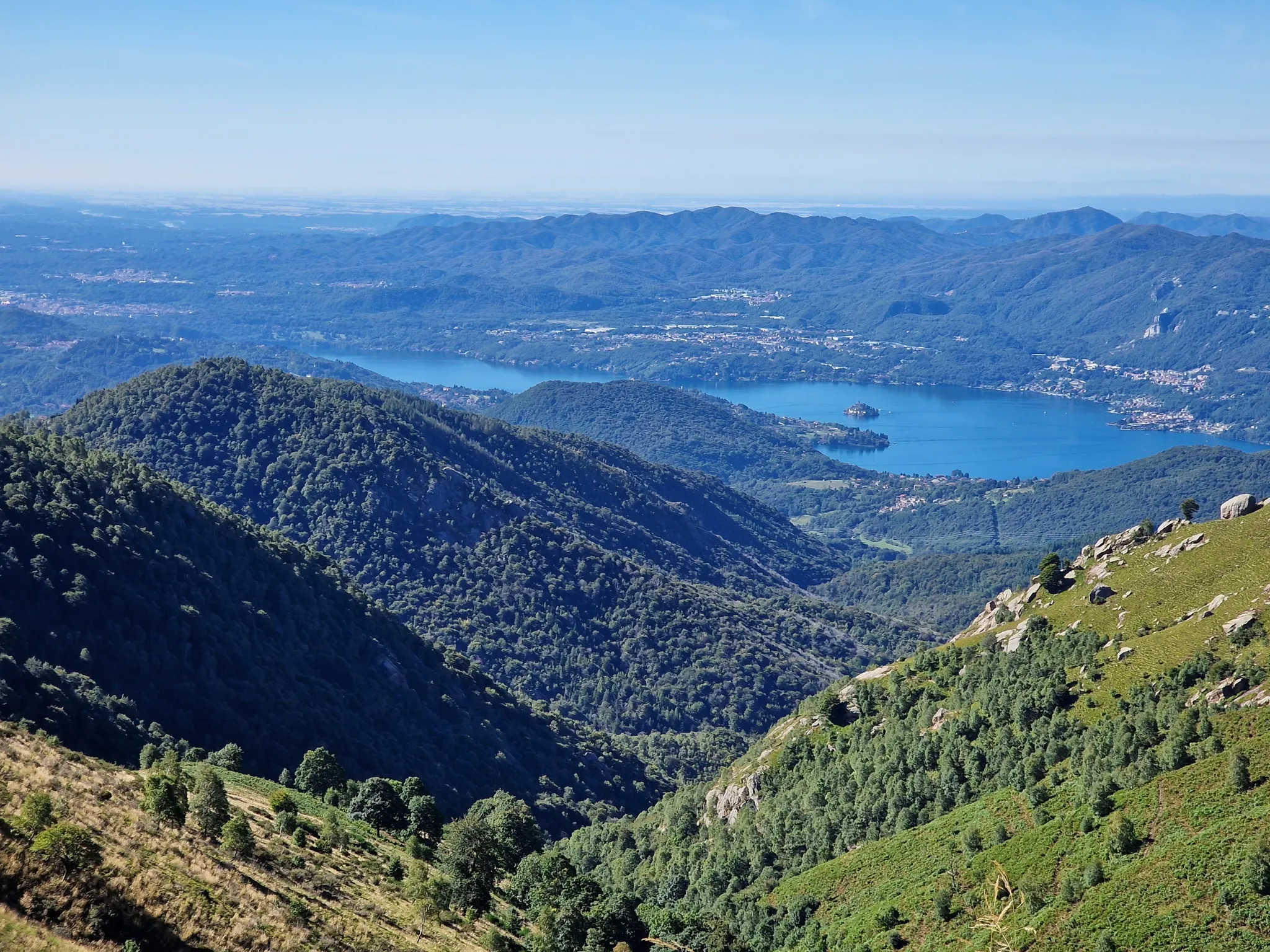
The routes often pass through the picturesque Ticino Valley Regional Park, offering views of forests, heathlands, and wetlands. You'll also cycle along the shores of Lake Maggiore and the Ticino River. Notable natural highlights include Lake Comabbio, known for its peaceful atmosphere, and various viewpoints like View of Lake Maggiore from Sasso Pizzo.
Are there any historical or cultural landmarks to visit while cycling?
Yes, the region is rich in history. While cycling, you might encounter landmarks such as the Panperduto Dam, an important hydraulic junction. Sesto Calende itself boasts historical sites like the Abbey of San Donato and the Chiesa di San Giovanni Battista. For a broader cultural experience, consider visiting Arona on Lake Maggiore, a charming settlement with historical significance.
Where can I park my car when starting a traffic-free road cycling route in Sesto Calende?
Sesto Calende offers various parking options, especially near the town center and along the lakefront, which are convenient starting points for many routes. Specific parking availability can vary, so it's advisable to check local signage upon arrival or use navigation apps for public parking areas.
Is it possible to reach the traffic-free road cycling routes in Sesto Calende by public transport?
Sesto Calende is accessible by train, making it possible to reach the starting points of many routes via public transport. The train station is centrally located, allowing for easy access to the Ticino River paths and connections to other cycling-friendly areas. Always check train schedules and bicycle transport policies beforehand.
What do other cyclists say about the traffic-free road cycling routes in Sesto Calende?
The traffic-free road cycling routes around Sesto Calende are highly rated by the komoot community, with an average score of 4.4 stars. Reviewers often praise the stunning views of Lake Maggiore and the Ticino River, the well-maintained paths, and the peaceful atmosphere away from car traffic, making for a truly enjoyable cycling experience.
Are there good viewpoints along the traffic-free road bike routes?
Many routes offer excellent viewpoints, especially those along Lake Maggiore and within the Ticino Valley Regional Park. You can find panoramic vistas such as the View of Lake Maggiore from Sasso Pizzo, providing breathtaking scenery to enjoy during your ride.
Most popular routes around Sesto Calende
Most popular attractions around Sesto Calende

Get inspired with the komoot mobile app


Explore more
Browse the best Road cycling routes in other regions.
