The best traffic-free bike rides around Gallio
4.3
(227)
8,254
riders
6
rides
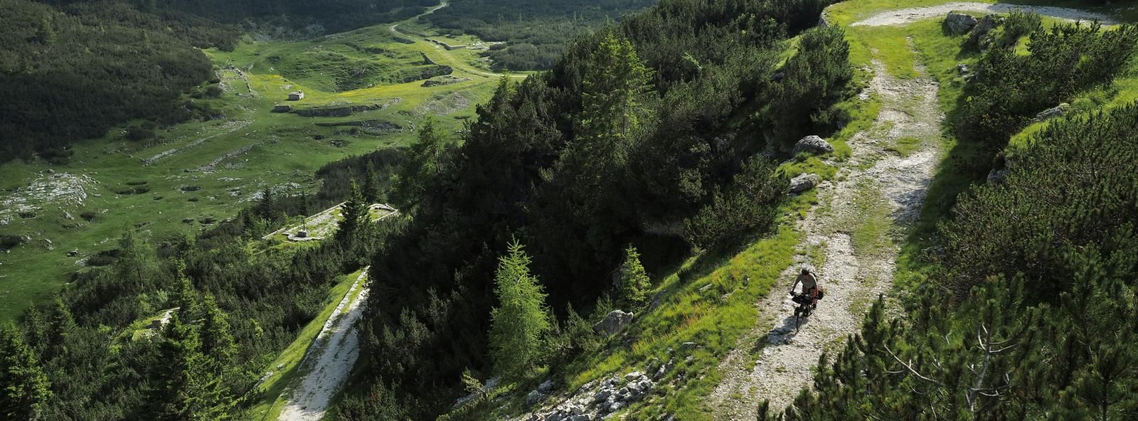
No traffic road cycling routes around Gallio traverse the diverse landscapes of the Veneto region, characterized by its mountainous and hilly terrain within the Prealps. The area features a mix of valleys, forests, and elevated plateaus, offering varied gradients for road cyclists. Routes often include significant elevation gains, providing panoramic views over the surrounding plains and natural features. This region is well-suited for road cycling, with numerous quiet roads winding through its scenic environment.
Best no traffic road cycling routes…
Last updated: May 19, 2026
4.8
(50)
1,462
riders
110km
04:51
1,010m
1,010m
Hard road ride. Very good fitness required. Some segments of this route may be unpaved and difficult to ride.
3.5
(4)
214
riders
Easy road ride. Great for any fitness level. Mostly well-paved surfaces and easy to ride.

Sign up for free
2.0
(2)
38
riders
Moderate road ride. Great for any fitness level. Some segments of this route may be unpaved and difficult to ride.
4.5
(2)
17
riders
25.7km
01:30
580m
580m
Moderate road ride. Good fitness required. Mostly well-paved surfaces and easy to ride.
7
riders
Moderate road ride. Good fitness required. Mostly well-paved surfaces and easy to ride.
Our route recommendations are based on thousands of hikes, rides, and runs completed by other people on komoot.
Start today with a free account
Your next adventure awaits.
Login or Signup



Tips from the Community

The Rialto Bridge of Valstagna is an important infrastructural work located in the municipality of Valbrenta, in the province of Vicenza. Crossing the Brenta river, this bridge historically connects the inhabited area of Valstagna, on the right bank, to the hamlet of Carpanè and the SS 47 of Valsugana, on the left bank, representing a vital hub for local traffic and for cycle tourists on the Brenta Cycle Path. Recently, the structure has undergone a radical restoration and safety intervention, which concluded with its reopening in the summer of 2025. The works, worth over one million euros, have made it possible to repair the damaged parts, widen the roadway, and create a protected pedestrian walkway. A spectacular LED lighting system has also been installed, which colors the bridge during historical events such as the Palio delle Zattere.
0
0

Wonderful 14 km climb to Foza, constant gradient of 8-10 %.
1
0

The castle that dominates Borgo Valsugana
0
0
The trail that runs along Lake Caldonazzo, takes you towards Venice
0
0

After a short descending staircase, you can see the bridge at water level with an original perspective.
0
0

Obligatory stop at sunset on the Bridge
0
0

Bassano del Grappa Bridge
0
0
Bassano del Grappa Bridge
0
0
Frequently Asked Questions
How many no-traffic road cycling routes are available around Gallio?
Gallio offers a selection of 6 dedicated no-traffic road cycling routes, ranging from easy to difficult, ensuring a suitable option for various skill levels. The wider region boasts an impressive network of 139 cycling routes, providing ample opportunities for exploration.
What is the best time of year for no-traffic road cycling in Gallio?
The most popular months for cycling in the Gallio area are July and August, when the weather is typically warm and favorable. However, the region's diverse landscapes can be enjoyed throughout the warmer seasons, offering stunning views and challenging ascents.
Are there any easy no-traffic road cycling routes suitable for families or beginners?
Yes, there is at least one easy no-traffic road cycling route available. The Valstagna and the River Brenta – View of Valstagna loop from Carpanè - Valstagna is a great option, covering 27.7 km with a moderate elevation gain, perfect for a more relaxed ride.
What kind of natural features or landmarks can I expect to see along these routes?
The routes around Gallio offer a mix of pre-alpine scenery, elevated vantage points, and historical sites. You might encounter natural monuments like Italia Junction or Portule Peak. The region also features significant historical sites such as the Mount Ortigara Memorial and various World War I caves and trenches.
Are there any challenging no-traffic road cycling routes for experienced riders?
Absolutely. For experienced riders seeking a challenge, the Valsugana Cycle Path – Valsugana Cycle Route loop from San Marino is a difficult route spanning nearly 110 km with over 1000 meters of elevation gain, offering a significant workout and rewarding views.
What do other cyclists say about the no-traffic road cycling experience in Gallio?
The no-traffic road cycling routes around Gallio are highly regarded by the komoot community, boasting an average rating of 4.3 out of 5 stars from over 220 reviews. Cyclists often praise the stunning natural beauty, the quiet roads, and the diverse terrain that caters to different fitness levels.
Are there any circular no-traffic road cycling routes available?
Yes, many of the routes are designed as loops, allowing you to start and end in the same location. For example, the View of Valstagna – Valstagna–Foza Climb loop from Campolongo sul Brenta offers a scenic circular ride with a good climb.
Can I access these no-traffic routes using public transport?
While specific public transport options for bikes directly to every trailhead are not detailed, Gallio and surrounding towns are generally accessible. It's advisable to check local bus or train schedules for services that accommodate bicycles, especially when planning to reach starting points further afield.
Where can I find parking for these no-traffic road cycling routes?
Parking is generally available in the towns and villages that serve as starting points for these routes, such as San Marino, Carpanè - Valstagna, or Campolongo sul Brenta. Look for designated parking areas or public car parks in these locations.
Are there cafes or amenities along the no-traffic road cycling routes?
While the routes themselves prioritize quiet roads, you'll find cafes, restaurants, and other amenities in the towns and villages you pass through or start from. The region is known for its hospitality, and many establishments cater to cyclists.
Are there any specific regulations or permits required for cycling in the Gallio area?
Generally, no special permits are required for road cycling on public roads in the Gallio area. However, always adhere to standard traffic laws and respect local regulations, especially when passing through villages or protected natural areas.
Most popular attractions around Gallio

Get inspired with the komoot mobile app


Explore more
Browse the best Road cycling routes in other regions.
