The best traffic-free bike rides around Gignod
4.6
(33)
407
riders
19
rides
Gravel biking around Gignod offers diverse landscapes and well-established trail networks in the Aosta Valley. The region features panoramic views of the Valpelline mountains and the Swiss Grand Combin massif, with lush forests and evocative valleys providing a scenic backdrop. Trails often follow ancient irrigation channels like the Ru Neuf and wind through unpaved "white roads" suitable for gravel bikes. The area's terrain includes a mix of forest tracks and country roads, providing varied experiences for gravel cyclists.
Best no…
Last updated: July 27, 2026
6
riders
16.1km
01:40
270m
270m
Moderate gravel ride. Good fitness required. Mostly paved surfaces. Suitable for all skill levels.
4.6
(5)
39
riders
Hard gravel ride. Very good fitness required. Mostly paved surfaces. Suitable for all skill levels.

Sign up for free
4.0
(1)
52
riders
51.3km
03:45
960m
960m
Hard gravel ride. Very good fitness required. Mostly paved surfaces. Suitable for all skill levels.
12
riders
33.2km
03:33
1,210m
1,210m
Hard gravel ride. Very good fitness required. Mostly paved surfaces. Suitable for all skill levels.
23
riders
49.8km
04:14
1,430m
1,430m
Hard gravel ride. Very good fitness required. Mostly paved surfaces. Suitable for all skill levels.
Get access to more routes and recommendations from other explorers.
Sign up for free
Already have an account?
Our route recommendations are based on thousands of hikes, rides, and runs completed by other people on komoot.
Start today with a free account
Your next adventure awaits.
Login or Signup


Other adventures around Gignod

Tips from the Community

The crystal clear and very cool mountain water is channelled downhill for irrigation. An refreshing cool-down is ensured at any time.
0
0

The Tour du Mont Fallère is a charming circular hiking route that covers about 35 kilometers in the heart of the Aosta Valley, winding around the mountain of the same name amidst panoramic peaks, forests, and alpine pastures. Designed to be completed in two or three stages on foot or by mountain bike, the trail passes through several high-altitude structures in the area, including the historic Rifugio Chaligne and the Rifugio Mont Fallère.
0
0
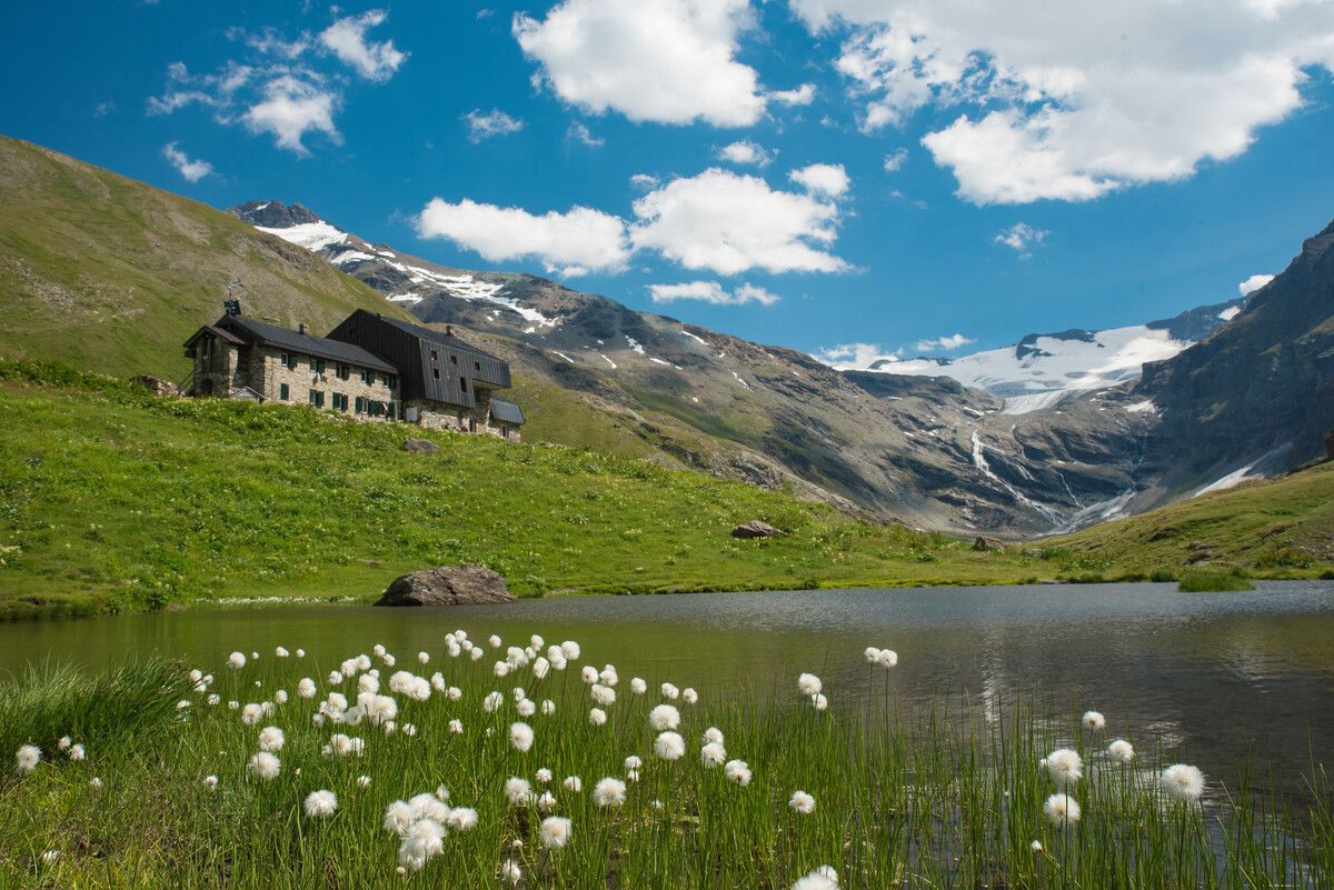
Carved out of the eco-sustainable renovation of a typical stone and wood hut at an altitude of 1,943 meters, Rifugio Chaligne in Gignod offers 32 beds and a cuisine based on dairy products from local pastures. Reachable on foot in just over an hour from Buthier or by mountain bike along the rural road, the structure is part of the famous Tour du Mont Fallère hiking circuit.
1
0

Arpuilles is a hamlet in the municipality of Aosta, nestled on the hill north of the city at an altitude of about 1000 meters. The village, along with nearby Signayes, is part of that system of mid-mountain settlements that the Salassi—the Celtic population who inhabited the valley before the Roman conquest—seemed to prefer to the valley floors, and which over the centuries has maintained a rural character distinct from that of the underlying capital. So strong was this sense of identity that in the past the inhabitants of Arpuilles and Signayes even attempted to separate from the municipality of Aosta to form an autonomous municipality. The inhabited core consists of stone and wood houses arranged along the road that climbs from the plain, surrounded by meadows, pastures, and deciduous woods. From Arpuilles, one enjoys an open view of the Aosta basin and the surrounding mountains: Monte Emilius, Becca di Nona, and, in the distance, the peaks of Gran Paradiso. Its sunny position, sheltered from the north winds, has historically made it an area for spring and autumn grazing. Here passes the terminal section of the Ru Neuf, the ancient irrigation canal from 1327 that brought water from Étroubles to the hill of Aosta.
0
0

This path runs along the Buthier stream and connects Porossan-Le Neyve to Roisan.
0
0
At this point, there's a covered rest area ideal for those pedaling these trails, complete with an e-bike charging station and a tire pump. From the rest area, you can enjoy a spectacular view of the valley floor, perfect for a relaxing break during your hike or bike ride.
1
0


Frequently Asked Questions
How many no-traffic gravel bike trails are available around Gignod?
There are over 10 dedicated no-traffic gravel bike trails around Gignod listed in this guide. These routes are specifically curated to offer serene rides away from vehicular traffic, allowing you to fully immerse yourself in the natural beauty of the Aosta Valley.
What is the typical difficulty level of no-traffic gravel routes in Gignod?
The no-traffic gravel routes around Gignod offer a range of difficulties. You'll find a good mix of moderate and difficult trails, with 5 routes rated as moderate and 9 as difficult. This ensures options for both experienced gravel bikers seeking a challenge and those looking for a more relaxed, yet engaging, ride.
Are there any family-friendly no-traffic gravel bike trails in Gignod?
While many routes in the region feature significant elevation, some sections of the ancient irrigation channels, known as 'Ru Neuf', offer flatter, more accessible paths suitable for families. For a moderate option, consider the Giro dei Ru di Roisan, which provides a scenic ride through the landscape without extreme challenges.
What kind of natural features and viewpoints can I expect along these gravel trails?
Gignod's gravel trails offer breathtaking panoramic views of the Valpelline mountains, the Swiss Grand Combin massif, and even glimpses of Mont Blanc and the Matterhorn. You'll ride through lush forests and evocative valleys. The Beautiful trail along the – Chaligne Hut loop from Aosta, for example, takes you towards Punta Chaligne, a prominent natural landmark, offering stunning vistas.
Are there any historical landmarks or attractions accessible from the no-traffic gravel routes?
Absolutely. The region is rich in history. You can explore routes that pass by ancient irrigation channels like the Ru Neuf, or even parts of the historic Via Francigena. The Castello Sarriod de la Tour – Sarriod de La Tour Castle loop from Aosta Istituto offers a chance to see a significant local castle. Additionally, the Roisan Village and Church – Pont d'Aël Roman Aqueduct loop from Aosta Viale Europa includes a visit to the impressive Roman aqueduct.
What is the best time of year for gravel biking in Gignod?
The best time for gravel biking in Gignod is typically from late spring through early autumn (May to October). During these months, the weather is generally mild, and the trails are clear of snow. While some higher elevation routes might still have snow in early spring, the lower valley paths are usually accessible. Winter riding is possible on some routes, but conditions can be challenging due to snow and ice.
Are there any circular no-traffic gravel bike trails around Gignod?
Yes, many of the gravel routes in this guide are designed as loops, allowing you to start and end at the same point without retracing your steps. For instance, the Les Iles Nature Reserve – Arch of Augustus loop from Aosta offers a scenic circular journey through diverse landscapes.
Where can I find parking near the no-traffic gravel bike trailheads in Gignod?
Gignod and its surrounding villages often have public parking areas, especially near town centers or trail access points. While specific parking details vary by trailhead, you can generally find convenient spots in villages like Roisan or near the starting points of popular routes. It's advisable to check local signage upon arrival.
What do other gravel bikers enjoy most about gravel biking in Gignod?
The komoot community highly rates the gravel biking experience in Gignod, with an average score of 4.77 stars. Reviewers often praise the region's diverse landscapes, the sense of freedom on the unpaved 'white roads', and the stunning mountain vistas. The tranquility of the no-traffic routes and the blend of natural beauty with historical elements are frequently highlighted.
Can I access these gravel trails using public transport?
Gignod is situated in the Aosta Valley, which has a regional bus network connecting various towns and villages. While direct access to every trailhead by public transport might be limited, you can often reach Gignod or nearby starting points via bus from Aosta. From there, you might have a short ride to the specific trailheads. Always check local bus schedules for the most up-to-date information.
Are there any lakes or water features along the no-traffic gravel routes?
Yes, the Aosta Valley is home to several beautiful lakes. While not directly on every gravel route, some trails offer views or access to nearby water bodies. For example, the Lac de Grand Saint Bernard is a notable lake in the wider region, and routes in the area might provide opportunities to explore such features.
Most popular attractions around Gignod

Get inspired with the komoot mobile app


Explore more
Browse the best Gravel rides in other regions.
