The best traffic-free bike rides around Zeri
4.3
(143)
1,846
riders
42
rides
No traffic touring cycling routes around Zeri traverse an uncontaminated valley within the Apennine foothills, offering varied terrain for cyclists. The region is characterized by a mix of ascents and descents, with routes often connecting historic towns and natural landscapes. This area provides diverse trails, from scenic paths through valleys to more challenging routes with significant elevation changes. The landscape supports a range of cycling experiences, catering to different skill levels.
Best no traffic touring cycling routes around Zeri
- The…
Last updated: July 27, 2026
29
riders
30.5km
03:04
920m
920m
Hard bike ride. Very good fitness required. Mostly paved surfaces. Suitable for all skill levels.
23
riders
40.5km
03:09
1,040m
1,040m
Hard bike ride. Very good fitness required. Mostly paved surfaces. Suitable for all skill levels.

Sign up for free
5.0
(1)
19
riders
51.5km
04:05
1,410m
1,410m
Hard bike ride. Very good fitness required. Mostly paved surfaces. Suitable for all skill levels.
15
riders
44.7km
03:31
1,200m
1,200m
Hard bike ride. Very good fitness required. Mostly paved surfaces. Suitable for all skill levels.
3.0
(1)
10
riders
22.6km
01:49
460m
460m
Hard bike ride. Very good fitness required. Mostly paved surfaces. Suitable for all skill levels.
Get access to more routes and recommendations from other explorers.
Sign up for free
Already have an account?
Our route recommendations are based on thousands of hikes, rides, and runs completed by other people on komoot.
Start today with a free account
Your next adventure awaits.
Login or Signup

Other adventures around Zeri

Tips from the Community

Point equipped for bicycles and with 2 wooden tables for picnics, as well as a fountain with good, drinkable water. There are also two information panels.
0
0
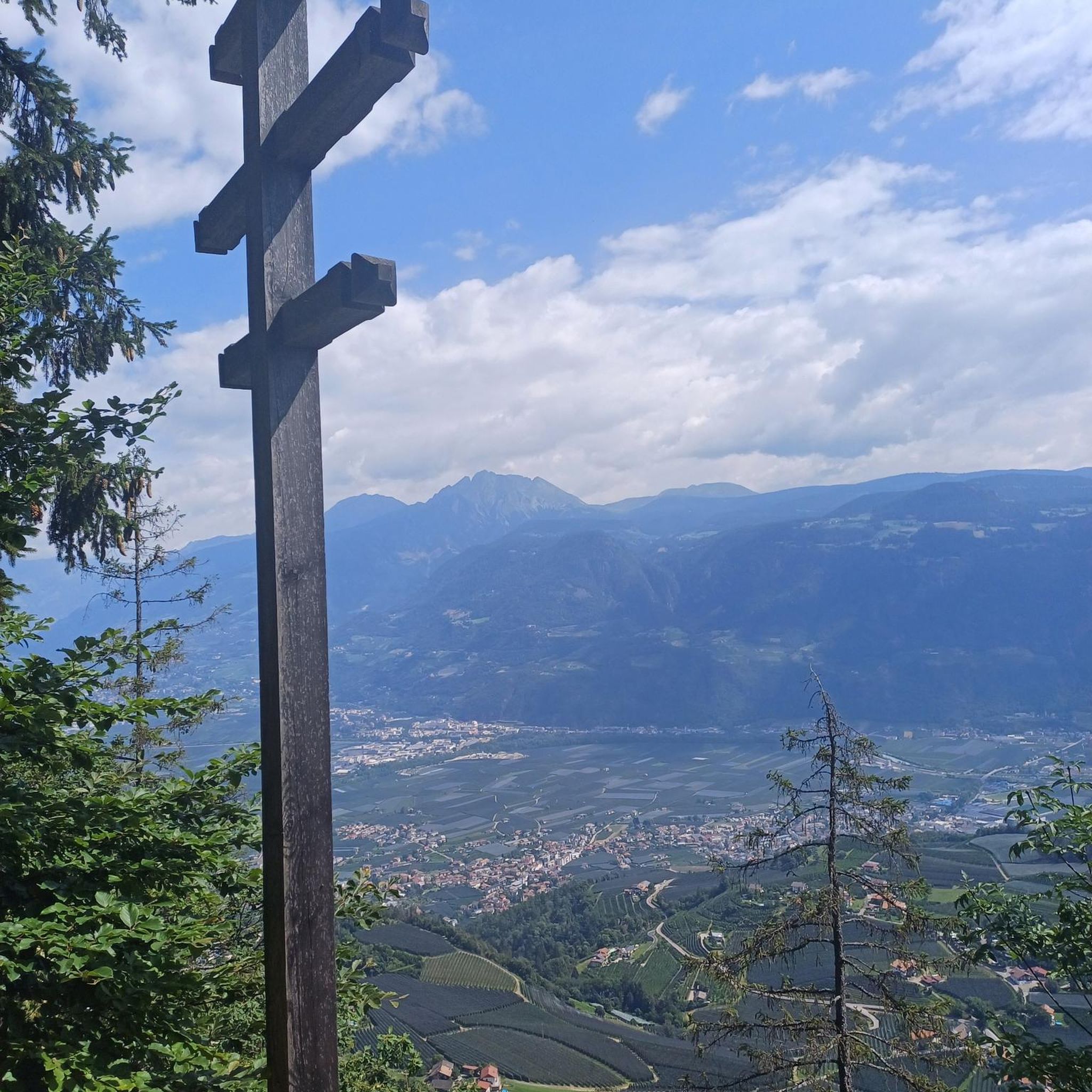
View over a large part of the Tuscan-Emilian ridge, which ranges from Monte Braiola to Monte Aquila, with Monte Marmagna in the center, whose large summit cross is also visible to the naked eye.
0
0

A beautiful mountain pass at 1,400 meters. There's a refuge, a small chapel, a monument—in short, everything you'd expect in a place like this. There's even a small clothing store. The only thing that's jarring is the constant noise of a combustion engine, which I assume is a generator for the refuge's operation.
0
0

small village but very suggestive and picturesque to pass by bicycle
0
0

Village historically linked to the tradition of transhumance The ancient village of Noce is one of the first villages you encounter when entering the Zeri Valleys. In ancient times, the village of Noce was completely rural, historically linked to the work of shepherds and with them to the beautiful tradition of transhumance towards the town of Formentara. This took place through the ancient road called "Trianara", recently restored. During the Second World War, the village of Noce suffered a terrible roundup, during which almost the entire village was burned down. Today, the current village is very different from the original, which in ancient times was built almost entirely of stone arches and vaults.
0
0
The Ponte della Cresa is a stone bridge built in the 14th century and despite the frequent flooding of the Verde river, it has maintained its original structure to this day. The bridge connects the new neighborhoods with the historic center. The bridge is located along the Verde river near Porta San Francesco. Under the arch of this bridge, on January 31, the characteristic fire of San Geminiano takes place. The Ponte della Cresa is considered by many to be the true symbol of the city of Pontremoli. It is also interesting to note that the name Pontremoli derives from the Latin 'Pons Tremulus', which means 'unsafe bridge'. This was a term used to describe the original conurbation of the city.
0
0
Entrance to Pontremoli from Porta San Francesco
0
0
Caffè degli Svizzeri F.lli Aichta the most famous café in the city, where you can't miss trying the "amor", the typical sweets made of two wafers with lots of delicious cream in the middle, whose recipe is a secret that every Pontremolese pastry shop has been handing down for years. the "Campanone" among the numerous towers that form the profile of Pontremoli is the most imposing. The Campanone was in fact one of the three towers of the so-called Cacciaguerra fortress, a sort of curtain that cut Pontremoli in two, from river to river. The construction of this barrier, wanted by Castruccio Castracani in 1322, was necessary to calm the violent struggles between Guelphs and Ghibellines, which in the 14th century also involved Pontremoli. The separation between the two parts of Pontremoli was so clear that the two areas had taken on a specific name: Imoborgo the southern one and Sommoborgo the northern one, each with its own square (the current Piazza del Duomo and Piazza della Repubblica).
0
0
Frequently Asked Questions
How many no-traffic touring cycling routes are available in Zeri?
Zeri offers a selection of 37 touring cycling routes designed to minimize traffic, providing a peaceful and immersive experience in its uncontaminated valley. While most are challenging, there is one easy route available for those seeking a gentler ride.
What kind of terrain and difficulty can I expect on Zeri's no-traffic touring routes?
The no-traffic touring routes in Zeri offer diverse terrain, from scenic paths to more technical sections. The majority of routes are rated as difficult, with 31 out of 37 routes falling into this category. You can expect significant elevation changes and rewarding climbs, typical of the Apennine landscape, providing breathtaking views and fresh air.
Are there any family-friendly no-traffic cycling options in Zeri?
While most routes are challenging, Zeri does offer one easy touring cycling route, which could be suitable for families or beginners looking for a less strenuous experience. The region's natural beauty and fresh air make it an appealing destination for outdoor activities with varying skill levels.
What are some scenic viewpoints or landmarks I can discover along these routes?
Many routes offer stunning vistas. For example, the Passo della Crocetta – View of Monte Marmagna loop from Pontremoli provides excellent mountain views. You can also explore significant mountain passes like Passo di Cento Croci (1,055 m) or the Crest Road Between Passo Cento Croci and Passo della Cappelletta. Additionally, the Three Borders Marker offers a unique historical landmark.
Are there any circular no-traffic touring cycling routes in Zeri?
Yes, many of the no-traffic touring routes in Zeri are designed as loops, allowing you to start and end in the same location. Examples include the Ponte della Cresa – Historic Center of Pontremoli loop from Zeri and the Historic Center of Pontremoli – Porta Parma loop from Pontremoli, offering convenient round trips through the scenic landscape.
What is the best time of year for no-traffic touring cycling in Zeri?
Given Zeri's characteristics as an 'uncontaminated valley' with 'breathtaking views' and 'fresh air,' the spring and autumn months typically offer the most pleasant cycling conditions. Temperatures are milder, and the natural scenery is vibrant, making for an ideal touring experience. Summer can also be good, especially at higher elevations, but be prepared for warmer temperatures.
Are there places to eat or stay along the no-traffic touring routes in Zeri?
Yes, you can find options for refreshments and accommodation. For instance, Trattoria Dei Cacciatori Casoni is a restaurant highlighted in the area. There are also huts and refuges like Bratello Free Hut and La Casermetta Refuge and Picnic Area that can serve as rest stops or overnight stays, particularly useful on longer tours like the Strada del Poggio Termine – Rastrello Pass loop from Zeri.
What do other touring cyclists enjoy most about Zeri's no-traffic routes?
The area is highly rated by the komoot community, with an average score of 4.4 stars. Reviewers often praise the tranquility of the 'uncontaminated valley,' the 'breathtaking views,' and the challenge of the diverse trails. The absence of heavy traffic is a significant draw, allowing for a more peaceful and immersive cycling experience.
How long do the no-traffic touring cycling routes in Zeri typically take to complete?
The duration varies significantly based on the route's distance and elevation gain, as well as your cycling pace. For example, the Cathedral of Pontremoli – Campanone of Pontremoli loop from Pontremoli is around 22.6 km and takes approximately 1 hour 49 minutes. More challenging routes, like the Strada del Poggio Termine – Rastrello Pass loop from Zeri, which is 35.1 km with significant climbing, can take over 3 hours 20 minutes.
Are there any natural features or points of interest along the routes?
Beyond the stunning mountain views, you can encounter natural features such as the Vergastrelli Spring, which is a highlighted natural monument in the region. The overall landscape of Zeri is characterized by its natural beauty and fresh air, making every ride an opportunity to connect with nature.
What are the parking options for accessing no-traffic touring cycling routes in Zeri?
While specific parking areas for each route are not detailed here, Zeri and nearby towns like Pontremoli, which serve as common starting points for many routes, generally offer public parking facilities. It's advisable to check local information for parking availability in the specific village or trailhead you plan to start from.
Most popular attractions around Zeri

Get inspired with the komoot mobile app


Explore more
Browse the best Cycling routes in other regions.
