The best traffic-free bike rides around Albino
4.4
(673)
22,005
riders
41
rides
No traffic road cycling routes around Albino, a comune in Lombardy, northern Italy, are situated within the Seriana Valley, offering diverse terrain for road cyclists. The region is characterized by its location on the right bank of the Serio River, surrounded by rolling hills and the foothills of the Alps. This geographical setting provides a mix of valley routes and ascents, including notable climbs like the Selvino Switchbacks, which contribute to varied cycling terrain.
Best no traffic road cycling routes…
Last updated: November 13, 2026
4.8
(9)
385
riders
31.3km
01:50
740m
740m
Moderate road ride. Good fitness required. Mostly well-paved surfaces and easy to ride.
5.0
(1)
179
riders
36.0km
01:42
400m
400m
Moderate road ride. Good fitness required. Some segments of this route may be unpaved and difficult to ride.

4.5
(4)
136
riders
25.6km
01:23
510m
500m
Moderate road ride. Good fitness required. Some segments of this route may be unpaved and difficult to ride.
4.7
(18)
583
riders
39.8km
02:13
800m
800m
Moderate road ride. Good fitness required. Mostly well-paved surfaces and easy to ride.
3.5
(2)
72
riders
22.7km
01:33
760m
760m
Moderate road ride. Good fitness required. Mostly well-paved surfaces and easy to ride.
Get access to more routes and recommendations from other explorers.
Already have an account?
Our route recommendations are based on thousands of hikes, rides, and runs completed by other people on komoot.
Start today with a free account
Your next adventure awaits.


Other adventures around Albino

Tips from the Community

Selvino is an Italian municipality of about 2,000 inhabitants located at an altitude of 960 meters in the Bergamasque Prealps, nestled on a plateau between the Val Seriana and the Val Brembana. The town, led by mayor Andrea Santopietro, is about half an hour from Bergamo and an hour from Milan, characteristics that make it one of the most appreciated holiday and family tourism destinations in Lombardy both in summer and winter. The name of the village derives from the Latin silva, a testament to the dense forests that originally covered the area.
0
0
Selvino is an Italian municipality of about 2,000 inhabitants located in Lombardy, in the province of Bergamo, at an altitude of about 960 meters above sea level. Nestled on the pre-Alpine plateau of the same name between the Seriana Valley and the Brembana Valley, it is about half an hour from Bergamo and an hour from Milan, historically positioning itself as a renowned summer and winter holiday resort. Nature, Sport and Activities • Monte Purito: It is the hub of local entertainment. It hosts a well-equipped Adventure Park with suspended tree-top courses, while in winter it transforms into a small ski area equipped with ski lifts, artificial snow, and ski slopes. • Hiking and Cycling: The area offers numerous trails suitable for family walks (such as the Sentiero basso BLU) or mountain bike itineraries. The road climb leading to the town is also famous among cyclists, having been a stage of the Giro d'Italia several times. • The Quartz of Selvino: The area is known among mineral collectors for the presence of characteristic double-terminated quartz crystals (the so-called "Selvino quartz"), easily found in the surrounding terrain. History and Culture • Sciesopoli: One of the most significant historical pages of the municipality. This large mountain colony hosted, between 1945 and 1948, about 800 Jewish children and teenagers who survived the Nazi extermination camps (known as the "Selvino Children"), helping them to rehabilitate before their transfer to Israel. Today it houses a Memorial Museum. • Borgo Taramelli: It represents the oldest historical hamlet of the town, once a fundamental hub for the trade of the Via Mercatorum heading towards Switzerland. • Sanctuary of Perello: Located in the surroundings, it is the main place of worship in the area, immersed in the woods and founded in the medieval period.
0
0
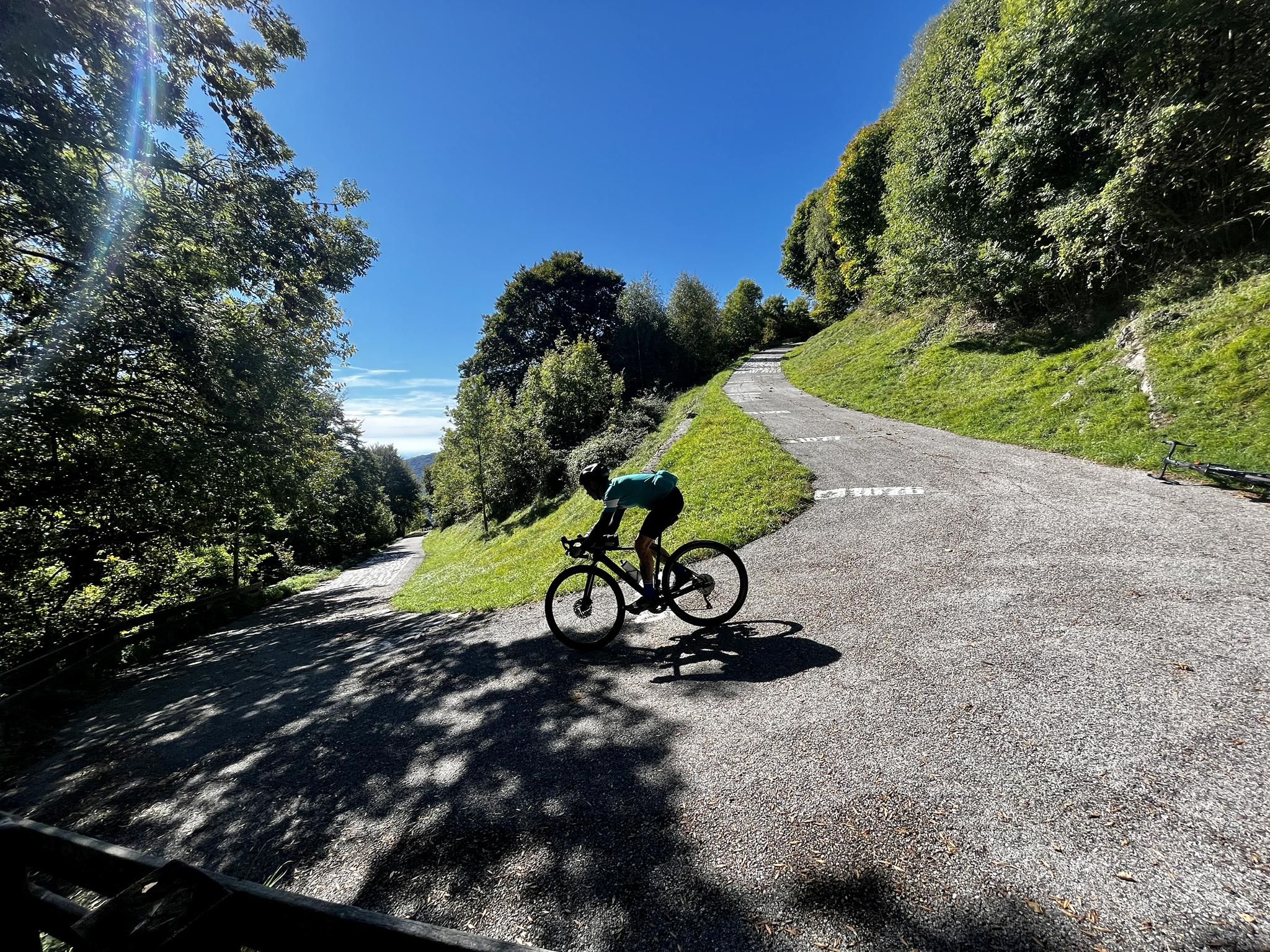
This writing refers to the famous "Polpacci Pelosi" (Hairy Calves) mural located along the hairpin bends of Selvino, in the province of Bergamo. It is a well-known point of interest among cyclists who frequent the area to train or ride loops. The mural is located on a low wall along the provincial road that climbs from Nembro towards Selvino. The area is particularly busy with road cycling enthusiasts and motorcyclists, especially during weekends.
1
0

The church is dedicated to Santa Maria Assunta and is classified as a subsidiary church of the Diocese of Bergamo. The building has a two-tiered facade, marked by pilasters and niches painted with figures of saints (Maria SS., St. Joseph, St. Roch, St. Paul, St. Peter, St. Anthony Abbot). The interior has a single nave, with three bays and side chapels dedicated to the Madonna del Rosario and the Crucifix.
0
1
The church is dedicated to Santa Maria Assunta and is classified as a subsidiary church of the Diocese of Bergamo. The building has a two-tier facade
0
1
Ganda is a hamlet in the municipality of Aviatico, in the province of Bergamo, located at about 1060 m altitude on a small plateau between Monte Ganda and Monte Rena, below Monte Poieto. The position is extremely panoramic: it overlooks the middle Seriana Valley, the Gandino Valley and, on clear days, even the plain. The SP41 road reaches it, which climbs from Gazzaniga, passes through Orezzo and crests at Col de la Muruna, before arriving at Amora and then at Aviatico. 🧭 Territory and environment The territory of Ganda includes: the Rovaro valley, a narrow gorge between Monte Ganda and Monte Rena; numerous seasonal streams that activate after heavy rains; ancient mule tracks that connected Ganda to Orezzo, Amora, Petello, Merà and the upper localities of Albino. 🕰️ Essential History The documented history is sparse, but the sources agree on some key points: Ancient Origins After the fall of the Roman Empire, groups of people took refuge at high altitudes to escape incursions and looting in the valley floors. Ganda was born this way: as a settlement of escape and survival. Etymology According to the historian Zambetti, the name would derive from the Celtic "gant", "pile of fallen rocks", linked to an ancient landslide of Cornagera that would have covered the area. Middle Ages and Tribulina Around the year 1000, some inhabitants of Aviatico took refuge here due to the "terror of the year 1000". On the highest point (1071 m) they built a small shrine used for prayer and burials. 1378: the best-known episode Barnabò Visconti, at war with the lords of Comenduno, sent troops to destroy the fortified village. Some inhabitants fled towards the Ganda small shrine, which became a refuge and the nucleus of the village.
0
0

in its simplicity it is always a pleasant environment to share
2
0
The Passo di Ganda is a pass in the Orobie Prealps located above Gazzaniga, between the hamlets of Orezzo and Aviatico, at an altitude of about 1060 m. It is known above all for the cycling climb, also made famous by the Giro di Lombardia.
0
0
Frequently Asked Questions
How many no-traffic road cycling routes are available around Albino?
You can explore over 40 dedicated no-traffic road cycling routes in the Albino area. These routes offer a range of experiences, from easier rides to more challenging climbs, ensuring there's something for every cyclist looking to avoid vehicle traffic.
What kind of terrain can I expect on these no-traffic road cycling routes?
The routes around Albino offer diverse terrain. You'll find picturesque paths along the Serio River, such as sections of the Val Seriana cycle path, as well as more challenging ascents into the surrounding rolling hills and towards the majestic Alps. Expect a mix of gentle gradients and significant climbs, often rewarded with stunning panoramic views.
Are there challenging no-traffic road cycling routes for experienced riders?
Yes, for experienced riders seeking a challenge, Albino offers routes with substantial elevation gain. A notable example is the Selvino Switchbacks – Climb to Selvino from Nembro loop from Albino, which features significant climbing. The region is known for its classic climbs, including the famous Selvino Switchbacks with their 19 hairpin bends.
Are there easier, no-traffic options suitable for beginners or a more relaxed ride?
Absolutely. There are 8 easy routes designed for a more relaxed pace or for beginners. The Val Seriana cycle path, which runs parallel to the Serio River, offers a fantastic, mostly flat experience through various villages and natural landscapes, perfect for a leisurely ride away from traffic.
Can I find routes that offer scenic viewpoints or historical landmarks?
Many routes around Albino provide access to breathtaking scenic viewpoints and historical sites. You can enjoy panoramic vistas from summits like Canto Alto Summit and Monte Misma Summit. Additionally, the region is rich in historical and cultural heritage, with medieval towers, churches like the Parish Church of Sant'Alessandro, and the Santuario Beata Vergine del Miracolo Madonna della Gamba, often accessible from or visible along the cycling paths.
What do other road cyclists enjoy most about road cycling in Albino?
The komoot community highly rates the road cycling experience in Albino, with an average score of 4.5 stars. Cyclists frequently praise the region's diverse landscapes, the challenge of its climbs, and the opportunity to ride on routes with minimal traffic, allowing for a more immersive experience in nature and local culture.
Are there any loop routes available for no-traffic road cycling?
Yes, many of the no-traffic road cycling routes around Albino are designed as loops, allowing you to start and finish at the same point. For instance, the Poppy Field – Barcicletta loop from Abbazia offers a moderate circular ride, and the View of the Bergamo Vineyards – Nembro Bridge loop from Abbazia provides a longer loop experience.
What is the best time of year for no-traffic road cycling in Albino?
Spring and autumn generally offer the most pleasant conditions for road cycling in Albino, with milder temperatures and beautiful scenery. Summer can also be excellent, especially in the mornings or late afternoons, though some climbs can be more strenuous in the heat. Winter cycling is possible, but be mindful of colder temperatures and potential snow at higher elevations.
Are there places to stop for refreshments or coffee along these routes?
Yes, as you cycle through the various villages and towns in the Seriana Valley, you'll find opportunities to stop at local cafes and bars. Many routes pass through or near these charming spots, allowing you to refuel and experience local hospitality.
Is parking available near the starting points of these no-traffic routes?
Parking is generally available in and around Albino and the surrounding villages. Many routes start from accessible points where public parking can be found, making it convenient to begin your ride. It's always a good idea to check specific starting points for the best parking options.
Can I reach the starting points of these routes using public transport?
Albino is well-connected within the Seriana Valley. Public transport options, including buses, can help you reach Albino and other starting points for the cycling routes. The Val Seriana cycle path, for example, is easily accessible from various points along its length, many of which are served by public transport.
Most popular attractions around Albino

Get inspired with the komoot mobile app


Explore more
Browse the best Road cycling routes in other regions.
