The best hikes from bus stations in Aigüestortes I Estany De Sant Maurici
4.6
(2552)
21,960
hikers
116
hikes
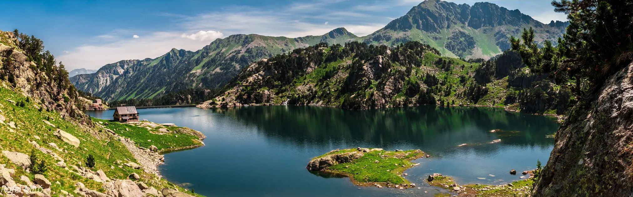
Bus station hiking trails in Aigüestortes I Estany De Sant Maurici traverse a high-mountain landscape shaped by ancient glacial activity, featuring elevations from 1,200 to over 3,000 meters. The region is characterized by U-shaped valleys, numerous glacial lakes, and towering peaks. Its name, "Aigüestortes," reflects the abundant rivers, streams, and over 200 mountain lakes that define the terrain. Extensive forests of fir and black pine, alongside diverse flora and fauna, contribute to the varied natural environment.
Best bus station hiking…
Last updated: July 27, 2026
4.3
(3)
32
hikers
Moderate hike. Good fitness required. Easily-accessible paths. Suitable for all skill levels.
4.0
(2)
27
hikers
Moderate hike. Good fitness required. Easily-accessible paths. Suitable for all skill levels.

Sign up for free
5.0
(1)
18
hikers
6.89km
02:43
510m
510m
Moderate hike. Good fitness required. Easily-accessible paths. Suitable for all skill levels.
4.9
(17)
139
hikers
27.6km
09:46
1,490m
1,490m
Hard hike. Very good fitness required. Easily-accessible paths. Suitable for all skill levels.
4.6
(16)
85
hikers
12.3km
03:56
470m
470m
Moderate hike. Good fitness required. Easily-accessible paths. Suitable for all skill levels.
Get access to more routes and recommendations from other explorers.
Sign up for free
Already have an account?
Our route recommendations are based on thousands of hikes, rides, and runs completed by other people on komoot.
Start today with a free account
Your next adventure awaits.
Login or Signup
Popular around Aigüestortes I Estany De Sant Maurici

Other adventures in Aigüestortes I Estany De Sant Maurici


Tips from the Community

This Romanesque cultural heritage is beautiful. The highlight for me was climbing the tower.
0
0

Convenient starting point for climbing the valley
0
0
Very beautiful waterfall with spectacular "giant's pothole" type pools.
0
0

It's better to do the route by ebike. There's a lot of elevation gain.
0
0

Park information point and toilets. From/till this point you can take a taxi back to Parking place.
0
0
From La Molina a nice walk to this Ermita / church. And a good place to rest for the next stage to the Cascada de Sant Esperit
0
0

The Estany de Llebreta is a glacial lake in the Parc Nacional d'Aigüestortes i Estany de Sant Maurici. Completely surrounded by forest, it lies at an altitude of 1,619 meters at the foot of the Tuc de Llebreta. There are even trout in the water, which is up to twelve meters deep. A beautiful hiking destination that even younger children can easily reach.
0
0

The Vall de Boí viewpoint, or simply Boí viewpoint, is located on the road that connects Boí and Barruera. From here you can see the valley and also impressive views of the L'Aüt peak and the Caldes area, with the town of Erill la Vall just in front. It is a highly recommended place to see the sunset.
2
0
Frequently Asked Questions
How many hiking trails are accessible directly from bus stations in Aigüestortes I Estany De Sant Maurici?
There are over 90 hiking trails in the Aigüestortes I Estany De Sant Maurici region that are conveniently accessible from bus stations. These routes offer a range of difficulties, with approximately 28 easy, 48 moderate, and 14 difficult options to explore.
Are there any easy, family-friendly hikes accessible by bus in the region?
Yes, the region offers several easy, family-friendly hikes accessible by bus. An excellent option is the Noguera de Tor River – Sant Joan de Boí Church loop from Sant Joan de Boí, which is an easy 2.1 km route. Many trails in the lower valleys, particularly around the Vall de Boí, are suitable for families and often start near bus stops in the villages.
What kind of natural features can I expect to see on bus-accessible trails?
Many bus-accessible trails offer stunning views of the park's glacial landscapes and abundant water features. You can often find yourself near picturesque lakes like Lake Sant Maurici or Ratera Lake, and experience the 'twisted waters' of the Valle del Río San Nicolás. The region is also known for its diverse forests of fir and black pine.
Are there circular hiking routes available from bus stations?
Yes, many routes accessible from bus stations are circular, allowing you to start and end your hike at the same point without needing to retrace your steps. For example, the Sant Joan de Boí Church – Caldes de Boí Thermal Springs loop from Boí is a moderate 12.1 km circular route that offers varied scenery.
What is the best time of year to hike from bus stations in Aigüestortes I Estany De Sant Maurici?
The best time to hike in Aigüestortes I Estany De Sant Maurici, especially from bus-accessible points, is typically from late spring (May/June) through early autumn (September/October). During these months, the weather is generally mild, trails are clear of snow, and bus services are more frequent. Summer offers lush landscapes, while autumn brings vibrant colors. Winter hiking is possible but requires specialized gear and knowledge due to snow and ice.
Are there any trails that lead to notable viewpoints or landmarks?
Absolutely. Many trails offer access to iconic landmarks and breathtaking viewpoints. For instance, some routes provide stunning perspectives of Estany de Sant Maurici and the iconic twin peaks of Els Encantats. The Sant Joan de Boí Church – Sant Climent de Taüll loop from Boí allows you to explore the Romanesque churches of the Vall de Boí, a UNESCO World Heritage site.
What should I wear for hiking in this region, especially when using public transport?
Given the high-mountain terrain and varied weather, it's essential to dress in layers. Even in summer, temperatures can drop, especially at higher elevations. We recommend sturdy hiking boots, waterproof and windproof outer layers, and appropriate clothing for sun protection. Always carry enough water, snacks, and a map or GPS device, as mobile signal can be intermittent.
Can I find cafes or amenities near the bus station trailheads?
Yes, many bus stations are located in or near villages such as Boí, Espot, or Taüll, which serve as gateway towns to the park. These villages typically offer cafes, restaurants, and small shops where you can purchase supplies or enjoy a meal before or after your hike. For example, the Sant Climent de Taüll – Pont del Fornet loop from Santa Eulàlia d'Erill la Vall starts near amenities in Santa Eulàlia d'Erill la Vall.
What do other hikers enjoy most about the bus-accessible trails in Aigüestortes I Estany De Sant Maurici?
The area is highly rated by the komoot community, with an average score of 4.6 stars. Reviewers often praise the stunning natural beauty, the well-maintained paths, and the convenience of accessing such pristine wilderness using public transport. The diverse landscapes, from serene lakes to dramatic peaks, are frequently highlighted as major attractions.
Are there any moderate hikes from bus stations that offer a good challenge?
For those seeking a moderate challenge, the Sant Climent de Taüll – Barranc d'Erill loop from Sant Climent de Taüll is an excellent option. This 12.3 km route involves significant elevation changes and provides a rewarding experience through varied terrain, showcasing the region's rugged beauty.
Are dogs allowed on the bus-accessible hiking trails?
While dogs are generally allowed on many trails outside the core protected areas of the National Park, specific regulations apply within the park boundaries to protect wildlife. It's crucial to check the latest park rules regarding pets, especially concerning leashing requirements and restricted zones. Always ensure your dog is under control and that you clean up after them.
Most popular routes in Aigüestortes I Estany De Sant Maurici
Most popular attractions in Aigüestortes I Estany De Sant Maurici

Get inspired with the komoot mobile app


Explore more
Browse the best Hikes in other regions.
