The best hikes from bus stations in Sierra De Alcarama Y Valle Del Alhama
4.3
(38)
299
hikers
3
hikes
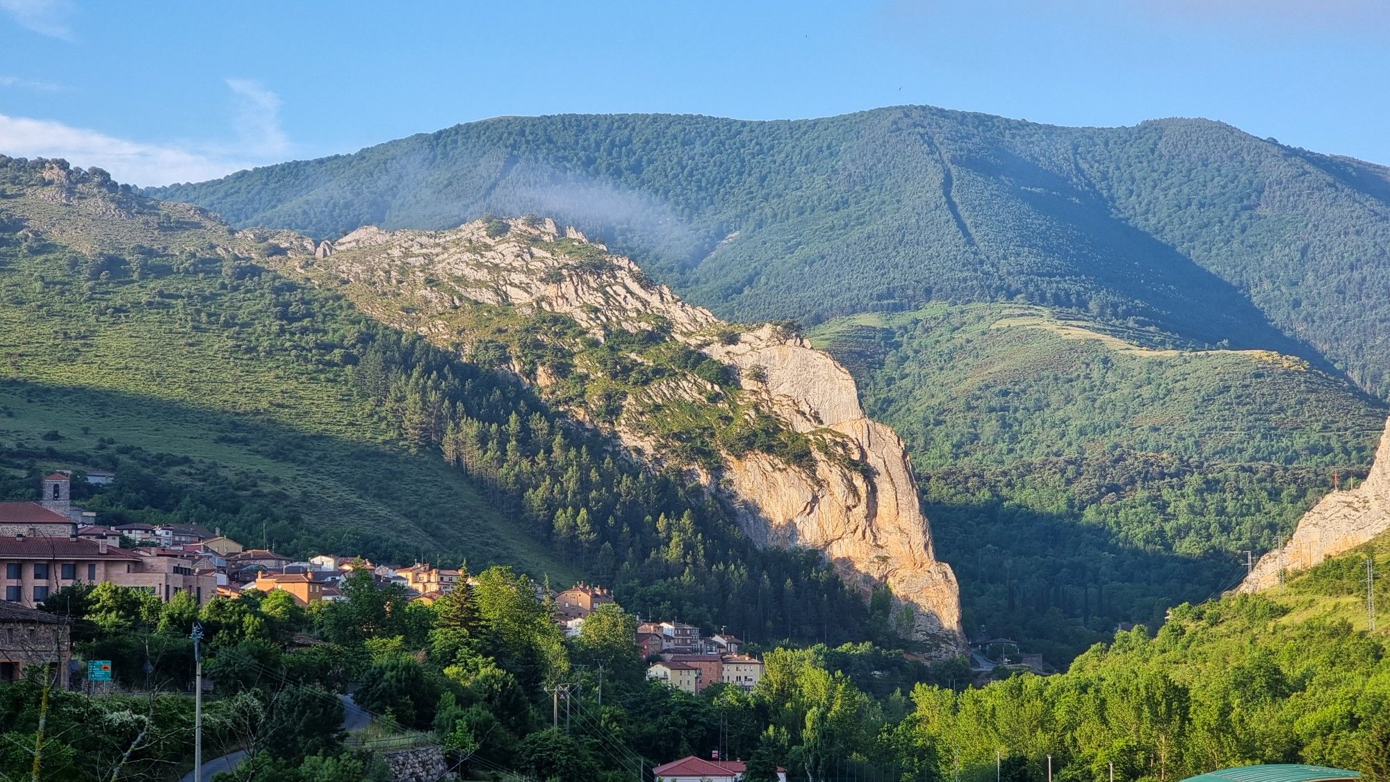
Bus station hiking trails in Sierra De Alcarama Y Valle Del Alhama traverse a landscape characterized by Mediterranean scrubland and extensive holm oak forests. The region features moderate altitudes, with the highest point reaching 1,187 meters. The Alhama River and its tributaries have carved out rocky cliffs, gorges, and ravines, providing varied terrain for hikers. This area is part of the Valles del Leza, Jubera, Cidacos y Alhama Biosphere Reserve.
Best bus station hiking trails in Sierra De Alcarama Y…
Last updated: October 3, 2026
13.1km
03:38
250m
250m
Moderate hike. Good fitness required. Easily-accessible paths. Suitable for all skill levels.
4.6
(9)
46
hikers
13.7km
03:50
260m
260m
Moderate hike. Good fitness required. Easily-accessible paths. Suitable for all skill levels.

4.4
(5)
49
hikers
8.73km
02:24
140m
140m
Moderate hike. Good fitness required. Easily-accessible paths. Suitable for all skill levels.
2
hikers
9.11km
02:36
200m
210m
Moderate hike. Good fitness required. Easily-accessible paths. Suitable for all skill levels.
Our route recommendations are based on thousands of hikes, rides, and runs completed by other people on komoot.
Start today with a free account
Your next adventure awaits.
Popular around Sierra De Alcarama Y Valle Del Alhama
Other adventures in Sierra De Alcarama Y Valle Del Alhama

Tips from the Community

Fitero stands out for three main reasons: Historical and architectural heritage (its Cistercian monastery), Thermal wellness (a highly regarded spa), and Outstanding natural beauty (Bardenas Reales Natural Park and hiking and biking trails). It also boasts local cuisine and a peaceful, welcoming atmosphere, ideal for getting away from it all. If you're looking for a trip that combines culture, relaxation, and nature in an authentic setting, Fitero is a highly recommended option.
3
0

The main attraction of the route lies in the spectacular geomorphology of the massif, formed by conglomerates composed of a diverse range of blocks and boulders of varying sizes, known locally as "Las Roscas" (The Rings). The track that circles them is in excellent condition. Access to the base is possible. Be aware of any restrictions!
0
0

Elevated space where there are good views and where it represents an old watchtower that had been located in this area of the mountain!
0
0

Valverde was located at the confluence of the kingdoms of Castilla, Navarra and Aragón. According to the legends, when the kings Sancho el Fuerte, Alfonso II el Casto and Alfonso VII met on one occasion to delimit the limits of their reigns, each one was sitting in his own kingdom.
1
0
Neighborhood with 15 inhabitants that belongs to the municipality of Cervera de Río Alhama. From here there is a very interesting path that takes you to the impressive Añamaza reservoir.
1
0

Impressive monastery, you can go around the entire perimeter.
2
0
The door was open... so I went in to take a look, I had never been inside a bullring before.
2
0
Good place to take a look at the Roscas crest.
3
0
Frequently Asked Questions
How many bus station hiking trails are available in Sierra De Alcarama Y Valle Del Alhama?
There are several moderate hiking routes in Sierra De Alcarama Y Valle Del Alhama that are accessible from bus stations. These routes offer a great way to explore the region's diverse landscapes using public transport.
Are there any circular walks accessible from bus stops in Sierra De Alcarama Y Valle Del Alhama?
Yes, several routes are circular and start conveniently from towns with bus access. For example, the From Valverde to Valdegutur — circular route is a moderate 13 km loop. Another option is the Circuito de las Roscas – circular from Fitero via Camino del Soto, which is an 8.7 km moderate loop.
What kind of landscapes can I expect on bus-accessible hikes in Sierra De Alcarama Y Valle Del Alhama?
The region offers diverse landscapes, from Mediterranean scrubland with rosemary, thyme, and gorse to extensive holm oak groves, especially around Monegro. You'll also encounter impressive rocky cliffs, gorges, and ravines carved by the Alhama River and its tributaries, often featuring gallery forests of white willow and white poplar.
What historical or cultural attractions can I find along bus station hiking trails?
Hikers can explore significant historical sites. The Celtiberian Archaeological Site of Contrebia Leucade, with its ancient settlements carved into rock, is a notable attraction. Additionally, towns like Cervera del Río Alhama offer architectural heritage and cultural insights, including its history of espadrille production.
Are there any family-friendly bus-accessible hikes in the area?
While all listed routes are moderate, their distances vary. The Circuito de las Roscas – circular from Fitero via Camino del Soto, at 8.7 km, or the Cruz de la Atalaya de Navillas – Fitero loop from Fitero, at 8.3 km, might be more suitable for families with older children or those accustomed to moderate distances. Always check the specific route details for elevation and terrain to ensure it matches your family's capabilities.
What do other hikers say about the bus station trails in Sierra De Alcarama Y Valle Del Alhama?
The komoot community rates the bus station accessible hikes in Sierra De Alcarama Y Valle Del Alhama highly, with an average score of 4.5 stars based on 36 ratings. Hikers often praise the natural beauty, the tranquility of the routes, and the convenience of accessing trailheads via public transport.
Are there any specific natural features or viewpoints to look out for on these hikes?
Yes, the region is known for its impressive rocky formations along the Alhama River, which serve as crucial nesting sites for various raptors like griffon vultures and Bonelli's eagles. The extensive holm oak groves, particularly at Monegro, are also a significant natural highlight. The Road leading to San Felices offers scenic views.
What is the best time of year to hike these bus-accessible trails?
Given the region's semi-arid climate and Mediterranean scrubland, spring and autumn are generally the most pleasant seasons for hiking, offering milder temperatures. Summer can be very hot, while winter might bring cooler conditions, though snow is less common at lower altitudes. Always check local weather forecasts before heading out.
Are there any longer, more challenging moderate routes accessible by bus?
For those seeking a longer moderate challenge, the Peña del Tío Fresquito loop from Ágreda covers approximately 13.7 km. Another option is the Hoyo del Puente Irrigation Canal – Fitero loop from Fitero, which is around 11.3 km long.
Is the Sierra De Alcarama Y Valle Del Alhama region recognized for its ecological importance?
Yes, the area is part of the Valles del Leza, Jubera, Cidacos y Alhama Biosphere Reserve, designated by UNESCO in 2003. This highlights its significant ecological and cultural value, making it a special place for outdoor exploration. You can learn more about this designation at unesco.org.
Most popular routes in Sierra De Alcarama Y Valle Del Alhama
Most popular attractions in Sierra De Alcarama Y Valle Del Alhama

Get inspired with the komoot mobile app


Explore more
Browse the best Hikes in other regions.
