The best hikes from bus stations in Sipoonkorven Kansallispuisto
4.5
(217)
3,249
hikers
84
hikes
Bus station hiking trails in Sipoonkorven Kansallispuisto traverse a diverse landscape of southern Finland, characterized by extensive forests, wetlands, and rocky outcrops. The region features ancient coniferous and spruce forests, alongside deciduous groves and bogs. Hikers can explore varied terrain including rugged cliffs, ravines, and small lakes such as Bisajärvi and Storträsk. Elevations like Högberget offer views over the surrounding woodlands.
Best bus station hiking trails in Sipoonkorven Kansallispuisto
- The most popular bus station hiking route is Kuusijärvi – Kuusijärvi Lake loop from Päiväkumpu, a 5.6 miles (9.1 km) trail that takes 2 hours 24 minutes to complete, offering views of Lake Kuusijärvi.
- Another top favourite among local hikers is Bisajärvi Camping Area – Högberget loop from Sotunki, a moderate 6.0 miles (9.6 km) path that leads through forests to the Högberget viewpoint.
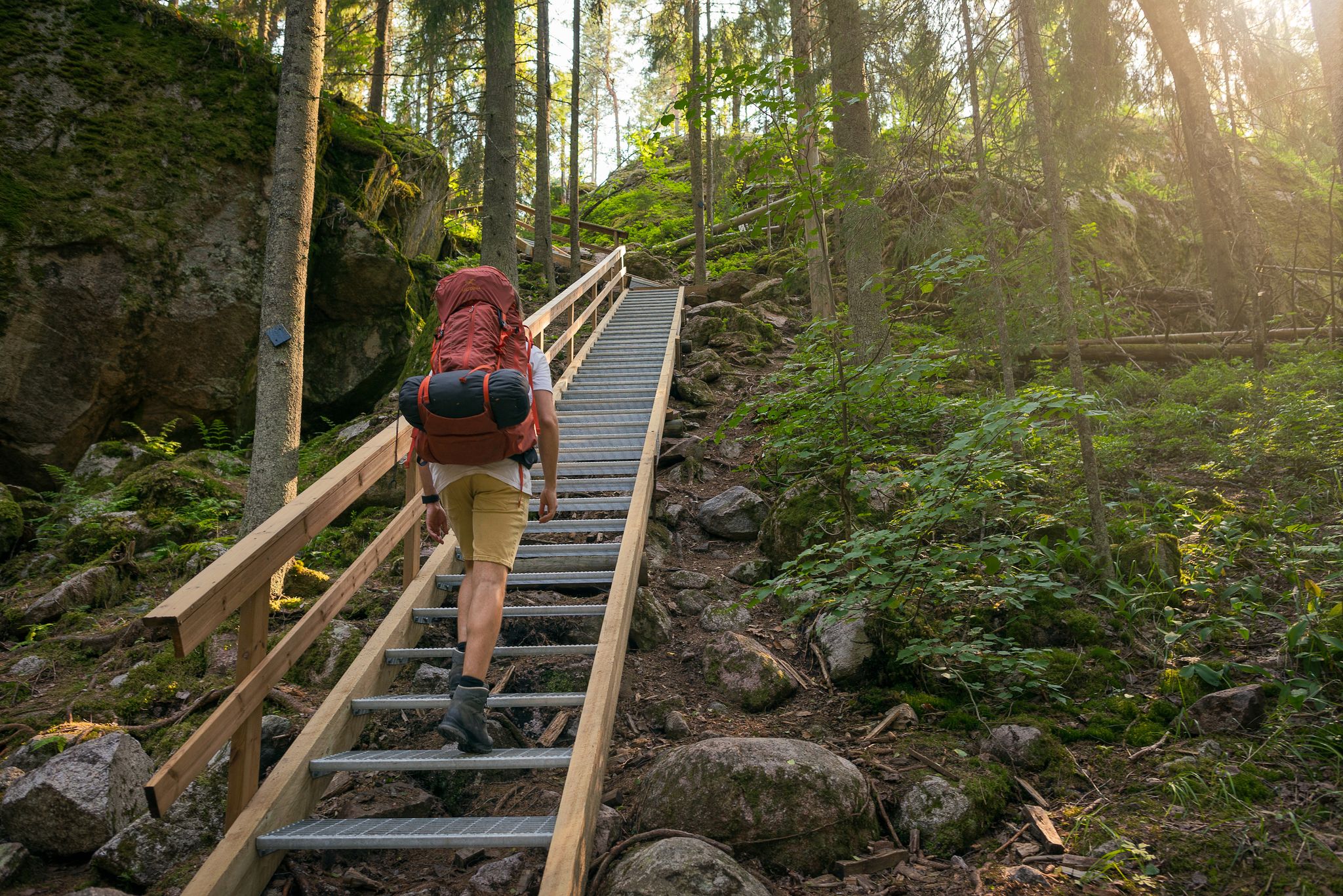
- Local hikers also love the Wooden staircase over rocks – Högberget loop from Hakunila, a 5.8 miles (9.3 km) trail leading through varied forest and rocky terrain, often completed in about 2 hours 28 minutes.
- Hiking in Sipoonkorven Kansallispuisto is defined by vast forests, wetlands, and rocky hills, with options for different ability levels. The park offers over 26 km of marked trails.
- The routes in Sipoonkorven Kansallispuisto are highly rated by the komoot community with an average score of 4.5 stars from nearly 200 reviews. More than 3000 hikers have used komoot to explore Sipoonkorven Kansallispuisto's varied terrain.
Last updated: July 27, 2026
6
hikers
10.1km
02:38
70m
70m
Moderate hike. Good fitness required. Mostly accessible paths. Sure-footedness required.
3.7
(12)
52
hikers
9.15km
02:25
80m
80m
Moderate hike. Good fitness required. Easily-accessible paths. Suitable for all skill levels.

Sign up for free
4.3
(3)
41
hikers
13.2km
03:32
150m
150m
Moderate hike. Good fitness required. Easily-accessible paths. Suitable for all skill levels.
4.5
(4)
39
hikers
9.64km
02:35
120m
120m
Moderate hike. Good fitness required. Easily-accessible paths. Suitable for all skill levels.
5.0
(1)
20
hikers
9.29km
02:28
100m
100m
Moderate hike. Good fitness required. Easily-accessible paths. Suitable for all skill levels.
Get access to more routes and recommendations from other explorers.
Sign up for free
Already have an account?
Our route recommendations are based on thousands of hikes, rides, and runs completed by other people on komoot.
Start today with a free account
Your next adventure awaits.
Login or Signup
Popular around Sipoonkorven Kansallispuisto


Tips from the Community

You can rent this hut. During peak months, it also serves as a pop-up trail cafe.
0
0
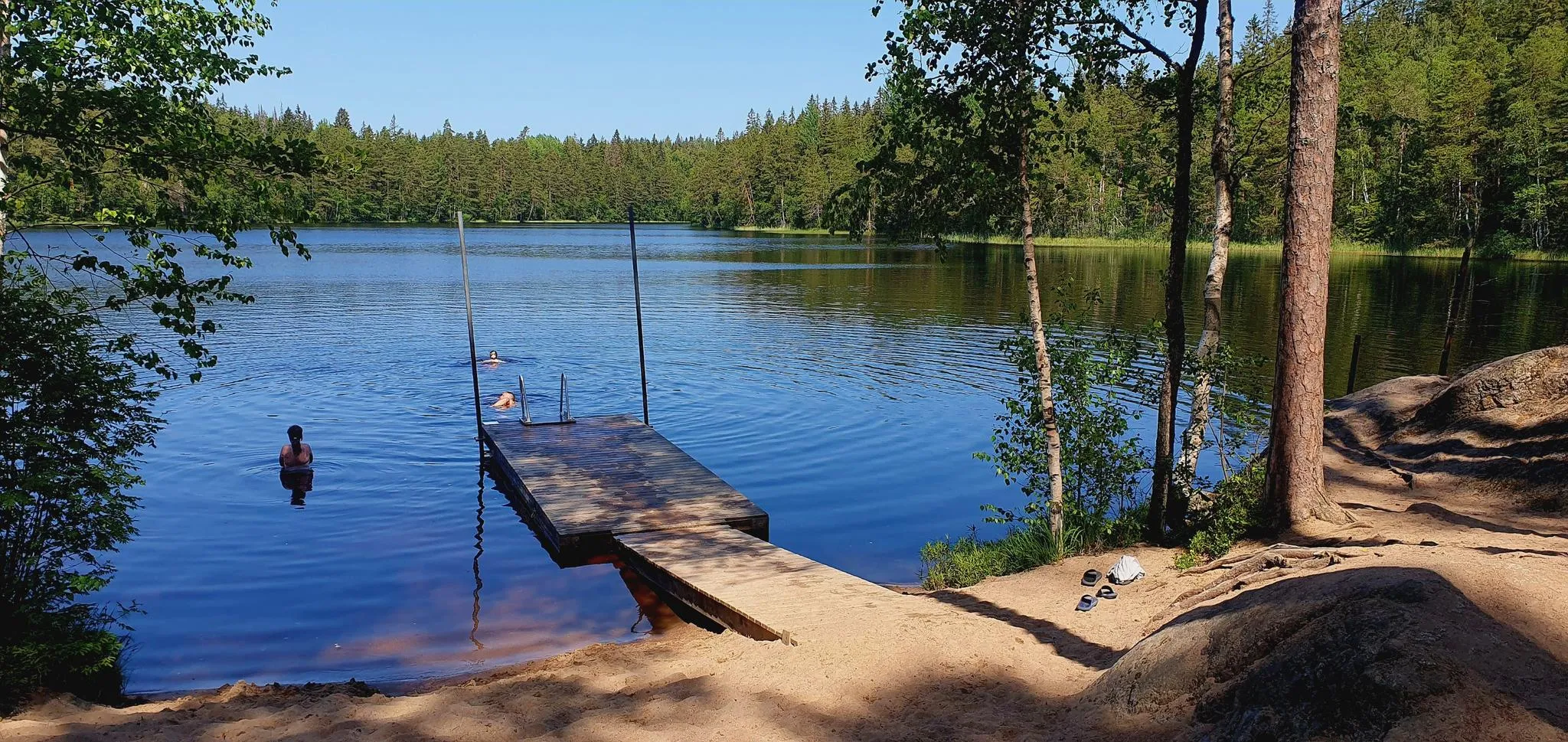
This is a small lake deep in the boreal forest, with a few swimming docks and a dry toilet on the shore.
0
0
This area is known for its rugged rocky outcrops and older boreal forests and swamps that are kept in a near-natural state. It is a hikers paradise.
0
0

The hiking routes in Sipoon kansallispuisto are well marked with rout markers and on bigger more frequently used routes you will find billboards with maps and valuable information about routes, nature and the area.
0
0
An accessible campfire site located on the east side of Lake Kuusijärvi. The area has one covered grilling area with a chimney and two uncovered campfire sites, picnic tables, scenic piers, and trash cans.
0
0
King Gustav III's trip to Finland in 1775 It is said about the king's trip that when King Gustav III came to Finland in 1775 at the age of 29, he visited Helsinki and ate with Johan Sederholm. Sederholm had a stone house on Senate Square and also owned the Häkansböle manor. He was a royalist and offered His Majesty a place to stay at his manor when the king traveled to Eastern Finland to establish a new province. The royal convoy consisted of 106 people and 38 four-wheeled horse-drawn carriages. Gustav III had become accustomed to being outdoors in France. While driving north, the royal party stopped at noon on a hill near Kuusijärvi, on Johan Sederholm's land, and enjoyed lunch there. The monarch's brief rest there was such an important event in the history books that the area was later named Kungsbacka, the King's Hill. Based on the map of the main divisions, the king's dining place is located approximately at Vanha Porvoontie 282 – 286. According to the story, after eating, the king climbed a nearby rock to look at the scenery. Gustav III's park, Gustav III:s park, was included in the local plan as the name of the local recreation area south of Kuusijärvi in 1996, and the city council approved the plan in 1999. It is a commemorative name. Source and more info: https://www.retkinikkari.fi/kuningas-kustaa-iiin-penkit/
0
0
Exactly 250 years ago, when King Gustav III of Sweden was travelling east along the Great Coastal Road, he stopped at Kuusijärvi in present-day Vantaa to have lunch under the open sky, “sitting on the bare ground”. The incident was so significant that the place was marked on the 1778 map on the hillock north of the road as “Ả detta ställe har hans Kungl. Maj. Gustaf Den Ill ätit middag den 10de Junii 1775 pa bara marken”. Now, based on a municipal initiative, a group of benches have been built at almost the same spot to commemorate that historic al fresco lunch. The benches, made of solid spruce, will offer hikers and other users of the area a fascinating and very beautifully situated resting place near the Kuusijärvi nature and recreation area and the Sipoonkorvi National Park.
0
0
A new resting place, Gustav III's benches, has been built on Lake Kuusijärvi in Vantaa, commemorating King Gustav III's historic lunch in the area on 10 June 1775. The benches, made of spruce, are located near the Sudentassu Bridge and offer hikers a place to rest in the middle of nature. The constructed hiking site includes three sturdy log benches. They are intended for resting or as seats for eating snacks. No fires or campfires are allowed at the site. The site follows the principle of litter-free hiking, meaning that visitors must take all their trash with them. There are no trash cans in the area around the benches; the nearest trash cans can be found at the campfire site on the shore.
0
0
Frequently Asked Questions
How many hiking trails accessible by bus are there in Sipoonkorven Kansallispuisto?
There are over 80 hiking trails in Sipoonkorven Kansallispuisto that are easily accessible from bus stations, offering a wide range of options for all skill levels. With 48 easy routes and 38 moderate ones, you'll find plenty to explore.
Are there easy, family-friendly hiking trails accessible by bus in Sipoonkorven Kansallispuisto?
Yes, Sipoonkorven Kansallispuisto offers many easy and family-friendly trails reachable by bus. The park features routes like the 2-kilometer Bakunkärr Trail, which winds through groves and spruce forests, and the Byabäcken Nature Trail, showcasing diverse landscapes. The 1-kilometer accessible trail to Storträsk Fireplace and Shelter is also a great option for families, providing a beautiful forest pond and a cooking shelter.
What kind of natural features can I expect to see on bus-accessible hikes in Sipoonkorven Kansallispuisto?
The bus-accessible trails in Sipoonkorven Kansallispuisto showcase a rich variety of natural features. You'll encounter vast forests, including ancient coniferous and dense spruce woods, as well as wetlands, bogs, and small lakes like Bisajärvi and Fiskträsk. Many routes also feature rocky outcrops, ravines, and impressive geological formations such as potholes, shaped by the last ice age.
Are there any challenging hiking routes accessible by bus in Sipoonkorven Kansallispuisto?
While most bus-accessible routes are easy to moderate, there are options for those seeking a bit more challenge. The park's terrain includes rugged cliffs and rocky areas, with some trails featuring steeper climbs. For example, the Bakunkärr barbecue area – Högberget loop from Sotunki is a longer, moderate route that covers 13.9 km with over 130 meters of elevation gain, offering a more demanding experience.
Can I bring my dog on the hiking trails in Sipoonkorven Kansallispuisto that are accessible by bus?
Yes, dogs are generally welcome on leashes on the hiking trails in Sipoonkorven Kansallispuisto. The park's diverse landscapes, from forests to open areas, provide an excellent environment for walks with your canine companion. Always remember to keep your dog under control and clean up after them to preserve the natural beauty for everyone.
Are there circular hiking routes available from bus stations in Sipoonkorven Kansallispuisto?
Many of the hiking trails accessible by bus in Sipoonkorven Kansallispuisto are circular, making them convenient for day trips without needing to retrace your steps. Examples include the Kuusijärvi – Kuusijärvi Lake loop from Päiväkumpu (9.1 km) and the Bisajärvi Camping Area – Högberget loop from Sotunki (9.6 km), both offering varied scenery.
What are some notable viewpoints or landmarks along bus-accessible trails?
Several bus-accessible trails lead to impressive viewpoints and landmarks. Högberget is a prominent rocky summit offering panoramic views over the surrounding forests, often featured on routes like the Wooden staircase over rocks – Högberget loop from Hakunila. The traditional landscape of the Byabäcken valley, with its meandering stream and meadows, is also a significant cultural feature.
What do other hikers enjoy most about hiking from bus stations in Sipoonkorven Kansallispuisto?
The area is highly rated by the komoot community, with an average score of 4.5 stars. Reviewers often praise the convenience of accessing diverse wilderness directly from public transport, the well-maintained trails, and the peaceful atmosphere. The variety of landscapes, from dense forests to open bogs and rocky viewpoints, is frequently highlighted as a major draw.
Are there any facilities like picnic areas or campfire spots along the bus-accessible routes?
Yes, Sipoonkorven Kansallispuisto provides several facilities along its trails, many of which are accessible from bus stops. You can find picnic areas like Fiskträsk Picnic Area and designated campfire spots and cooking shelters, such as the one at Storträsk Fireplace and Shelter. These amenities enhance the outdoor experience, allowing for comfortable breaks and meals.
What is the best time of year to hike in Sipoonkorven Kansallispuisto using public transport?
Sipoonkorven Kansallispuisto offers unique experiences throughout the year. Spring and autumn are particularly beautiful, with vibrant foliage or fresh greenery. Summer provides long daylight hours for extended hikes. Even in winter, many trails are suitable for hiking, and if there's enough snow, for skiing and snowshoeing. Public transport access remains consistent, making it a year-round destination.
Are there any shorter, easy routes for beginners accessible by bus?
Absolutely. For beginners or those looking for a shorter stroll, there are several easy routes. The Wooden staircase over rocks – Högberget loop from Sotunki is a good example, covering 4.9 km with minimal elevation gain, making it a gentle introduction to the park's beauty.
Most popular routes in Sipoonkorven Kansallispuisto
Most popular attractions in Sipoonkorven Kansallispuisto

Get inspired with the komoot mobile app


Explore more
Browse the best Hikes in other regions.
