The best traffic-free bike rides around Montiggler Wald - Bosco di Monticolo
4.4
(338)
2,965
riders
18
rides
No traffic touring cycling routes around Montiggler Wald - Bosco di Monticolo are characterized by a diverse landscape featuring mixed forests of spruces, chestnuts, and lime trees, situated on the Monte di Mezzo mountain. The region encompasses the picturesque Great and Small Monticolo Lakes, which are ancient glacial formations. Cyclists will encounter varied terrains including asphalted roads, forest trails, and gravel paths, often surrounded by vineyard landscapes. The area also includes hills like "Wilder Mann Bühel," offering panoramic views.
Best no traffic touring cycling routes around Montiggler Wald - Bosco di Monticolo
- The most popular no traffic touring cycling route is View of Bolzano – View of Castel Firmiano loop from Trentino – Alto Adige/Südtirol, a 17.1 miles (27.5 km) trail that takes 1 hour 45 minutes to complete. This route offers moderate climbs and scenic views of the surrounding area.
- Another top favourite among local touring cyclists is View of the Lake – Montiggler Lake loop from Kaltern an der Weinstraße - Caldaro sulla Strada del Vino, a moderate 7.1 miles (11.5 km) path. This trail winds through forest and offers views of the Monticolo Lakes.
- Local touring cyclists also love the Monticolo Forest – Small Monticolo Lake loop from Trentino – Alto Adige/Südtirol, a 4.5 miles (7.2 km) trail leading through dense forest and past the Small Monticolo Lake, often completed in about 34 minutes.
- Touring cycling around Montiggler Wald - Bosco di Monticolo is defined by dense forests, tranquil lakes, and vineyard landscapes. The network offers options for different ability levels, from easy family rides to more challenging routes.
- The routes in Montiggler Wald - Bosco di Monticolo are highly rated by the komoot community with an average score of 4.3 stars from over 700 reviews. More than 5,700 touring cyclists have used komoot to explore Montiggler Wald - Bosco di Monticolo's varied terrain.
Last updated: November 13, 2026
4.5
(140)
1,045
riders
Moderate bike ride. Good fitness required. Mostly paved surfaces.
4.6
(76)
571
riders
Moderate bike ride. Good fitness required. Mostly paved surfaces.

5.0
(12)
160
riders
Moderate bike ride. Good fitness required. Mostly paved surfaces.
4.4
(13)
84
riders
Easy bike ride. Mostly paved surfaces.
4.3
(6)
44
riders
21.1km
01:41
420m
420m
Moderate bike ride. Good fitness required. Mostly paved surfaces.
Get access to more routes and recommendations from other explorers.
Already have an account?
Our route recommendations are based on thousands of hikes, rides, and runs completed by other people on komoot.
Start today with a free account
Your next adventure awaits.
Popular around Montiggler Wald - Bosco di Monticolo

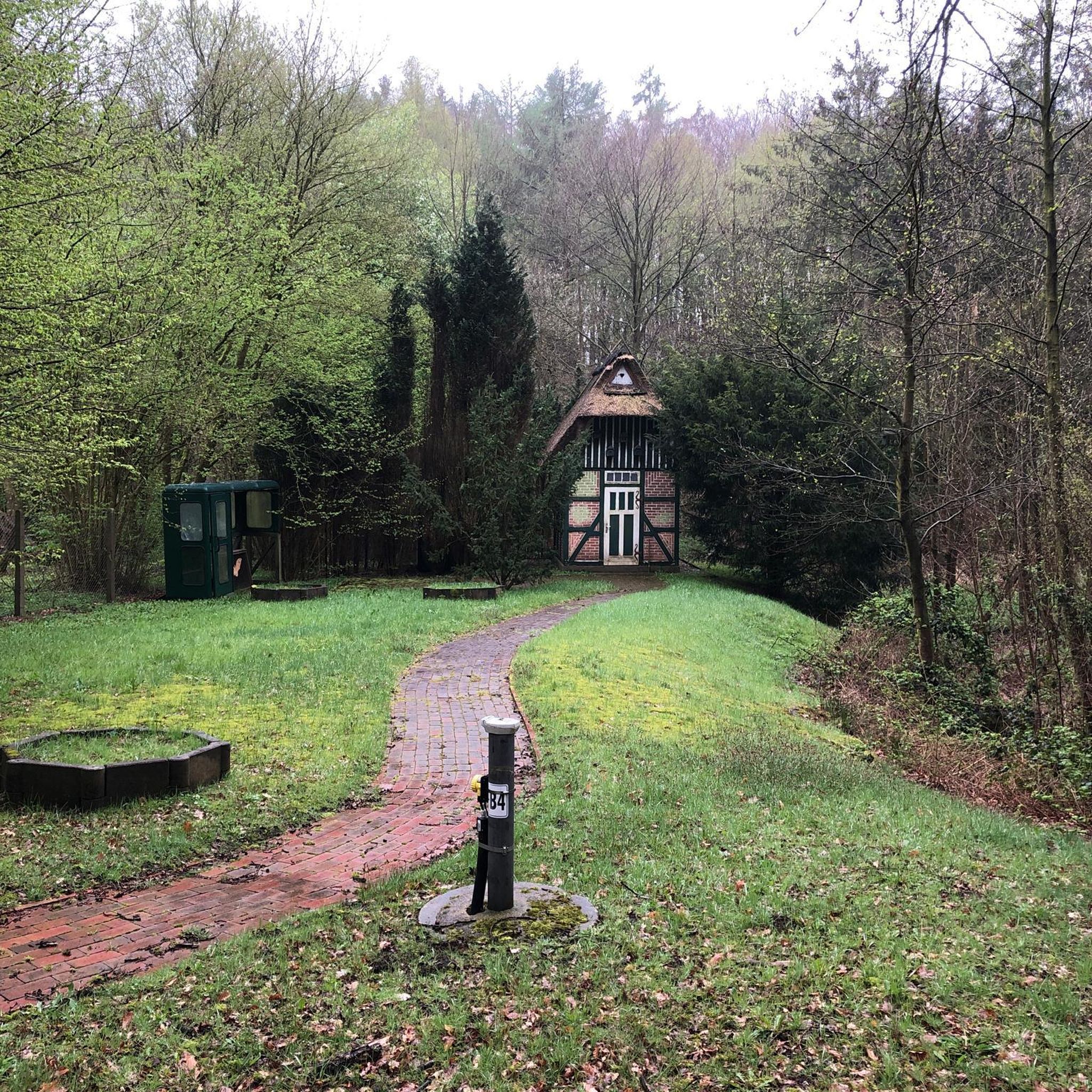
Tips from the Community

Cycle path section under completion
0
0


Montiggl, a district of Appiano, is a tiny village near the two lakes of the same name. It was first mentioned in 1191 in the Caldaro Letter of St. Vigilius as Monticulum (little mountain). At its center stands the small late Gothic church dedicated to the Three Kings. It dates back to 1470. The church tower also has its own history. The only bell was cast around 1505 and still rings today. The low pyramid roof was added in 1518. In addition to Gothic elements, the church also features Baroque and Renaissance elements: The Baroque altar from 1695, for example, was designed by Jörg Stieger of Ehrenburg, and the sacristy dates from the late Baroque period. The Tyrolean coat of arms is located on the keystone of the choir. Before the parish of St. Michael was founded in 1921, the Church of the Three Kings in Montiggl was cared for by Franciscans. When taking a walk to the Montiggler Lakes or the Frühlingstal valley, a visit to the hamlet with its old houses in the Überetsch style is recommended.
1
0


Lake Caldaro is beautiful but be careful of the heat in summer, temperatures can reach very high levels
0
0

Nice place to stop during a tour and the prices were still reasonable for the area.
1
0

Large selection of excellent wines.
1
0

Cycling through the vineyards of the Frühlingstal valley is a delight for all the senses. The fresh air, the delicate green of the vines, and the view of the South Tyrolean mountain landscape make every ride an unforgettable experience.
1
0
Frequently Asked Questions
How many no-traffic touring cycling routes are available in Montiggler Wald - Bosco di Monticolo?
There are 16 dedicated no-traffic touring cycling routes in the Montiggler Wald - Bosco di Monticolo area. These routes offer a mix of easy, moderate, and a few more challenging options, ensuring there's something for every skill level.
What kind of terrain can I expect on these no-traffic routes?
The no-traffic routes in Montiggler Wald - Bosco di Monticolo feature a diverse range of terrain. You'll find a mix of asphalted roads, forest trails, and gravel paths. The region's varied landscape, from dense forests to vineyard-lined paths, provides a dynamic cycling experience.
Are there any easy, family-friendly no-traffic routes suitable for beginners?
Yes, there are 8 easy routes perfect for families and beginners. A great option is the Monticolo Forest – Small Monticolo Lake loop from Trentino – Alto Adige/Südtirol, which offers a gentle ride through the forest and past the picturesque lake. Another easy route is the Girlan / Cornaiano Village – View of Lake Caldaro loop from Trentino – Alto Adige/Südtirol.
What natural attractions can I see along the no-traffic touring cycling routes?
Many routes pass by stunning natural features. The two picturesque Monticolo Lakes, the Great and the Small Lake, are central to the area and popular for swimming in warmer months. You can explore highlights like the Montiggler Lakes (Laghetti di Monticolo) or the Small Monticolo Lake. The Frühlingstal Nature Reserve also offers beautiful forest scenery.
Are there any circular no-traffic touring cycling routes?
Yes, many of the no-traffic routes are designed as loops, allowing you to start and end at the same point. For example, the View of the Lake – Montiggler Lake loop from Kaltern an der Weinstraße - Caldaro sulla Strada del Vino is a moderate circular route that takes you around the Monticolo Lake.
What is the best time of year to go touring cycling in Montiggler Wald - Bosco di Monticolo?
The Montiggler Wald - Bosco di Monticolo is ideal for touring cycling from spring through autumn. The warmer months allow for combining cycling with a refreshing swim in the Monticolo Lakes. Spring and early autumn offer pleasant temperatures and vibrant natural colors, making for a very scenic ride.
What do other touring cyclists enjoy most about the routes in Montiggler Wald - Bosco di Monticolo?
The area is highly rated by the komoot community, with an average score of 4.3 stars from over 700 ratings. Reviewers often praise the peaceful, traffic-free environment, the beautiful Monticolo Lakes, and the diverse landscapes that combine dense forests with scenic vineyards.
Are there any viewpoints or panoramic spots along the no-traffic routes?
Yes, the region offers several spots with great views. The "Wilder Mann Bühel" hill provides panoramic views of the surroundings. Additionally, some routes, like the View of Bolzano – View of Castel Firmiano loop from Trentino – Alto Adige/Südtirol, offer scenic vistas of the broader landscape, including glimpses of Bolzano and historical sites.
Can I reach the starting points of these routes by public transport?
The Montiggler Wald - Bosco di Monticolo area is generally well-connected. While specific public transport details for each starting point vary, many routes are accessible from towns like Kaltern an der Weinstraße (Caldaro sulla Strada del Vino) or San Michele Appiano, which have public transport links. It's advisable to check local bus schedules for the most convenient access to your chosen route's starting point.
Are there any cafes or places to stop for refreshments along the no-traffic routes?
Yes, the Montiggler Wald - Bosco di Monticolo area is popular, and you'll find opportunities for refreshments. The Monticolo Lakes, in particular, are popular spots with facilities. Many routes also pass through or near charming villages like Girlan and Caldaro, where you can find cafes and restaurants to take a break.
What is the elevation gain like on these no-traffic touring cycling routes?
The elevation gain varies significantly across the routes. Easy routes might have around 70-130 meters of elevation gain, while moderate routes can range from 250-330 meters. This variety allows cyclists to choose a route that matches their fitness level, from gentle climbs to more undulating terrain.
Most popular routes around Montiggler Wald - Bosco di Monticolo
Most popular attractions around Montiggler Wald - Bosco di Monticolo

Get inspired with the komoot mobile app


Explore more
Browse the best Cycling routes in other regions.
