The best hikes from bus stations around Loch Laggan
4.7
(225)
1,772
hikers
4
hikes
Bus station hiking trails around Loch Laggan are situated within the Scottish Highlands, offering access to a landscape characterized by freshwater lochs, mountains, and extensive moorland. The region includes parts of the Monadhliath and Grampian mountains, with significant elevation changes. Hikers can explore diverse terrain, from the shores of Loch Laggan to higher peaks and glacial corries. The area features a mix of forests, open moorland, and various burns and rivers.
Best bus station hiking trails around Loch Laggan
- The most popular bus station hiking route is Beinn a' Chlachair – Creag Pitridh loop from Torr a' Ghuilhinn, a 17.6 miles (28.3 km) trail that takes 9 hours 51 minutes to complete. This difficult route involves significant elevation gain through mountainous terrain.
- Another top favourite among local hikers is View of the Scottish Highlands – Lochan na h-Earba loop from Torr a' Ghuilhinn, a moderate 7.9 miles (12.7 km) path. This route offers views of the Scottish Highlands and leads to Lochan na h-Earba.
- Local hikers also love the Lochan na h-Earba Sandy Beach – Loch Laggan loop from Torr a' Ghuilhinn, a 15.5 miles (24.9 km) trail leading through varied landscapes including a sandy beach, often completed in about 6 hours 34 minutes.
- Hiking around Loch Laggan is defined by freshwater lochs, mountainous terrain, and expansive moorlands. The network offers options for different ability levels, from moderate loops to challenging mountain ascents.
- The routes in Loch Laggan are highly rated by the komoot community with an average score of 4.6 stars from more than 100 reviews. More than 1600 hikers have used komoot to explore Loch Laggan's varied terrain.
Last updated: August 8, 2026
4.4
(11)
164
hikers
28.3km
09:51
1,180m
1,180m
Hard hike. Very good fitness required. Mostly accessible paths. Sure-footedness required.
5.0
(2)
12
hikers
Hard hike. Very good fitness required. Easily-accessible paths. Suitable for all skill levels.

Sign up for free
4.0
(1)
19
hikers
Moderate hike. Good fitness required. Easily-accessible paths. Suitable for all skill levels.
9
hikers
Hard hike. Very good fitness required. Easily-accessible paths. Suitable for all skill levels.
Our route recommendations are based on thousands of hikes, rides, and runs completed by other people on komoot.
Start today with a free account
Your next adventure awaits.
Login or Signup


Tips from the Community


Beautiful freshwater beach on the shores of Lochan na h-Earba, easy cycle in from the A86.
0
0

a beautiful mountain stream along loch laggan
0
0
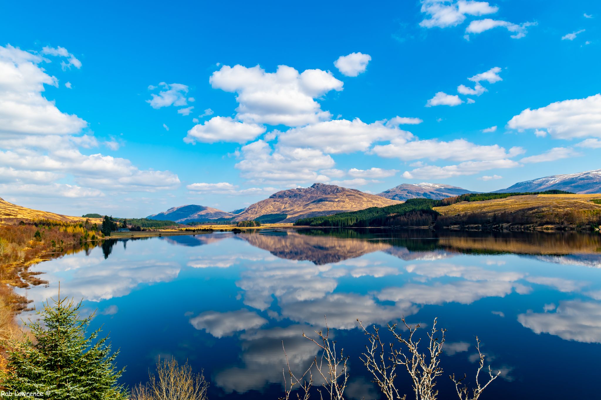
a beautiful view of an islet in Loch Laggan
0
0

Easy to ride path along the lake Lochan na h-Earba (there are two lakes up here with the same name - this is the bigger one) Awesome remote area with great views - always worth a visit!
0
0
Wonderful part of the road - great views.
0
0
Frequently Asked Questions
How many bus station hiking trails are available around Loch Laggan?
There are 4 distinct hiking routes accessible directly from bus stations around Loch Laggan. These trails offer a range of experiences, from moderate loops to challenging mountain ascents.
What is the general difficulty level of bus station hikes in the Loch Laggan area?
The bus station hikes around Loch Laggan tend to be on the more challenging side. There is 1 moderate route and 3 difficult routes, often involving significant elevation gains and longer distances. Hikers should be prepared for varied terrain.
Are there any moderate hiking options accessible by bus around Loch Laggan?
Yes, for a moderate option, consider the View of the Scottish Highlands – Lochan na h-Earba loop from Torr a' Ghuilhinn. This route covers approximately 12.7 km with about 125 meters of elevation gain, offering beautiful views without the extreme demands of the more difficult trails.
What kind of landscapes can I expect to see on these bus-accessible trails?
The trails accessible from bus stations around Loch Laggan traverse a stunning variety of Highland landscapes. You'll encounter dramatic scenery with mountains, forests, and open moorland. Many routes offer views of Loch Laggan itself, as well as smaller tranquil lochs like Lochan na h-Earba, and the impressive peaks of the Monadhliath and Grampian mountains.
Are there any long-distance or challenging hikes from bus stops in the region?
Absolutely. For experienced hikers seeking a challenge, the Beinn a' Chlachair – Creag Pitridh loop from Torr a' Ghuilhinn is a demanding option, covering over 28 km with more than 1180 meters of ascent. Another long and difficult route is the Lochan na h-Earba Sandy Beach – Loch Laggan loop from Torr a' Ghuilhinn, which is nearly 25 km long.
What do other hikers enjoy most about the Loch Laggan bus station trails?
The komoot community highly rates the hiking experience around Loch Laggan, with an average score of 4.6 stars from 188 reviews. Hikers frequently praise the breathtaking dramatic scenery, the sense of wilderness, and the rewarding views from higher elevations. The accessibility via public transport is also a key highlight for many.
Are there any circular routes starting from bus stations?
Yes, all the listed routes accessible from bus stations around Loch Laggan are circular. This means you can start and end your hike at the same point, making them convenient for public transport users. Examples include the View of the Scottish Highlands – Lochan na h-Earba loop and the more challenging Creag Pitridh – Lochan na h-Earba Sandy Beach loop.
What natural features or landmarks can I expect to see on these trails?
Many trails offer views of the expansive Loch Laggan, known for Britain's largest freshwater beach at its eastern end. You'll also encounter smaller, picturesque lochs like Lochan na h-Earba. The routes often provide panoramic vistas of the surrounding Monadhliath and Grampian mountains, and you might spot wildlife such as red deer or even golden eagles.
What is the best time of year to hike around Loch Laggan?
While Loch Laggan offers beauty year-round, the best time for hiking is typically from late spring to early autumn (May to October). During these months, the weather is generally milder, daylight hours are longer, and the trails are more accessible. Be prepared for changeable weather conditions even in summer, and always check forecasts before heading out.
Are there opportunities for wildlife spotting on these bus-accessible hikes?
Yes, the diverse habitats around Loch Laggan support a variety of wildlife. Hikers often have opportunities to spot red deer, especially in the more remote moorland areas. Keep an eye out for otters near the loch and rivers, and if you're lucky, you might even see golden eagles soaring above the mountain peaks.
What should I consider regarding elevation and duration for these bus station hikes?
The bus station hikes vary significantly in elevation and duration. The moderate View of the Scottish Highlands – Lochan na h-Earba loop takes around 3.5 hours with 125m elevation. More difficult routes, like the Creag Pitridh – Lochan na h-Earba Sandy Beach loop, can involve over 660m of ascent and take around 7 hours, while the most challenging, like the Beinn a' Chlachair – Creag Pitridh loop, can exceed 1180m elevation and take over 9 hours. Always check the specific route details for accurate figures.
Most popular routes around Loch Laggan

Get inspired with the komoot mobile app


Explore more
Browse the best Hikes in other regions.
