The best traffic-free bike rides around Réserve Naturelle du Bagnas
4.3
(135)
800
riders
41
rides
Gravel biking around Réserve Naturelle du Bagnas offers diverse landscapes across a 561-hectare coastal wetland. The region features a mix of marshes, ponds, salt meadows, and cultivated land, providing varied natural environments for cycling. Pathways along the historic Canal du Midi and routes offering views of the Thau Lagoon are common. The area also includes the ancient volcano Mont Saint-Loup, which provides elevation and panoramic views.
Best no traffic gravel bike trails around Réserve Naturelle du Bagnas
- The most popular…
Last updated: October 2, 2026
4.3
(4)
26
riders
Moderate gravel ride. Good fitness required. Mostly paved surfaces. Suitable for all skill levels.
4.7
(3)
9
riders
Moderate gravel ride. Good fitness required. Mostly paved surfaces. Suitable for all skill levels.

5.0
(1)
10
riders
Moderate gravel ride. Good fitness required. Mostly paved surfaces. Suitable for all skill levels.
4.6
(5)
14
riders
Moderate gravel ride. Good fitness required. Mostly paved surfaces. Suitable for all skill levels.
4.3
(10)
67
riders
Moderate gravel ride. Good fitness required. Mostly paved surfaces. Suitable for all skill levels.
Get access to more routes and recommendations from other explorers.
Already have an account?
Our route recommendations are based on thousands of hikes, rides, and runs completed by other people on komoot.
Start today with a free account
Your next adventure awaits.
Popular around Réserve Naturelle du Bagnas
Tips from the Community

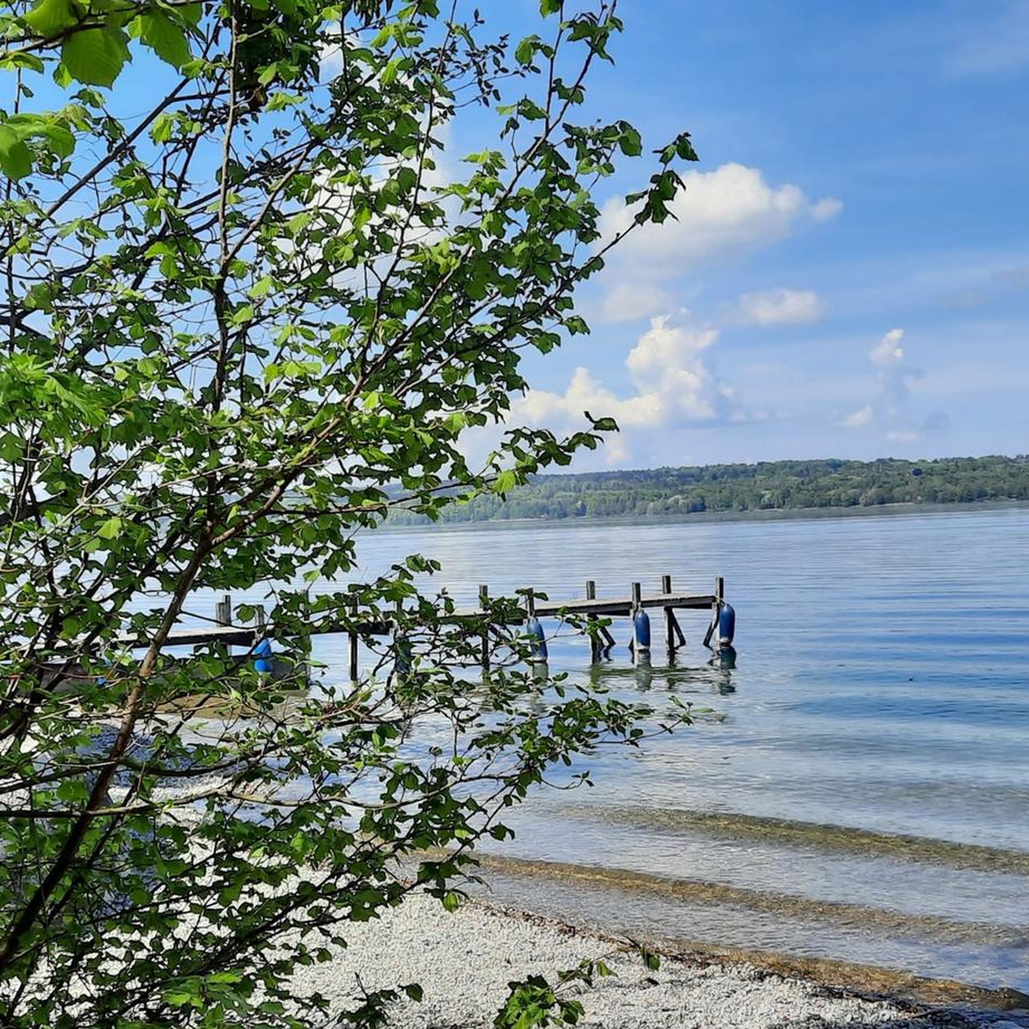
The Étang de Thau is the largest lagoon in Occitania and a species-rich inland sea, separated from the Mediterranean by a narrow sandbank. The waters are the center of South French oyster farming, whose hanging mussel beds shape the landscape. As a nautical hub, the lagoon also connects the famous Canal du Midi with the Canal du Rhône à Sète. Along the shore, charming towns line up, such as the fishing town of Sète, the vermouth town of Marseillan, and the oyster towns of Bouzigues and Mèze, which can be perfectly explored via the 53-kilometer-long cycling route around the basin.
0
0

This remarkable structure composed of mobile aqueducts allows boats navigating the Canal du Midi to cross the small river Libron. Created in 1855 by Urbain Maguès, an engineer also responsible for the bridge-canal of Béziers.
1
0

The Grande Maïre educational trail allows you to enjoy this vast wetland. You will see flamingos and other wading birds, which come to take advantage of the richness of the soil to feed.
0
0

🌉 Pont des Trois Yeux – the bridge with the three eyes This unusual old stone bridge stands directly on the Canal du Midi. Its actual name is Pont Saint-Joseph, but it is best known as the “Pont des Trois Yeux” – Bridge of the Three Eyes. 🇫🇷 The name is immediately explained upon closer inspection: the bridge has three arches. The large central arch allowed boats to pass, while the two smaller openings served the water or the towing path at the time. The history of towing is particularly interesting: Before motorboats navigated the canal, the barges were primarily pulled by horses from the bank. 🐴 At many bridges, the tow rope had to be detached and reattached on the other side – such structures today still beautifully illustrate how shipping on the Canal du Midi worked in the past. Another special feature are the overflows on both sides of the bridge, through which excess water could be drained. Not a huge sight, but exactly one of those small historical structures that make a bike tour along the Canal du Midi so interesting. 🚲👌🏼 Greetings Marcus ✌🏼
0
0
⚓ Écluse du Bagnas – one of the last locks on the Canal du Midi The Écluse du Bagnas is located near Agde at the eastern end of the Canal du Midi. It was built around 1676 and is therefore one of the historic locks from the canal's early days. 📍 Canal kilometer: approx. 235.3 km from Toulouse ⚙️ Type: single lock with one chamber 🌊 Altitude: only about 2 meters above sea level 🚤 Distance to Les Onglous / Étang de Thau: only just under 5 km Historically, the lock chambers here were about 30 meters long and 6 meters wide at the gates. The eastern section of the Canal du Midi was later modernized for larger ships; today, the usable lock dimensions in this area are around 40.6 × 5.85 meters. Its location is particularly interesting: the Bagnas lock is situated in the middle of a wetland and separates different water areas here. Behind it, you are practically on the final straight of the Canal du Midi – via Les Onglous, the canal flows into the Étang de Thau, and from there, there is the connection towards Sète and the Mediterranean Sea. 🌊🇫🇷 After more than 235 kilometers of canal route, you have almost reached the Mediterranean Sea here – a small but historically interesting structure at the end of the Canal du Midi. 🚲👌🏼 Greetings Marcus ✌🏼
1
0
😂😂 Apparently, I was already thinking about the second cold blonde. 🫣🍺 🚲 On the Canal du Midi near Vias A really beautiful section on the Canal du Midi near Vias. Sometimes directly along the water, sometimes under shady trees, and in between on small, narrow paths through reeds and nature. 🌿🚲 The alternation between well-developed cycle paths, gravel, and small natural passages makes the route varied. In addition, there are always beautiful views of the canal, passing boats, and that typical relaxed atmosphere of Southern France. 🇫🇷☀️ Especially around Vias, the Canal du Midi can be wonderfully explored by bike – quiet, scenically beautiful, and definitely a section that is worth riding a little slower to enjoy the surroundings. 👌🏼 Greetings Marcus ✌🏼
1
0
The Canal du Midi was built between 1667 and 1681 and stretches for around 240 kilometers from Toulouse to the Étang de Thau. Since 1996, it has been a UNESCO World Heritage site. Over 340 years of history – and yet, it is sometimes the very simple moments by the water that remain the most memorable. 👌🏼 Greetings Marcus ✌🏼
2
0
🌅 Evening mood on the Canal du Midi When the sun slowly sets and its light reflects on the water of the Canal du Midi, the canal shows itself from a completely different side. Between the dark rows of trees, the calm water, and the low-lying sun, precisely that typical southern French atmosphere is created, for which you don't really need a grand viewpoint. 🇫🇷☀️ Greetings Marcus
2
0
Frequently Asked Questions
How many no-traffic gravel bike trails are available in the Réserve Naturelle du Bagnas?
There are over 30 dedicated no-traffic gravel bike trails in the Réserve Naturelle du Bagnas. These routes cater to various skill levels, with 11 easy, 19 moderate, and 1 difficult option to explore the diverse landscapes.
What kind of terrain can I expect on the gravel bike trails in Réserve Naturelle du Bagnas?
The trails offer a varied experience, ranging from mostly paved surfaces along the Voie Verte Canal du Midi to unpaved segments through marshes, ponds, and salt meadows. While many paths are accessible, some unpaved sections might require more advanced riding skills or even walking your bike.
Are there any family-friendly no-traffic gravel bike trails in the area?
Yes, there are several easy routes suitable for families. For instance, the Bagnas Nature Reserve – Voie Verte Canal du Midi loop from Camp d'Agde is an easy 15 km ride that offers a pleasant experience for all ages, keeping you away from traffic.
What natural features or landmarks can I see along the gravel bike routes?
You'll encounter a rich variety of natural features. Many routes offer panoramic views of the Étang de Thau (Thau Lagoon) and pass through the Bagnas Nature Reserve itself, a haven for birdwatching. You can also integrate paths leading to Mont Saint-Loup Summit for stunning panoramic views of the entire region.
What is the best time of year for gravel biking in Réserve Naturelle du Bagnas?
Spring and autumn are generally the best times for gravel biking. The weather is milder, and the natural beauty of the reserve, including its diverse birdlife, is particularly vibrant. Summers can be hot, so early mornings or late afternoons are preferable if riding during that season.
Are there any circular gravel bike routes available?
Yes, many of the no-traffic gravel routes are circular, allowing you to start and end at the same point. Examples include the moderate Voie Verte Canal du Midi – Bagnas Nature Reserve loop from Marseillan-Plage (50.4 km) or the longer View of the Étang de Thau – The Fairy Stretcher loop from Marseillan-Plage (66.8 km).
What do other gravel bikers enjoy most about the Réserve Naturelle du Bagnas?
The area is highly rated by the komoot community, with an average score of 4.4 stars from 82 ratings. Reviewers often praise the tranquility of the no-traffic routes, the stunning views of the Étang de Thau, and the rich biodiversity, especially the opportunities for birdwatching within the nature reserve.
Can I access the trails using public transport?
While direct public transport to all trailheads might be limited, the region is well-equipped for cyclists. The Réserve Naturelle du Bagnas is designated "Accueil Vélo," indicating services for cyclists. You can often find routes starting from towns like Marseillan-Plage or Agde, which have better public transport connections.
Are there any specific routes that offer great views of the Étang de Thau?
Absolutely. Routes like the Bagnas Nature Reserve – View of the Étang de Thau loop from Marseillan-Plage are specifically designed to showcase the beautiful Thau Lagoon. You can also witness the unique mixing of the Canal du Midi's waters with the lagoon at the Onglous lighthouse.
Where can I find parking for these no-traffic gravel bike trails?
Many of the routes start from towns or popular access points like Marseillan-Plage or Camp d'Agde, where public parking is generally available. It's advisable to check specific starting points for designated parking areas, especially during peak seasons.
What is the typical duration for a moderate gravel bike ride in this region?
A moderate gravel bike ride can vary in duration depending on the distance and your pace. For example, the Bagnas Nature Reserve – Voie Verte Canal du Midi loop from Marseillan-Plage, which is about 57 km, typically takes around 3.5 to 4 hours to complete at a steady pace.
Most popular routes around Réserve Naturelle du Bagnas
Most popular attractions around Réserve Naturelle du Bagnas

Get inspired with the komoot mobile app


Explore more
Browse the best Gravel rides in other regions.
