The best traffic-free bike rides around Gommiswald
4.6
(32)
499
riders
15
rides
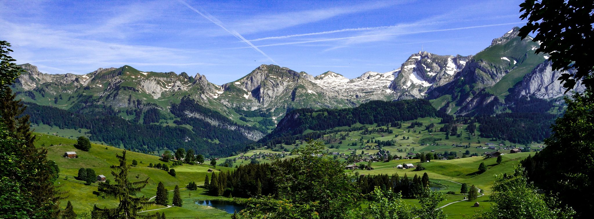
Gravel biking around Gommiswald, a municipality in the canton of St. Gallen, Switzerland, offers diverse landscapes and varied terrain. Situated on a high ridge between the Linth and Regelstein valleys, the region features significant elevation changes, unpaved roads, and forest paths. This topography provides routes with both demanding climbs and descents, alongside panoramic views of the Linthebene, Lake Zurich, and the Glarus and Schwyz mountains. An extensive network of trails and paths makes Gommiswald suitable for gravel biking.
Best no…
Last updated: October 1, 2026
4.5
(2)
108
riders
51.7km
02:30
150m
150m
Moderate gravel ride. Good fitness required. Mostly paved surfaces. Suitable for all skill levels.
4.0
(1)
21
riders
38.0km
03:03
1,220m
1,220m
Hard gravel ride. Very good fitness required. Mostly paved surfaces. Suitable for all skill levels.

5.0
(1)
13
riders
19.9km
01:26
280m
280m
Moderate gravel ride. Good fitness required. Mostly paved surfaces. Suitable for all skill levels.
8
riders
32.4km
02:16
580m
580m
Hard gravel ride. Very good fitness required. Mostly paved surfaces. Suitable for all skill levels.
4.7
(3)
10
riders
42.1km
02:56
810m
810m
Hard gravel ride. Very good fitness required. Mostly paved surfaces. Suitable for all skill levels.
Get access to more routes and recommendations from other explorers.
Already have an account?
Our route recommendations are based on thousands of hikes, rides, and runs completed by other people on komoot.
Start today with a free account
Your next adventure awaits.
Other adventures around Gommiswald

Tips from the Community

There will probably never be so much water again
0
0

In clear weather, the view is simply impressive
0
0
Great old wooden construction
0
0
Great cycle path with a super view
0
0

the fastest and most beautiful way from Weesen to Kerenzerberg / Mollis
1
0
Frequently Asked Questions
How many no-traffic gravel bike trails are available around Gommiswald?
There are 18 dedicated no-traffic gravel bike trails around Gommiswald. These routes offer a mix of challenges, with 8 categorized as moderate and 10 as difficult, ensuring options for various skill levels.
What kind of terrain will I encounter on Gommiswald's no-traffic gravel trails?
Gommiswald's trails are known for their varied terrain and significant elevation changes, situated on a high ridge between the Linth and Regelstein valleys. You can expect a mix of demanding climbs and thrilling descents, often on unpaved roads and forest paths, providing a true gravel biking experience.
Are there any family-friendly no-traffic gravel routes in Gommiswald?
While many routes in Gommiswald feature significant elevation, some sections along the Linth Canal offer flatter, more accessible terrain. For example, the Linth Canal – View of the Glarus Alps loop from Uznach or the Linth Canal – View of the Glarus Alps loop from Schmerikon provide scenic rides with less strenuous climbs, suitable for families with older children or those seeking a more relaxed pace.
What are the best times of year for gravel biking in Gommiswald?
The best times for gravel biking in Gommiswald are typically spring, summer, and autumn. June and September are particularly popular months for cycling. During winter, some higher elevation trails might be affected by snow or ice, so it's advisable to check local conditions.
Can I find circular no-traffic gravel routes in the Gommiswald area?
Yes, many of the no-traffic gravel routes around Gommiswald are designed as loops, allowing you to start and end at the same point. Examples include the Linth Canal – View of the Glarus Alps loop from Uznach and the Aabach Bridge Schmerikon – View of Bätzimatt and Obersee loop from Schmerikon, offering convenient exploration.
What kind of views and landmarks can I expect along these routes?
Gommiswald's elevated position offers stunning panoramic views of the Linthebene, upper Lake Zurich, and the Glarus and Schwyz mountains. You might pass by highlights such as Schmerikon — lakeside on Lake Zurich, or enjoy vistas from viewpoints like View from Hirzli. The region also features impressive natural attractions like the Seerenbach Falls and historical sites like Mount Zion Abbey, though these may require a slight detour from the main gravel paths.
Are there any routes that pass by lakes or water features?
Absolutely. Several routes run alongside or offer views of water bodies. The Linth Canal – View of the Glarus Alps loop from Uznach and the Linth Canal – View of the Glarus Alps loop from Schmerikon follow the Linth Canal, and you can also find routes near Shore of Lake Obersee, providing picturesque lakeside riding.
What do other gravel bikers enjoy most about Gommiswald's trails?
The komoot community highly rates the gravel biking experience in Gommiswald, with an average score of 4.58 stars. Reviewers often praise the diverse landscapes, the challenging yet rewarding climbs, and the breathtaking panoramic views of the Swiss Alps and Lake Zurich, all while enjoying the tranquility of traffic-free paths.
Are there options for advanced gravel bikers looking for a challenge?
Yes, Gommiswald offers several difficult routes with significant elevation gain. For instance, the Tanzboden Mountain Inn – View from the Tanzboden loop from Kaltbrunn involves over 1200 meters of ascent, providing a substantial challenge for experienced riders seeking demanding climbs and thrilling descents.
How accessible are the no-traffic gravel trails by public transport?
Gommiswald and surrounding towns like Uznach and Schmerikon are generally well-connected by public transport, making it possible to access many trailheads without a car. It's advisable to check specific train or bus schedules and bike transport policies for your chosen starting point.
Can I find places to eat or drink along the no-traffic gravel routes?
While many routes venture into natural, secluded areas, some trails may pass near villages or mountain inns. For example, the Tanzboden Mountain Inn – View from the Tanzboden loop from Kaltbrunn specifically mentions a mountain inn, offering a potential stop for refreshments. It's always a good idea to carry sufficient water and snacks, especially on longer or more remote rides.
Most popular routes around Gommiswald
Most popular attractions around Gommiswald

Get inspired with the komoot mobile app


Explore more
Browse the best Gravel rides in other regions.
