The best city hikes and walks in the Rincon Mountains
4.8
(88)
945
hikers
3
hikes
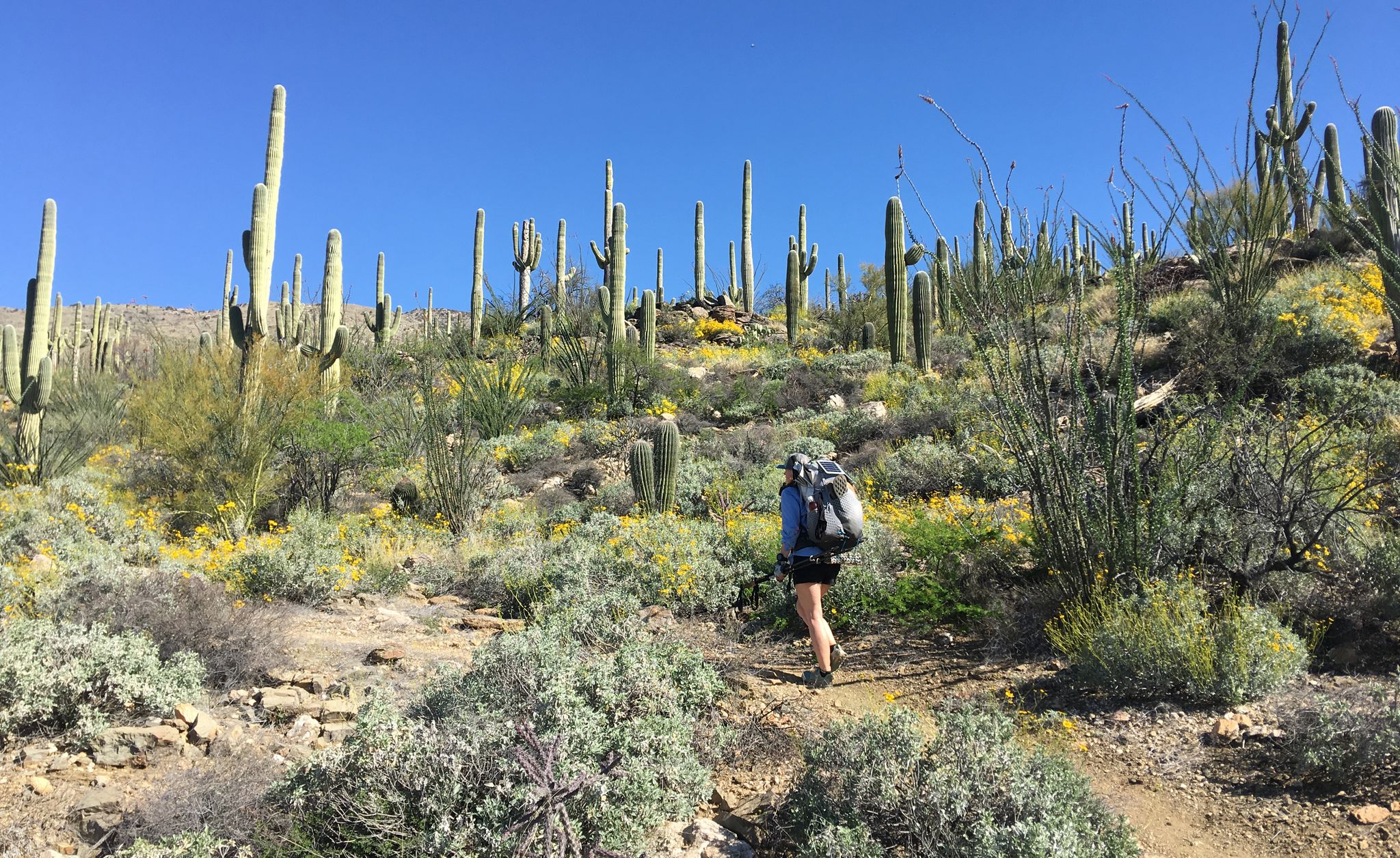
Urban hiking trails in the Rincon Mountains offer diverse landscapes, transitioning from the Sonoran Desert floor to areas with riparian habitats. The region features iconic saguaro cacti at lower elevations and varied terrain, including greenways and river parks. These trails provide accessible outdoor experiences within or adjacent to urban areas, showcasing the natural environment. The elevation changes, even on urban routes, contribute to varied scenery and views.
Best urban hiking trails in the Rincon Mountains
- The most popular urban hiking…
Last updated: October 25, 2026
1
hikers
1.33km
00:20
0m
0m
Embark on an easy hike along the Udall Park Loop, a gentle route spanning 0.8 miles (1.3 km) with a minimal elevation gain of 11 feet (3 metres). You can…
9.61km
02:28
60m
10m
Embark on the Pantano River Park Trail for a moderate hike that blends urban convenience with desert beauty. This route spans 6.0 miles (9.6 km) and involves a gentle elevation…

33.1km
08:26
20m
230m
Embark on a challenging hike along the Julian Wash Greenway to the Santa Cruz River, a difficult 20.6 miles (33.1 km) route that takes about 8 hours and 25 minutes…
Our route recommendations are based on thousands of hikes, rides, and runs completed by other people on komoot.
Start today with a free account
Your next adventure awaits.
Popular around Rincon Mountains
Other adventures in the Rincon Mountains


Tips from the Community

Bicycle Built for Two, 2023. Artist: Joe Pagac. The cyclist is a javelina, perched on the front seat of a life-size tandem bicycle; the back seat is open to anyone who wants to pose for a photo. The sculpture is the work of local artist Joe Pagac, who was inspired by the interactive sculptures he’d seen in his travels.
0
0
Spoked Cathedral, 2015. Artist: Joseph Lupiani. Overview: The design is reminiscent of a cathedral window, with a vegetative pattern on the lower section tying into the natural world. The star shape is based on the Arizona flag. There is also a covered rest area here.
0
0
Batty Biker, 2015. Artist: Stephen Fairfield. Overview: This bat on a bike pays tribute not only to the Broadway bridge where bats roost but also to the thousands of cyclists who pedal along The Loop every week.
0
0

Scenic dedicated bike trails follow the Santa Cruz River on both sides. Here the Cushing bridge crosses the river, with wide trails on the sidewalk and great views.
1
0

Julian Wash Greenway in Tucson offers cyclists a scenic route through a picturesque environment. The well-maintained concrete trail winds through nature, providing an enjoyable cycling experience. Surrounded by desert landscapes, the greenway allows riders to appreciate the unique beauty of the Tucson area.
0
0

The park, located on the bank of Pantano Wash, provides ample waterfront views. It features well-maintained trails suitable for walking, running, cycling, and equestrian activities. Additionally, the park houses a Children's Memorial site and a tree memorial park.
0
0

This urban park is a wonderful complement to the Urban Trails System, offering nearly three miles of dual pathways, a children's memorial garden, and an overlook gathering area. As you ride along the route, you can stop at information panels that provide a wealth of history and science on topics ranging from changes in the climate over thousands of years to details of life at historic Fort Lowell, located in Fort Lowell Park, just off the path. Along the way, you can take in the beautiful scenery, from trees with leaves still showing autumn hues to winter-blooming wildflowers, and expansive views of the Catalina Mountains.
0
0
Frequently Asked Questions
How many urban hiking trails are available in the Rincon Mountains?
This guide features three distinct urban hiking trails in the Rincon Mountains, offering a range of experiences from easy loops to more challenging, longer routes. You can find one easy, one moderate, and one difficult trail to explore.
What kind of natural features can I expect to see on urban hikes in the Rincon Mountains?
Urban hikes in the Rincon Mountains often showcase the unique Sonoran Desert landscape, including iconic saguaro cacti and desert riparian habitats. Depending on the trail, you might encounter rugged topography and seasonal water features. For example, the Bridal Wreath Falls are a notable natural monument in the wider Rincon Mountains area, often flowing in cooler months.
Are there any easy, family-friendly urban hikes in the Rincon Mountains?
Yes, for an easy and family-friendly option, consider the Udall Park Loop. This route is just over 1.3 kilometers long with minimal elevation gain, making it suitable for a leisurely stroll with children or those looking for a gentle outdoor experience within the city's edge.
What do other hikers enjoy most about urban hiking in the Rincon Mountains?
The komoot community highly rates the hiking experiences in the Rincon Mountains, with an average score of 4.86 out of 5 stars. Hikers often praise the accessibility of these trails from Tucson, the unique desert scenery, and the opportunity to connect with nature close to the city.
Are there any longer urban trails for more experienced hikers?
For a more challenging and extensive urban hike, the Julian Wash Greenway to the Santa Cruz River offers a difficult 33-kilometer route. This trail provides a significant distance for those looking to spend more time exploring the urban greenways and river paths.
Can I find urban trails that follow river paths or greenways?
Absolutely. The Pantano River Park Trail is a moderate 9.6-kilometer route that follows a river park, offering a pleasant experience along a green corridor. Additionally, the Julian Wash Greenway to the Santa Cruz River is another excellent option for exploring urban greenways.
What are some interesting landmarks or points of interest near these urban trails?
While the urban trails themselves offer natural beauty, the broader Rincon Mountains area is rich with points of interest. You can find highlights like the Freeman Homestead Trail, which leads to a grove of old saguaros and an historic site, or explore the Saguaro East Loop for classic Sonoran Desert scenery.
What is the best time of year for urban hiking in the Rincon Mountains?
The cooler months, typically from late fall through spring (October to April), are ideal for urban hiking in the Rincon Mountains. Temperatures are more comfortable, making for a more enjoyable experience. Summer months can be very hot, so early morning or late evening hikes are recommended if visiting during that time.
Are there any urban trails that offer good viewpoints?
While specific viewpoints are less common on the flatter urban greenway trails, the surrounding Rincon Mountains offer spectacular vistas. Many of the urban trails provide open views of the mountain range itself, giving a sense of the dramatic transition from desert floor to mountain peaks. For more elevated views, you would typically need to venture onto trails deeper within Saguaro National Park East.
What should I bring for an urban hike in the Rincon Mountains?
Even on urban trails, it's essential to be prepared. Always carry plenty of water, especially during warmer months. Sun protection like a hat, sunglasses, and sunscreen is crucial. Comfortable walking shoes are a must, and it's advisable to bring a map or use a navigation app like komoot, even for shorter routes.
Most popular routes in the Rincon Mountains
Most popular attractions in the Rincon Mountains

Get inspired with the komoot mobile app


Explore more
Browse the best Hikes in other regions.
