The best hikes from bus stations around Gössitz
4.6
(7905)
24,465
hikers
22
hikes
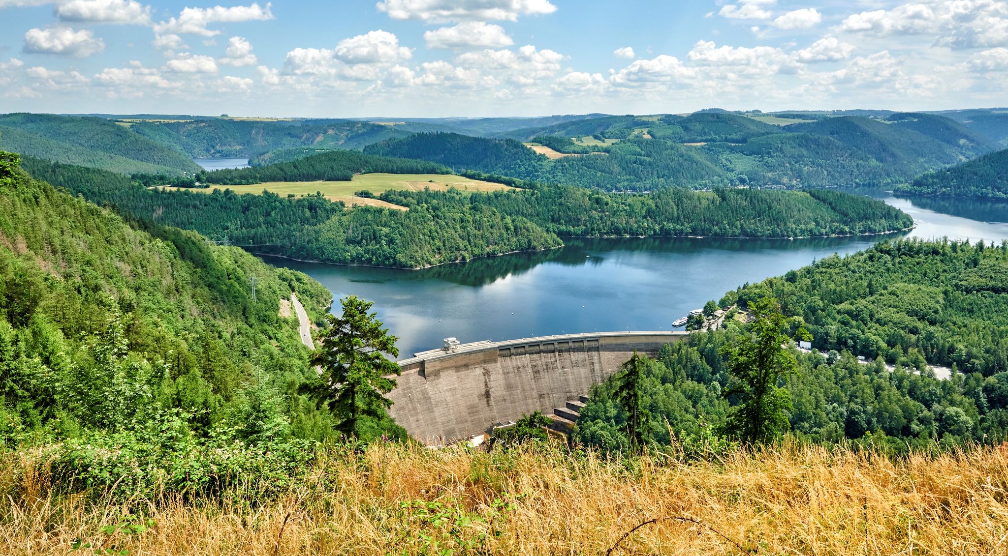
Bus station hiking trails around Gössitz are situated in the Saale-Orla district of Germany, within the Thuringian Slate Mountains. The region features rolling hills, dense green forests, and the Saale River, which meanders through natural scenery. A prominent natural feature is the Hohenwarte Reservoir, characterized by its fjord-like water landscape. The terrain offers a mix of riverside paths, forest trails, and climbs to viewpoints.
Best bus station hiking trails around Gössitz
- The most popular bus station hiking route is View…
Last updated: October 28, 2026
4.8
(131)
357
hikers
Moderate hike. Good fitness required. Easily walkable paths.
4.7
(313)
840
hikers
14.3km
04:08
330m
330m
Moderate hike. Good fitness required. Mostly walkable paths. Sure-footedness required.

4.7
(70)
212
hikers
11.5km
03:23
290m
290m
Moderate hike. Good fitness required. Mostly walkable paths. Sure-footedness required.
4.9
(33)
86
hikers
Moderate hike. Good fitness required. Mostly walkable paths. Sure-footedness required.
4.9
(28)
83
hikers
6.60km
01:50
120m
120m
Easy hike. Easily walkable paths.
Get access to more routes and recommendations from other explorers.
Already have an account?
Our route recommendations are based on thousands of hikes, rides, and runs completed by other people on komoot.
Start today with a free account
Your next adventure awaits.
Popular around Gössitz
Other adventures around Gössitz

Tips from the Community


Great photo spot ♥️ with a view of Ziegenrück Castle. Of course, there's a lovely bench on the banks of the Saale River.
16
0
Offers a wonderful view 🤩.
15
0
Many relaxing benches and picnic areas are located here on the edge of the weir.
15
0

Especially in the morning sun at the beginning of autumn simply dreamy
0
0
Very friendly owners, who not only serve delicious goat milk products but also provide lots of interesting information about the surrounding area. Goat breed: Thuringian Forest Goat
1
0
At the Teufelskanzel (Devil's Pulpit), you'll find a magnificent view of the Saale River Loop and the historic Conrod Power Station. There's also a bench for a rest. If you want to walk a few more meters, you'll reach a sealing platform. (Distant view)
0
0
A beautiful hiking trail runs along the banks, offering repeated views of the reservoir.
0
0
Frequently Asked Questions
How many hiking trails are accessible directly from bus stations around Gössitz?
There are 14 hiking trails around Gössitz that are easily accessible from bus stations. These routes offer a variety of experiences, ranging from easy strolls to more challenging day hikes.
What kind of difficulty can I expect from the bus-accessible hiking trails in Gössitz?
The bus-accessible trails around Gössitz cater to various fitness levels. You'll find 3 easy routes perfect for a relaxed outing, 9 moderate trails for a good workout, and 2 more difficult options for experienced hikers seeking a challenge.
Are there family-friendly hiking trails accessible by bus in Gössitz?
Yes, several easy routes are ideal for families. For example, the View of the Saale River – Gössitz Goat Farm loop from Gössitz is an easy 6.4 km hike that offers pleasant scenery suitable for all ages. The Saale River area, with its gentle paths and small waterfalls, is generally very family-friendly.
Can I bring my dog on these bus-accessible hiking trails?
Gössitz is a great region for hiking with dogs, and many of the trails accessible from bus stations are dog-friendly. The natural landscapes, especially along the Saale River and through the forests, provide ample space for dogs to enjoy. Always remember to keep your dog on a leash where required and clean up after them.
Are there circular hiking routes that start and end at bus stops?
Yes, many of the bus-accessible routes are circular, allowing you to start and finish your hike at the same bus stop. This is convenient for public transport users. An example is the View of the Saale River – Gössitz Goat Farm loop from Gössitz, which is an easy circular route.
What natural features can I expect to see on hikes from Gössitz bus stations?
You can explore diverse natural features, including the picturesque Saale River with its dense forests and small waterfalls, and the stunning fjord-like landscape of the Hohenwarte Reservoir. Trails like the View of the Saale River bend – View of the Saale River loop from Gössitz offer continuous scenic views of the water.
Are there any historical landmarks or attractions accessible from bus station trails?
Absolutely. The region is rich in history. You can discover the impressive Hohenwarte Dam, a significant structure offering expansive views. The Wysburg Castle Ruins are also a regional secret tip, offering a rewarding visit for those up for a more challenging approach. The Green Belt, a former border strip, also offers historical paths.
What is the best time of year to hike from Gössitz bus stations?
The most favorable seasons for hiking in Gössitz are spring and autumn. Spring brings the natural environment to full bloom, while autumn is celebrated for its vibrant colorful foliage, making for particularly scenic hikes. Summer is also pleasant, though it can be warmer, and winter offers a different, quieter beauty, especially on cleared paths.
What do other hikers enjoy most about the bus-accessible trails in Gössitz?
The trails around Gössitz are highly rated by the komoot community, with an average score of 4.6 stars from over 7,300 ratings. Hikers often praise the diverse landscapes, the stunning views of the Hohenwarte Reservoir and Saale River, and the well-maintained paths that make exploring the Thuringian Slate Mountains enjoyable and accessible.
Are there longer, more challenging routes available from bus stops for experienced hikers?
Yes, for experienced hikers, there are more demanding routes. The View of the Saale River bend – View of the Saale River loop from Gössitz is a difficult 20.3 km hike, while the Gnome houses on the Gnome Trail – Mooshäuschen Viewpoint loop from Altenbeuthen is an even longer, difficult 21.9 km route, both offering significant elevation changes and rewarding views.
Where can I find viewpoints along the bus-accessible hiking trails?
Many trails offer fantastic viewpoints. The View over the Hohenwarte Reservoir and the Mooshäuschen Viewpoint are popular spots. The Waldstein mountain also provides spectacular views from its summit cross, accessible via some of the more challenging routes.
How can I find specific bus routes to reach these trailheads?
The local public transport provider, KomBus, operates routes serving the Gössitz area and its surrounding villages, providing access to various trailheads. It's recommended to check the KomBus website or local schedules for the most up-to-date information on routes and timings to plan your journey to the starting points of these hikes.
Most popular attractions around Gössitz

Get inspired with the komoot mobile app


Explore more
Browse the best Hikes in other regions.
