The best traffic-free bike rides around Frauenberg
5.0
(3)
22
riders
5
rides
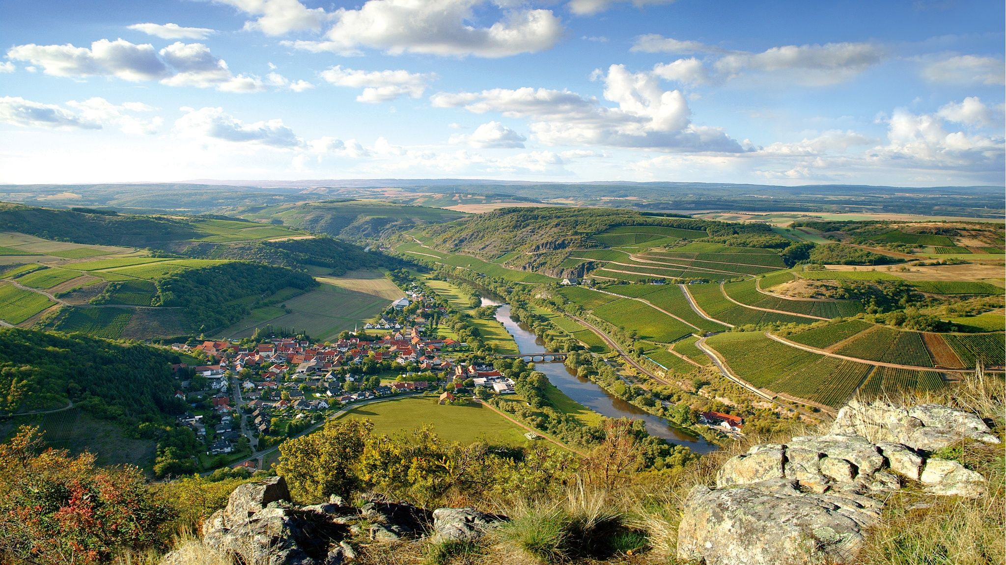
Gravel biking around Frauenberg offers routes through the diverse landscapes of the Saar-Hunsrück Nature Park. The region is characterized by rolling hills, extensive green forests, and the scenic Nahe River valley, providing varied terrain for gravel cyclists. Routes often feature a mix of natural paths and unpaved sections, suitable for exploring the area's natural beauty. This environment provides a challenging backdrop for outdoor activities, with elevation changes and wide views.
Best no traffic gravel bike trails around Frauenberg
- The most popular no traffic gravel bike trail is Nonnweiler Reservoir – Nonnweiler Reservoir Loop loop from Birkenfeld, a 35.1 miles (56.5 km) trail that takes 3 hours 33 minutes to complete. This difficult route explores the varied terrain around the Nonnweiler Reservoir.
- Another top favourite among local gravel bikers is Lichtenberg Castle – Old Railway Bridge loop from Baumholder, a difficult 32.9 miles (52.9 km) path. This route offers views of historical sites and natural landscapes, including an old railway bridge.
- Local gravel bikers also love the Oberkirchen Viaduct – Oberkirchener Tunnel loop from Baumholder, a 23.8 miles (38.2 km) trail leading through forested areas and past notable structures, often completed in about 2 hours 24 minutes.
- Gravel biking around Frauenberg is defined by rolling hills, green forests, and the Nahe River valley. The network offers challenging options for experienced gravel bikers.
- The routes in Frauenberg are highly rated by the komoot community with an average score of 5.0 stars from 2 reviews. More than 20 gravel bikers have used komoot to explore Frauenberg's varied terrain.
Last updated: November 11, 2026
3
riders
34.5km
02:31
590m
590m
Hard gravel ride. Very good fitness required. Mostly paved surfaces.
4
riders
56.5km
03:34
740m
740m
Hard gravel ride. Very good fitness required. Mostly paved surfaces.

5.0
(1)
2
riders
52.9km
03:21
780m
780m
Hard gravel ride. Very good fitness required. Mostly paved surfaces.
5.0
(2)
4
riders
38.6km
02:25
640m
640m
Hard gravel ride. Very good fitness required. Mostly paved surfaces.
3
riders
62.3km
04:03
860m
850m
Hard gravel ride. Very good fitness required. You may need to push your bike for some segments of this route.
Our route recommendations are based on thousands of hikes, rides, and runs completed by other people on komoot.
Start today with a free account
Your next adventure awaits.


Other adventures around Frauenberg

Tips from the Community

A very beautiful view from the market square
0
0
You have to book tours in advance for €5
0
0
Sitting idyllically on the market square and enjoying the old buildings and the view :-D
0
0

a PREMIUM cycle path; super well-maintained, smooth surface, lots of information, beautiful scenery - simply great!
0
0

From the old town, you can see the remains of Oberstein Castle steeply upwards.
0
0
very unusual church location!
0
0

A very beautiful place, very idyllic,
0
0
Frequently Asked Questions
How many traffic-free gravel bike trails are available around Frauenberg?
There are several dedicated traffic-free gravel bike routes around Frauenberg, with this guide featuring 4 challenging options. These routes are designed to offer an immersive experience through the region's natural beauty without vehicle interference.
What kind of terrain can I expect on these no-traffic gravel routes?
The no-traffic gravel routes around Frauenberg primarily feature varied terrain, including rolling hills, extensive green forests, and natural paths. You can expect a mix of unpaved sections, varied gradients, and some challenging segments, making them ideal for gravel bikes.
Are there any loop trails among the traffic-free gravel routes?
Yes, several of the traffic-free gravel routes around Frauenberg are designed as loops. For instance, you can explore the challenging Nonnweiler Reservoir – Nonnweiler Reservoir Loop loop from Birkenfeld or the Lichtenberg Castle – Old Railway Bridge loop from Baumholder, both offering extensive circular rides through the scenic landscape.
What are the best times of year to gravel bike in Frauenberg to avoid traffic?
The best time to enjoy traffic-free gravel biking around Frauenberg is generally from spring to autumn. During these seasons, the weather is most favorable for outdoor activities, and the natural landscapes of the Saar-Hunsrück Nature Park are at their most vibrant. Weekdays typically offer the quietest experience.
What can I see along the no-traffic gravel bike trails?
The routes offer a chance to discover various natural and historical sights. While cycling, you might encounter natural formations like the Teufelsgraben gorge or enjoy views of the Nahe River Valley. For specific attractions, consider exploring nearby highlights such as the Wildfrauenloch (Wild Women's Cave) or the Steinkaulenberg Gemstone Mine. The region is also home to historical landmarks like the Frauenburg castle ruins.
Are there any scenic viewpoints on these gravel routes?
Yes, the Frauenberg region is known for its picturesque landscapes and offers several scenic viewpoints. While cycling, you'll often encounter wide views of the rolling hills and forests. The Hattgenstein Observation Tower is a popular spot for panoramic vistas, and the Frauenburg castle ruins also provide wonderful views of the surrounding area.
Are the traffic-free gravel trails around Frauenberg suitable for families?
The routes featured in this guide are generally rated as difficult due to their length and elevation gain, making them more suitable for experienced gravel bikers. While the traffic-free nature is appealing for families, the challenging terrain might be demanding for younger children or those new to gravel biking. We recommend checking individual route details for suitability.
Where can I park my car when starting a gravel bike tour in Frauenberg?
Parking options are available near the starting points of many routes. For example, tours like the Lichtenberg Castle – Old Railway Bridge loop and the Oberkirchen Viaduct – Oberkirchener Tunnel loop start from Baumholder, where you can typically find suitable parking facilities to begin your ride.
What do other gravel bikers enjoy most about the Frauenberg region?
The Frauenberg region is highly rated by the komoot community, with an average score of 5.0 stars. Reviewers often praise the quiet woodlands, the diverse and challenging terrain perfect for gravel bikes, and the opportunity to explore historical sites and natural formations away from traffic.
Are there any cafes or pubs along the traffic-free gravel routes for a break?
While the routes themselves focus on natural, traffic-free sections, many pass through or near charming villages where you can find cafes, pubs, or restaurants. It's always a good idea to check the specific route details and plan your stops in advance, especially for longer rides, to ensure you have refreshment options available.
What is the typical length and elevation gain for these traffic-free gravel routes?
The traffic-free gravel routes around Frauenberg vary in length and elevation. For example, the Nonnweiler Reservoir loop is approximately 56.5 km with over 730 meters of elevation gain, while the Oberkirchen Viaduct loop is about 38 km with over 630 meters of climbing. These routes are generally considered challenging.
Most popular attractions around Frauenberg

Get inspired with the komoot mobile app


Explore more
Browse the best Gravel rides in other regions.
