The best family-friendly hikes and walks around Glauchau
4.6
(2113)
6,959
hikers
278
hikes
Family friendly hiking trails around Glauchau are characterized by the town's location at the foothills of the Ore Mountains, offering a mix of low mountain range scenery, forests, and open fields. The Zwickauer Mulde River traverses the region, providing scenic riverside paths and floodplains. Glauchau's landscape includes the Glauchau Reservoir, a central point for recreation with circular routes, and significant green spaces like Gründel Park. The terrain generally features easy to moderate elevation gains, making it accessible for various fitness…
Last updated: July 24, 2026
4.8
(206)
730
hikers
Easy hike. Great for any fitness level. Easily-accessible paths. Suitable for all skill levels.
4.8
(153)
376
hikers
15.0km
04:05
210m
210m
Moderate hike. Good fitness required. Easily-accessible paths. Suitable for all skill levels.

Sign up for free
4.7
(71)
252
hikers
Moderate hike. Good fitness required. Easily-accessible paths. Suitable for all skill levels.
4.7
(74)
259
hikers
9.27km
02:21
30m
30m
Moderate hike. Good fitness required. Easily-accessible paths. Suitable for all skill levels.
4.9
(72)
164
hikers
11.0km
02:55
110m
110m
Moderate hike. Good fitness required. Easily-accessible paths. Suitable for all skill levels.
Get access to more routes and recommendations from other explorers.
Sign up for free
Already have an account?
Our route recommendations are based on thousands of hikes, rides, and runs completed by other people on komoot.
Start today with a free account
Your next adventure awaits.
Login or Signup
Popular around Glauchau
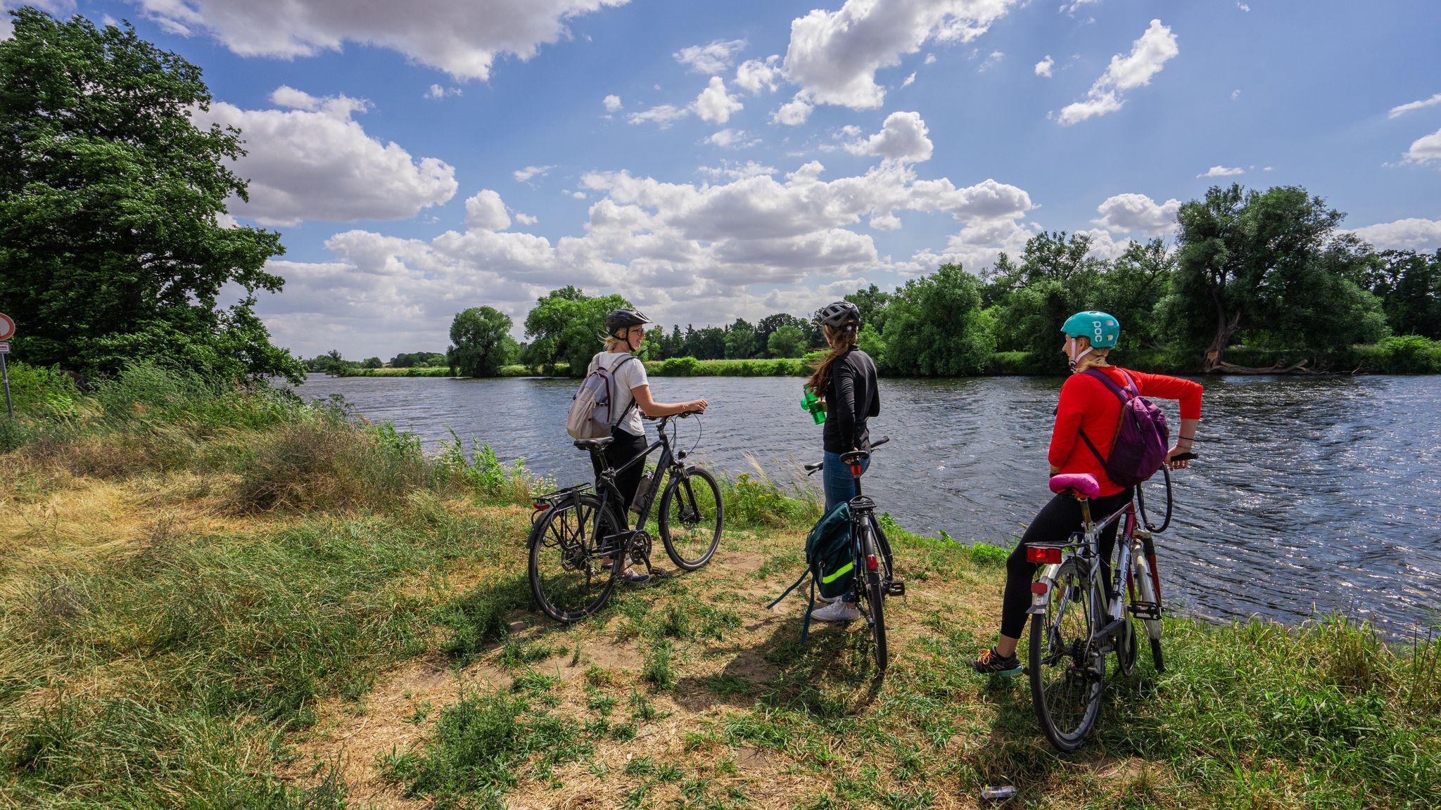
Other adventures around Glauchau

Tips from the Community

A few benches and a small hut invite you to take a short break.
0
0

The Stone Cow (next to an information panel and visitor's book) in the Rümpfwald forest. Information: An approximately 200-million-year-old silicified tuff agglomerate of volcanic origin, which took on its present form through weathering processes during the Cretaceous and Tertiary periods. Geological investigations have determined that it is not an artificial formation, but rather a natural one.
1
0


Dam of the Zwickauer Mulde near Wernsdorf.
0
0

Beautiful scenery, great gravel road!
0
1

Very beautiful lake. Lots of grey herons there. Nice for a walk or bike ride.
1
0

The reservoir, whose construction began in 1936, is located on the site of the former Naundorf Meadows, a typical Mulde floodplain. They were enclosed by a river and a slope on the right side of the Mulde valley between the Schindmaas weir and the town of Glauchau. The Naundorf Meadows were named after a village located on this site in the 13th century. However, the inhabitants probably moved away due to the unfavorable location, exposed to flooding from the Mulde River, and later settled elsewhere.
12
0
The Mulde Bridge near Wernsdorf is a so-called tensioned ribbon bridge, measuring 105 meters long and 3.5 meters wide. It was awarded the Thuringian State Prize for Engineering Achievements in 2017. The same construction method is also found in the Drachenschwanz Adventure Bridge.
12
0
Frequently Asked Questions
How many family-friendly hiking trails are available around Glauchau?
There are over 270 family-friendly hiking trails and walks around Glauchau, offering a wide variety of options for all ages and fitness levels. Many of these are easy to moderate, perfect for a family outing.
Are there easy hiking options suitable for young children or toddlers?
Yes, Glauchau offers many easy trails perfect for young children and toddlers. For example, the Glauchau Reservoir – Glauchau Reservoir loop from Glauchau is an easy 5 km route with minimal elevation gain, ideal for a relaxed family stroll. The Glauchau Reservoir area, in general, provides accessible paths.
Can we find circular routes for family hikes in Glauchau?
Absolutely! Many of the family-friendly trails around Glauchau are circular, making them convenient for day trips. Popular options include the Glauchau Reservoir – Glauchau Reservoir loop from Hölzel, which is an easy 6.3 km loop, and the slightly longer Rümpfwald – Black Pond loop from Am Rümpfwald.
What kind of natural landscapes can we expect on family hikes near Glauchau?
Glauchau's family hikes offer a diverse range of landscapes. You'll find picturesque trails along the Mulde River, serene paths around the Glauchau Reservoir, and routes through woodlands and open fields at the foothills of the Ore Mountains. Gründel Park also provides a lovely green space within the town.
Are there any specific attractions or points of interest along the family-friendly trails?
Yes, several trails feature interesting sights. You can explore the Karl May cave with rest area, a historical natural attraction. The Glauchau Reservoir itself is a central point for recreation, and you can enjoy views from the View over the Altenburg and Leipzig regions from Langenberger Höhe or the View from Pfaffenberg.
Are the hiking trails around Glauchau suitable for dogs?
Many trails around Glauchau are dog-friendly, allowing your furry family members to join the adventure. It's always a good idea to keep dogs on a leash, especially in nature reserves or near wildlife, and to carry waste bags. The open areas along the Mulde River and around the Glauchau Reservoir are generally welcoming for dogs.
What is the best time of year for family hiking in Glauchau?
Glauchau offers enjoyable hiking experiences throughout the year. Spring brings blooming nature, summer provides warm weather for reservoir activities, and autumn showcases beautiful fall foliage. Even in winter, easy, well-maintained paths can be pleasant for a crisp family walk, especially around the Glauchau Reservoir.
Are there trails accessible by public transport or with good parking options?
Many trailheads in and around Glauchau are easily accessible. The Glauchau Reservoir, a popular starting point for family hikes, often has designated parking areas. For trails along the Mulde River, public transport connections to various points in Glauchau can also provide access, though specific route details should be checked locally.
What do other hikers say about the family-friendly trails in Glauchau?
The komoot community highly rates the trails around Glauchau, with an average score of 4.6 stars from over 2000 ratings. Hikers often praise the well-maintained paths, the scenic beauty of the Mulde River and Glauchau Reservoir, and the suitability of routes for families with children.
Are there any trails that feature water bodies like lakes or rivers?
Yes, water features are a highlight of hiking in Glauchau. The Glauchau Reservoir is a central point with circular trails, and many routes follow the picturesque Zwickauer Mulde River. The Mulden Bridge Wernsdorf – Glauchau Weir loop from Glauchau-Schönbörnchen is an excellent example of a river-focused hike.
Can we find trails with viewpoints or scenic vistas?
Yes, Glauchau's location at the foothills of the Ore Mountains means you can find trails offering lovely views. The west shore of the Glauchau Reservoir provides pleasant vistas, and highlights like the View over the Altenburg and Leipzig regions from Langenberger Höhe offer expansive panoramas.
Most popular routes around Glauchau
Most popular attractions around Glauchau

Get inspired with the komoot mobile app


Explore more
Browse the best Hikes in other regions.
