The best family-friendly hikes and walks around Würselen
4.4
(1870)
9,679
hikers
138
hikes
Family friendly hiking trails around Würselen are set within a diverse landscape on the edge of the Eifel National Park, characterized by rolling hills, dense forests, and serene river courses. The region features prominent natural areas like the Wurm Valley and Broichbach Valley, offering varied terrain for outdoor activities. Würselen's city forest provides additional signposted routes, contributing to a network of paths suitable for different preferences and fitness levels.
Best family friendly hiking trails around Würselen
- The most popular family…
Last updated: August 7, 2026
4.2
(44)
159
hikers
4.92km
01:20
70m
70m
Easy hike. Great for any fitness level. Easily-accessible paths. Suitable for all skill levels.
4.8
(410)
1,702
hikers
6.21km
01:39
70m
70m
Easy hike. Great for any fitness level. Easily-accessible paths. Suitable for all skill levels.

Sign up for free
4.8
(322)
1,420
hikers
5.13km
01:22
60m
60m
Easy hike. Great for any fitness level. Easily-accessible paths. Suitable for all skill levels.
4.7
(85)
411
hikers
9.18km
02:30
140m
140m
Moderate hike. Good fitness required. Easily-accessible paths. Suitable for all skill levels.
4.6
(54)
207
hikers
Easy hike. Great for any fitness level. Easily-accessible paths. Suitable for all skill levels.
Get access to more routes and recommendations from other explorers.
Sign up for free
Already have an account?
Our route recommendations are based on thousands of hikes, rides, and runs completed by other people on komoot.
Start today with a free account
Your next adventure awaits.
Login or Signup
Popular around Würselen
Other adventures around Würselen

Tips from the Community

Beautiful view of fields and meadows along the Wurm river
0
0

The picnic area at Wilhelmstein Bridge is a peaceful, almost natural resting spot in the landscape where water, greenery, and history converge. The bridge spans the Wurm River here, forming a natural transition between banks while the surrounding valley opens up in soft lines of grass, shrubs, and trees. It's a place that invites you to sit down for a moment, put down your backpack, and relax. From the picnic area, your gaze follows the rippling water beneath the bridge, while birds and the rustling of leaves create the backdrop. The proximity of Wilhelmstein also evokes a sense of history: not far from here lies the rocky plateau with the remains of the old castle that overlooked this same valley for centuries. This combination of nature and history gives the place added depth without being obtrusive. It is precisely its simplicity that makes this picnic area special. No crowds, no grand views, but a sheltered spot where the landscape does its work. It is a moment of rest along the route where walking briefly turns into staying and where the environment tells its story undisturbed and at its own pace.
0
0
The Wetterpilz in the Wurmtal is a striking natural phenomenon and artistic object, notable for its unique shape and location in the Wurm Valley just south of Herzogenrath. The Wetterpilz, which literally means "weather mushroom," is often a sheltered path or small natural structure resembling a giant mushroom, making it both a landmark and a refuge for hikers. The Wetterpilz stands amidst a diverse landscape of deciduous and coniferous forests along the Wurm River, which meanders through the valley. It offers visitors a unique opportunity to pause and enjoy the tranquility while simultaneously enjoying excellent views of the surrounding flora and fauna. The object often also reflects a playful element of landscape art, where natural forms and human imagination merge.
0
0
The entrance to the Gouley mine tunnel, also known as the Stollenmundloch, is located in the picturesque Wurmtal valley near Würselen/Morsbach in Germany. This tunnel was an important part of Grube Gouley, one of the oldest coal mines in the Aachen region, first mentioned in 1599 under the name "Gute Ley." Gouley was one of the longest-operating coal mines in the region, with mining operations continuing until 1969. The tunnel was originally used for coal extraction and later for dewatering the mine, as underground mines often caused water problems. Today, water still flows from the tunnel into the Wurm, a clear sign of the landscape's industrial past. Although the tunnel is not open to visitors, the entrance itself is a tangible industrial monument and bears witness to centuries of mining tradition. Over the centuries, Gouley has enjoyed a rich and eventful history. In the 19th century, the mine was modernized with steam engines for water and coal extraction. In 1834, a sudden ingress of water led to a serious mining accident in which several miners died. This tragedy resulted in stricter safety measures in the Aachen region. Later in the 19th and 20th centuries, the mine was further expanded with rail and coal transport, and it became a major employer in the region. Following the declining demand for coal and the changing energy market, Gouley finally closed its doors on March 31, 1969. Today, the area around the tunnel is part of hiking trails through the Wurmtal, where visitors can discover traces of the industrial past: remnants of old railway lines, railway bridges, workers' houses, and the contours of former mining sites. This combination of nature and industrial heritage makes the area particularly attractive for hikers and cyclists. The Wurmtal itself offers a beautiful river landscape where forests, streams, and valleys blend harmoniously, creating a serene experience of Gouley's historical context. The Gouley Mine Tunnel symbolizes the region's long mining tradition and illustrates how an industrial landscape can transform into a place of natural recreation and remembrance. Walkers along the path alongside the tunnel literally experience the traces of the past while enjoying the tranquility of the watercourse and the surrounding green landscape. It is a place where history, nature, and culture converge, telling the story of human endeavor, technological progress, and the resilience of the landscape.
0
0
Deep in the green belt of the Wurmtal, just south of Herzogenrath, a quiet forest path winds alongside the gently meandering Wurm River. The path leads through a landscape where nature and history intertwine: ancient forest edges, slopes thick with fern thickets, and clearings where sunlight breaks through the treetops, illuminating the moss. The Wurm itself always murmurs softly in the background, amidst rippling plants and rocky outcrops that recall the valley's mining past.
0
0
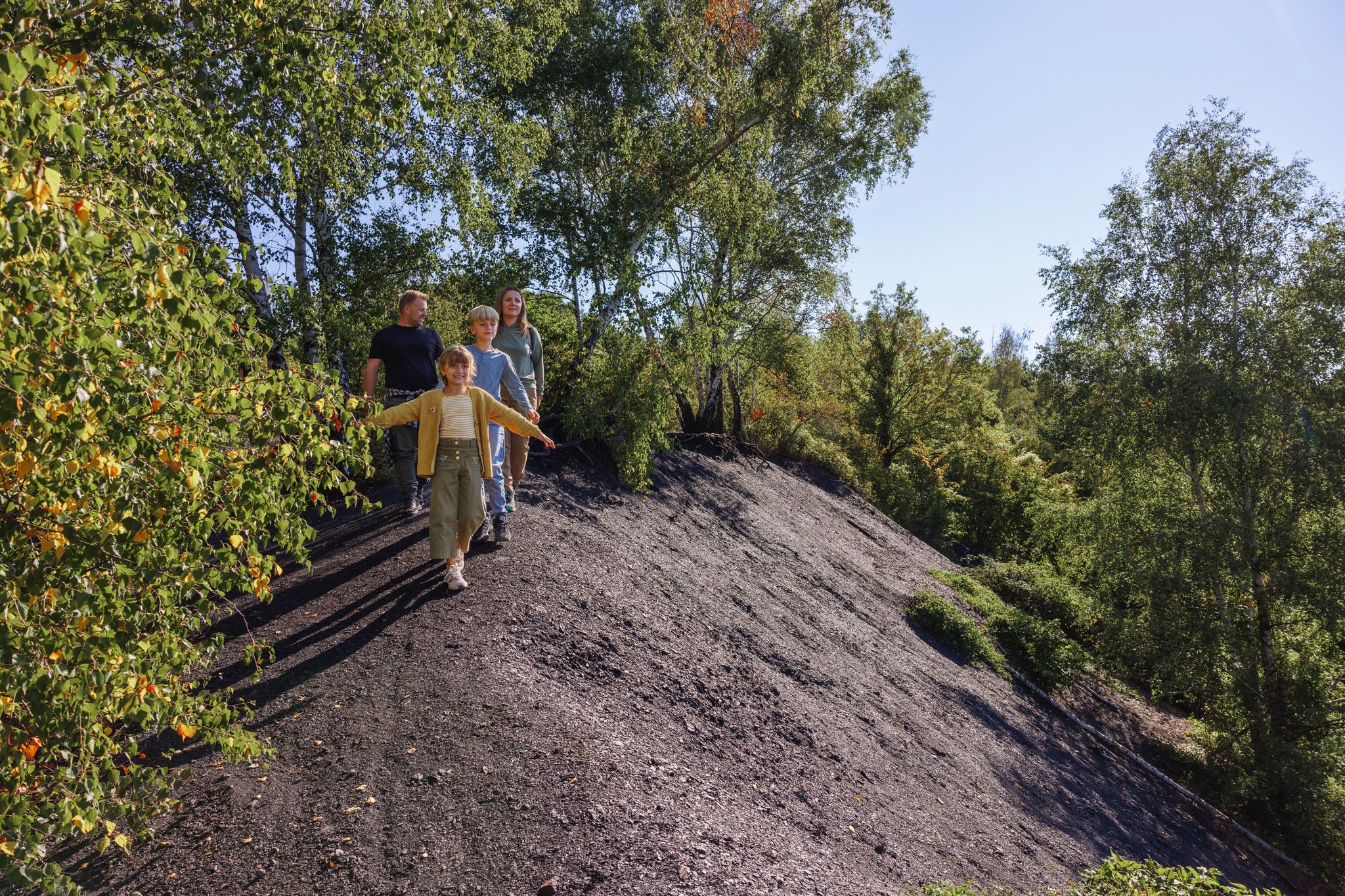
The Wurm Valley, the valley around the Wurm River near Aachen/Würselen (Germany), boasts a rich and fascinating industrial past. Coal was mined in this valley from very early times, and mining played a major role well into the 20th century. What was once synonymous with industrial smoke and coal railways has now been transformed: slag heaps, old tunnels, abandoned tracks, and a green landscape bear witness to what has been. Below is an overview of the historical legacy and current experience. Written sources mention coal mining in the Wurm Valley as early as the 12th century, according to the annals of the abbey in Klosterrath. In (the later) area around present-day Würselen, coal mining began in the Middle Ages primarily through open-pit mining or very shallow excavation, where the coal seams lie relatively close to the surface. The real transition to large-scale industrial coal mining did not occur until the 19th century. The establishment of associations and mining companies (including the Association for Coal Mining in the Wurm Valley in 1836) allowed production to be concentrated and expanded. Mines such as Grube Teut (now completely gone) and Grube Gouley were important production centers. The Gouley mine was the largest in the Wurm region at its peak in the early 19th century. Mining was not without risk. For example, in 1834 at the Gouley mine, a collapse caused by water pressure claimed the lives of dozens of miners. Over the course of the 20th century, coal mining in the Wurm Valley became less profitable due to competition from deep mining and a changing economy. The last shafts closed in 1969. Stoves (slag heaps) at various locations in the Wurm Valley now lie green hills: former coal heaps (slag heaps) that give the landscape a distinctive relief. These "halden" were later reclaimed and are now walking and recreational areas. Old railway lines and viaducts where coal trains once ran have been converted into walking paths and cycling routes. For example, the route from the former railway line to the Gouley mine is now part of a walking and cycling network.
1
0

The discarded trolley reminds of the region's mining past
5
0
The Wurmtal - a great local recreation area
4
0
Frequently Asked Questions
How many family-friendly hiking trails are available around Würselen?
Würselen offers a fantastic selection of family-friendly hiking trails, with over 100 easy routes specifically tailored for families. In total, you'll find more than 140 hiking tours in the area, ensuring plenty of options for all ages and fitness levels.
What kind of terrain can we expect on family hikes in Würselen?
The region around Würselen features a diverse landscape, perfect for family adventures. You can expect a mix of rolling hills, dense forests, and serene river valleys, particularly along the Wurm and Broichbach. Many trails are well-maintained and offer gentle ascents, making them suitable for younger hikers.
Are there any stroller-friendly walks in Würselen?
Yes, Würselen offers several paths suitable for strollers. The Broichbach Valley, for instance, features a well-marked, barrier-free node system, making it easier to navigate with a stroller. Look for routes described as 'easy' and with minimal elevation gain for the most comfortable experience.
Can we bring our dog on these family-friendly hikes?
Many of the trails in and around Würselen are dog-friendly, allowing your furry family members to join the adventure. Always keep your dog on a leash, especially in nature reserves or areas with wildlife, and remember to clean up after them. Specific route details on komoot will often indicate if a trail is suitable for dogs.
What natural features or landmarks can we see along the trails?
You'll discover a variety of natural beauty and historical points of interest. The Wurm Valley is a highlight, offering lush greenery and the meandering Wurm River. You might also encounter historical sites like the former mining areas on the Gouley Tour Würselen-Morsbacher Heide. For a broader view, consider visiting the Vaalserberg Three-Country Point, a significant nearby attraction.
Are there any circular routes suitable for families?
Absolutely! Many family-friendly trails in Würselen are designed as circular routes, allowing you to start and end at the same point without retracing your steps. An example is the Wurm River near Würselen – Teuterhof loop, which offers a pleasant 5 km walk along the river.
What is the best time of year for family hiking in Würselen?
Spring, summer, and early autumn are generally the best times for family hiking in Würselen. During these seasons, the weather is mild, the landscapes are vibrant, and trails are typically dry and well-maintained. Winter can also be beautiful, but some paths might be muddy or icy, so check conditions before you go.
Are there any shorter walks for families with very young children?
Yes, there are several shorter, easy walks perfect for families with very young children. The Old Mill Bardenberg loop is just over 3 km, offering a manageable distance for little legs. Würselen's city forest also provides four signposted routes ranging from 1.5 to 5 kilometers.
What do other hikers say about the family-friendly trails in Würselen?
The family-friendly trails around Würselen are highly regarded by the komoot community, with an average rating of 4.4 out of 5 stars. Hikers frequently praise the well-maintained paths, the peaceful natural surroundings, and the variety of landscapes, from river valleys to gentle hills, making them ideal for family outings.
Where can we find parking for these hiking trails?
Many trailheads in and around Würselen offer convenient parking options. For example, the Old Mill Bardenberg – Ginsterweg Trailhead Parking loop explicitly mentions parking at its starting point. It's always a good idea to check the specific route details on komoot for parking information before you head out.
Are there any trails that combine nature with historical elements?
Yes, Würselen's history is woven into its landscape. Trails like the Gouley Tour Würselen-Morsbacher Heide take you through historic mining areas, offering a glimpse into the region's past while enjoying nature. The 'Dinotour Würselen' also promises a blend of natural and man-made features.
Most popular routes around Würselen
Most popular attractions around Würselen

Get inspired with the komoot mobile app


Explore more
Browse the best Hikes in other regions.
