The best family-friendly hikes and walks around Meckenheim
4.5
(27375)
118,881
hikers
185
hikes
Family friendly hiking trails around Meckenheim offer a diverse landscape characterized by rolling hills, extensive wooded areas, and scenic valleys. The region is situated between the Siebengebirge and Eifel mountains, featuring natural reserves like Kottenforst-Ville and areas around the Eulenbach stream. These varied terrains provide numerous opportunities for outdoor exploration, from gentle forest paths to trails through flowering meadows and orchards.
Best family friendly hiking trails around Meckenheim
- The most popular family friendly hiking route is Kottenforst Station – Path Near Borkeshof loop from Meckenheim Kottenforst, a 2.8 miles (4.4 km) trail that takes 1 hour 8 minutes to complete. This easy path winds through the extensive Kottenforst-Ville Nature Reserve.
- Another top favourite among local hikers is Felten Farm Shop loop from Bundeskriminalamt Meckenheim, an easy 3.1 miles (5.1 km) path. This route offers a pleasant walk through agricultural landscapes and local scenery.
- Local hikers also love the Feuerroute Trail – Meckenheim-Merl Forest Cemetery loop from Merl, a 2.8 miles (4.5 km) trail leading through wooded areas, often completed in about 1 hour 10 minutes.
- Hiking around Meckenheim is defined by rolling hills, extensive wooded areas, and scenic valleys, with options for various ability levels, including many easy family friendly routes.
- The routes in Meckenheim are highly rated by the komoot community with an average score of 4.5 stars from over 1,700 reviews. More than 7,400 hikers have used komoot to explore Meckenheim's varied terrain.
Last updated: July 24, 2026
4.4
(41)
142
hikers
Easy hike. Great for any fitness level. Easily-accessible paths. Suitable for all skill levels.
4.6
(17)
149
hikers
5.06km
01:19
30m
30m
Easy hike. Great for any fitness level. Easily-accessible paths. Suitable for all skill levels.

Sign up for free
4.9
(18)
72
hikers
14.5km
03:56
190m
190m
Moderate hike. Good fitness required. Easily-accessible paths. Suitable for all skill levels.
4.6
(12)
54
hikers
4.54km
01:13
40m
40m
Easy hike. Great for any fitness level. Easily-accessible paths. Suitable for all skill levels.
4.6
(8)
55
hikers
Moderate hike. Good fitness required. Easily-accessible paths. Suitable for all skill levels.
Get access to more routes and recommendations from other explorers.
Sign up for free
Already have an account?
Our route recommendations are based on thousands of hikes, rides, and runs completed by other people on komoot.
Start today with a free account
Your next adventure awaits.
Login or Signup


Tips from the Community

From and around the Tomburg: a magnificent view of a diverse settlement, culture, and landscape area, from the Ville and Börden landscape in the west, across the 'Middle Rhine Gate', where the Rhine Valley widens, to the Siebengebirge on the horizon, and further into the Wachtberg region with Landskron Castle in the south. 😎👌
0
0

Sit comfortably and enjoy the wonderful view.
0
0

This striking tree is a feast for the eyes
1
0
"The stream originates as the Gräbbach on the eastern outskirts of Todenfeld in the Voreifel region at an elevation of 357 m above sea level. From here, it flows predominantly northward. Shortly below the parking lot at the forest chapel, the stream divides into an eastern branch (Eulenbach) and a western branch (Gräbbach). The Cistercian monks of Himmerod probably had the branch dug in the 13th century to power mills with this water. After crossing the Rheinbach urban area, the two stream branches merge again in the northeastern section of the bypass road (Bundesstraße 266). From here, the stream is called Eulenbach. Before this, the western branch (Gräbbach) takes in the Stiefelsbach, which also flows northward, on the left bank of the city park on the southern outskirts of Rheinbach. After crossing under the Bundesstraße 266 and the Bundesautobahn 61, the stream flows The Eulenbach continues north and passes Ramershoven. A few hundred meters before its own confluence, the Eulenbach joins the Hochbach. The stream then flows into the Swist on the left bank at the southern edge of Morenhoven at 146 m above sea level. Before its confluence, the Eulenbach used to flow parallel to the Swist for about a kilometer further west, flowing only shortly before the Wallbach. The original course can be traced along the largely still existing streambed. As part of the implementation of the EU Water Framework Directive, numerous measures are to be taken with the aim of achieving a more natural design and natural development, especially along its course north of Rheinbach. South of Rheinbach, above and below the Waldkapelle (forest chapel), the stream feeds several ponds, such as the Alten Weiher (Old Ponds) and the Pilgerpfadsweiher (pilgrim's path ponds), which are of great importance for local recreation. However, the latter have been in poor condition for some time. This is due not only to dilapidated dams but also, above all, to the droughts of recent years and their associated droughts. Water shortages, silting, and silting up. However, remediation is proving difficult because, in addition to the remediation costs, the special protection status of the Rheinbach municipal forest as a Natura 2000 area under the European Fauna-Flora-Habitat (FFH) Directive must be taken into account. https://de.wikipedia.org/wiki/Eulenbach_(Swist)
4
0

nice quiet road through fields
1
0
Beer garden Kottenforst train station
1
0
Hardly possible to walk, lots of mud and bushes in the way.
1
1
Frequently Asked Questions
How many family-friendly hiking trails are available around Meckenheim?
Meckenheim offers a wide selection of family-friendly hiking opportunities, with over 100 easy and 50 moderate trails. These routes are designed to be accessible and enjoyable for all ages, providing diverse experiences in the region's beautiful landscapes.
What is the best time of year for family hikes in Meckenheim?
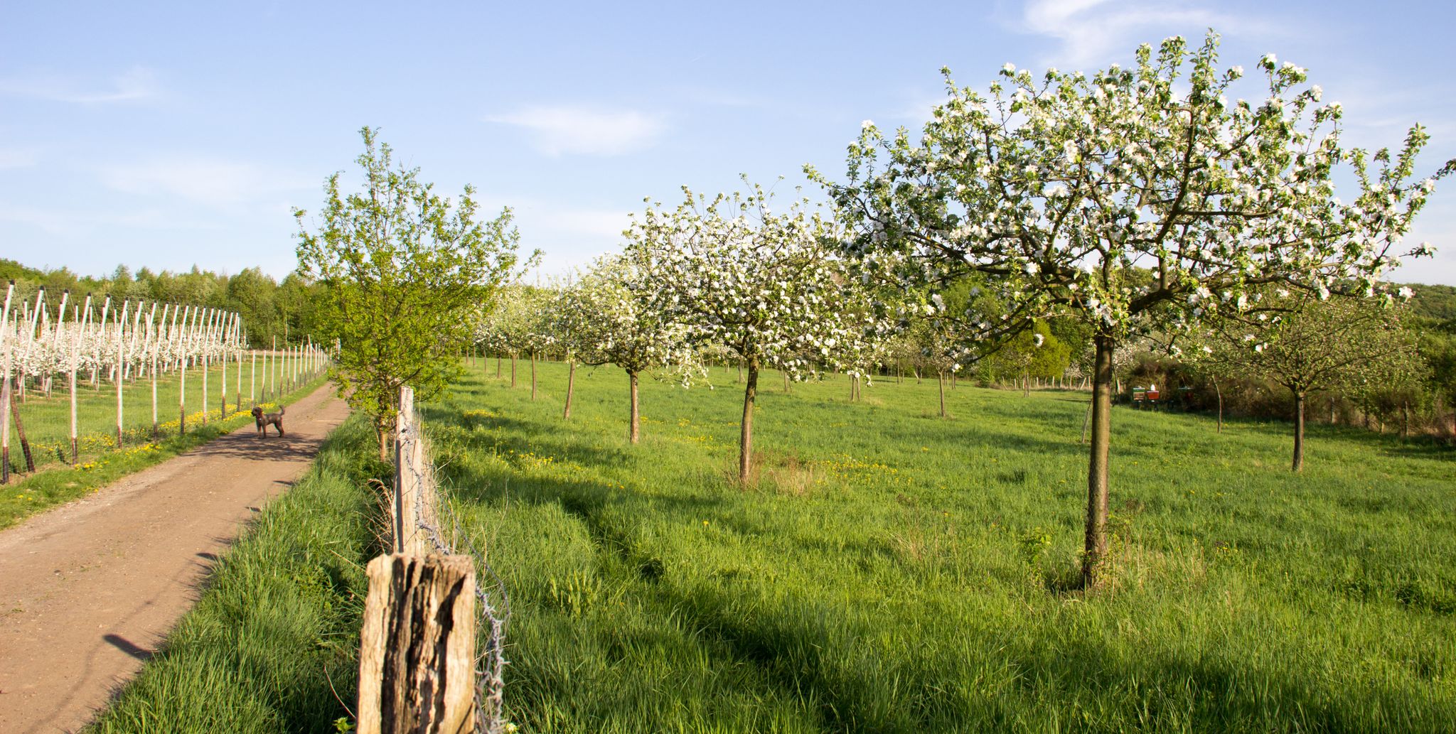
The most pleasant seasons for family hiking in Meckenheim are spring and autumn. Spring brings blooming flowers and lush green forests, while autumn offers a spectacular display of colorful foliage. Both seasons provide comfortable temperatures and picturesque scenery for outdoor adventures.
Are there any circular hiking routes suitable for families?
Yes, many family-friendly trails around Meckenheim are circular, making them convenient for day trips. For example, the Kottenforst Station – Path Near Borkeshof loop from Meckenheim Kottenforst is an easy, circular option perfect for families looking for a straightforward walk.
What kind of natural features or landmarks can we expect to see on these trails?
Meckenheim's trails often lead through diverse landscapes. You might encounter the extensive Kottenforst-Ville Nature Reserve, scenic valleys, and charming orchards. Notable natural features include the Eulenbach stream with its ponds, and you can even find historical sites like the Devil's Hole, a natural monument steeped in local legend.
Are there any trails that offer scenic views of the surrounding area?
Absolutely. Many routes provide lovely vistas. The View of the Siebengebirge – Grimmersdorfer Hof loop from Bundeskriminalamt Meckenheim, for instance, offers beautiful views towards the Siebengebirge mountains, combining natural beauty with accessible terrain.
Are the family-friendly trails suitable for strollers or young children?
Many easy trails in the region are suitable for strollers, especially those with well-maintained paths. The Kottenforst-Ville Nature Reserve, in particular, features the "Wurzelweg" (root path), which is designed for children with elements like a barefoot path and a treehouse, making it engaging for younger explorers.
What do other hikers say about the family-friendly trails in Meckenheim?
The komoot community highly rates the hiking experiences around Meckenheim, with an average score of 4.5 stars. Reviewers frequently praise the well-maintained paths, the peaceful forest settings, and the variety of easy routes perfect for families.
Are there any trails that pass by historical sites or cultural attractions?
Yes, the region is rich in history. You can find trails that connect various historical water castles, offering a blend of nature and cultural exploration. While not directly on a family-friendly route listed here, the broader area also features the Römerkanal-Wanderweg (Roman Aqueduct Trail) for those interested in historical paths.
Are there options for parking near the trailheads?
Many trailheads for family-friendly hikes around Meckenheim offer convenient parking facilities. It's always a good idea to check the specific route details on komoot for information on parking availability at the starting point of your chosen trail.
Can we access these trails using public transport?
Public transport access varies by trailhead, but Meckenheim is generally well-connected. Some routes, like the Kottenforst Station – Path Near Borkeshof loop, are accessible near train stations, making them convenient for those traveling without a car. We recommend checking local public transport schedules for specific starting points.
Are dogs allowed on the family-friendly hiking trails?
Generally, dogs are welcome on most hiking trails in the Meckenheim area, provided they are kept on a leash. It's always advisable to check local regulations or specific trail signs, especially in nature reserves, to ensure a pleasant experience for everyone.
Are there any trails that are particularly less crowded for a more peaceful family outing?
While popular spots can see more visitors, many of Meckenheim's numerous easy trails offer a peaceful experience, especially during off-peak hours or on weekdays. Exploring routes within the extensive Kottenforst-Ville Nature Reserve, such as the Feuerroute Trail – Meckenheim-Merl Forest Cemetery loop, can provide a serene environment away from larger crowds.
Most popular routes around Meckenheim
Most popular attractions around Meckenheim

Get inspired with the komoot mobile app


Explore more
Browse the best Hikes in other regions.
