Far Ings Nature Reserve
Far Ings Nature Reserve
The best traffic-free bike rides in Far Ings Nature Reserve
4.7
(162)
1,574
riders
77
rides
No traffic touring cycling routes in Far Ings Nature Reserve are situated along the south bank of the Humber Estuary, an area characterized by its unique blend of reclaimed industrial land and diverse natural habitats. The landscape features extensive reedbeds, meadows, and wetlands formed from flooded clay pits, providing a flat to gently undulating terrain suitable for touring cyclists. While direct cycling within the core nature reserve is restricted to protect its ecosystems, the surrounding area offers numerous routes that…
Last updated: May 13, 2026
4
riders
18.6km
01:22
140m
140m
Easy bike ride. Great for any fitness level. Mostly paved surfaces. Suitable for all skill levels.
36
riders
68.1km
04:03
400m
400m
Moderate bike ride. Good fitness required. Mostly paved surfaces. Suitable for all skill levels.

Sign up for free
17
riders
59.3km
03:38
450m
450m
Hard bike ride. Very good fitness required. Mostly paved surfaces. Suitable for all skill levels.
13
riders
24.2km
01:27
40m
40m
Easy bike ride. Great for any fitness level. Mostly paved surfaces. Suitable for all skill levels.
5
riders
50.6km
03:03
350m
350m
Moderate bike ride. Good fitness required. Mostly paved surfaces. Suitable for all skill levels.
Get access to more routes and recommendations from other explorers.
Sign up for free
Already have an account?
Our route recommendations are based on thousands of hikes, rides, and runs completed by other people on komoot.
Start today with a free account
Your next adventure awaits.
Login or Signup
Popular around Far Ings Nature Reserve
Tips from the Community


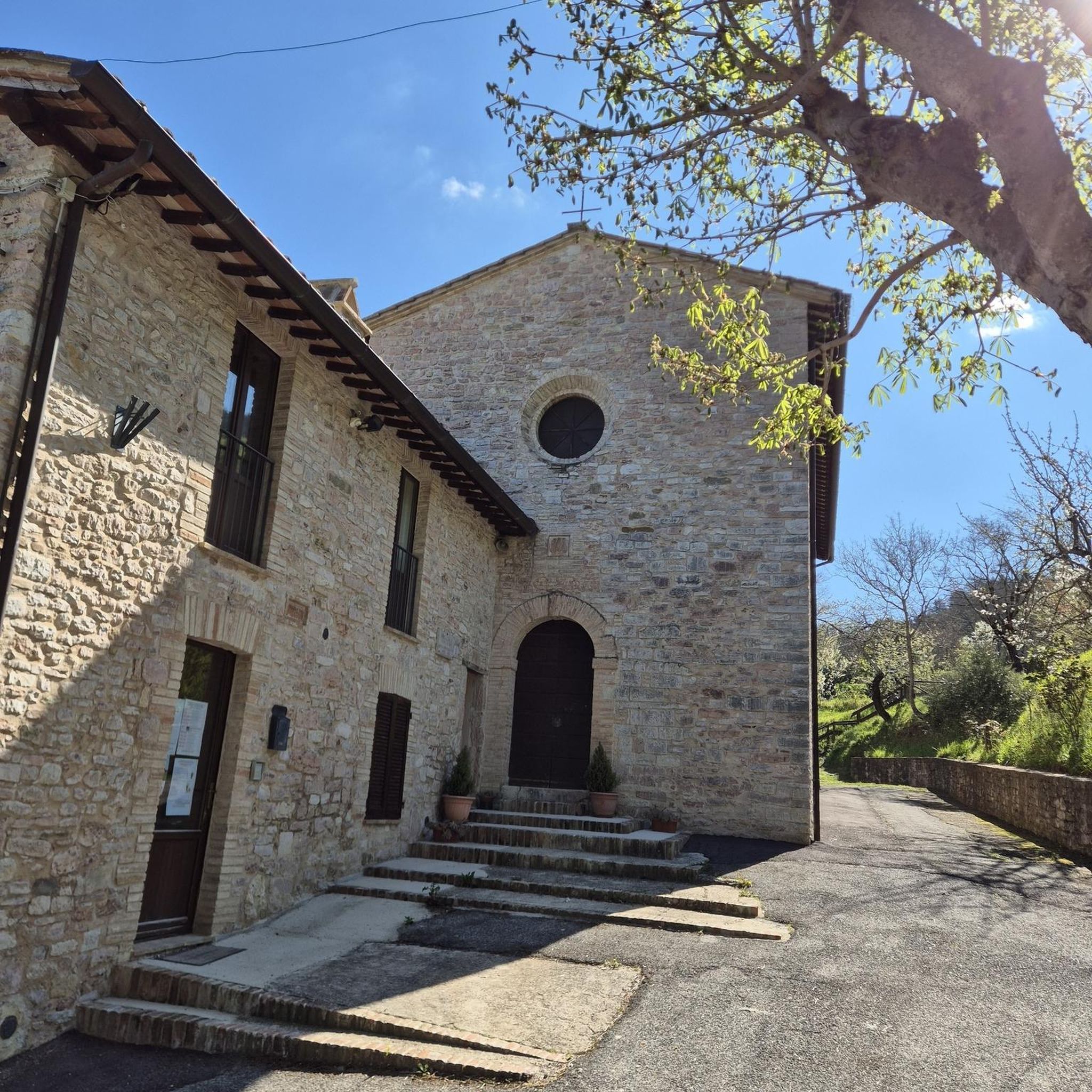
The church has several interesting features, such as the window near the chancel.
0
0

Nice views over the Humber however can get busy with dog walkers, families etc.
0
0


Quaint village with free car park on Edwins Garth (clearly signposted), the main street running towards Market Weighton.
1
0
All Saints’ Church is 12th Century in origin and was restored by the Victorians in the late 19th Century. It is situated almost at the foot of Brantingham Dale in an open aspect. It is without doubt one of the most picturesque churches in the East Riding of Yorkshire. A fairly detailed history of the church compiled in 1965 and updated in 2014 is available as a pdf at https://d3hgrlq6yacptf.cloudfront.net/5f115a55324ea/content/pages/documents/1573224210.pdf
1
0
All Saints’ Church is 12th Century in origin and was restored by the Victorians in the late 19th Century. It is situated almost at the foot of Brantingham Dale in an open aspect. It is without doubt one of the most picturesque churches in the East Riding of Yorkshire. A fairly detailed history of the church compiled in 1965 and updated in 2014 is available as a pdf at https://d3hgrlq6yacptf.cloudfront.net/5f115a55324ea/content/pages/documents/1573224210.pdf
1
0
Frequently Asked Questions
How many traffic-free touring cycling routes are available around Far Ings Nature Reserve?
There are over 75 touring cycling routes available in the vicinity of Far Ings Nature Reserve, many of which offer traffic-free sections or quiet roads. These routes cater to various skill levels, with 27 easy, 39 moderate, and 9 difficult options.
Are there any cycling restrictions within Far Ings Nature Reserve itself?
Yes, direct touring cycling *within* the core Far Ings Nature Reserve is generally restricted to protect its delicate ecosystems. However, the reserve serves as an excellent hub and destination, with many cycling routes in the surrounding area leading to its visitor center and offering scenic views of the Humber Estuary.
What kind of terrain can I expect on the no-traffic touring cycling routes near Far Ings Nature Reserve?
The terrain around Far Ings Nature Reserve is varied. You can expect a mix of paved surfaces, especially on routes connecting to the Humber Bridge, and potentially some unpaved segments on trails that follow the Humber Bank. The landscape, shaped by its industrial past and now reclaimed by nature, features wetlands, reedbeds, and estuary views.
Do any of the no-traffic touring routes connect to established trails like the Viking Way or South Humber Heritage Trail?
Yes, Far Ings Nature Reserve is strategically located. The Viking Way walking route, which also crosses through Far Ings along the Humber Bank, offers paths for cyclists leading to the visitor center and provides access to surrounding areas. The South Humber Heritage Trail also offers longer cycling opportunities in the wider region, connecting various villages.
Are there family-friendly or easy no-traffic touring cycling routes suitable for beginners?
Absolutely. Out of the available routes, 27 are classified as easy, making them suitable for families and beginners looking for a relaxed touring cycling experience. An example is the View of the Humber Bridge – Baysgarth Park loop from Barton-on-Humber, which is an easy 18.8 km ride.
What are some interesting landmarks or attractions I can see along the no-traffic touring cycling routes?
Many routes offer views of the iconic Humber Bridge. You can also explore the area's industrial heritage, such as the Barton Old Cement Works Ruins. The Far Ings Nature Reserve itself is a major highlight, offering excellent birdwatching opportunities and the Riverbank Pathway Along the Humber.
What do other touring cyclists enjoy most about cycling in the Far Ings Nature Reserve area?
The area is highly rated by the komoot community, with an average score of 4.7 stars. Reviewers often praise the unique blend of natural beauty, the tranquility of the traffic-free sections, and the excellent birdwatching opportunities, especially along the Humber Estuary. The views of the Humber Bridge are also a frequently mentioned highlight.
Are there any circular no-traffic touring cycling routes available?
Yes, many of the touring cycling routes in the area are designed as loops, allowing you to start and end at the same point. For example, the View of Hull – Humber Bridge loop from Hessle offers a moderate 27.1 km circular ride with estuary views.
Is there parking available for cyclists near the no-traffic routes or Far Ings Nature Reserve?
The Far Ings Nature Reserve visitor center provides amenities including bike racks and parking, making it a convenient starting or stopping point for your touring cycling adventure. Other routes may have parking available at their designated start points, often near towns like Barton-upon-Humber or Hessle.
Can I find places for refreshments or facilities along the no-traffic touring cycling routes?
Yes, the Far Ings Nature Reserve visitor center offers toilets, refreshments, and a gift shop. Additionally, the The Old Tile Works Coffee Shop and Restaurant is located nearby. Routes often pass through or near villages where you can find cafes and pubs to refuel.
What is the best time of year to cycle the no-traffic touring routes near Far Ings Nature Reserve?
The area offers different experiences throughout the year. Spring and autumn are excellent for birdwatching, especially during migration seasons when the Humber Estuary is bustling with activity. Summer provides longer daylight hours and generally milder weather, while winter can offer crisp, clear views, though some paths might be wetter. Always check local weather conditions before heading out.
Most popular routes in Far Ings Nature Reserve
Most popular attractions in Far Ings Nature Reserve

Get inspired with the komoot mobile app


