The best traffic-free bike rides in Sic Altopiano Dei Sette Comuni
4.5
(1096)
28,813
riders
23
rides
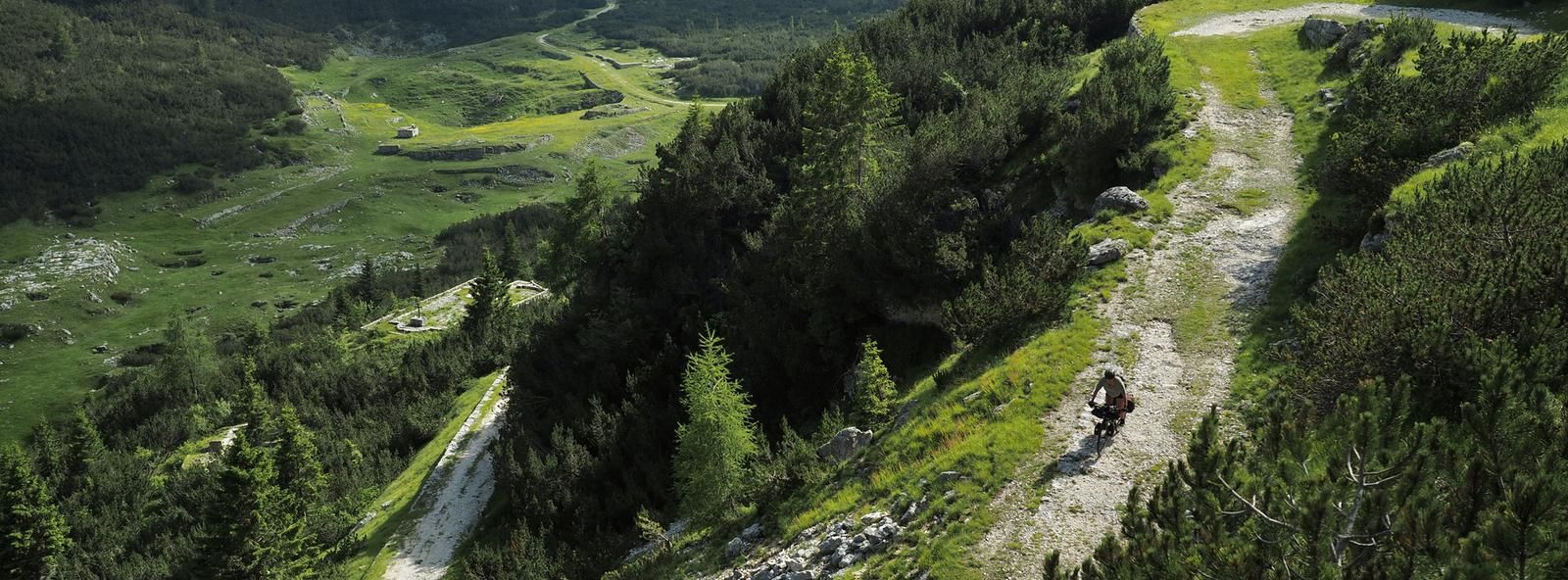
Road cycling in Sic Altopiano Dei Sette Comuni offers diverse landscapes, from a central basin at 1,000 meters to higher peaks and hills descending towards the Po Valley. The region features varied topography with significant elevation changes, making it suitable for different cycling preferences. Lush forests, gentle meadows, and karstic rock formations characterize the natural environment, providing scenic backdrops for rides. This area is known for its hundreds of kilometers of military roads and forestry tracks, many of which are…
Last updated: October 12, 2026
4.3
(26)
284
riders
53.9km
02:37
780m
780m
Moderate road ride. Good fitness required. Mostly well-paved surfaces and easy to ride.
4.4
(5)
116
riders
46.2km
02:05
490m
490m
Moderate road ride. Good fitness required. Mostly well-paved surfaces and easy to ride.

59
riders
28.2km
01:37
620m
620m
Moderate road ride. Good fitness required. Some segments of this route may be unpaved and difficult to ride.
16
riders
43.2km
03:01
1,510m
1,510m
Hard road ride. Very good fitness required. Some segments of this route may be unpaved and difficult to ride.
3.0
(1)
13
riders
Easy road ride. Great for any fitness level. Mostly well-paved surfaces and easy to ride.
Get access to more routes and recommendations from other explorers.
Already have an account?
Our route recommendations are based on thousands of hikes, rides, and runs completed by other people on komoot.
Start today with a free account
Your next adventure awaits.
Popular around Sic Altopiano Dei Sette Comuni

Other adventures in Sic Altopiano Dei Sette Comuni

Tips from the Community

Artistic encounters with arte povera along the route
0
0
The cycle path that runs along the Brenta river and allows you to enjoy the coolness of the water
0
0

The Brenta cycle path is a beautiful bike route (trekking bikes, mountain bikes, and gravel bikes are recommended, as there are both paved and light dirt sections on the banks) that connects the mountains of Trento to the lagoon of Venice, passing through Bassano del Grappa and Padua. It is a total of about 175 kilometers long, has comfortable roads, and is easy for everyone to cycle.
0
0
historic mountain road with eight hairpin bends, the Tagliata della Scala and the Tagliata delle Fontanelle. They are located between the Valsugana and the territory of Feltre, in Veneto. The fortifications: Between 1892 and 1895, the Tagliata della Scala in the lower part and the Tagliata delle Fontanelle in the upper part were built to defend the border. The walkway: The two parts are joined by a long covered gallery with loopholes. War: They did not play a major military role during World War I and were later abandoned.
0
0
The beautiful and fresh cycle path along the river
1
0
The cycle path towards Cismon del Grappa, very cool and shaded.
0
0
Fortification built in a natural cave. In the Great War it was a blocking point defending Valsugana. There are references to it as a fortification around the year 1000.
0
0
Essential carriageway. Cool due to the shade and the water of the Brenta river flowing alongside
0
0
Frequently Asked Questions
How many no traffic road cycling routes are available in Sic Altopiano Dei Sette Comuni?
There are over 25 dedicated no traffic road cycling routes in the Sic Altopiano Dei Sette Comuni, ranging from easy to difficult, ensuring options for all skill levels.
What is the best time of year for traffic-free road cycling in the Altopiano dei Sette Comuni?
The Altopiano dei Sette Comuni is ideal for road cycling from spring through autumn. Spring offers lush green landscapes and pleasant temperatures, while summer provides warm, sunny days perfect for longer rides. Autumn brings stunning foliage and cooler air, making it comfortable for more challenging routes. The region's diverse topography means you can find suitable conditions across these seasons.
Are there easy no traffic road cycling routes for beginners?
Yes, the region offers several easy no traffic road cycling routes perfect for beginners. For instance, the Primolano Railway Station – Bicigrill di Tezze loop from Tezze di Grigno is an excellent choice, featuring minimal elevation gain over 17 km, making it a gentle introduction to the plateau's beauty.
Are there challenging no traffic road cycling routes for experienced riders?
Absolutely. Experienced riders looking for a challenge will find plenty of options. The Castelnovo Bike Grill – Serot Mountain Hut loop from Strigno is a difficult route covering over 43 km with significant elevation gain, testing your endurance amidst the plateau's demanding terrain.
Can I find half-day no traffic road bike routes?
Many of the no traffic road cycling routes in the Altopiano dei Sette Comuni are suitable for half-day excursions. Routes like the Castelnovo Bike Grill – Great view over the valley loop from Strigno, at just over 28 km and taking around 1.5-2 hours, are perfect for a shorter ride while still offering rewarding views and terrain.
Are there circular no traffic road cycling routes?
Yes, many of the no traffic road cycling routes on the Altopiano dei Sette Comuni are designed as loops, allowing you to start and end at the same point. For example, the Primolano Steps – San Michele Hermitage, Fonzaso loop from Tezze di Grigno offers a moderate 46 km circular ride through varied landscapes.
What natural features or viewpoints can I expect to see on these routes?
The Altopiano dei Sette Comuni offers magnificent scenery. You'll encounter lush forests, gentle meadows, and dramatic karstic rock formations. Many routes provide panoramic views over the plateau basin and majestic peaks. Keep an eye out for unique features like peat bogs and the clear night skies, which make Asiago an ideal spot for stargazing.
Are there historical sites or landmarks along the no traffic road cycling routes?
The plateau is rich in World War I history. You can find numerous traces of this past, including forts like Verena, Interrotto, and Campolongo, as well as wartime trenches and shelters. While cycling, you might pass by significant sites such as the Mount Ortigara Memorial or the unique Castelloni of San Marco natural monument, which also holds historical significance.
Where can I find parking for these traffic-free road cycling routes?
Many starting points for routes in the Altopiano dei Sette Comuni, especially near towns like Asiago, Tezze di Grigno, or Strigno, offer designated parking areas. It's advisable to check specific route details on komoot for recommended parking spots near the trailhead or starting village.
Are there cafes or places to stop for refreshments on these routes?
Yes, the Altopiano dei Sette Comuni is well-equipped for cyclists. You'll find charming villages with cafes and restaurants, especially in towns like Asiago. Additionally, the region has bike hotels and specific 'Bicigrill' stops, like the one mentioned in the Primolano Railway Station – Bicigrill di Tezze loop, which cater specifically to cyclists with refreshments and services.
Is public transport an option to reach the starting points of these routes?
While the Altopiano dei Sette Comuni is generally best accessed by car, some public transport options, primarily bus services, connect the plateau with surrounding towns. However, carrying bikes on public transport can be limited. For specific route starting points, checking local bus schedules and bike carriage policies is recommended.
What do other road cyclists enjoy the most about road cycling in Sic Altopiano Dei Sette Comuni?
The area is highly rated by the komoot community, with an average score of 4.6 stars. Reviewers often praise the region's quiet, traffic-free roads, the stunning panoramic views, and the diverse terrain that caters to both leisurely rides and challenging climbs. The blend of natural beauty and historical sites also receives frequent commendation.
Most popular routes in Sic Altopiano Dei Sette Comuni
Most popular attractions in Sic Altopiano Dei Sette Comuni

Get inspired with the komoot mobile app


Explore more
Browse the best Road cycling routes in other regions.
