The best traffic-free bike rides in Thomasschollen
4.4
(21)
101
riders
14
rides
Gravel biking in Thomasschollen offers a network of no traffic routes, primarily traversing flat to gently rolling terrain. The region is characterized by its proximity to significant waterways, including the Rhine Canal and the Canal du Rhône au Rhin, suggesting routes often follow river landscapes and floodplains. Elevations are minimal, with most routes featuring only small hills, making the area suitable for extended rides without significant climbing. The presence of nature reserves like Elzwiesen and floodplains such as Taubergießen indicates…
Last updated: September 28, 2026
3
riders
Moderate gravel ride. Good fitness required. Mostly paved surfaces. Suitable for all skill levels.
5.0
(2)
8
riders
Moderate gravel ride. Good fitness required. Mostly paved surfaces. Suitable for all skill levels.

3.0
(2)
5
riders
Hard gravel ride. Good fitness required. You may need to push your bike for some segments of this route.
5.0
(2)
4
riders
35.3km
02:11
40m
40m
Moderate gravel ride. Good fitness required. Mostly paved surfaces. Suitable for all skill levels.
6
riders
159km
10:59
1,860m
1,860m
Hard gravel ride. Very good fitness required. You may need to push your bike for some segments of this route.
Get access to more routes and recommendations from other explorers.
Already have an account?
Our route recommendations are based on thousands of hikes, rides, and runs completed by other people on komoot.
Start today with a free account
Your next adventure awaits.
Popular around Thomasschollen
Tips from the Community

The Odilienberg (763 m) in Alsace is the most important spiritual center of the region. Founded around 690 by Saint Odilia, the monastery attracts hundreds of thousands of pilgrims annually. The centerpiece of the complex is the Basilica of the Assumption of Mary (1687–1692) with the burial chapel, where the relics of the patron saint rest in an 8th-century sandstone sarcophagus. Directly on the panoramic terrace are the Chapel of Tears and the Chapel of Angels (12th century), known for their luminous gold mosaics from 1935. Inside the basilica, there is also a fine wooden inlaid Way of the Cross by Charles Spindler. Below the monastery rocks runs a magnificent hiking trail. It leads past the monumental, colorful ceramic Way of the Cross (14 stations) and the Lourdes Grotto, both integrated directly into the red sandstone by Léon Elchinger in the 1930s. About a 15-minute walk further down, the Odilien spring emerges in the forest, its water traditionally sought for eye ailments. The entire mountain plateau is enclosed by the Heidenmauer, a mysterious, 11-kilometer-long prehistoric defensive wall. Following the hiking trails further south, you reach the Maennelstein (817 m), the highest point of the ridge, which offers a wide panoramic view over the Rhine plain to the Black Forest. The monastery grounds are open all year round and admission is free. Would you like to use this short text for a brochure or are you still looking for information on how to get there for your tour? AI answers may contain errors. For legal advice, you should consult an expert. More information
0
1

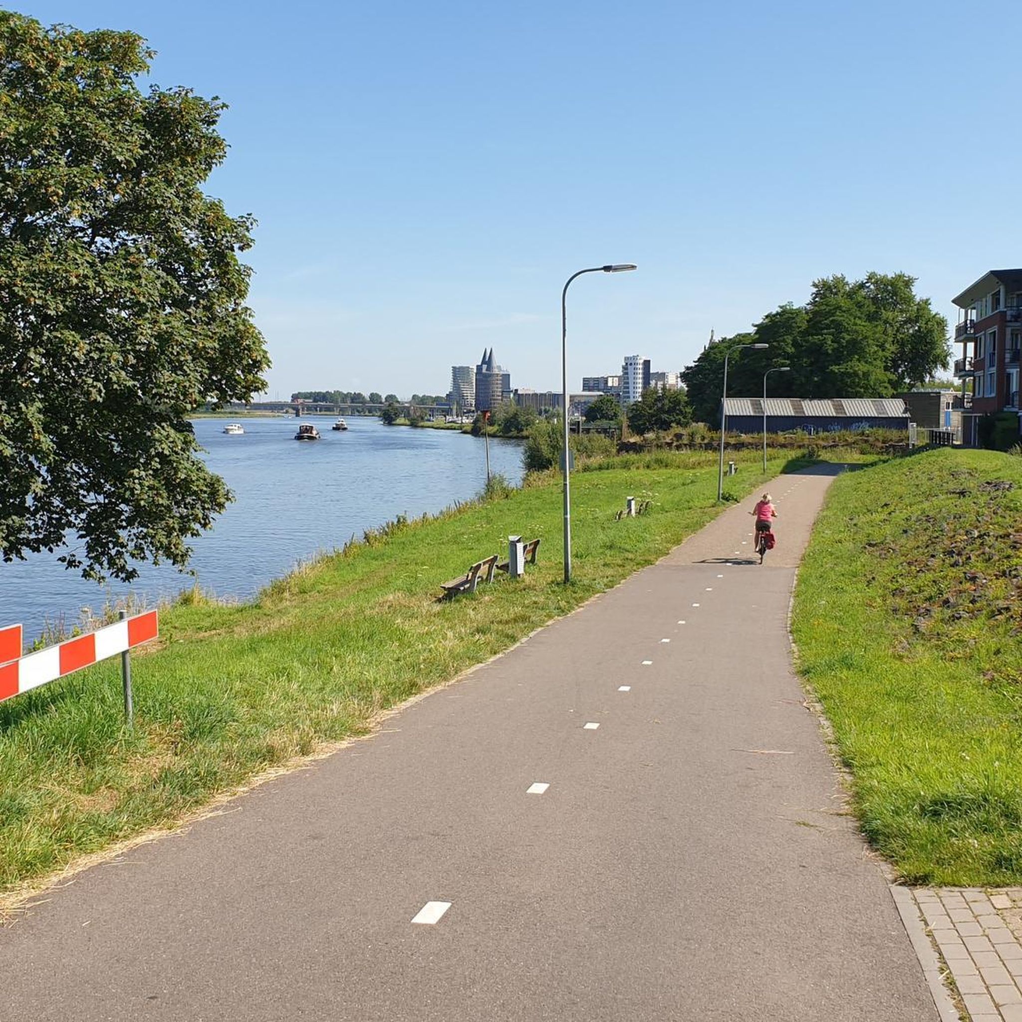
Great landscape and beautiful cycle path.
0
0

Beautiful little village on the way to Santiago de Compostela coming from Germany.
0
0

An absolute natural idyll. Absolutely beautiful!!
1
0

These boats are still sailing there, the locks are working 🤪
0
0

A beautiful tower for birdwatching. Spacious with seating for observing or photographing the birds.
0
0

The Canal de la Bruche is a canal in eastern France that originally connected Soultz-les-Bains near Molsheim with the city of Strasbourg. It was built in 1682 by the famous military engineer Vauban, primarily to transport sandstone from the Soultz quarries for the construction of Strasbourg's fortifications.
0
0

We really enjoyed the cycle path along the Canal de la Bruche
0
0
Frequently Asked Questions
How many no-traffic gravel bike trails are available in Thomasschollen?
There are 13 dedicated no-traffic gravel bike trails in Thomasschollen, offering a variety of experiences for different skill levels.
What is the general difficulty level of no-traffic gravel bike routes in Thomasschollen?
The no-traffic gravel bike routes in Thomasschollen cater to a range of abilities. You'll find 5 easy routes, 4 moderate routes, and 4 more challenging routes, ensuring there's something for everyone.
Are there any beginner-friendly no-traffic gravel bike routes in Thomasschollen?
Yes, Thomasschollen offers several beginner-friendly options. For an easy ride, consider the Étang Saint Julien loop from Obenheim, which is 18.3 km long with minimal elevation gain.
What are some options for advanced no-traffic gravel biking in Thomasschollen?
For more advanced riders seeking a challenge, routes like the Rhine Canal Cycle Path – Canal du Rhône au Rhin loop from Obenheim are rated as difficult. This route covers 40 km with some varied terrain.
Are the no-traffic gravel bike trails in Thomasschollen mostly loop routes?
Yes, the majority of the no-traffic gravel bike trails in Thomasschollen are designed as convenient loop routes. This allows you to start and finish at the same point, such as the Elzwiesen Nature Reserve – Taubergießen Floodplain loop from VVG der Gemeinde Schwanau.
What is the typical distance for no-traffic gravel bike trails in Thomasschollen?
The distances for no-traffic gravel bike trails in Thomasschollen vary significantly. You can find shorter rides around 18 km, like the Étang Saint Julien loop from Obenheim, up to longer excursions over 50 km, such as the Taubergießen Floodplain – Taubergießen River Landscape loop from Schwanau.
Are there any family-friendly no-traffic gravel trails in Thomasschollen?
While specific 'family-friendly' designations aren't available, the 5 easy-rated routes with minimal elevation are generally suitable for families. These routes offer a safe and enjoyable experience away from traffic.
What kind of landscapes can I expect on the no-traffic gravel bike trails?
The no-traffic gravel bike trails in Thomasschollen often follow waterways and natural reserves. For example, routes like the Elzwiesen Nature Reserve – Taubergießen Floodplain loop explore areas known for their natural beauty and quiet paths.
What do other gravel bikers enjoy most about the no-traffic trails in Thomasschollen?
The no-traffic gravel bike trails in Thomasschollen are highly rated by the komoot community, with an average score of 4.8 stars. Riders frequently praise the peaceful environment and the well-maintained paths that allow for uninterrupted cycling.
Are there any routes that follow canals or rivers for a scenic ride?
Yes, several routes in Thomasschollen utilize scenic canal and river paths. The Canal du Rhone au Rhin – Rhône–Rhine Canal loop from Plobsheim is a great example, offering a pleasant ride alongside the water.
Is there parking available near the no-traffic gravel bike trails in Thomasschollen?
While specific parking details for each trailhead are not universally listed, routes typically start from villages or accessible points where public parking is often available. It's advisable to check the starting point of your chosen route for local parking information.
Most popular routes in Thomasschollen

Get inspired with the komoot mobile app


Explore more
Browse the best Gravel rides in other regions.
