Wälder Um Maroldsweisach, Königsberg U. Rentweinsdorf Mit Schloss
Wälder Um Maroldsweisach, Königsberg U. Rentweinsdorf Mit Schloss
The best traffic-free bike rides in Wälder Um Maroldsweisach, Königsberg U. Rentweinsdorf Mit Schloss
4.6
(4766)
22,946
riders
440
rides
No traffic touring cycling routes in Wälder Um Maroldsweisach, Königsberg U. Rentweinsdorf Mit Schloss traverse the gently rolling hills of the Haßberge Nature Park. This region features extensive mixed forests interspersed with narrow meadow valleys, providing varied and scenic backdrops for cycling. The landscape also includes Rhät sandstone formations and offers expansive views from elevated points like the Zeilberg. The terrain is well-suited for touring cyclists, with diverse options for different skill levels.
Best no traffic touring cycling routes in Wälder Um Maroldsweisach, Königsberg U. Rentweinsdorf Mit Schloss
- The most popular no traffic touring cycling route is View from Veitenstein – Veitenstein Viewpoint loop from Gerach, an 8.0 miles (12.9 km) trail that takes 58 minutes to complete, offering views from Veitenstein.
- Another top favourite among local touring cyclists is Bramberg Village – Burgpreppach Castle loop from Greßelgrund, a moderate 15.3 miles (24.6 km) path, passing historic sites like Burgpreppach Castle.
- Local touring cyclists also love the Rentweinsdorf Castle – Weißer See loop from Salmsdorf, a 14.5 miles (23.3 km) trail leading through varied landscapes including Rentweinsdorf Castle, often completed in about 1 hour 34 minutes.
- Touring cycling in Wälder Um Maroldsweisach, Königsberg U. Rentweinsdorf Mit Schloss is defined by rolling hills, mixed forests, and historic castles. The network offers options for different ability levels, from easy rides to more challenging routes.
- The routes in Wälder Um Maroldsweisach, Königsberg U. Rentweinsdorf Mit Schloss are highly rated by the komoot community with an average score of 4.6 stars from over 4000 reviews. More than 20000 touring cyclists have used komoot to explore Wälder Um Maroldsweisach, Königsberg U. Rentweinsdorf Mit Schloss's varied terrain.
Last updated: August 5, 2026
5.0
(8)
5
riders
12.9km
00:58
230m
230m
Moderate bike ride. Good fitness required. Mostly paved surfaces. Suitable for all skill levels.
5.0
(1)
6
riders
24.6km
01:44
400m
400m
Moderate bike ride. Good fitness required. Mostly paved surfaces. Suitable for all skill levels.

Sign up for free
4.6
(5)
40
riders
Easy bike ride. Great for any fitness level. Mostly paved surfaces. Suitable for all skill levels.
4.8
(5)
12
riders
27.5km
01:43
210m
210m
Moderate bike ride. Good fitness required. Mostly paved surfaces. Suitable for all skill levels.
10
riders
23.6km
01:43
320m
320m
Moderate bike ride. Good fitness required. Mostly paved surfaces. Suitable for all skill levels.
Get access to more routes and recommendations from other explorers.
Sign up for free
Already have an account?
Our route recommendations are based on thousands of hikes, rides, and runs completed by other people on komoot.
Start today with a free account
Your next adventure awaits.
Login or Signup
Popular around Wälder Um Maroldsweisach, Königsberg U. Rentweinsdorf Mit Schloss

Tips from the Community

This church is one of the most beautiful in the area.
0
0

Striking building on the already beautiful Marktstraße;
0
0

Frickendorfer Baroque Bridge over the Bunacha
0
0

The Weisach River rises at an elevation of 354 meters above sea level northeast of the town of Maroldsweisach and just west of the border with Thuringia. From there, the Weisach initially flows southwest, passes under the St 2428 state road, and then flows through Maroldsweisach. Within the town, it passes under the B 279 federal highway and then runs parallel to it in a southeasterly direction. North of Pfaffendorf, it passes under the B 303 federal highway, which then continues as the valley road for approximately five kilometers. Not far to the east lies the Galgenberg-Goßberg nature reserve, covering about 45.5 hectares. After passing through the town of Pfarrweisach, it makes a bend of about one kilometer to the right and finally flows into the Baunach River from the left at an elevation of 272 meters above sea level. A small observation tower stands in the floodplain near the mouth of the Weisach River. The Weisach River, which is 13.86 km long, ends approximately 82 meters below its source, giving it an average gradient of about 5.9‰. Source: https://de.wikipedia.org/wiki/Weisach_(Baunach)
15
0
Altenstein is clearly visible from here; a detour is well worth it. Altenstein near Ebern is a castle ruin situated above the village of the same name and is one of the largest and most impressive castle ruins in Franconia. The site offers visitors an interactive visitor center that brings medieval history to life. Highlights include a castle information center, an armory, and a beautiful view over the Haßberge hills.
15
0
Direct view of Altenstein guaranteed.
15
0

A beautiful playground for children and adults.
17
1

Frequently Asked Questions
How many no traffic touring cycling routes are available in Wälder Um Maroldsweisach, Königsberg U. Rentweinsdorf Mit Schloss?
There are over 450 dedicated no traffic touring cycling routes in the Wälder Um Maroldsweisach, Königsberg U. Rentweinsdorf Mit Schloss region. These routes cater to various skill levels, with approximately 90 easy, 240 moderate, and 120 difficult options.
What kind of terrain can I expect on these no traffic cycling routes?
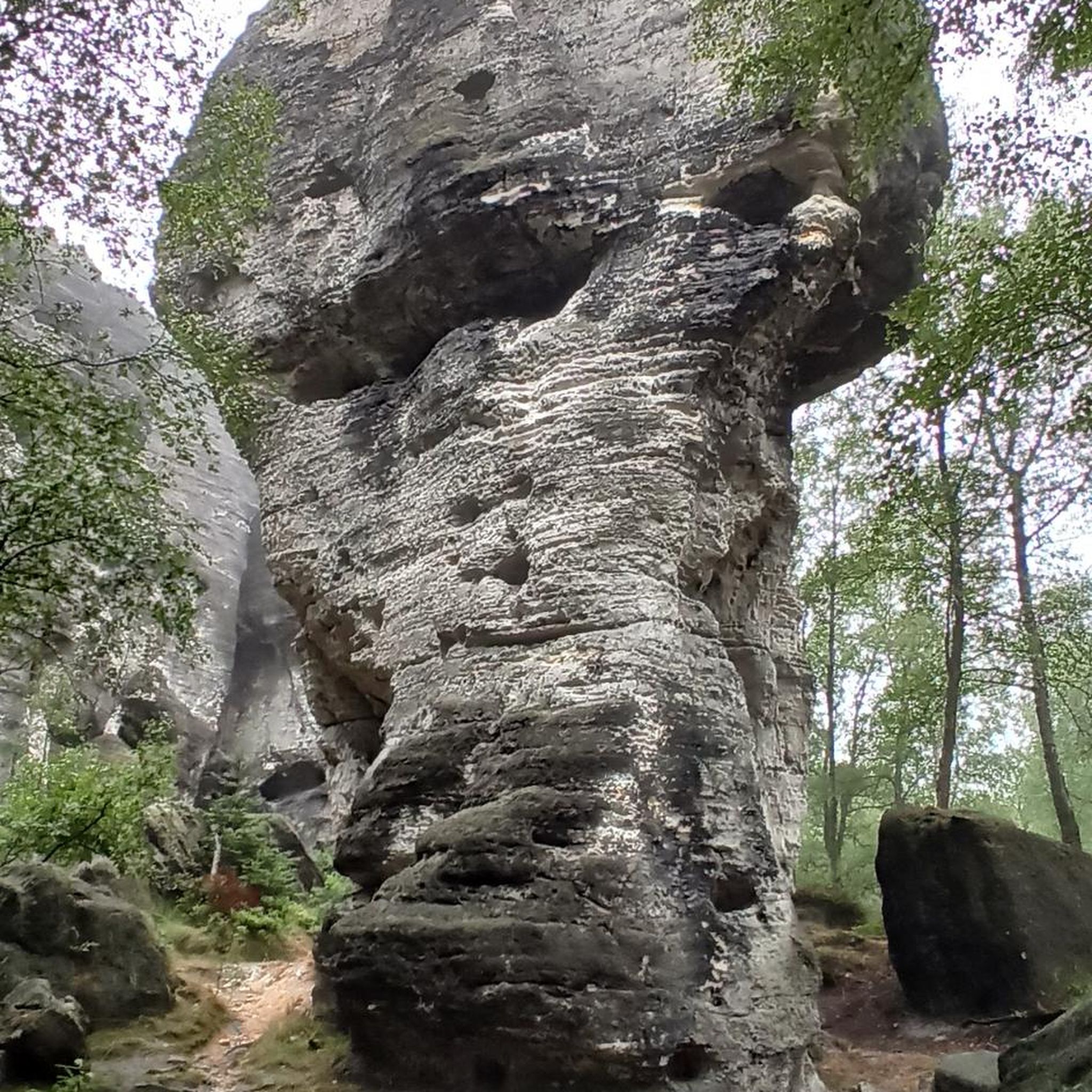
The routes primarily traverse the gently rolling hills of the Haßberge Nature Park, featuring extensive mixed forests and narrow meadow valleys. While many paths are well-paved, some areas might include challenging passes. The region is also known for unique geological features like Rhät sandstone formations and bizarre rock gardens, particularly near Lichtenstein and Pfarrweisach, adding to the varied landscape.
Are there any easy, family-friendly no traffic cycling routes?
Yes, the region offers around 90 easy routes suitable for families. An excellent option is the Pfaffendorf Castle loop from Maroldsweisach, which is approximately 14.5 km long and features minimal elevation gain, making it a pleasant ride for all ages.
What historical attractions can I see along the no traffic touring cycling routes?
The region is rich in history, often called 'the land of castles, palaces, and ruins.' You can encounter over 40 historic sites. Notable attractions include the ruins of Königsberg Castle, Altenstein Castle Ruins, and Eyrichshof Castle. While Rentweinsdorf Castle is a prominent landmark, it remains a private residence. Many routes integrate these historical sites, allowing you to combine cycling with cultural exploration.
Are there any circular no traffic cycling routes in the area?
Yes, many of the no traffic touring cycling routes in the region are circular, offering convenient starting and ending points. Examples include the moderate View from Veitenstein – Veitenstein Viewpoint loop from Gerach, or the Rentweinsdorf Castle – Weißer See loop from Salmsdorf.
What natural features or viewpoints can I discover on these routes?
Cyclists can enjoy breathtaking views from various points, such as the Zeilberg near Maroldsweisach, which offers expansive vistas stretching towards Coburg and Thuringia. The region also features unique flora like cotton grass and marsh orchids, and natural monuments like Herrmannsbrünle Spring and Hermannsbrünnle in the Gresselgrund. The bizarre rock gardens near Lichtenstein and Pfarrweisach are also points of geological interest.
What do other touring cyclists enjoy most about cycling in this region?
The Wälder Um Maroldsweisach, Königsberg U. Rentweinsdorf Mit Schloss region is highly rated by the komoot community, with an average score of 4.6 stars from over 4,150 ratings. Reviewers often praise the peaceful, traffic-free nature of the routes, the diverse landscapes, and the integration of historical attractions into scenic rides.
Are there any longer, more challenging no traffic routes for experienced cyclists?
Yes, the region offers approximately 120 difficult routes for experienced touring cyclists. These routes often feature more significant elevation changes and longer distances. A moderate option that provides a good challenge is the Bramberg Village – Burgpreppach Castle loop from Greßelgrund, covering nearly 25 km with considerable elevation gain.
Is public transport accessible near the no traffic cycling routes?
While the region is best explored by bike, some towns like Königsberg and Rentweinsdorf may have local bus connections. For specific route access via public transport, it's advisable to check local bus schedules for the starting points of your chosen routes. Parking is generally available in the towns and villages where routes begin.
What is the best time of year for touring cycling in Wälder Um Maroldsweisach, Königsberg U. Rentweinsdorf Mit Schloss?
The spring, summer, and early autumn months (April to October) are generally the best times for touring cycling in the Haßberge mountains. During these periods, the weather is typically mild, and the natural landscapes are at their most vibrant, offering pleasant conditions for exploring the forests and valleys.
Are there any facilities or rest areas along the no traffic cycling routes?
Yes, some routes pass by facilities and rest areas. For instance, the Rote Marter Rest Area on the Rennweg is one such spot where cyclists can take a break. Many villages and towns along the routes also offer cafes, pubs, and accommodation options.
Most popular routes in Wälder Um Maroldsweisach, Königsberg U. Rentweinsdorf Mit Schloss
Most popular attractions in Wälder Um Maroldsweisach, Königsberg U. Rentweinsdorf Mit Schloss

Get inspired with the komoot mobile app


Explore more
Browse the best Cycling routes in other regions.
