The best hikes from bus stations in Naturpark Diemelsee
4.6
(2634)
9,321
hikers
153
hikes
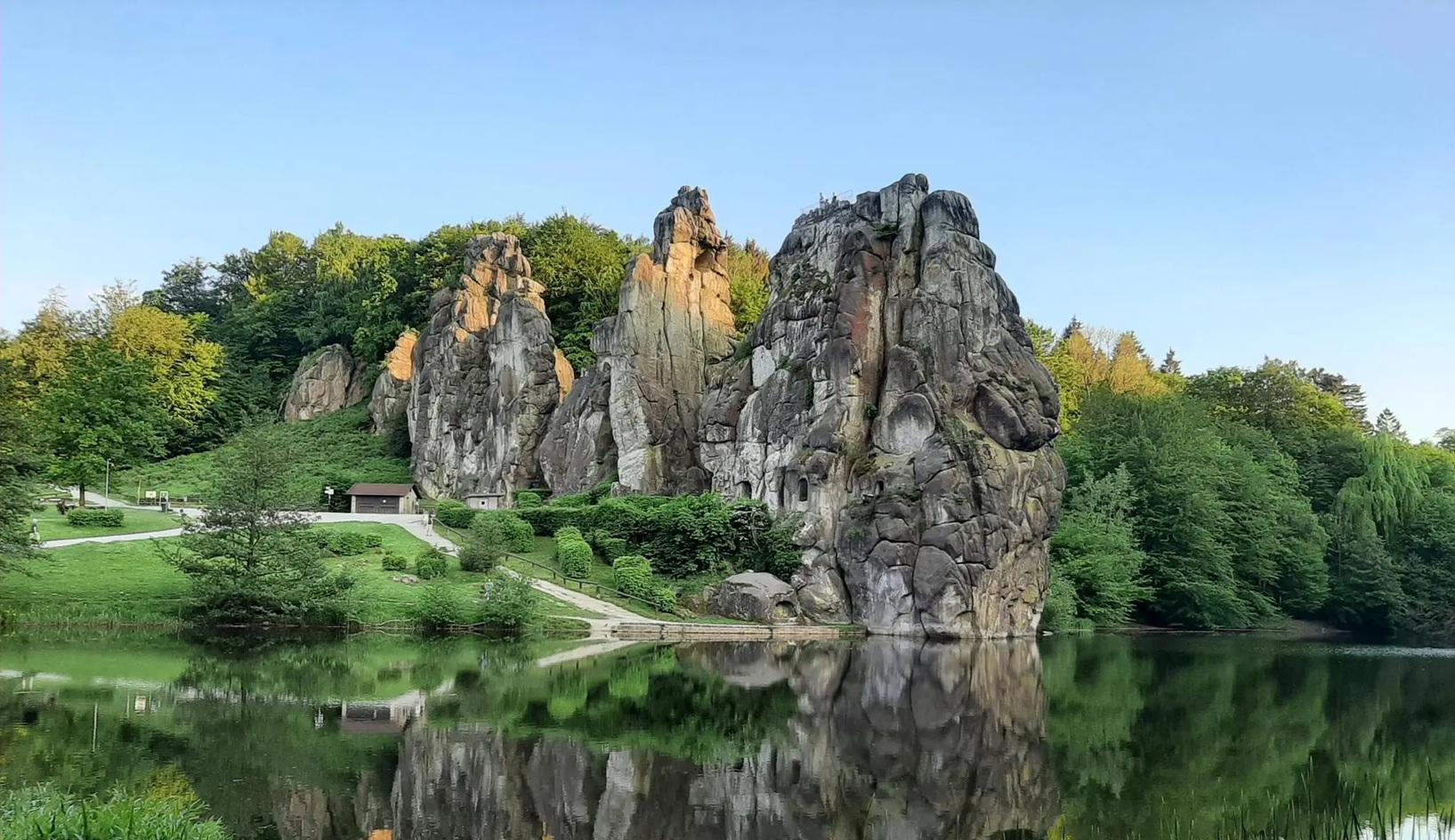
Bus station hiking trails in Naturpark Diemelsee offer access to a diverse low mountain range landscape, part of the Rothaargebirge. The region features dense forests, open fields, wide valleys, and crystal-clear streams, with the Diemelsee Lake as a central natural feature. Hikers can explore varied terrains and protected areas that preserve valuable habitats. The landscape includes imposing mountain views and challenging ascents, with several hills over 200 meters.
Best bus station hiking trails in Naturpark Diemelsee
- The most popular bus…
Last updated: May 13, 2026
4.7
(242)
816
hikers
Hard hike. Good fitness required. Sure-footedness, sturdy shoes and alpine experience required.
4.8
(38)
109
hikers
5.92km
01:41
130m
130m
Easy hike. Great for any fitness level. Easily-accessible paths. Suitable for all skill levels.

Sign up for free
4.5
(25)
85
hikers
Hard hike. Good fitness required. Sure-footedness, sturdy shoes and alpine experience required.
4.7
(36)
113
hikers
10.2km
02:52
200m
200m
Moderate hike. Good fitness required. Easily-accessible paths. Suitable for all skill levels.
4.9
(16)
71
hikers
10.5km
02:55
190m
190m
Moderate hike. Good fitness required. Mostly accessible paths. Sure-footedness required.
Get access to more routes and recommendations from other explorers.
Sign up for free
Already have an account?
Our route recommendations are based on thousands of hikes, rides, and runs completed by other people on komoot.
Start today with a free account
Your next adventure awaits.
Login or Signup

Other adventures in Naturpark Diemelsee


Tips from the Community

A beautiful site with information about mining and geology in the Diemel Valley. Ideal for a break while hiking or cycling on the Diemel Cycle Path. A visit is especially worthwhile during the Giershagen Charcoal Burners' Week.
0
0

Great adventurous hiking trail
0
0

Beautiful up there, unfortunately there is no summit cross
0
0
From here you can see far over the surrounding area
0
0

On its way, it flows through the Diemelsee reservoir and passes the towns of Marsberg, Warburg and Trendelburg before flowing into the Weser on the left bank near Bad Karlshafen.
1
0
View along the Diemel River, winding through the valleys, toward Padberg. There's the village and the conical mountain of the same name (517 m) with the castle ruins to the right.
1
0
The Eisenberg is a 594.6 m high mountain in the Diemelbergland and the highest elevation in the town of Marsberg.
1
0
From the St. Muffert viewpoint with its summit cross, there is a breathtaking view over Lake Diemelsee and its surroundings.
2
0
Frequently Asked Questions
How many bus station hiking trails are available in Naturpark Diemelsee?
Naturpark Diemelsee offers a wide selection of bus station hiking trails. You can find nearly 150 routes that are accessible by public transport, providing diverse options for exploring the region's natural beauty.
What are the difficulty levels of bus station hikes in Naturpark Diemelsee?
The bus station hikes in Naturpark Diemelsee cater to various fitness levels. There are over 75 easy routes, nearly 60 moderate trails, and about 15 more challenging options, ensuring there's a suitable hike for everyone.
Are there family-friendly bus station hikes in Naturpark Diemelsee?
Yes, many bus station hikes in Naturpark Diemelsee are suitable for families. Look for the easy-rated routes, which often feature gentler terrain and shorter distances. For example, the Weisse Frau Viewing Platform – Weiße Frau Viewpoint loop from Egge is an easy option that offers scenic views without being too strenuous.
Can I bring my dog on bus station hikes in Naturpark Diemelsee?
Most hiking trails in Naturpark Diemelsee are dog-friendly, allowing you to enjoy the natural landscape with your canine companion. Always keep your dog on a leash, especially in nature protection areas and near livestock, and remember to pack water for both of you.
Are there circular bus station hikes available?
Yes, many bus station hikes in Naturpark Diemelsee are designed as circular routes, allowing you to start and end at the same bus stop. This is convenient for public transport users. An example of a circular route is the View of the Diemelsee Dam – Highest Point of Marsberg loop from Naturpark Diemelsee.
What scenic spots or viewpoints can I expect on bus station hikes?
Naturpark Diemelsee is rich in scenic beauty. Many bus station hikes offer impressive mountain views, vistas of the Diemelsee Lake, and opportunities to explore dense forests and open meadows. You might encounter highlights like the Dreiskopf Summit and Shelter or enjoy panoramic views of the Diemelsee Dam.
What kind of natural features can I discover along the trails?
The region boasts diverse natural features, including the central Diemelsee Lake, dense forests, open fields, and rare high heath areas. You can also find crystal-clear streams and protected areas preserving unique habitats. The Grube Reinhard/Lüllingshohl – Diemel River loop from Neuer Hagen Padberg, for instance, takes you along the Diemel River.
Are there any interesting historical or geological sites accessible from bus stops?
Yes, the region is part of the Geopark Grenzwelten, offering insights into Earth's history. You can find historical stones marking ancient borders and explore areas with significant rock and fossil deposits. Some trails might lead you near visitor mines or natural slate caves, such as those mentioned in the Caves in Naturpark Diemelsee guide, like the Draken Caves, Obermarsberg.
What is the best time of year to go hiking from bus stations in Naturpark Diemelsee?
Naturpark Diemelsee offers beautiful hiking experiences year-round. Spring brings blooming meadows, summer provides lush greenery, and autumn transforms the landscape with golden foliage, creating picturesque settings. Even winter offers unique charm for walks, though some trails might be more challenging due to snow or ice.
What do other hikers enjoy most about bus station hikes in Naturpark Diemelsee?
The komoot community highly rates the hiking experiences in Naturpark Diemelsee, with an average score of 4.6 stars from nearly 2,500 ratings. Hikers often praise the well-maintained trails, the diverse landscapes ranging from lake views to dense forests, and the convenience of accessing routes directly from bus stops.
Are there facilities like shelters or rest stops along the bus station routes?
Yes, many routes in Naturpark Diemelsee feature shelters and rest stops. These can provide a welcome break, especially on longer tours. You might find facilities like the Kneipp Basin Padberg or various huts and shelters listed in the Huts and Cabins in Naturpark Diemelsee guide.
Can I find cafes or pubs near bus stops for refreshments after a hike?
While specific cafes or pubs directly at every bus stop cannot be guaranteed, many villages and towns within Naturpark Diemelsee, which serve as bus hubs, offer local eateries and pubs where you can enjoy refreshments and traditional cuisine after your hike. Planning your route to end in a larger village will increase your chances.
Most popular routes in Naturpark Diemelsee
Most popular attractions in Naturpark Diemelsee

Get inspired with the komoot mobile app


Explore more
Browse the best Hikes in other regions.
