The best traffic-free bike rides in Overasselt En Hatertsevennen
4.4
(3300)
44,879
riders
431
rides
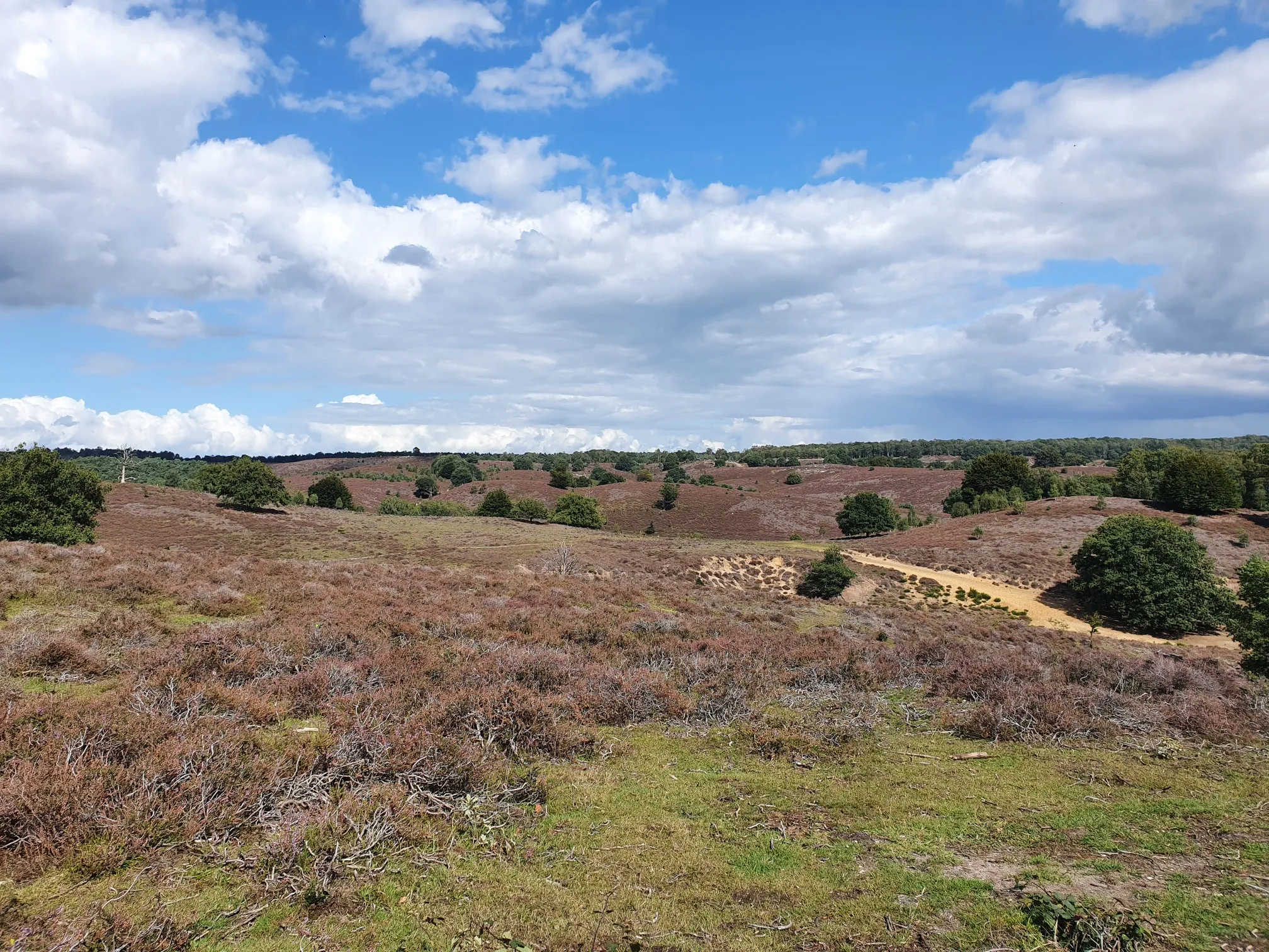
No traffic touring cycling routes in Overasselt En Hatertsevennen traverse a diverse landscape characterized by numerous fens, river dunes, and expansive forest areas. The region, situated southwest of Nijmegen, offers a predominantly flat terrain ideal for relaxed cycling. Cyclists can explore both wet and dry heathlands, which transform with vibrant purple heather in August. This area is well-known for its extensive and clearly signposted cycle paths, providing a serene environment for touring.
Best no traffic touring cycling routes in Overasselt…
Last updated: May 12, 2026
4.0
(1)
25
riders
47.8km
02:46
60m
60m
Moderate bike ride. Good fitness required. Mostly paved surfaces. Suitable for all skill levels.
3.0
(1)
13
riders
Moderate bike ride. Good fitness required. Mostly paved surfaces. Suitable for all skill levels.

Sign up for free
5.0
(1)
18
riders
Easy bike ride. Great for any fitness level. Mostly paved surfaces. Suitable for all skill levels.
12
riders
Easy bike ride. Great for any fitness level. Mostly paved surfaces. Suitable for all skill levels.
5.0
(1)
8
riders
21.1km
01:13
30m
30m
Easy bike ride. Great for any fitness level. Mostly paved surfaces. Suitable for all skill levels.
Get access to more routes and recommendations from other explorers.
Sign up for free
Already have an account?
Our route recommendations are based on thousands of hikes, rides, and runs completed by other people on komoot.
Start today with a free account
Your next adventure awaits.
Login or Signup
Popular around Overasselt En Hatertsevennen


Other adventures in Overasselt En Hatertsevennen

Tips from the Community


A beautiful, sturdy bridge. On the Grave side. You can see a bunker. There's a monument next to it with information about the Second World War. Turning the wheel plays a spoken commentary. Definitely worth listening to.
0
0

I read on the column at the front that the architecture resembles that of fairy tales. A beautiful little castle!
0
0
Nice and high on a mound for when the water comes ;-).
0
0

The John S. Thompson Bridge, located near Grave, is a strategic bridge over the Maas River, officially known as the Bridge at Grave. It was named in honor of Lt. Col. John S. Thompson, commander of the 82nd Airborne Regiment, which successfully captured the bridge during Operation Market Garden (September 1944). The airborne units captured the bridge virtually intact, preserving a vital link in the Allied advance toward Nijmegen and Arnhem. A small monument commemorates this action stands on the north side. The bridge is therefore an important war memorial in the Maas-Grave area.
0
0
The Van Sasse Pumping Station near Grave is a striking waterworks that plays a key role in controlling the waters of the Meuse River. Built at the end of the 19th century, it forms, together with the nearby locks and dikes, an ingenious system that protects the land behind it from high water levels. The pumping station is named after Cornelis van Sasse, a hydraulic engineer involved in the construction of various Meuse-Rhine projects. The robust brick casing with large round arches and iron details reflects the typical industrial architecture of that period. From the walking route, you have a good view of the water inlets, the discharge pipes, and the heavy metal gates. The entire structure demonstrates how important water management has always been here: without these types of installations, the low-lying areas around Grave would be much more vulnerable to flooding. The pumping station is no longer in use, but it remains a recognizable part of the landscape and a tangible reminder of the battle against the water.
0
0

1903: The mill was rebuilt using an octagonal frame from a Groningen mill. The mill was the former Faber oil mill, later Bakker, which was transferred from Middelstum in 1903 and rebuilt in Schoonoord for J.G. (Jakob Gerrit) de Vries (1835-1916). According to the records of the Wouda sailmaker's shop in Meppel, sails were rented for this mill from 1912 to 1932 for a 68-foot wing and sails for a 72-foot wing. No sails were rented between 1913 and 1929. 1937: The trestle was replaced. The trestle height is 5.50 m. 1945: The mill was decommissioned. 1946: The mill was fitted with streamlined noses from Wetsinge. 1949: The mill remained in operation until 1949. 1952: Last repaired and put back into operation. 1978: Finally stopped working. By the time of the dismantling in 1978, the internal workings were already missing. One of the sails was clearly second-hand and far too heavy for this mill. During the dismantling in 1978, it was found to be more or less wedged in the shaft head. Turning was impossible: the cutting torch had to be used. (https://www.molens.nl/ontdek-molens/alle-molens/korenmolen-te-schoonoord)
1
0

Frequently Asked Questions
How many no traffic touring cycling routes are available in Overasselt En Hatertsevennen?
The Overasselt En Hatertsevennen region offers a vast network of no traffic touring cycling routes. There are over 420 routes available, with more than 250 classified as easy, making it accessible for various skill levels.
What do other touring cyclists enjoy most about cycling in Overasselt En Hatertsevennen?
The komoot community highly rates touring cycling in this region, with an average score of 4.4 out of 5 stars from over 3,200 ratings. Cyclists frequently praise the serene wetland environments, diverse landscapes of fens, river dunes, heathlands, and forests, and the well-maintained, quiet cycle paths that allow for peaceful exploration away from traffic.
What is the best time of year to go touring cycling in Overasselt En Hatertsevennen?
While beautiful year-round, the region is particularly stunning in August when the heathlands burst into vibrant purple heather. Spring and early autumn also offer pleasant temperatures and lush scenery, making them ideal for touring cycling.
Are there many loop touring cycling routes in the Overasselt En Hatertsevennen area?
Yes, many of the no traffic touring cycling routes in Overasselt En Hatertsevennen are designed as loops, allowing you to start and end at the same point. An example is the View of the Lake – Munnekeveldweg Cycle Path loop from Nederasselt, which is an easy 12.8 km route.
What natural features can I expect to see along the no traffic touring cycling routes?
You'll encounter a rich variety of natural features, including approximately twenty named fens, river dunes, both wet and dry heathlands, and expansive forest areas. The region is known for its diverse plant communities, such as peat mosses and sundew. You can explore highlights like the Hatert and Overasselt Ponds or the tranquil Uiversnest Lake.
Are there any historical sites or landmarks to visit on these routes?
Yes, the region offers historical points of interest. A notable landmark is the 15th-century ruin of the Sint Walrick Chapel and the adjacent Koortsboom van Overasselt, an ancient pedunculate oak tree with traditional healing lore. You can find these along routes like the Hernen Castle – Batenburg Ruins loop from Alverna.
Are there family-friendly no traffic touring cycling routes?
Absolutely. With over 250 easy routes, many are suitable for families. The flat terrain and dedicated cycle paths ensure a safe and enjoyable experience for all ages. Routes like the Heumen Lock Complex – View of the Fens loop from Heumen offer a manageable 21 km distance with minimal elevation.
Is parking available near the starting points of these routes?
Yes, parking is generally available at or near the starting points of many touring cycling routes in the Overasselt En Hatertsevennen area. Given the region's popularity for outdoor activities, you'll often find designated parking areas, especially near nature reserves and recreational zones.
What kind of wildlife might I encounter while cycling?
The diverse habitats of Overasselt En Hatertsevennen support a variety of wildlife. You might spot wild animals such as badgers, rabbits, deer, and foxes. The fens and forests are also home to numerous bird species, making it a great spot for birdwatching while you cycle.
Are there cafes or places to stop for refreshments along the routes?
Yes, you can find places to stop for refreshments. For instance, the Pancake House St. Walrick is a popular spot located near some of the routes, offering a chance to refuel and relax amidst the natural beauty.
How can I access the no traffic touring cycling routes using public transport?
The region is well-connected, and public transport options are available to reach the vicinity of the routes. You can often take a bus to towns like Overasselt or Heumen, which serve as good starting points for many of the cycling tours. From there, you can easily connect to the dedicated cycle path network.
Can I bring my dog on these touring cycling routes?
Many natural areas in the Netherlands are dog-friendly, often requiring dogs to be on a leash to protect wildlife. There's even a specific highlight, the Dog Swimming Pond, indicating dog-friendly facilities. Always check local signage for specific rules regarding dogs in different sections of the nature reserve.
Most popular routes in Overasselt En Hatertsevennen
Most popular attractions in Overasselt En Hatertsevennen

Get inspired with the komoot mobile app


Explore more
Browse the best Cycling routes in other regions.
