Routes

Planner

Features

Updates

App

Login or Signup

Get the App

Login or Signup

Login or Signup

Routes
Hikes
Yorkshire And The Humber
North Yorkshire
Harrogate

High And Low Bishopside

The best family-friendly hikes and walks around High And Low Bishopside

4.5

(1358)

10,965

hikers

61

hikes

Family friendly hiking trails around High And Low Bishopside are situated within the Nidderdale National Landscape, characterized by tranquil reservoirs, rolling farmland, and gritstone moorlands. The region's terrain includes sheltered glacial valleys, wooded areas, and the River Nidd, offering diverse natural features for exploration. Notable landmarks like Brimham Rocks provide unique rock formations and expansive views. This area offers a variety of paths suitable for families, ranging from gentle riverside strolls to routes through woodlands and past reservoirs.

Best family friendly hiking trails around High And Low Bishopside

  • The most popular family friendly hiking route is Wath Lane and River Nidd loop from Pateley Bridge — Nidderdale, a 3.4 miles (5.5 km) trail that takes 1 hour 42 minutes to complete. This easy route follows the scenic River Nidd, offering tranquil waterside views.
  • Another top favourite among local hikers is Eagle Hall and Fishpond Wood loop from Pateley Bridge — Nidderdale, an easy 2.8 miles (4.5 km) path. This trail leads through wooded areas and offers gentle gradients suitable for families.
  • Local hikers also love the Brimham Rocks & Glasshouses village loop from Pateley Bridge, an 8.4 miles (13.5 km) trail leading through varied terrain including the distinctive gritstone formations of Brimham Rocks, often completed in about 3 hours 45 minutes.
  • Hiking around High And Low Bishopside is defined by riverside paths along the River Nidd, routes through woodlands, and trails around reservoirs. The network offers options for different ability levels, with many easy and moderate family friendly hiking trails.
  • The routes in High And Low Bishopside are highly rated by the komoot community with an average score of 4.5 stars from more than 1,200 reviews. More than 10,000 hikers have used komoot to explore High And Low Bishopside's varied terrain.

Last updated: May 10, 2026

4.8

(123)

578

hikers

#1.

Brimham Rocks & Glasshouses village loop from Pateley Bridge

13.5km

03:46

260m

260m

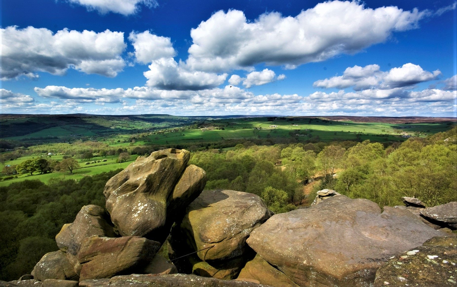
Embark on a moderate 8.4-mile (13.5 km) hike through the scenic Nidderdale Area of Outstanding Natural Beauty, a journey that typically takes around 3 hours and 45 minutes. You will gain about 865 feet (264 metres) in elevation as you explore varied terrain, from tranquil riverside paths along the River Nidd to peaceful woodlands and open farmland. The highlight of this route is undoubtedly Brimham Rocks, where you'll encounter bizarrely shaped gritstone pinnacles and impossibly balanced boulders, carved by glaciers and wind over centuries. Expect a mix of natural paths, asphalt, and gravel, with some sloping sections, steps, and steep drops around the rocks themselves, offering panoramic views across Nidderdale and to the Vale of York.

This loop begins in Pateley Bridge, a charming market town known as the 'Capital of Nidderdale.' While much of the walk is straightforward, some uphill sections exist, particularly the climb back to Brimham Rocks from Smelthouses. Sturdy footwear is highly advisable due to rough footpaths and sections with rocks and tree roots. The paths around Brimham Rocks are not suitable for mobility scooters, prams, or wheelchairs due to steep gradients and uneven surfaces, so plan accordingly if you are visiting with young children or those with mobility challenges.

Beyond the dramatic rock formations, the trail offers a rich tapestry of local history and natural beauty. You will pass through picturesque villages like Glasshouses and Smelthouses, and Pateley Bridge itself is home to the world's oldest sweet shop. The route also incorporates sections of well-known long-distance paths, including the Nidderdale Way and the Six Dales Trail, connecting you to a wider network of hiking adventures. Keep an eye out for public art installations, such as the

Navigate with device

Send to Phone

Save

Moderate

Embark on the Wath Lane and River Nidd loop for an easy 3.4-mile (5.5 km) hike that blends serene riverside paths with elevated vistas. You will gain about 653 feet (199 metres) in elevation over approximately 1 hour and 42 minutes, traversing green fields, woodlands, and quiet country lanes. Enjoy enchanting views of the River Nidd and, from Wath Lane, look out over Pateley Bridge and Gouthwaite Reservoir, showcasing the beauty of the Nidderdale National Landscape. While mostly flat, expect some gentle climbs, particularly after Wath Bridge.

Your journey begins in Pateley Bridge, a charming market town known as the “Capital of Nidderdale.” This convenient starting point offers an award-winning high street with independent shops and tea rooms, perfect for a pre-hike coffee or a post-hike treat. The town is also home to the world's oldest sweet shop, adding a unique touch to your visit. The trail is generally well-maintained, but be prepared for potentially muddy sections, especially across farmland or after rain.

This route offers a rich tapestry of natural beauty and local history. As you follow the River Nidd, keep an eye out for wildlife like kingfishers and otters. The trail also passes by historic lead mining sites, such as Prosperous and Providence Lead Mines, and the village of Wath, with its unique pentagon-shaped chapel. You will also encounter traces of the former 19th-century Nidd Valley Light Railway, providing glimpses into the area's industrial past.

Easy
guide_signup
Let us show you the way with the komoot mobile app
With a free komoot account, you can easily find, customize, and navigate endless outdoor adventures.

Sign up for free

1.0

(1)

15

hikers

Embark on the Nidderdale Way: Gouthwaite Reservoir Loop, a difficult hiking route that takes you through the heart of Nidderdale National Landscape. This challenging trail covers 12.4 miles (19.9 km) and involves a significant elevation gain of 968 feet (295 metres), typically requiring about 5 hours and 25 minutes to complete. As you hike, you will experience diverse terrain, from open pastoral hills to tranquil woodlands, with the scenic Gouthwaite Reservoir as a constant visual anchor. The route often follows the winding River Nidd, offering a peaceful atmosphere throughout your journey. Prepare for a rewarding experience that tests your endurance while immersing you in natural beauty.

To plan your hike, begin your adventure near Pateley Bridge, a charming market town that provides convenient access to the trailhead. You will find amenities there, including parking options, making it a good starting point for your day. While the route is generally accessible, be prepared for varied terrain underfoot. Expect potentially muddy sections, especially if you are hiking on the western side of the reservoir, so appropriate footwear is essential. Always check local conditions before you set out.

This loop is particularly notable for its rich wildlife, as Gouthwaite Reservoir is a designated Site of Special Scientific Interest. Keep an eye out for numerous species of wildfowl and waders, making it a prime spot for birdwatching. Beyond the natural beauty, you will also encounter historical remnants along the way, including the intriguing ruins of the Prosperous and Providence Lead Mines, offering a glimpse into the region's industrial past.

Hard

The Gouthwaite Reservoir and Ramsgill loop from Wath offers a picturesque hiking experience through Nidderdale. You will follow the shoreline of Gouthwaite Reservoir, enjoying views of the water, the River Nidd, and surrounding pastoral hills. This moderate hike covers 10.8 miles (17.3 km) with an elevation gain of 892 feet (272 metres), typically taking around 4 hours and 44 minutes to complete. The paths are a mix of minor tarmac roads, gravel tracks, and grass, though some sections can be muddy after rain. Expect idyllic rolling fields and livestock as you explore this scenic route.

This moderate loop is generally accessible, making it suitable for most fitness levels. The trail starts from Wath and largely follows the reservoir's edge. Be aware that some grass paths can become muddy, especially after wet weather, so appropriate footwear is advisable for your hike. The route is considered largely flat, offering a pleasant experience for a variety of hikers.

Gouthwaite Reservoir is a significant highlight, designated as both a nature reserve and a Site of Special Scientific Interest. It is a popular spot for birdwatchers, with over 200 species recorded, including oystercatchers, kingfishers, and red kites. You can find a viewing platform and a sandmartin wall near Ramsgill to observe the rich birdlife. Sections of this loop are also part of the longer 53-mile (85 km) Nidderdale Way, exploring the valley and uplands.

Moderate

Easy hike. Great for any fitness level. Easily-accessible paths. Suitable for all skill levels.

Easy
Sign up for free to see 57 more hikes around High And Low Bishopside.

Get access to more routes and recommendations from other explorers.

Sign up for free

Already have an account?

Our route recommendations are based on thousands of hikes, rides, and runs completed by other people on komoot.

Start today with a free account

Your next adventure awaits.

Login or Signup

Popular around High And Low Bishopside
Nidderdale Way — Discover one of Yorkshire's most loved dales

Cycle the Way of the Roses – Historic cities to rolling hills

Other adventures around High And Low Bishopside

Nidderdale Way — Discover one of Yorkshire's most loved dales

Hiking Collection by

Dan Hobson

Tips from the Community

RichD
June 1, 2025, Pateley Bridge Market Town

Quintessentially pretty market town, arrive early to find suitable parking, best place is next to the showground on the southern side of the bridge over the River Nidd. Honesty box only (no payment cards), cheap at £1 up to 4 hours and £2 all day (spring 2025 prices). The southern end of Nidderdale around Pateley Bridge has one of the densest concentrations of public footpaths in North Yorkshire, so loads of routeing options. See the North Yorks public rights of way map at https://maps.northyorks.gov.uk/connect/analyst/mobile/#/main?mapcfg=Out_and_About

1

0

RichD
June 1, 2025, Brimham Rocks

If you can stomach getting up very early for hikes and runs, then you will have the place to yourself. Absolutely stunning at around 6-7am in the early morning May sunshine.

1

0

Great views both up and downstream, with parking on both sides of the bridge. The car park on the southern side, next to the cricket pitch and showground, is quite big and now relies on an honesty box for payment.

1

0

Drinking water is available for free and there is toilets and hot drinks and cold

0

0

A lovely historic spot with some great information boards, a perfect place to take a break - watch out for the ground-nesting bees in the spoil heaps during summer months!

0

0

A fantastic National Trust site, where the main attraction is the staggering rock formations. It is also worthwhile walking through the woodlands especially when the Bluebells are in season.

0

0

A fantastic National Trust site, where the main attraction is the staggering rock formations. It is also worthwhile walking through the woodlands especially when the Bluebells are in season.

0

0

A small but quaint town in the Yorkshire Dales.

0

0

Frequently Asked Questions

How many family-friendly hiking trails are available in High And Low Bishopside?

High And Low Bishopside, nestled in the Nidderdale National Landscape, offers a fantastic selection of family-friendly routes. You'll find over 60 trails, with more than 25 specifically rated as easy, making them perfect for families with children.

What kind of natural features can families explore on these trails?

The region is rich in diverse natural beauty. Families can discover the dramatic gritstone formations at Brimham Rocks, enjoy tranquil walks around several reservoirs like Gouthwaite Reservoir, or follow the scenic River Nidd. Don't miss the intriguing limestone gorge of Trollers Gill, steeped in local folklore.

Are there any easy circular walks suitable for families with young children?

Absolutely! Many trails are designed as circular routes, perfect for a family day out. For a gentle, accessible option, consider the Eagle Hall and Fishpond Wood loop from Pateley Bridge, which offers a pleasant, shorter distance through woodlands.

What do other hikers enjoy most about the family trails in High And Low Bishopside?

The komoot community highly rates the trails in this area, with an average score of 4.46 stars. Hikers often praise the well-maintained paths, the stunning views of the Nidderdale National Landscape, and the variety of landscapes, from riverside strolls to unique rock formations, making it enjoyable for all ages.

Are the family-friendly trails in High And Low Bishopside dog-friendly?

Yes, many of the trails in High And Low Bishopside are dog-friendly, allowing your furry companions to join the adventure. However, please remember to keep dogs on a lead, especially around livestock and in nature conservation areas, to protect wildlife and farm animals.

Are there any waterfalls or interesting water features to see on these family hikes?

While the area is known for its reservoirs and the River Nidd, you can also find charming water features. Consider exploring areas like Fell Beck Ford and Weir or the Waterfall and Stream in Nidderdale National Landscape for delightful sights along the way.

What are the best times of year for family hiking in this region?

Spring and summer offer vibrant wildflowers and lush greenery, ideal for pleasant walks. Autumn brings spectacular colours to the landscape, while winter can provide crisp, clear days, though some paths might be muddy or icy. Always check local weather conditions before heading out.

Where can we find parking and public transport options for family hikes?

The charming market town of Pateley Bridge, often called the 'Capital of Nidderdale,' serves as a central hub with parking facilities and public transport links. Many routes, such as the Wath Lane and River Nidd loop, start from or are easily accessible from Pateley Bridge.

Are there any unique landmarks or historical sites suitable for a family visit?

Beyond the natural beauty, families can visit the intriguing Druid's Temple, a 19th-century folly styled after ancient stone circles, which offers an atmospheric and educational experience. The historic town of Pateley Bridge itself is also a delightful place to explore.

What kind of terrain should we expect on family-friendly trails?

The family-friendly trails in High And Low Bishopside generally feature gentle paths, often along riverside, through woodlands, or around reservoirs. While some routes might have slight inclines, they are typically manageable for most fitness levels. Expect a mix of well-trodden earth paths, gravel tracks, and occasional paved sections.

Are there any longer, but still family-friendly, routes for older children?

For families with older children looking for a bit more of a challenge, the Brimham Rocks & Glasshouses village loop from Pateley Bridge offers a moderate, longer distance with rewarding views and the unique rock formations of Brimham Rocks to explore.

Can we find places to eat or picnic near the trails?

Yes, Pateley Bridge offers various cafes, pubs, and shops where you can grab a bite or stock up for a picnic. Many trails also pass through scenic spots perfect for a family picnic amidst the beautiful Nidderdale landscape.

Most popular routes around High And Low Bishopside

Hiking around High And Low Bishopside

Most popular attractions around High And Low Bishopside

Places to see

Store rating

Get inspired with the komoot mobile app

With a free komoot account, you can easily find, customize, and navigate endless outdoor adventures.

or

Join komoot Now

Store rating

Explore more

Browse the best Hikes in other regions.

Nidderdale AonbBewerleyLindrick With Studley Royal And FountainsHartwith Cum WinsleyThruscross ReservoirStonebeck UpKnaresboroughStonebeck DownMashamFewstonSpofforth With StockeldFountains EarthGouthwaite ReservoirRiponNorwoodAldfieldSwinton With WarthermarskeBurton-On-YoreGrewelthorpeLeighton ReservoirRoundhill ReservoirLittle TimbleScar House ReservoirAngram ReservoirBlubberhousesLindley Wood ReservoirRipleyIlton-Cum-PottBoroughbridgeLindleyFarnleyStainburnBeckwithshawNewall With CliftonHampsthwaiteScottonDacreNesfield With LangbarKillinghallThruscrossHealeyGreat TimbleDarley And MenwithSicklinghallLeathleyScrivenNorth RigtonBirstwithStudley RogerFearbyBurton LeonardStaveleyAzerleyPannal And Burn BridgeMiddletonFollifootMarkington With WallerthwaiteSouth Stainley With CaytonBishop MonktonBreartonKirkby MalzeardBishop ThorntonClint Cum HamletsDentonWarsill

Nearby adventure guides

Things to Do in Nidderdale Aonb

background

Get ready to conquer new peaks

Sign up for Free

Explore
RoutesRoute plannerFeaturesHikesMTB TrailsRoad cycling routesBikepackingSitemap
Download the app
Follow Us on Socials

© komoot GmbH

Privacy Policy