The best family-friendly hikes and walks around Kirriemuir Landward West
4.5
(709)
7,458
hikers
13
hikes
Family friendly hiking trails around Kirriemuir Landward West traverse a landscape characterized by rolling hills, quiet glens, and serene lochs. The region features diverse terrain, including woodlands like Caddam Wood and the steep-sided Kirriemuir Den, through which the Gairie Burn flows. Notable natural features include Loch of Lintrathen, Loch Shandra, and Kirriemuir Hill, which rises to 193 meters. This varied topography provides a range of experiences for hikers.
Best family friendly hiking trails around Kirriemuir Landward West
- The most popular family friendly hiking route is Cateran Trail: Loch Shandra and Auchintaple Loch Loop, a 10.9 miles (17.6 km) trail that takes 4 hours 45 minutes to complete. This moderate route offers views of lochs and highland scenery.
- Another top favourite among local hikers is View Up Glen Isla – Auchintaple Loch loop from Folda, a moderate 4.4 miles (7.1 km) path. This trail provides views up Glen Isla and around Auchintaple Loch.
- Local hikers also love the Wee Bear Cafe – Loch of Lintrathen loop from Bridgend of Lintrathen, a 4.3 miles (6.9 km) trail leading through varied landscapes around Loch of Lintrathen, often completed in about 1 hour 48 minutes.
- Hiking around Kirriemuir Landward West is defined by rolling hills, tranquil lochs, and extensive woodlands. The network offers options for various ability levels, including 3 easy and 9 moderate family friendly hiking trails.
- The routes in Kirriemuir Landward West are highly rated by the komoot community with an average score of 4.5 stars from over 600 reviews. More than 7,000 hikers have used komoot to explore Kirriemuir Landward West's varied terrain.
Last updated: July 20, 2026
4.5
(6)
24
hikers
17.6km
04:46
250m
250m
Moderate hike. Good fitness required. Easily-accessible paths. Suitable for all skill levels.
4.8
(10)
22
hikers
9.99km
02:46
180m
180m
Moderate hike. Good fitness required. Easily-accessible paths. Suitable for all skill levels.

Sign up for free
4.8
(9)
21
hikers
7.06km
02:00
160m
160m
Moderate hike. Good fitness required. Easily-accessible paths. Suitable for all skill levels.
4.0
(2)
20
hikers
Easy hike. Great for any fitness level. Easily-accessible paths. Suitable for all skill levels.
5.0
(1)
22
hikers
13.8km
03:46
210m
210m
Moderate hike. Good fitness required. Easily-accessible paths. Suitable for all skill levels.
Get access to more routes and recommendations from other explorers.
Sign up for free
Already have an account?
Our route recommendations are based on thousands of hikes, rides, and runs completed by other people on komoot.
Start today with a free account
Your next adventure awaits.
Login or Signup
Popular around Kirriemuir Landward West
Other adventures around Kirriemuir Landward West

Tips from the Community

Glenisla Kirk, a small Gothic church built in 1821, is located at the west end of Kirkton of Glenisla on the B951. Originally part of a religious site dating back to the 13th century, it was first gifted to the Abbey of Cambuskenneth by King William the Lion and later transferred to the Abbey of Coupar Angus in 1311. After numerous repairs, the original church was replaced with the current structure. Now owned by the Glenisla Church Trust, it continues to serve the community with monthly informal evening services (April to December) and a Christmas Eve Watch Night Service. It also offers a venue for weddings and funerals, with local venues providing additional support.
0
0
Kirkton of Glenisla, an ancient farming community with Bronze Age and Pictish remains, has a deep ecclesiastical heritage reflected in its name, meaning "church town." From the 14th to 16th centuries, it was part of the lands of Coupar Angus Abbey, which influenced the area's farming development. After the Reformation, the lands were feued to the Ogilvy family, later Earls of Airlie, with Forter Castle remaining as a historical landmark. In the 19th century, the area became a romantic destination, attracting Queen Victoria and Prince Albert. Glenisla also saw the construction of Brackny Bridge in 1824, designed by John Justice, marking a significant moment in the area's architectural history.
0
0
Glenisla, planted in 1949, is a productive forest mainly consisting of Sitka Spruce, a species known for its rapid growth and high-quality timber. Introduced to Scotland in 1831 by David Douglas, Sitka Spruce originates from the fog-belt of western North America, where it had various uses such as in basketry and boat caulking. Plans to establish native riparian woodlands are underway, though deer management is crucial to protect young trees. The forest is served by three main burns—Glen Taitney, Finlet, and Muckle—which supply water to the Backwater Reservoir and local rivers, benefiting nearby towns in Angus and Dundee.
0
0
This man-made loch, created by damming the burn flowing down the glen, is a peaceful spot renowned for its excellent fly fishing opportunities, where anglers can catch wild brown and rainbow trout. The loch's name is believed to stem from the Scottish Gaelic term "Seantruibh," meaning "Old farmtoun" or "settlement," reflecting the area's deep historical roots. This connection to the Gaelic past adds cultural significance to the loch, enhancing its charm alongside its natural beauty and recreational appeal.
1
0
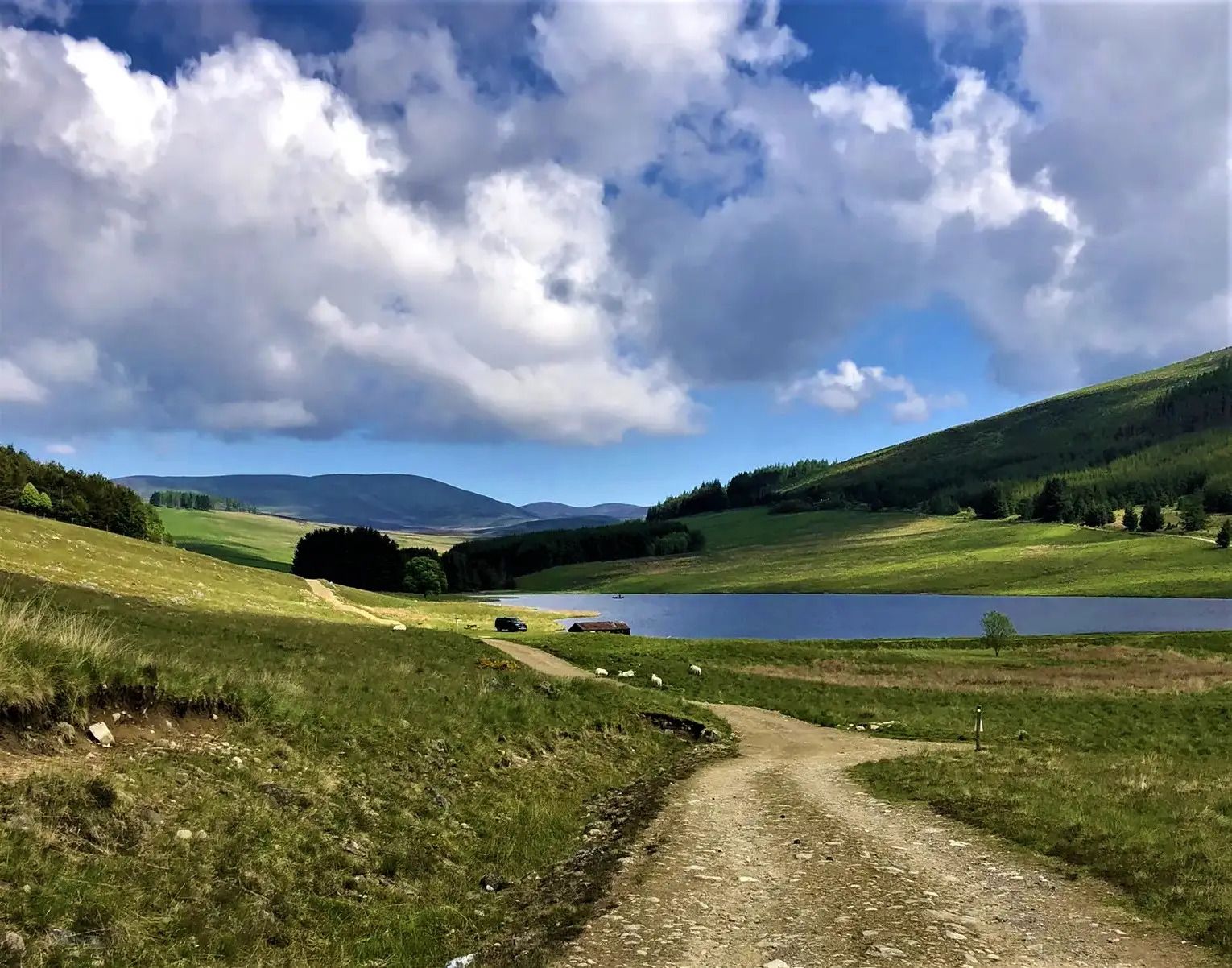
Auchintaple Loch, a popular spot for walkers on the Cateran Trail, features a boat house on its far side. Although man-made, the area is rich in history, with nearby remnants of an early chapel at Chapel Hillock. The site, marked by a turf-covered stone bank enclosing a hollow, contains several stones. Close by is the Lady Well, or Virgin Mary's Well, which still flows with clear water. Historically, this well, along with others in the region, was believed to have curative properties, attracting people seeking healing. The first Sabbath in May was thought to be the time when the waters were most powerful, and drinking from the well before sunrise was considered particularly beneficial.
0
0
Forter Castle, built in 1560 by the Ogilvys of Airlie, is a four-storey tower house that was restored in the 1990s after falling into ruin. Its strong defenses made it difficult to capture by surprise, and it withstood various attacks until 1640, when it was besieged by a force of 5,000 men with heavy artillery. The castle was at the heart of a personal feud between the Ogilvys and the Campbells, stemming from land disputes and religious differences. The feud escalated into violent raids, with the Campbells attacking Forter and its lands. In 1640, Archibald Campbell, the Earl of Argyll, led a campaign against the Ogilvys, ultimately razing the castle in an act of personal vengeance. The Countess of Ogilvy is said to have witnessed the destruction from a nearby hill, marking the end of an era for the Ogilvy family in Glenshee.
0
0

The only potential refreshment stop around here that I know of.
0
0

Frequently Asked Questions
How many family-friendly hiking trails are there in Kirriemuir Landward West?
There are 13 family-friendly hiking routes available in Kirriemuir Landward West, ranging from easy strolls to moderate adventures. This guide focuses on routes suitable for families, ensuring manageable distances and gentle paths.
What are some easy family walks suitable for beginners or younger children?
For an easy and enjoyable family outing, consider the Wee Bear Cafe – Loch of Lintrathen loop from Bridgend of Lintrathen. This 6.9 km route offers gentle terrain and takes around 2 hours to complete, with the added bonus of a cafe nearby. The area also features accessible paths around Loch Kinnordy, which is an RSPB nature reserve, perfect for nature observation.
Are there any circular family walks in Kirriemuir Landward West?
Yes, many of the family-friendly routes in Kirriemuir Landward West are circular, making them convenient for starting and ending at the same point. Examples include the Cateran Trail: Loch Shandra and Auchintaple Loch Loop, a longer option at 17.5 km, or the shorter View Up Glen Isla – Auchintaple Loch loop from Folda, which is 7 km.
What can we see along the family-friendly hiking trails?
The trails offer diverse scenery, from rolling hills and tranquil glens to serene lochs and woodlands. You might spot wildlife around Loch Kinnordy, an RSPB nature reserve. For stunning views, consider a walk up Kirriemuir Hill, where you can also find the Camera Obscura, gifted by J.M. Barrie, offering panoramic vistas of the Angus countryside. The Gairie Burn also features pleasant walks and sometimes attractive waterfalls.
Are the family-friendly trails in Kirriemuir Landward West suitable for dogs?
Many trails in Kirriemuir Landward West are dog-friendly, allowing your furry companions to join the adventure. However, always keep dogs under control, especially near livestock or wildlife, and follow the Scottish Outdoor Access Code. Routes like the Wee Bear Cafe – Loch of Lintrathen loop are popular choices for families with dogs.
What is the best time of year to go hiking with family in Kirriemuir Landward West?
Spring and summer are generally ideal for family hiking in Kirriemuir Landward West, with milder weather and longer daylight hours. During spring, you might spot ospreys near the Reekie Linn Waterfall in Glen Isla. Autumn also offers beautiful scenery with changing foliage. Always check local weather forecasts before heading out.
Are there any trails with waterfalls that are suitable for families?
Yes, the Gairie Burn, which flows through Kirriemuir, offers pleasant walks through woodland and sometimes leads to attractive waterfalls. For a more dramatic sight, the Reekie Linn Waterfall in Glen Isla is a stunning natural feature, though access might vary in difficulty depending on the specific path taken.
Where can we find parking for family hikes in the area?
Parking is generally available at common starting points for trails, such as near Bridgend of Lintrathen for the Wee Bear Cafe loop, or in villages like Folda for the View Up Glen Isla – Auchintaple Loch loop. Kirriemuir town centre also serves as a starting point for several local circuits, including walks up Kirrie Hill and through Caddam Wood, where parking facilities can be found.
How long do family-friendly hikes typically take in Kirriemuir Landward West?
The duration of family-friendly hikes varies depending on the route and your pace. Easier walks, like the 6.9 km Wee Bear Cafe – Loch of Lintrathen loop, typically take around 2 hours. Longer moderate routes, such as the 11.2 km Glenisla Hotel – Loch Shandra loop, can take closer to 3 hours.
What do other hikers enjoy most about family hiking in Kirriemuir Landward West?
The area is highly rated by the komoot community, with an average score of 4.5 stars. Reviewers often praise the diverse and picturesque landscapes, the tranquility of the glens and lochs, and the well-maintained paths suitable for families. The blend of rolling hills, woodlands, and waterside walks provides a variety of experiences that hikers appreciate.
Are there any cafes or facilities near the family-friendly trails?
Yes, some routes, like the Wee Bear Cafe – Loch of Lintrathen loop, have cafes conveniently located nearby. Kirriemuir itself offers various amenities, including cafes and pubs, which can be accessed after walks starting from or passing through the town. For more information on local facilities, you can visit the Visit Angus website.
Can we access any of the family-friendly trails using public transport?
While many trails are best accessed by car, some routes around Kirriemuir town centre are reachable via local bus services. For detailed information on public transport options and specific routes, it's advisable to check local bus timetables and route maps, such as those provided by Angus Council's path network guide, which often includes accessibility notes.
Most popular routes around Kirriemuir Landward West
Most popular attractions around Kirriemuir Landward West

Get inspired with the komoot mobile app


Explore more
Browse the best Hikes in other regions.
