The best hikes from bus stations in Gjørdøldalen
4.3
(44)
277
hikers
5
hikes
Bus station hiking trails in Gjørdøldalen offer access to an expansive valley within Norway's Trollheimen mountain range. The region features diverse terrain, including ancient woodlands, river valleys, and mountain lakes, shaped by millions of years of glacial activity. This area forms a key segment of the Trollheimen Triangle, providing varied landscapes for hikers. The valley floor and surrounding areas present a mix of gentle paths and more challenging ascents towards higher ground.
Best bus station hiking trails in Gjørdøldalen
- The…
Last updated: October 29, 2026
7
hikers
22.3km
08:17
940m
950m
Hard hike. Very good fitness required. Mostly walkable paths. Sure-footedness required.
4.7
(10)
86
hikers
19.6km
07:09
610m
620m
Hard hike. Very good fitness required. Mostly walkable paths. Sure-footedness required.

4.6
(5)
14
hikers
4.20km
01:11
80m
90m
Easy hike. Easily walkable paths.
5.0
(1)
2
hikers
Easy hike. Easily walkable paths.
1
hikers
10.1km
03:08
370m
370m
Moderate hike. Good fitness required. Easily walkable paths.
Our route recommendations are based on thousands of hikes, rides, and runs completed by other people on komoot.
Start today with a free account
Your next adventure awaits.


Tips from the Community

An elevated scenic viewpoint overlooking a steep river canyon. Framed by mature pine trees and dense forest foliage, the vantage point offers striking views looking down into the rushing river channel carved through the surrounding forested valley slopes.
0
0
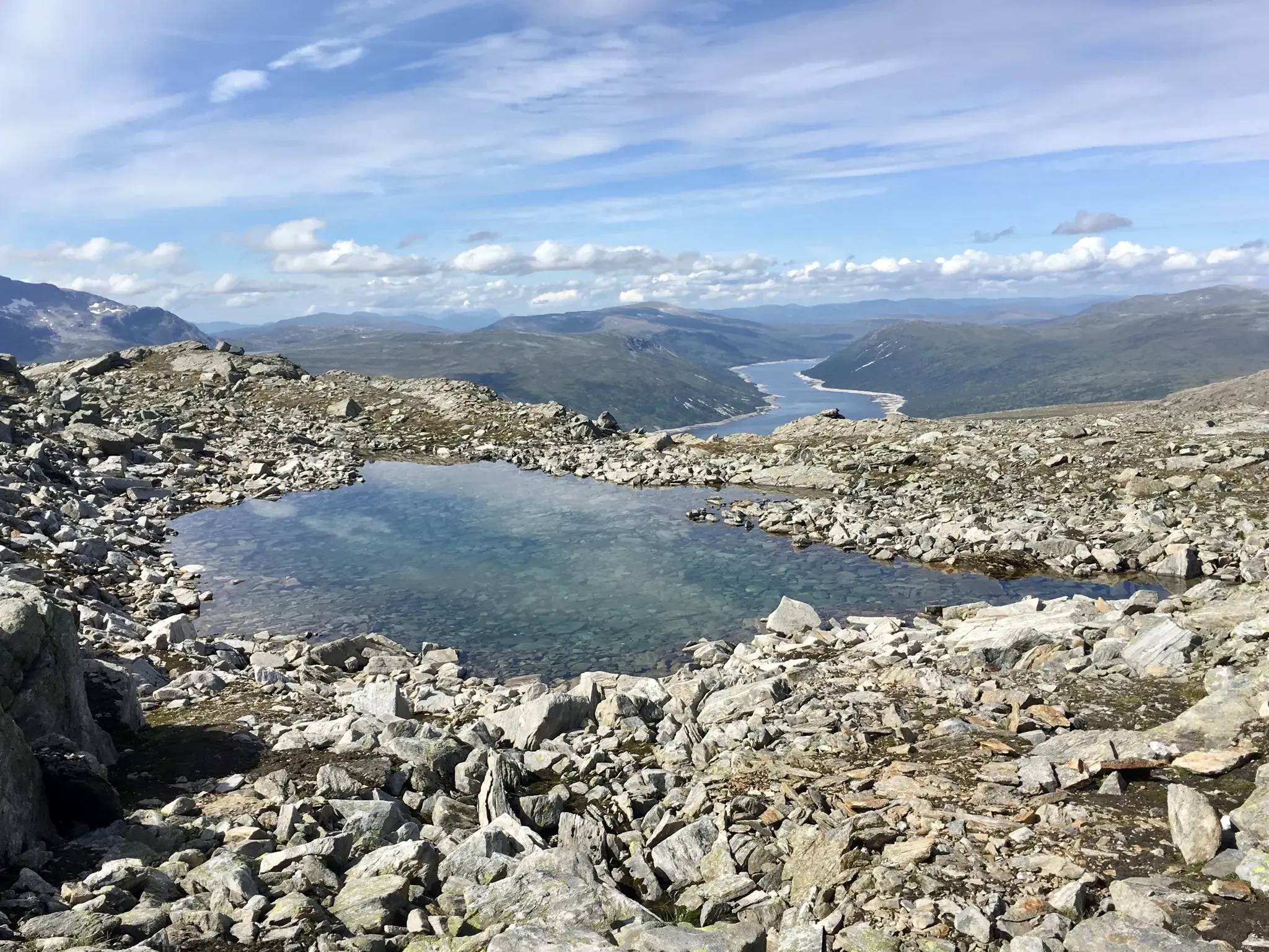
Rising above high-altitude alpine terrain, this scenic summit features open moorland slopes, rocky crests, and wide vistas across the surrounding valleys, mountain plateaus, and rolling highlands.
0
0

A break with coffee and waffles at Gjevilvasshytta. Recommended.
0
0

This is a beautiful lake nestled beneath the slopes of Blåhøa, the highest peak in the northeast of the Trollheimen range. There's a small cabin here, Kamtjønnkoia, which was built in the 1950s to support botanists studying the region's mountain flora. There's around 500 metres (1,600 ft) of ascent from here up to Blåhøa's summit, which stands proud at 1,671 metres (5,482 ft). The hike is relatively straightforward in good weather.
1
0
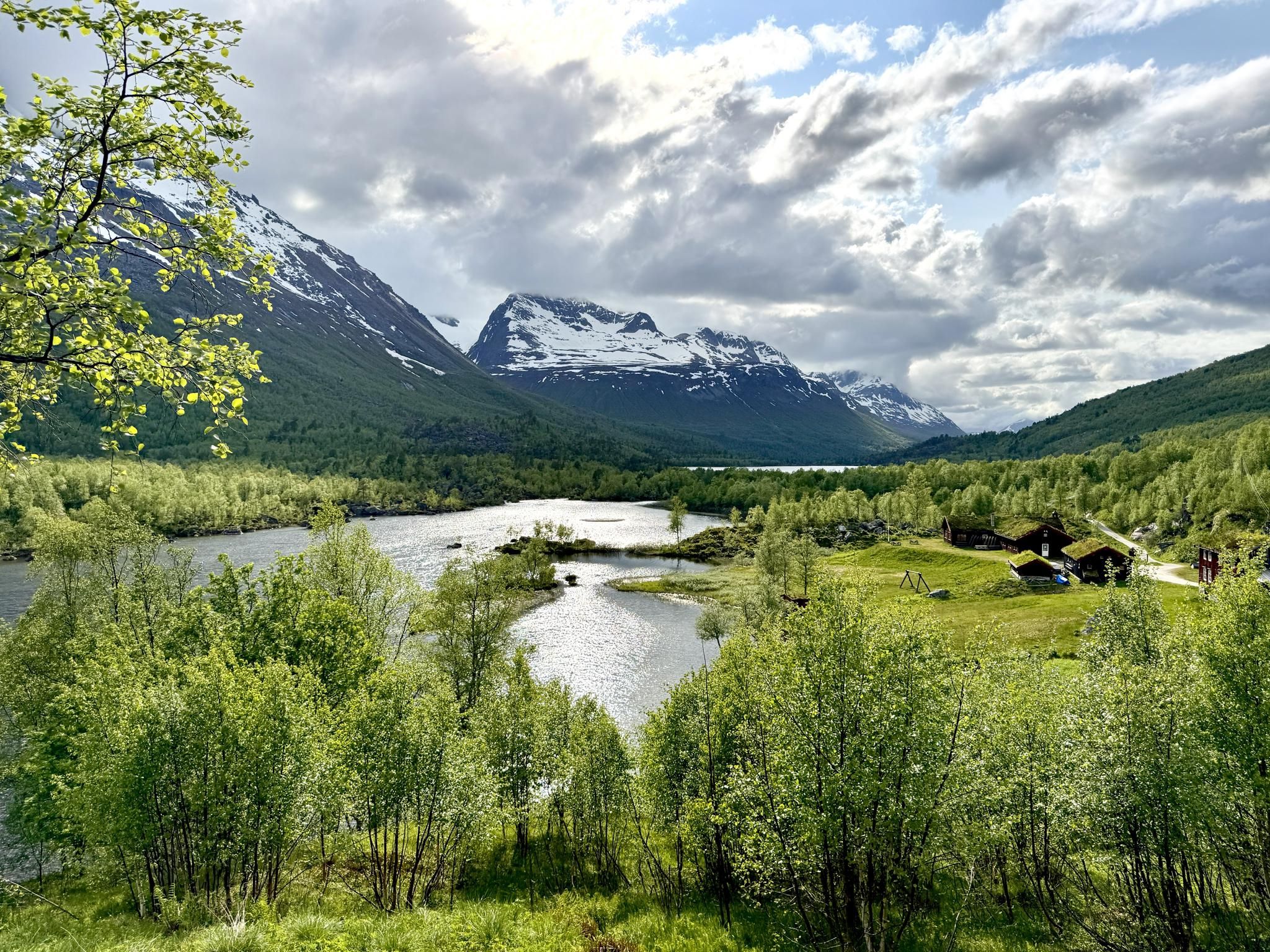
This new bridge takes hikers across Gravbekken on the way to and from Gjevilvasshytta, the oldest DNT hut. From here, the SignaTUR Trollheimen follows the stream all the way to Gjevillvatnet.
1
0

Gjevilvasshytta’s got that old-school charm – basic rooms, big views, and loads of character.
0
0
A well-built bridge that allows you to cross the river without getting wet.
0
0

Above the sandy beach (highly recommended) the tour begins or ends between Gjevilvasshytta and Trollheimshytta
0
0
Frequently Asked Questions
How many bus-accessible hiking trails are there in Gjørdøldalen?
Currently, there are three distinct hiking trails in Gjørdøldalen that are easily accessible directly from bus stations, allowing for car-free adventures in the region.
Are there easy hiking options available from bus stations in Gjørdøldalen?
Yes, Gjørdøldalen offers two easy hiking routes accessible by bus. For a pleasant short walk, consider the DNT Gjevilvasshytta loop from Rolvsjordsætra, which is 4.2 km long. Another accessible option is the DNT Gjevilvasshytta – Path along the Gravbekken loop from Rolvsjordsætra, covering 4.7 km.
Can I find challenging hikes accessible by bus in Gjørdøldalen?
For those seeking a more demanding experience, there is one difficult route available from a bus station: the DNT Gjevilvasshytta – Gravbekken Bridge loop from Rolvsjordsætra. This trail spans nearly 20 km with significant elevation changes, offering a rewarding challenge.
Are there any circular routes starting from bus stops in Gjørdøldalen?
Yes, all three of the bus-accessible routes in Gjørdøldalen are designed as loops, allowing you to start and finish your hike at the same point without needing to arrange return transport from a different location.
What kind of landscapes can I expect on these bus-accessible trails?
The trails in Gjørdøldalen traverse a diverse landscape characteristic of the Trollheimen mountain range. You can expect to encounter ancient woodlands, lush river valleys, and potentially views towards crystal-clear mountain lakes and dramatic peaks that define this region shaped by glacial activity.
Is Gjørdøldalen suitable for family-friendly hikes from bus stations?
Absolutely. The two easy loop routes, the DNT Gjevilvasshytta loop (4.2 km) and the DNT Gjevilvasshytta – Path along the Gravbekken loop (4.7 km), are excellent choices for families. They offer manageable distances and gentle terrain, perfect for enjoying nature together.
What is the best time of year to hike in Gjørdøldalen?
The best time for hiking in Gjørdøldalen, like much of the Trollheimen region, is typically during the summer months, from late June to early September. During this period, the weather is generally milder, and the trails are free of snow, making for optimal hiking conditions.
Are there any notable landmarks or points of interest along these trails?
While specific highlights are not detailed for these routes, Gjørdøldalen is part of the historically rich Trollheimen Triangle. Hikers often experience charming turf-roofed cottages, storybook bridges, and luxuriant meadows along the Svartåa River, especially on the lower-level valley walks.
What do other hikers enjoy most about hiking in Gjørdøldalen?
The area is highly rated by the komoot community, with an average score of 4.4 stars. Reviewers often praise the serene natural beauty, the well-integrated trail network, and the opportunity to experience the diverse landscapes of the Trollheimen region.
Are there any accommodations or places to eat near the bus-accessible trails?
Gjørdøldalen is a key segment of the Trollheimen Triangle, which connects historic mountain huts like Gjevilvasshytta. While specific cafes or pubs directly at bus stops are not listed, the presence of such huts and a campsite near the valley's headwaters indicates opportunities for overnight stays and basic provisions within the broader hiking area.

Get inspired with the komoot mobile app


Explore more
Browse the best Hikes in other regions.
