The best walks and hikes around Ridgeley
11
hikers
5
hikes
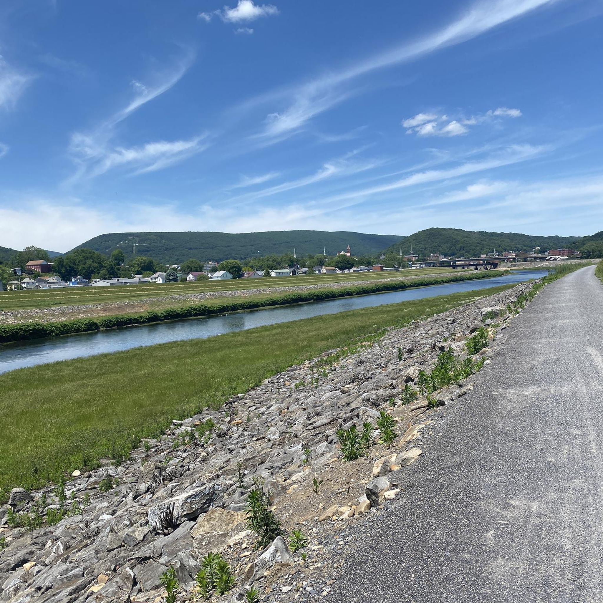
Hiking around Ridgeley, West Virginia, offers diverse trails through mountainous terrain and forests, characteristic of the Appalachian landscape. The region features elevation changes and woodlands, providing a natural setting for exploration. Proximity to the North Branch of the Potomac River means some trails offer waterside views. The area also includes historic pathways like the C&O Canal Towpath, connecting to other trails and landmarks.
Best hiking trails around Ridgeley
- The most popular hiking route is Great Allegheny Passage: Cumberland to Frostburg, a 24.1 miles (39 km) trail that takes 10 hours 29 minutes to complete. This difficult trail features significant elevation gain through varied landscapes.
- Another top favourite among local hikers is C&O Canal Trail: Cumberland to North Branch, a moderate 9.4 miles (15 km) path. This route follows the historic C&O Canal, offering scenic waterside views.
- Local hikers also love the Knobley Tunnel Trail loop from Cumberland, a 3.8 miles (6 km) trail leading through a historic tunnel and over a river, often completed in about 1 hour 33 minutes.
- Hiking around Ridgeley is defined by mountainous terrain, dense forests, and riverine paths along the Potomac. The network offers options for different ability levels, from easy loops to challenging long-distance trails.
- The guide includes highly-rated routes that showcase the best of the region's landscape. More than 10 hikers have used komoot to explore Ridgeley's varied terrain.
Last updated: July 26, 2026
1
hikers
38.9km
10:29
680m
210m
Hard hike. Very good fitness required. Easily-accessible paths. Suitable for all skill levels.
4.58km
01:13
50m
40m
Easy hike. Great for any fitness level. Easily-accessible paths. Suitable for all skill levels.

Sign up for free
15.2km
03:51
20m
40m
Moderate hike. Good fitness required. Easily-accessible paths. Suitable for all skill levels.
5
hikers
4.58km
01:15
70m
70m
Easy hike. Great for any fitness level. Easily-accessible paths. Suitable for all skill levels.
5
hikers
6.15km
01:34
10m
10m
Easy hike. Great for any fitness level. Easily-accessible paths. Suitable for all skill levels.
Our route recommendations are based on thousands of hikes, rides, and runs completed by other people on komoot.
Start today with a free account
Your next adventure awaits.
Login or Signup
Popular around Ridgeley

Tips from the Community

One of my favorites! Mostly flat and easy with some slightly uphill sections. Family friendly with wi-fi connectivity, food resupply and lodging/camping available (not too many options as the C&O is offering.... just plan ahead)
0
0

The Knobley Tunnel Trail, also known as the Carpendale Trail, is a short but scenic rail-trail spanning only 0.8 miles. Bikers can check out the 1,500-foot tunnel through Knobley Mountain and a 386-foot wooden bridge over the North Branch of the Potomac River. The Knobley Tunnel Trail connects directly to the C&O Canal Towpath near mile marker 183, and is not always open, so check for posted signage.
1
0
The Mason-Dixon Line Monument marks the historic boundary between the states of Maryland and Pennsylvania. Today, it is a scenic rest stop for hikers, featuring a granite obelisk, engraved blocks spelling "Mason & Dixon," and a replica of the surveyors' 66-foot chain. It is a great photo opportunity and Easily a must-see for history buffs.
1
0
The Western Maryland Scenic Railroad crosses two historic girder bridges built by the Cumberland & Pennsylvania Railroad. Now part of the scenic route traveled by the Frostburg Flyer, these bridges show off iconic views of steam locomotives climbing the final stretch into town, which are popular among train photographers.
0
0

The official Mile 0 of the Great Allegheny Passage is found in downtown Cumberland under the arch, next to the train station and connected to the northern terminus of the C&O Canal and Towpath. The town is well-connected, with Amtrak service and ample overnight parking.
0
0
The Brush Tunnel is a 911-foot-long tunnel along the GAP that takes you through the Allegheny Mountains. The tunnel was constructed in 1911 by the Western Maryland and there is still an active train line that runs through it.
1
0
Helmstetter’s Curve is one of the most notable sections of the GAP. Located between Cumberland and Frostburg, the curve was built to help ease the gradients for trains trying to get up the steep slope. Now, it is a popular spot along the GAP for the great views it gives you as you gradually ascend the hills.
0
0
The Brush Tunnel is a 911-foot-long tunnel along the GAP that takes you through the Allegheny Mountains. The tunnel was constructed in 1911 by the Western Maryland and there is still an active train line that runs through it.
0
0
Frequently Asked Questions
How many hiking trails are available around Ridgeley?
Our collection features 5 diverse hiking trails around Ridgeley. These include 3 easy routes, 1 moderate trail, and 1 challenging option, ensuring there's something for every skill level.
Are there easy hiking trails suitable for beginners or families near Ridgeley?
Yes, Ridgeley offers several easy hiking options perfect for beginners or families. For a pleasant outing, consider the Bishop Walsh to Cumberland Overlook, which is just over 4.5 km long. Another great choice is the Helmstetter’s Curve – Brush Tunnel loop from La Vale, offering a scenic loop experience.
What are some challenging hikes in the Ridgeley area?
For those seeking a more demanding adventure, the Great Allegheny Passage: Cumberland to Frostburg route is classified as difficult. This extensive trail covers nearly 39 km and features significant elevation gain, providing a true test of endurance amidst the Appalachian landscape.
Can I bring my dog on the trails around Ridgeley?
Many trails in the Ridgeley area are dog-friendly, allowing you to enjoy the outdoors with your canine companion. While specific regulations can vary, the region is generally welcoming to leashed dogs. Always check local signage for any specific rules or restrictions on individual trails.
Are there any circular hiking routes near Ridgeley?
Absolutely! You can enjoy several circular routes. The Helmstetter’s Curve – Brush Tunnel loop from La Vale is a great option, as is the Knobley Tunnel Trail loop from Cumberland. These loops offer convenient starting and ending points, bringing you back to where you began.
What interesting landmarks or viewpoints can I discover on hikes near Ridgeley?
The Ridgeley area is rich with historical and natural points of interest. You can explore the historic Helmstetter’s Curve, a significant railway landmark, or visit the Great Allegheny Passage KM 0 and C&O Canal Towpath Northern Terminus. The unique Knobley Tunnel Trail itself is a highlight, featuring a tunnel and a bridge over the North Branch of the Potomac River.
Are there trails that feature rivers or other water bodies?
Yes, Ridgeley's proximity to the North Branch of the Potomac River and the C&O Canal means many trails offer scenic waterside views. The C&O Canal Trail: Cumberland to North Branch is an excellent example, running alongside the historic canal and providing a unique experience.
What is the best time of year to go hiking around Ridgeley?
The Ridgeley area offers great hiking opportunities throughout much of the year. Spring brings lush greenery and comfortable temperatures, while autumn showcases stunning fall foliage. Summer is also popular, though it can be warmer. Winter hiking is possible, but trails may be icy or snowy, requiring appropriate gear.
How long do hikes in the Ridgeley area typically take?
Hike durations vary significantly depending on the trail's length and your pace. Our routes range from shorter walks like the Bishop Walsh to Cumberland Overlook (around 1 hour 15 minutes) to much longer, more challenging treks such as the Great Allegheny Passage: Cumberland to Frostburg, which can take over 10 hours.
Is parking available at the trailheads?
While specific parking details for each trailhead are not always listed, many popular hiking areas and trail access points around Ridgeley, especially those connected to the C&O Canal Towpath or state parks, typically offer designated parking facilities. It's advisable to check local resources or maps for specific parking locations before your hike.
Are there any trails with significant elevation changes for a good workout?
Yes, the mountainous terrain around Ridgeley provides trails with notable elevation gains. The Great Allegheny Passage: Cumberland to Frostburg, for instance, features an ascent of over 678 meters, offering a substantial workout and rewarding views as you climb through the Appalachian landscape.
Most popular routes around Ridgeley
Most popular attractions around Ridgeley

Get inspired with the komoot mobile app


Explore more
Browse the best Hikes in other regions.
