The best walks and hikes in Laurel County
9
hikers
10
hikes
Hiking trails in Laurel County, Kentucky, are primarily situated within the Daniel Boone National Forest, offering diverse landscapes for outdoor exploration. The region features dense forest settings, significant waterways like Laurel River Lake, and notable geological formations including waterfalls and natural arches. The terrain varies from gentle paths along rivers to more challenging routes through hills and valleys, providing a range of experiences for hikers.
Best hiking trails in Laurel County
- The most popular hiking route is Whitley Branch Veterans Park Trail, a 2.2 miles (3.5 km) trail that takes 54 minutes to complete. This easy path offers a straightforward walk through a park setting.
- Another top favourite among local hikers is Van Hook Falls and Cane Creek Valley, an easy 2.4 miles (3.9 km) path. This route features a prominent waterfall and follows a scenic creek valley.
- Local hikers also love the Sheltowee Trace NRT: Section 26 "Laurel Lake", a 12.7 miles (20.4 km) trail leading through the Daniel Boone National Forest with views of Laurel River Lake, often completed in about 5 hours 25 minutes.
- Hiking in Laurel County is defined by dense forests, impressive waterfalls, and unique rock formations. The network offers options for different ability levels, from easy strolls to difficult long-distance trails.
- The guide includes highly-rated routes that showcase the best of the region's landscape.
Last updated: July 21, 2026
4
hikers
3.50km
00:54
20m
20m
Embark on an easy hike along the Whitley Branch Veterans Park Trail, a well-maintained path spanning 2.2 miles (3.5 km). You will experience a gentle elevation gain of 70 feet (21 metres), making this route perfect for a relaxed outing that takes about 54 minutes. The trail offers a pleasant mix of shaded wooded areas and open spaces as it winds through the park, crossing charming bridges over Whitley Branch and offering views of the natural stream. Keep an eye out for a historic tree that predates the United States, adding a unique touch to your walk.
Planning your visit to Whitley Branch Veterans Park Trail is straightforward, as parking is readily available for easy access. The park is handicap accessible, ensuring everyone can enjoy the outdoors. You will find ample amenities on site, including convenient restroom facilities and refreshing water fountains. This trail is also very family-friendly and dog-friendly, so feel free to bring your loved ones, including your furry companions, for a pleasant day out.
This trail stands out for its blend of natural beauty and historical significance within the London, Kentucky area. Beyond the scenic bridges and natural stream views, the presence of a historic tree offers a unique connection to the past. It provides a serene escape and a chance to enjoy nature without venturing far from urban conveniences, making it a notable destination for local outdoor enthusiasts.
3
hikers
20.4km
05:26
200m
240m
Embark on a difficult hike along Sheltowee Trace NRT: Section 26 "Laurel Lake", a route that spans 12.7 miles (20.4 km) and climbs 644 feet (196 metres). This challenging journey through the Daniel Boone National Forest takes about 5 hours and 25 minutes. You will encounter rugged terrain as the path winds along the pristine, emerald green waters of Laurel River Lake. The dramatic cliff-lined shores offer a constant scenic backdrop, making for a demanding yet rewarding outdoor experience. Expect a true wilderness feel on this section of the Sheltowee Trace. You will be immersed in nature from start to finish. This trail is best suited for experienced hikers looking for a significant physical challenge.
Before you head out, make sure to check the Komoot tour page for specific details regarding trailhead access and parking. It is always wise to review current conditions, especially concerning weather and any potential trail closures within the Daniel Boone National Forest. Pack enough water and snacks for the full duration, as amenities are not available along the route. Starting early in the day is recommended to allow ample time to complete the hike before dusk, especially given its difficult rating and estimated duration. Always inform someone of your hiking plans.
This particular section of the Sheltowee Trace National Recreation Trail stands out for its intimate connection with Laurel River Lake. The trail's path closely follows the lake's edge, providing continuous views of its clear waters and the surrounding forest. It is part of a much longer trail system, but this segment offers a concentrated experience of the region's natural beauty. The ruggedness of the terrain is a defining characteristic, reflecting the wild nature of the Daniel Boone National Forest. This route is a prime example of the challenging and scenic hiking opportunities available in this part of Kentucky.

Sign up for free
3.92km
01:03
20m
100m
Step into a world of natural wonder on the Van Hook Falls and Cane Creek Valley trail, where the air hums with the sound of falling water and ancient rock formations rise around you. This easy 2.4-mile (3.9 km) hike, taking about 1 hour and 3 minutes with only 71 feet (22 metres) of elevation gain, guides you through a lush, forested valley. You'll discover numerous smaller waterfalls and cascades along Cane Creek, culminating in the impressive 40-foot Van Hook Falls, dramatically set within a sandstone recess. It's a truly picturesque journey for all skill levels.
Planning your visit is straightforward, though timing is key to fully appreciate the area's beauty. The trail is best used from March to October, offering vibrant foliage and optimal water flow for the falls. Dogs are permitted on a leash, making it a great family-friendly outing. While specific parking information isn't detailed, arriving early is always a good strategy to ensure a spot and a peaceful experience on this popular route.
This trail is a standout in Kentucky's Daniel Boone National Forest, celebrated for its striking geological formations and abundant water features. It's a segment of the longer Sheltowee Trace National Recreational Trail, offering a taste of its rugged beauty. The Cane Creek Gorge section, with its dynamic waterways and rock formations, is particularly notable, often compared to more famous national parks. It's recognized as one of the best kid-friendly hikes in Kentucky, providing a rich experience for families and day hikers.
2.76km
00:46
10m
120m
Embark on the Hawk Creek Valley Suspension Bridge Trail for a moderate hike that takes you through varied landscapes. You will traverse dry sandy ridges and lush sections, which burst with wildflowers during the right season. The highlight of this 1.7-mile (2.8 km) route is the impressive 100-foot suspension bridge spanning Hawk Creek. As you cross, you can feel it sway gently, offering unique perspectives of the valley below. This trail involves a gentle 32 feet (10 metres) of elevation gain and typically takes about 45 minutes to complete, making it a perfect short adventure.
Planning your visit to the Hawk Creek Valley Suspension Bridge Trail is straightforward. The trailhead offers generally available parking, making it easy to start your adventure. This route is accessible year-round, so you can enjoy its beauty in any season. Hikers are welcome, and you can also bring your leashed dogs along for the journey. Before you head out, always remember to check local conditions, especially if you are visiting during times of changing weather, to ensure a safe and enjoyable experience.
The Hawk Creek Valley Suspension Bridge Trail is nestled within the expansive Daniel Boone National Forest, offering a glimpse into its rich natural environment. As you explore, keep an eye out for rainbow trout swimming in Hawk Creek below the suspension bridge. The trail's diverse ecosystem also supports various other wildlife, adding to the distinctive outdoor experience. This route stands out as an accessible way to enjoy the forest's beauty and its unique engineering marvel.
22.6km
06:10
320m
370m
The Sheltowee Trace NRT Section 27 "Moonbow" offers a rugged and immersive hiking experience along the Cumberland River, characterized by its singletrack path winding through dense forests and over majestic hills. You'll encounter dramatic cliffs, bluffs, and numerous small stream crossings, with some sections featuring stone steps built by the Civilian Conservation Corps. The terrain is consistently challenging, making it ideal for hikers who appreciate a strenuous workout amidst captivating natural beauty.
Planning your trip requires preparation for this difficult route, which covers 14.0 miles (22.6 km) with 1059 feet (323 metres) of elevation gain, typically taking around 6 hours and 9 minutes. Parking is usually straightforward, and the trail sees lighter traffic compared to other popular routes. Remember that there are few easy exit points once you're on the trail, so assess your stamina before you set out. Dogs are welcome, provided they remain on a leash.
This section is most famous for its proximity to Cumberland Falls, often called the "Niagara of the South," a truly impressive waterfall. It's one of the only places in the Western Hemisphere where you can consistently observe a "moonbow," a lunar rainbow visible during a full moon. Another significant landmark along the way is Dog Slaughter Falls, adding to the trail's unique natural features and making it a standout choice for those seeking a memorable Kentucky adventure.
1.03km
00:17
20m
0m
Embark on the Boone Trace Trail for an easy hiking experience through a pleasant forest setting. This short route covers 0.6 miles (1.0 km) and involves a gentle elevation gain of 62 feet (19 metres), making it perfect for a quick outdoor escape. You will encounter a fun climb up steps and a slight hill near the entrance, adding a touch of variety to the terrain as you immerse yourself in nature. Expect a well-labeled path that is easy to navigate, offering a serene atmosphere for your walk.
Planning your visit to the Boone Trace Trail is straightforward, as it is accessible year-round within Levi Jackson Wilderness Road Park. You will find convenient parking and clear access points readily available at the park. This trail is an excellent choice if you are looking for a family-friendly outing or if you wish to bring your dog along, provided they remain on a leash throughout your hike. Its short duration of approximately 16 minutes makes it ideal for fitting into a busy schedule.
The Boone Trace Trail holds historical significance as part of the original route Daniel Boone blazed through the Cumberland Gap into Kentucky. While you hike, you are walking a path that played a crucial role in early American westward expansion. This trail offers a unique blend of natural beauty and historical context, providing more than just a simple walk. It is a notable feature within Levi Jackson Wilderness Road Park, inviting you to connect with both nature and history.
874m
00:15
0m
70m
The Pine Creek Falls Trail offers an incredibly accessible and rewarding experience, leading you through a beautiful lodgepole forest alongside the serene Pine Creek. The highlight is undoubtedly the majestic 100-foot, multi-tiered Pine Creek Falls, which cascades gracefully and can be admired from a bridge at its base. You'll find clear pools and interesting rock formations, all framed by distant views of the Absaroka Mountains, making for a picturesque journey.
This easy 0.5-mile (0.9 km) hike involves virtually no elevation gain (0 feet / 0 metres) and takes only about 15 minutes, making it an ideal choice for families and beginner hikers. It's a popular and family-friendly destination within the Custer Gallatin National Forest, providing a quick burst of Montana beauty. The trail is also dog-friendly, offering ample shade and natural water sources for pets.
While the path to the falls is easy, be aware that the trail continues another four miles to Pine Creek Lake, which is a significantly more strenuous undertaking with around 3,000 feet of elevation gain. This trail is a beloved hike in the Livingston area of Paradise Valley, known for its accessibility and rewarding scenery throughout the year. Remember to be mindful of local wildlife, including bears, in the area.
1.31km
00:22
30m
30m
Embark on an easy hike along the Laurel Bridge Trail, a short 0.8-mile (1.3 km) route that takes about 22 minutes to complete. You will experience a gentle elevation gain of 85 feet (26 metres) as you navigate varied terrain, including leaf-covered paths and sections with stairs. Keep an eye out for the distinctive "3 Sisters Rock" and a scenic lookout point offering views of a nearby bridge.
Planning your visit is straightforward, as the Laurel Bridge Recreation Area provides ample parking. You will also find amenities like seasonal bathrooms and a shelter, making it a convenient spot to start your adventure. The trails are clearly marked, ensuring an easy and enjoyable navigation experience for everyone.
This trail offers a wonderful opportunity to explore a diverse landscape within the Daniel Boone National Forest. You can access a rocky "beach" area by the lake, perfect for a brief stop to enjoy the water. The route's varied character, from inclines to declines and unique rock formations, makes it a notable and accessible option in the region.
818m
00:12
0m
0m
Embark on an easy hike along the Boone Trace Loop, a short 0.5-mile (0.8 km) path that takes only about 12 minutes to complete. You'll find yourself surrounded by a beautiful forest, with a minimal elevation gain of just 4 feet (1 metres). Keep an eye out for the distinctive 'wolf trees,' ancient, open-canopied trees that hint at the area's past. A small segment near a creek is thought to be part of the historic Boone Trace itself, offering a unique connection to history as you stroll.
This loop is accessible year-round, making it a convenient option no matter the season. You can easily find parking at Levi Jackson Wilderness Road Park, where the trail starts with a short climb up some steps. Dogs are welcome to join you on the route, but please ensure they remain on a leash throughout your visit.
The Boone Trace Loop is nestled within Levi Jackson Wilderness Road Park, a location rich in historical significance. This area is believed to contain a genuine piece of the original Boone Trace, a path integral to early American frontier history. Hiking here offers a tangible link to the past, allowing you to walk in the footsteps of pioneers.
2
hikers
3.22km
00:53
50m
50m
Embark on an easy hike along the Wildcat Trail, a pleasant journey through the natural beauty of Daniel Boone National Forest. This route covers 2.0 miles (3.2 km) with a gentle elevation gain of 152 feet (46 metres), making it perfect for a quick outdoor escape. You can expect to complete the trail in about 52 minutes, enjoying a peaceful walk that leads you towards the historic Camp Wildcat Battlefield.
Planning your visit to the Wildcat Trail is straightforward and convenient. The trailhead is easily accessible, and you will find parking readily available at the starting point. This makes the route an excellent choice for a spontaneous outing, allowing you to quickly immerse yourself in the forest environment without any hassle.
The Wildcat Trail offers more than just a walk; it provides a glimpse into a significant historical site within Daniel Boone National Forest. As you hike, you'll approach the area of the Camp Wildcat Battlefield, connecting you to the past. The trail also links to the wider network, including the Hoosier Knob Trail, showcasing the diverse outdoor opportunities in this region.
Our route recommendations are based on thousands of hikes, rides, and runs completed by other people on komoot.
Start today with a free account
Your next adventure awaits.
Login or Signup



Tips from the Community

Known as the “Niagara of the South,” Cumberland Falls is a must-see with its powerful 70-foot drop. The state park also features other waterfalls like Eagle Falls, and during a full moon, it's one of the few places in the world where you can witness a rare moonbow. Easy trails lead to great viewpoints, and the surrounding park offers plenty of quiet spots by the river. Best visited after heavy rain for peak flow. Cumberland Falls Campground is a solid choice for camping, with prices starting at $22 per night. Other campground options are also available nearby if you prefer something different.
0
0
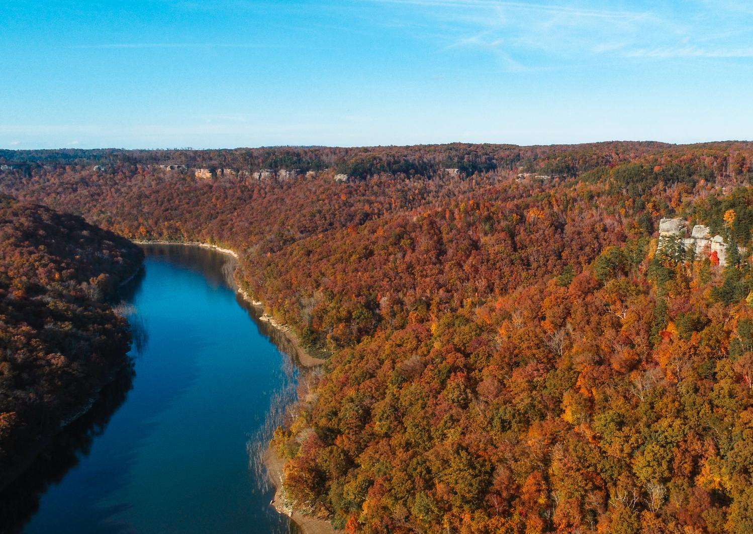
Laurel River Lake is nestled within the Daniel Boone National Forest, with trees lining the edges of the water. Here you can enjoy swimming, boating, and fishing. The Sheltowee Trace Trail runs near the lake, and there are also side trails like the 2.9-mile Laurel River Lake Trail. If you want to spend the night, Holly Bay Campground is a solid option, with sites starting at $29 per night.
0
0

Beautiful scenery and seasonal foliage contrast with the bloody history of the American Civil War here, where the Union Army secured its first victory of the war against the Confederate Army in October of 1861. Hoosier Knob and Infantry Ridge Trails lead from Camp Wildcat and offer glimpses of still-remaining trenches and other history in situ.
0
0
Wildcat Trail leads to Hoosier Knob Trail, and along both you'll find dramatic seasonal foliage, ample historical plaques that describe the battle and its historical context—even how the area's geology affected the battle's strategy and tactics. The highpoint of the trail affords a short loop to break up the pure out-and-back hike.
0
0
Frequently Asked Questions
How many hiking trails are available in Laurel County?
Laurel County offers a diverse selection of 10 hiking routes, catering to various skill levels and interests. You'll find everything from short, easy strolls to more challenging, longer treks through the beautiful landscapes of the Daniel Boone National Forest.
Are there easy hiking trails suitable for beginners in Laurel County?
Yes, Laurel County is very welcoming for beginners and casual hikers, with 7 easy routes available. A great option is the Whitley Branch Veterans Park Trail, which offers a gentle walk with minimal elevation gain. Another accessible choice is the Boone Trace Trail, perfect for a short, historical walk.
Can I find trails with waterfalls in Laurel County?
Absolutely! Laurel County is home to several impressive waterfalls. The Van Hook Falls and Cane Creek Valley trail leads to the significant Vanhook Falls. While just outside the county, Cumberland Falls, known as the "Niagara of the South," is also easily accessible and a popular destination for waterfall enthusiasts.
Are there any family-friendly hiking options in Laurel County?
Many of Laurel County's trails are suitable for families. The easy routes, such as the Laurel Bridge Trail, are ideal for outings with children. These trails often feature gentle terrain and offer opportunities to explore nature together without being overly strenuous.
What kind of natural features can I expect to see on hikes in Laurel County?
Laurel County's trails showcase a rich variety of natural beauty. You'll encounter dense forests, especially within the Daniel Boone National Forest, serene waterways like Laurel River Lake, and unique geological formations such as natural arches. The region is also known for its vibrant wildflowers in season.
Are there any long-distance or challenging hikes in the area?
Yes, for those seeking a challenge, Laurel County offers more demanding routes. Sections of the Sheltowee Trace National Recreational Trail, such as Sheltowee Trace NRT Section 27 "Moonbow", provide extensive hiking opportunities with significant elevation changes, making them suitable for experienced hikers.
Are dogs allowed on hiking trails in Laurel County?
Most trails within the Daniel Boone National Forest and other public lands in Laurel County are dog-friendly, provided your pet is on a leash. Always check specific trail regulations before heading out. The Wildcat Trail is a great option for a walk with your canine companion.
What are some notable landmarks or attractions near the hiking trails?
Beyond the trails themselves, Laurel County offers several points of interest. You can explore Laurel River Lake, visit the historic Camp Wildcat Battlefield, or discover the Old Wilderness Road. These attractions provide additional context and beauty to your hiking experience.
Are there any circular hiking routes in Laurel County?
Yes, for those who prefer not to retrace their steps, there are circular routes available. The Boone Trace Loop is a good example of a shorter, easy loop trail that allows you to experience different scenery throughout your walk.
Is parking readily available at trailheads in Laurel County?
Parking is generally available at most major trailheads within Laurel County, especially those in the Daniel Boone National Forest. Specific parking information can often be found on signage at the trail entrances or by checking local visitor resources like Visit London KY.
What is the best time of year to go hiking in Laurel County?
Spring and fall are generally considered the best times for hiking in Laurel County. Spring brings lush greenery and blooming wildflowers, while fall offers spectacular foliage. Summer can be warm and humid, but shaded forest trails provide relief. Winter hiking is also possible, with a different kind of quiet beauty, though some trails may be slick.
Are there any trails that offer scenic viewpoints or overlooks?
Many trails in Laurel County, particularly those traversing the varied topography of the Daniel Boone National Forest, offer scenic viewpoints. While specific named overlooks are less common, you'll find numerous spots along routes like the Sheltowee Trace NRT: Section 26 "Laurel Lake" that provide beautiful vistas of the surrounding forests and waterways.
Most popular routes in Laurel County
Most popular attractions in Laurel County

Get inspired with the komoot mobile app


Explore more
Browse the best Hikes in other regions.
