Attractions and Places To See in Lake Superior Provincial Park - Top 4
Best attractions and places to see in Lake Superior Provincial Park include a vast wilderness area in Ontario, Canada, known for its dramatic landscapes and rich cultural heritage. The park features a rugged Lake Superior coastline, towering cliffs, numerous inland water bodies, and diverse ecosystems. It offers a mix of accessible and remote natural features, alongside significant Indigenous cultural sites. This destination provides opportunities for exploring natural beauty and historical significance.
Best attractions and places to see in Lake Superior Provincial Park
- The most popular attractions is Agawa Rock Pictographs, a historical_site that features 35 red-ochre paintings on towering granite cliffs by Anishinaabe artists. This sacred site depicts canoes, animals, and war expeditions, with some paintings dating back to at least the 17th century.
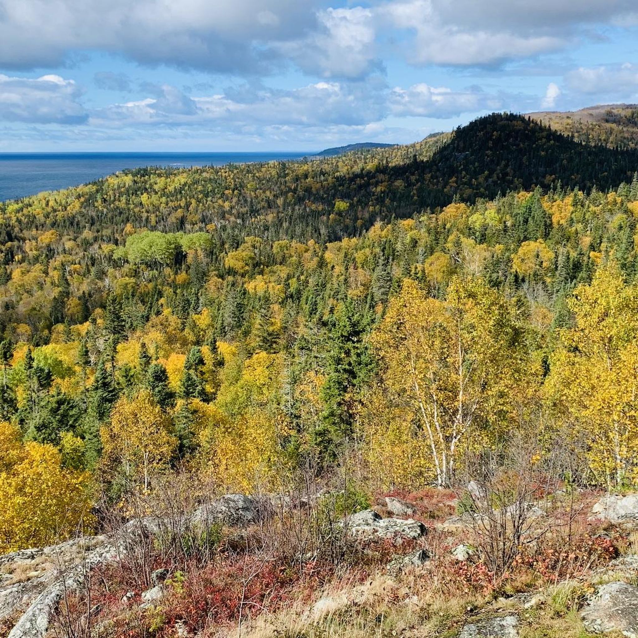
- Another must-see spot is Awausee Trail, a challenging trail with four viewpoints atop Agawa Mountain. This loop hike provides panoramic views across Lake Superior.
- Visitors also love Lake Superior Provincial Park, a natural area covering more than 160,000 hectares along the rugged Lake Superior shoreline. Established in 1944, the park is renowned for its dramatic cliffs, sandy beaches, waterfalls, and inland lakes.
- Lake Superior Provincial Park is known for its historical sites, diverse trails, and natural monuments. The park offers a variety of attractions to see and explore, from ancient pictographs to expansive viewpoints and rugged coastlines.
- The attractions in Lake Superior Provincial Park are appreciated by the komoot community, with 3 upvotes and 10 photos shared by visitors.
Last updated: October 12, 2026
Agawa Rock Pictographs
Highlight • Historical Site
Although the glyphs are only a short distance from the parking area this is not a hike one should attempt during inclement weather since you need to negotiate a narrow rock shelf right at the water level in order to access the site.
Tip by

Old Woman Bay
Highlight • Beach
Tip by

Sign up now to discover places like this
Get recommendations on the best single tracks, peaks, & plenty of other exciting outdoor places.
Nokomis Trailhead
Highlight • Rest Area
Tip by

Awausee Trail
Highlight (Segment) • Trail
Tip by
Agawa Bay Dark-Sky Preserve
Highlight • Viewpoint
The beach at Agawa Bay Campground serves as the designated viewing area of the Dark-Sky Preserve.
Source: rasc.ca/lpa/lake-superior
During our stay, an expert offered a night sky observation for stargazers on the evening of May 30, 2026. This allows us to see the planets Jupiter and Venus on the horizon with our own eyes.
Showing Translation
Tip by

Sign up for free to discover even more attractions in Lake Superior Provincial Park.
Already have an account?
Start today with a free account
Your next adventure awaits.
Popular around Lake Superior Provincial Park
Tips from the Community

The Nokomis Trail, a loop trail, leads through coniferous trees, first level and later steeply up onto the rocks. At the top there are several viewpoints with views over the bay and the densely wooded valley of the Old Woman River. We are near the highway; traffic noise is almost constantly audible. (Visit on June 2, 2026)
0
0
Old Woman Bay is located in the north of Lake Superior Provincial Park – about 25 kilometers away from the small town of Wawa. Access is via Highway 17 (Trans-Canada Highway), which runs directly past the bay. The South Old Woman River flows into Lake Superior on the sandy beach. The name Old Woman Bay comes from a distinctive rock formation in the bay. Viewed from a distance and from a certain angle, the contours of the rock cliffs form the profile of an old woman's face. The popular Nokomis Trail begins at the parking lot by the bay. (Visit on June 2, 2026)
0
0
The visit to the rock art site is a short walk steeply down to the coast. Everywhere there are signs with warnings indicating the dangerous undertaking. The somewhat steep, walkable rocks are extremely exposed to water; during storms and wet conditions, there is a risk to life. People have died or been injured during visits when they were washed into the water. It looks as if there used to be a walkable platform. However, during our visit on May 31, 2026, none of this is an issue: with calm seas and a bright blue sky, we can view the somewhat faded paintings together. The passage on Highway 17 is closed today; since we have already been in Lake Superior Provincial Park since yesterday and will be staying for a few more days, we are not affected by the road closure.
0
0

Lake Superior Provincial Park was designated a Dark-Sky Preserve in 2018 in partnership by Ontario Parks and the Algoma Astronomers. The nearest source of light pollution is the community of Wawa; it is located 16 km from the northern park boundary. To the south, the city of Sault Ste. Marie is approximately 125 km away. The beach at Agawa Bay Campground serves as the designated viewing area of the Dark-Sky Preserve. Source: https://rasc.ca/lpa/lake-superior During our stay, an expert offered a night sky observation for stargazers on the evening of May 30, 2026. This allows us to see the planets Jupiter and Venus on the horizon with our own eyes.
0
0

The Agawa Rock Pictographs are a collection of 35 red-ochre paintings on the face of Lake Superior's towering granite cliffs. In Ojibwe, the area is known as Mazinaubikinguning, meaning "the adorned rock of Lake Agawa". Although the glyphs are only a short distance from the parking area this is not a hike one should attempt during inclement weather since you need to negotiate a narrow rock shelf right at the water level in order to access the site.
0
0
The Awausee Trail is a great loop hike within Lake Superior Provincial Park, with four excellent viewpoint atop Agawa Mountain that give you panoramic views across Lake Superior. You can hike the trail in either direction but recent weather may determine which way you choose. If the water is high it's recommended to hike clockwise, that way you have a shorter return trip if the river crossing is unsafe. Hiking counter-clockwise means a very steep and rocky ascent in the first few kilometers and a flatter, more relaxing descent at the end of the loop.
0
0

Frequently Asked Questions
What natural landmarks and viewpoints should I visit in Lake Superior Provincial Park?
The park is renowned for its dramatic landscapes. Don't miss the impressive 200-meter high cliffs at Old Woman Bay, offering breathtaking panoramic views of Lake Superior. The Lake Superior Viewpoint, accessible via the Awausee Trail, also provides expansive vistas. You can also explore sandy beaches like those at Agawa Bay and Katherine Cove.
Are there any notable waterfalls in Lake Superior Provincial Park?
Yes, the park features several beautiful waterfalls. Sand River Falls are easily accessible from Highway 17. For a more challenging adventure, the Towab Trail leads to the remote and spectacular Agawa Falls. Till Creek Falls, the tallest in the park, is uniquely accessible by water.
What cultural and historical sites can I explore in the park?
The most significant cultural site is the Agawa Rock Pictographs. These ancient red-ochre paintings by Anishinaabe artists are found on the towering granite cliffs along Lake Superior. It's a sacred site depicting canoes, animals, and war expeditions. Access requires navigating a narrow rock ledge at water level, so check conditions before visiting.
What are the most popular hiking trails in Lake Superior Provincial Park?
Popular trails include the challenging Coastal Hiking Trail, which spans 56 to 60.2 kilometers along the rugged Lake Superior coastline. For spectacular views over Old Woman Bay, the 5-kilometer Nokomis Trail is highly recommended. The Awausee Trail is another great loop hike with four viewpoints atop Agawa Mountain.
Are there easy hiking trails suitable for beginners or families?
Yes, there are several easy trails. The Pinguisibi Trail (Sand River Trail) is an easy 3.5-kilometer out-and-back route that follows the Sand River to scenic waterfalls. For more options, you can find family-friendly hikes like the Bathtub Island trail or the Lake Superior Coastal Trail to Katherine Cove in the Family-friendly hikes in Lake Superior Provincial Park guide.
What outdoor activities can I do near the attractions in Lake Superior Provincial Park?
Beyond exploring the attractions, the park offers world-class hiking, paddling, and trout fishing. You can find various hiking routes, from easy to challenging, in guides like Hiking in Lake Superior Provincial Park and Easy hikes in Lake Superior Provincial Park. The park's inland lakes and rivers, such as Mijinemungshing Lake, are popular for canoeing.
When is the best time to visit Lake Superior Provincial Park?
The park is beautiful year-round, but the best time depends on your preferred activities. Summer offers ideal conditions for hiking, paddling, and swimming. Fall brings stunning autumn foliage, particularly with the abundant sugar maples. Spring is great for spotting wildlife and enjoying the fresh bloom, while winter offers opportunities for snowshoeing and cross-country skiing, though some facilities may be closed.
Is Lake Superior Provincial Park good for stargazing?
Absolutely! Lake Superior Provincial Park is a designated Dark Sky Preserve by the Royal Astronomical Society of Canada. This recognition means it offers exceptional opportunities for stargazing and, at times, viewing the Northern Lights, thanks to its minimal light pollution.
Is there a visitor center in Lake Superior Provincial Park?
Yes, the Visitor Centre is located near the Agawa Bay campground. It provides comprehensive exhibits on the park's cultural and natural history, and serves as a hub for weekly programs, guided hikes, and the park's Discovery Program.
Do I need a permit or pay fees to enter Lake Superior Provincial Park?
As a provincial park, a valid park permit is required for entry and to use its facilities, including day-use areas, campgrounds, and backcountry access. You can typically purchase these at the park gates or visitor centers.
Are there any loop trails in Lake Superior Provincial Park?
Yes, the park offers several loop trails. The Awausee Trail is an 8-kilometer loop that provides four distinct viewpoints atop Agawa Mountain. The Orphan Lake Trail is another 8-kilometer loop that explores Orphan Lake and descends to Lake Superior, featuring a picturesque cascade waterfall.
Most popular routes in Lake Superior Provincial Park
Most popular attractions in Lake Superior Provincial Park

Get inspired with the komoot mobile app


Explore more
Still not found the Highlight you’re looking for? See guides of the top attractions in other regions:
