Top 4 Mountain Passes around Bischofstetten
Best mountain passes around Bischofstetten are located within the Mostviertel region of Lower Austria. While Bischofstetten features gently rolling hills, meadows, and forests, the broader Mostviertel transitions into more mountainous terrain to the south. This area offers diverse elevated routes and scenic landscapes, attracting cyclists and outdoor enthusiasts. The region provides opportunities for both moderate and challenging routes with significant elevation gains.
Best mountain passes around Bischofstetten
- The most popular mountain pass is Luftberg Pass, a mountain pass that connects the villages of Kettenreith and Kirchberg an der Pielach. It features manageable altitude differences and moderate inclines, making it popular among local cyclists.
- Another must-see spot is Windschnur Pass Between Traisental and Pielachtal, a mountain pass offering a scenic route between the Traisental and Pielachtal valleys. It includes switchbacks that provide an engaging ride.
- Visitors also love Moarigrabensattel, a mountain pass known for its beautiful and quiet route. On the descent towards Schrambach, it offers viewpoints into the valley.
- Bischofstetten is known for intermediate and challenging mountain passes. The region offers a variety of routes, from those with moderate inclines to more demanding ascents.
- The mountain passes around Bischofstetten are appreciated by the komoot community, with 26 upvotes and 3 photos shared.
Last updated: October 11, 2026
Luftberg Pass
Highlight • Mountain Pass
Together with the neighboring crossings Plankenstein (670 m), Wetterlucke (543 m) and Kohlenberg (437 m), the Luftberg represents the first real hurdle in the (Melk) Alpine foothills. All of these mountain roads lead into the Pielachtal. From here, the 1,000-meter mark can already be overcome with the road via Wastl am Wald (1,110 m).
Above all, north of the Luftberg, the gently hilly Mostviertel stretches out to the Danube. The countless cider pear trees and the mighty square farms in many places are typical of this region. Cyclists who cross this area from the Luftberg can reach the city of Melk with the famous Melk Abbey in less than an hour. Together with the Danube Cycle Path, the UNESCO World Heritage Site Wachau and the neighboring Waldviertel, a varied and very interesting racing bike area opens up to cyclists from the Luftberg.
The Luftberg is particularly popular among local cyclists: First of all, it can be classified as rather easy in terms of the meters in altitude to be covered and the percentage of incline. Secondly, the road with its many curves on the Pielachtal side is very entertaining and interesting to drive - especially downhill: the downhill menu ranges from hairpin bends and curve combinations to a long high-speed curve. The best conditions to hone your cornering technique.
It should not go unmentioned at this point that until 2005 the Uniqa-Classic stage cycle race, which was no longer held, often passed the Luftberg. (From 1953 to 2000 the race was called Vienna-Rabenstein-Gresten-Vienna.) The Luftberg heralded a mostly selective stage final, in which one or the other short climb had to be mastered to the finish in Rabenstein an der Pielach.
Note: If you are looking for the Luftberg on the map, you will most likely not find it, since at the highest point of the road usually only "Wh. zur Luft” or something similar is entered on maps. The "Wh.", which stands for tavern, was closed a few years ago and does not refer to the street crossing.
Translated by Google •
Tip by

Windschnur Pass Between Traisental and Pielachtal
Highlight • Mountain Pass
Translated by Google •
Tip by

Sign up now to discover places like this
Get recommendations on the best single tracks, peaks, & plenty of other exciting outdoor places.
Geiseben Pass
Highlight • Mountain Pass
Translated by Google •
Tip by

Moarigrabensattel
Highlight (Segment) • Mountain Pass
Translated by Google •
Tip by
Goaßbichl – Pass summit with a view of the Ötscher
Highlight • Mountain Pass
Showing Translation
Tip by

Start today with a free account
Your next adventure awaits.

Tips from the Community

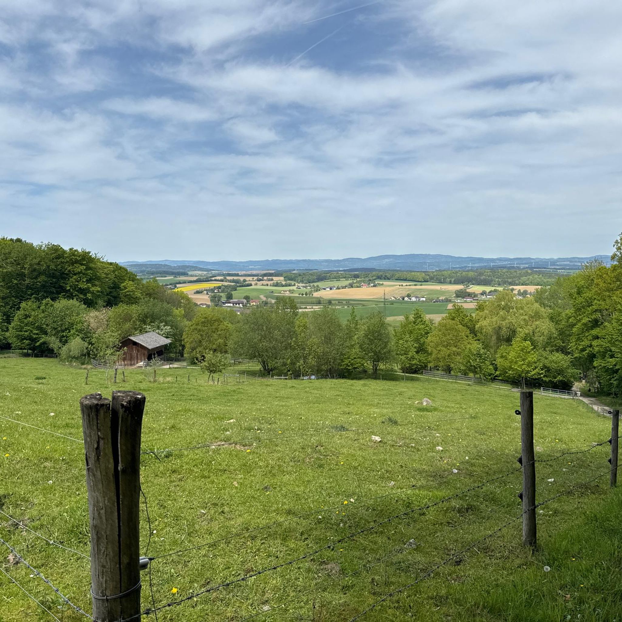
beautiful MTB route with a great view of the Alpine foothills - and the mountain is popularly called "Goaßbichl"!
0
0
scenic route to Tarschberg
0
0
super connection from or to Plambaheck
0
0
Scenically beautiful connection from Rabenstein to Tradigist, but ATTENTION with MTB without power: from Tradigist upwards the last 100m of altitude are with approx. 18% deep gravel! Much more pleasant is the asphalt road from Rabenstein upwards and then down to Tradigist!
0
0
beautiful connection from Kirchberg to the north
0
0


Small hill with a beautiful view, along the route from Kammerhof to Grubtal near Wilhelmsburg and with relatively little general traffic.
0
0

Beautiful and quiet route over the Moarigrabensattel. On the descent towards Schrambach there are a few beautiful viewpoints into the valley.
1
0
Frequently Asked Questions
What are some popular mountain passes for cycling near Bischofstetten?
The Mostviertel region offers several scenic passes popular with cyclists. The Luftberg Pass is particularly well-known for its winding roads and manageable inclines, connecting Kettenreith and Kirchberg an der Pielach. Other notable passes include the Windschnur Pass Between Traisental and Pielachtal and the Geiseben Pass, both offering enjoyable cycling experiences.
Are there any challenging mountain passes for experienced cyclists or mountain bikers?
Yes, for those seeking more challenging terrain, the southern Mostviertel region, particularly around the Ybbstal Alps and Ötscher-Tormäuer Nature Park, offers diverse mountain biking experiences with significant elevation gains. The Goaßbichl – Pass summit with a view of the Ötscher is noted for its challenging ascent, especially the gravel section from Tradigist. Routes like the Laurenzi Route (40 km with 710m elevation) and trails around Göstling also provide demanding ascents.
What kind of views can I expect from the mountain passes in the Mostviertel region?
Many passes in the region offer beautiful panoramic views. For instance, the Moarigrabensattel provides scenic viewpoints into the valley on its descent towards Schrambach. The Goaßbichl offers stunning vistas of the Ötscher mountain. Generally, you can expect expansive views across the gently rolling hills, forests, and farmlands typical of the Mostviertel, transitioning to more dramatic mountainous scenery in the south.
Are there family-friendly options among the mountain passes or nearby elevated routes?
While specific mountain passes might be more geared towards cycling, the broader Mostviertel region offers family-friendly elevated routes. The Krumpe cycle path is known for being family-friendly. Additionally, the Ybbstal Alps and Nature Parks feature easier trails suitable for families, especially in the foothills. The easy hikes around Bischofstetten guide also lists routes with manageable distances and elevation.
What is the best time of year to visit the mountain passes around Bischofstetten?
The best time to visit is generally from spring to autumn (April to October) when the weather is mild and conditions are ideal for cycling, hiking, and enjoying the scenic routes. During these months, the landscapes are lush, and most roads and trails are free of snow and ice. Winter can offer opportunities for snow-related activities, but access to some higher passes might be limited.
Can I find hiking trails near these mountain passes?
Yes, the region around Bischofstetten and the Mostviertel offers numerous hiking opportunities. You can find a variety of trails, from easy walks to more moderate routes. For example, the Easy hikes around Bischofstetten guide and the Hikes from bus stations around Bischofstetten guide provide options for exploring the natural beauty on foot.
Are there options for mountain biking in the Mostviertel region?
Absolutely. The southern Mostviertel, particularly around the Ybbstal Alps and Ötscher-Tormäuer Nature Park, is a prime destination for mountain biking. The region boasts over 80 mountain bike routes, ranging from moderate to demanding alpine ascents around areas like Annaberg, Königsberg, Göstling-Hochkar, and Ötscher. These trails often lead through forests and past meadows to managed huts.
How can I reach these mountain passes, particularly regarding public transport or parking?
Access to many of these passes is primarily by car, with parking available at various points along the routes or in nearby villages. For specific passes like the Luftberg Pass, you would typically drive to the connecting villages like Kettenreith or Kirchberg an der Pielach. While public transport options might be limited directly to the highest points of the passes, local bus services connect many towns in the Mostviertel. For hiking, some routes are accessible from bus stations, as detailed in the Hikes from bus stations around Bischofstetten guide.
Are there any cafes or restaurants near the mountain passes?
While specific cafes might not be directly on every pass summit, the villages and towns surrounding the passes in the Mostviertel region offer various dining options. Many mountain bike trails and scenic routes also lead past managed huts where you can enjoy local delicacies. For example, cycling the Luftberg Pass can lead you towards Melk, which has numerous culinary establishments.
What other outdoor activities can I do near the mountain passes around Bischofstetten?
Beyond cycling and mountain biking, the area offers a wide range of outdoor activities. You can explore numerous running trails, with options listed in the Running Trails around Bischofstetten guide. The Mostviertel is also excellent for general hiking, with guides available for easy hikes and hikes from bus stations. The region's rivers and nature parks also provide opportunities for water sports and nature observation.
Are the mountain passes around Bischofstetten suitable for dog walking?
Generally, the natural trails and roads over the mountain passes in the Mostviertel are suitable for walking with dogs, provided they are kept on a leash, especially in areas with wildlife or livestock. Always ensure your dog is well-behaved and that you clean up after them. It's advisable to check local regulations for specific nature reserves or protected areas.
What is the Panoramahöhenweg and how does it relate to mountain passes?
The Panoramahöhenweg (Panoramic High Road) is a 24-kilometer network of scenic roads in the Mostviertel, averaging 700 meters in elevation, stretching from the Sonntagberg Church to Randegg. While not a traditional mountain pass, it offers a similar experience of traversing elevated, scenic terrain with expansive vistas across the region. It's a great option for a leisurely drive or ride through elevated landscapes.
Most popular routes around Bischofstetten
Most popular attractions around Bischofstetten

Get inspired with the komoot mobile app


Explore more
See even more epic mountain passes by checking out these guides around Bischofstetten:
