Top 12 Natural Monuments around Vilar
Best natural monuments around Vilar are concentrated around the Serra de Montejunto mountain range. This area is characterized by its karst landscape, featuring deep valleys, gravel pits, and lapiás formations that showcase various geological eras. The region also includes significant river systems, such as the Ota River, which carves through the terrain. These natural attractions offer diverse opportunities for exploration.
Best natural monuments around Vilar
- The most popular natural monument is Serra de Montejunto Watchtower, a viewpoint that offers…
Last updated: July 27, 2026
Serra de Montejunto Watchtower
Highlight • Viewpoint
Translated by Google •
Tip by

Gravel Bend
Highlight • Natural Monument
Translated by Google •
Tip by

Sign up now to discover places like this
Get recommendations on the best single tracks, peaks, & plenty of other exciting outdoor places.
Sign up for free
Ota River
Highlight • River
Translated by Google •
Tip by
Windmills of Serra de Montejunto
Highlight • Monument
The trail has small sections with very steep slopes, so the easiest way to do it is …
Translated by Google •
Tip by
Montejunto - Squirrel Trail
Highlight (Segment) • Trail
Translated by Google •
Tip by
Sign up for free to discover even more natural monuments around Vilar.
Sign up for free
Already have an account?
Start today with a free account
Your next adventure awaits.
Login or Signup

Tips from the Community

The area of the springs, on the Ota River, was once a leisure area for the local population, including the local bathing area in the summer. This site remained natural for a long time after the EPAL was installed, but at a certain point, the intensification of agriculture with the use of chemical fertilizers and pesticides, intensive livestock farming, and urban sewage made the flow from upstream a polluting threat to EPAL's water intakes, and EPAL paved several dozen meters of the river course near the site where it is installed with reinforced concrete.
1
0

The Ota River has its source in the Montejunto mountain range. It flows through the Ota area and empties into the Alenquer River, which in turn meets the Tagus River near Vila Nova da Rainha. At this point the river is close to the village of the same name, Ota.
1
0
The Serra de Montejunto Forest Watch Station can be accessed via a pastoral trail from the picnic park. It offers a beautiful panorama of the region north of the Serra.
3
0
I mentioned that on my previous suggestion for this place. There is an alternative to the blackberry vines: a little before you start to find them, turn left to a little footpath that goes between the trees, it is sloping and can be slippery in winter.
2
0

This trail was great fun, but unfortunately blackberry vines have joined the ferns near the end and made the passing a bit complicated.
3
0
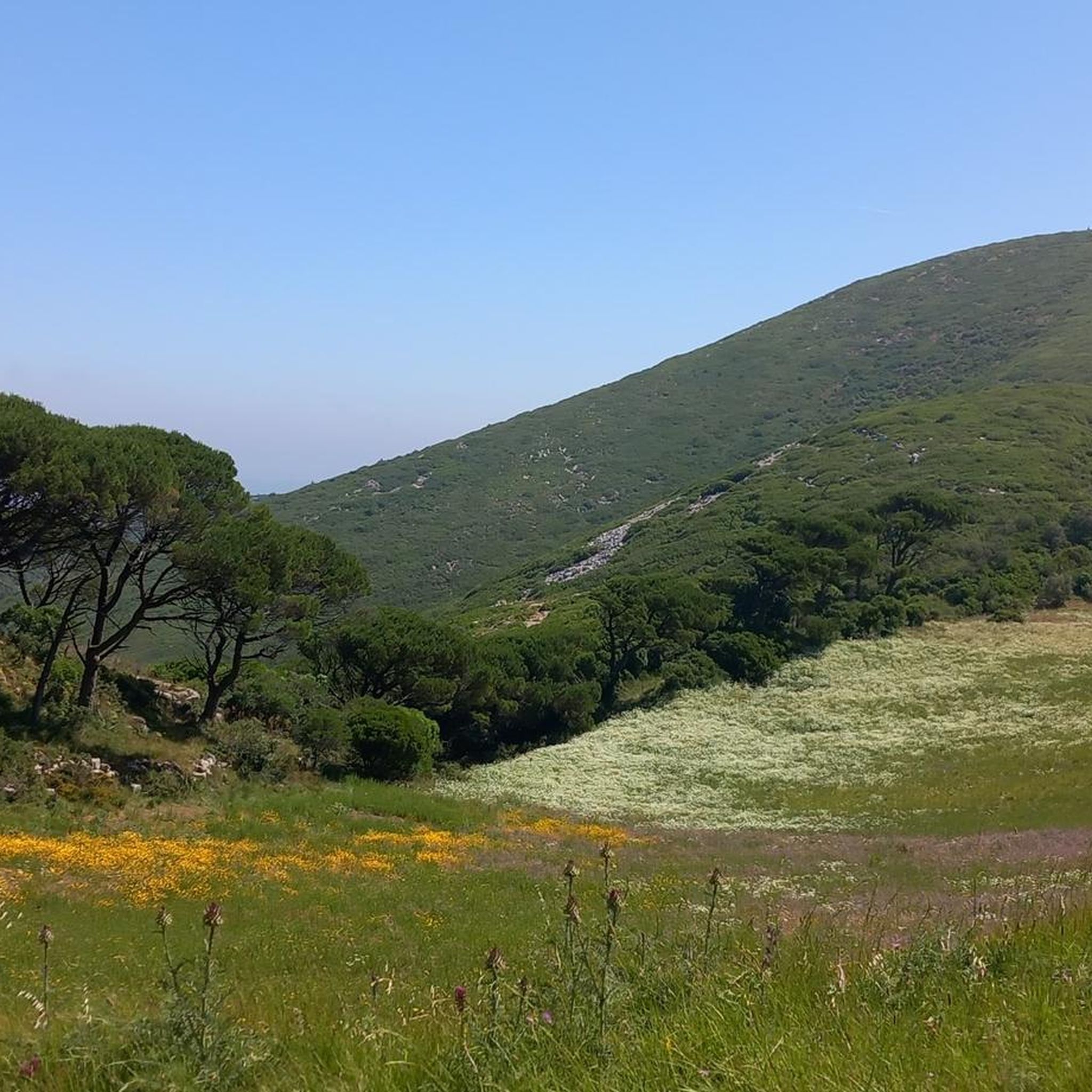
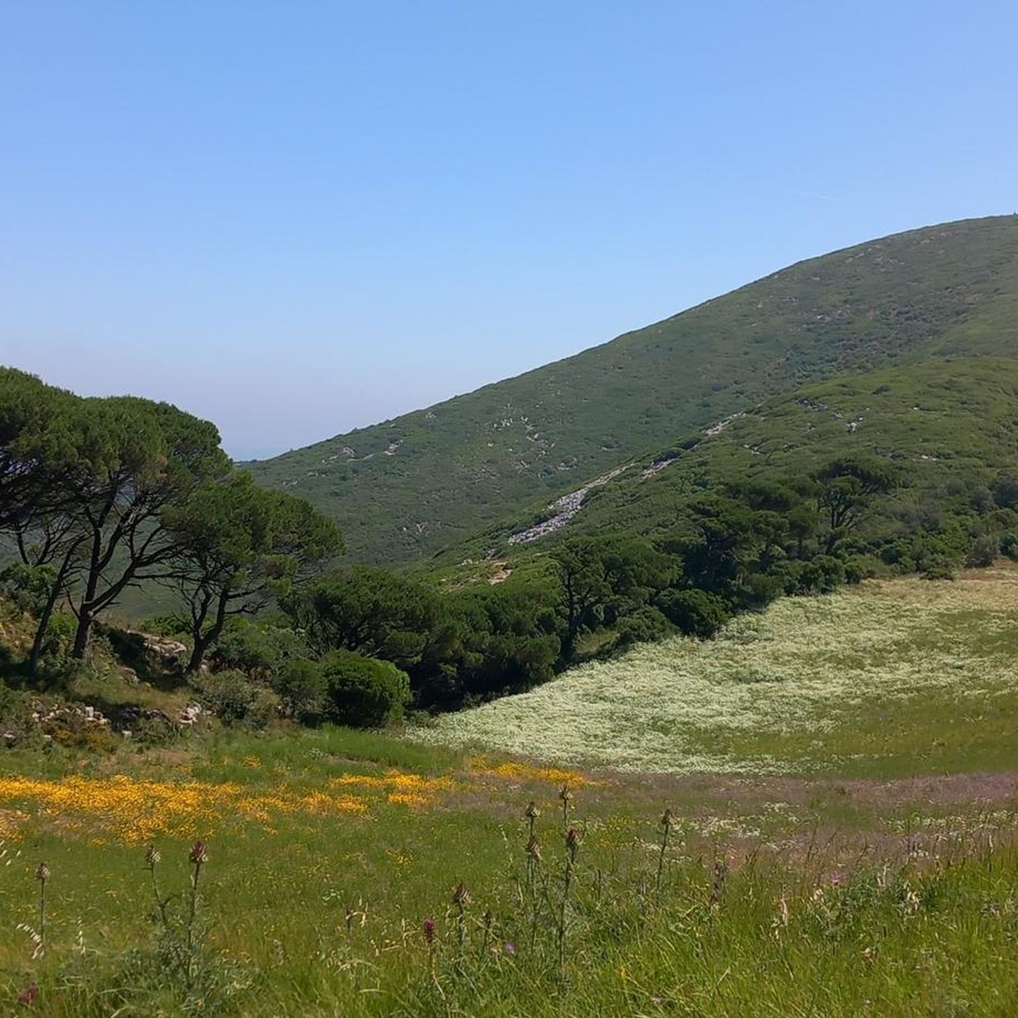
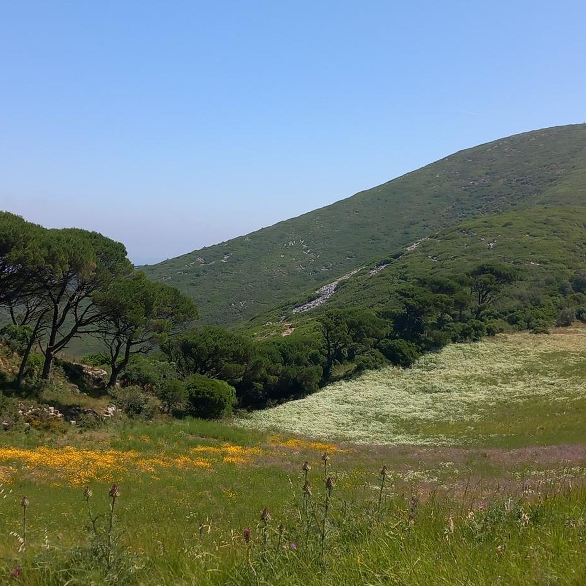
The karst landscape of Montejunto constitutes the extreme southwest of the Estremenho Limestone Massif. Deep valleys, lakes, gravel pits and lapiás are some of the formations found here, testimonies of various geological eras. Water has been the protagonist in erosion phenomena over time. Several deposits of gravel pits result from the cracking of the outcrops caused by the expansion of the water which, when freezing, breaks the rock into small parts. Source: https://montejunto.pt/natureza/paisagens/
3
0
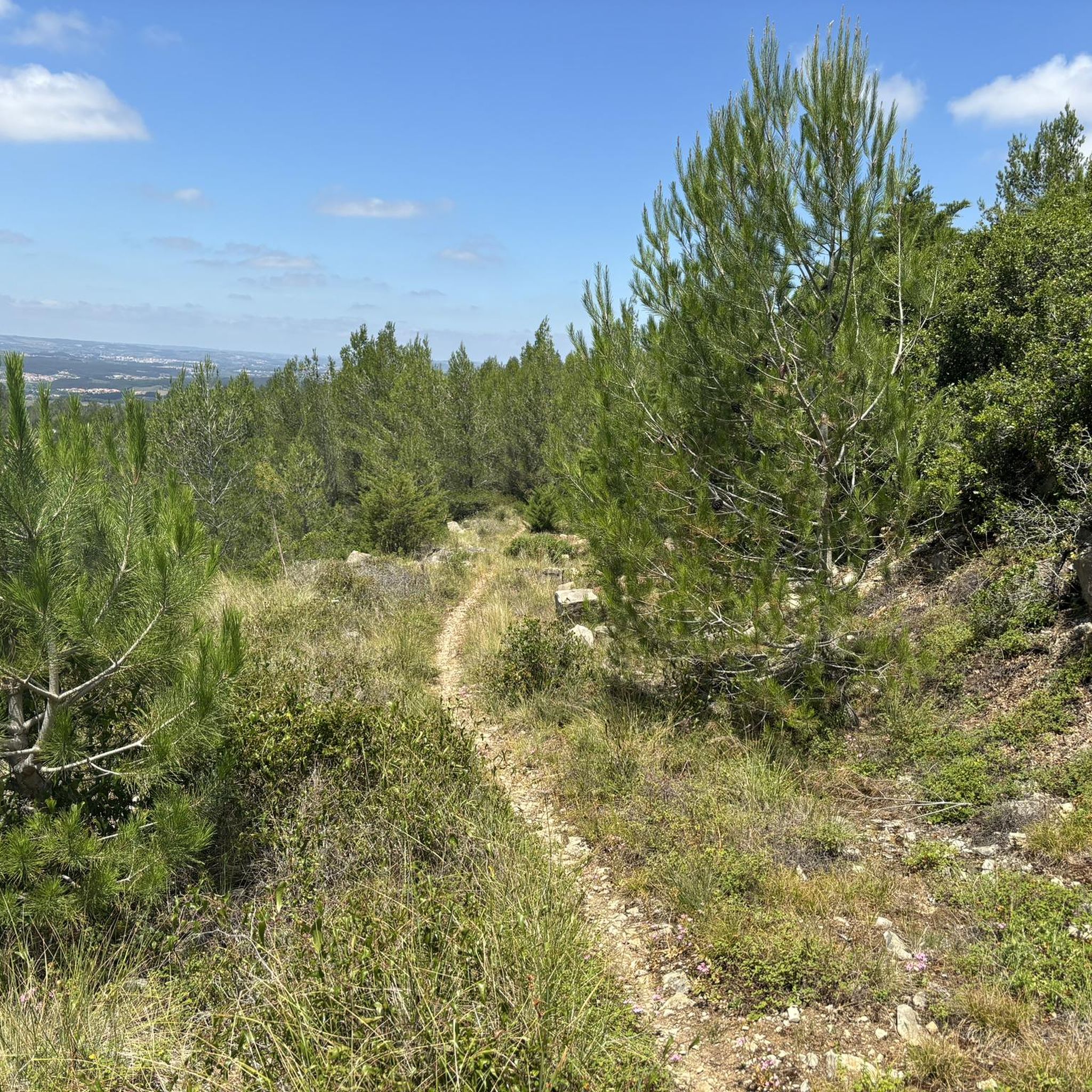
Small trail that goes through the stunning vegetation that surrounds it. At the end, the trail seems to have no way out, carefully pass between the ferns that are probably taller than you and that block visibility. Visit and respect and Nature.
3
0
Interesting trail, which passes right next to several windmills, some of them recovered. The trail has small sections with very steep slopes, so the easiest way to do it is downhill, that is, towards Serra de Montejunto, Vila Verde dos Francos. For those who are in Vila Verde dos Francos, it is preferable to go up the Estrada de Montejunto (N-115) to the sign that says Caminho dos Moinhos, and then turn right.
1
0
Frequently Asked Questions
What are some of the most popular natural monuments around Vilar?
The region around Vilar, particularly the Serra de Montejunto, offers several popular natural monuments. The Serra de Montejunto Watchtower is highly regarded for its panoramic views of the northern Serra. Another notable spot is Gravel Bend, which showcases the unique karst landscape with deep valleys and lapiás formations.
What kind of natural features can I expect to see around Vilar?
Vilar is characterized by the karst landscape of the Serra de Montejunto. You can observe geological formations like deep valleys, gravel pits, and lapiás, which are results of water erosion over time. The region also features significant river systems, such as the Ota River, known for its geomorphological characteristics, including the impressive 'Cannon' of its valley.
Are there family-friendly natural monuments or activities in the Vilar area?
While specific 'family-friendly' tags aren't always present, many natural monuments around Vilar can be enjoyed by families. The pastoral trail leading to the Serra de Montejunto Watchtower from a nearby picnic park offers an accessible outing. Exploring the Windmills of Serra de Montejunto can also be an engaging experience, though some trails have steep sections.
What outdoor activities can I do near the natural monuments around Vilar?
The area around Vilar is excellent for various outdoor activities. You can find numerous routes for cycling, mountain biking, and running. For instance, there are challenging cycling routes like the 'Quinta da Abrigada – View of Serra de Montejunto loop' (Cycling around Vilar), and mountain biking trails such as the 'Gravel Bend – Chapel of Saint George loop' (MTB Trails around Vilar). Running enthusiasts can explore trails like the 'Serra de Montejunto Windmills Trail' (Running Trails around Vilar).
Are there hiking trails near Vilar's natural monuments?
Yes, there are several hiking opportunities. The Montejunto - Squirrel Trail offers a walk through stunning vegetation. For more extensive options, you can explore the running trails guide, which includes routes like the 'Quinta da Serra Trail' and the 'Carreiro dos SS Loop Trail' (Running Trails around Vilar). Be aware that some trails may have steep sections or dense vegetation.
What is the best time of year to visit the natural monuments around Vilar?
The Serra de Montejunto region, where Vilar's natural monuments are located, is generally pleasant for outdoor activities during spring and autumn when temperatures are milder. Summer can be warm, while winter might bring cooler, potentially wet conditions, especially on higher trails. Always check local weather forecasts before your visit.
Are the natural monuments around Vilar dog-friendly?
Many natural areas and trails in Portugal are generally dog-friendly, provided dogs are kept on a leash and owners clean up after them. For specific natural monuments like the Montejunto - Squirrel Trail, dogs are usually welcome, but it's always advisable to check local signage or regulations for any specific restrictions in protected areas.
How long should I plan for a visit to the natural monuments in Vilar?
The duration of your visit depends on which natural monuments you choose to explore. A quick stop at a viewpoint like the Serra de Montejunto Watchtower might take an hour, while exploring the geological formations at Gravel Bend or hiking a trail could take several hours. For a comprehensive experience, consider dedicating a full day to the region.
What do visitors enjoy most about the natural monuments around Vilar?
Visitors frequently appreciate the stunning panoramic views, especially from spots like the Serra de Montejunto Watchtower. The unique karst landscape and geological formations at places like Gravel Bend also draw significant interest. The blend of natural beauty with historical elements, such as the recovered Windmills of Serra de Montejunto, is also a highlight for many.
Are there any hidden natural monuments or less-known spots worth visiting near Vilar?
While the main highlights are well-documented, exploring the various trails within the Serra de Montejunto can lead to less-trafficked areas. The Montejunto - Squirrel Trail, for example, offers a more intimate experience with the local vegetation and can feel quite secluded, especially if you venture slightly off the main paths.
Where can I find parking near the natural monuments in Vilar?
Parking availability varies by location. For popular spots like the Serra de Montejunto Watchtower, there is often parking available near the picnic park from which the pastoral trail begins. For other trails and natural monuments, you may find designated parking areas at trailheads or small pull-offs along access roads. It's advisable to check maps or local information for specific parking instructions for your chosen destination.
Most popular attractions around Vilar

Get inspired with the komoot mobile app


Explore more
Extend your search for the best caves by checking out these guides of the top ones around Vilar:
