Top 12 Natural Monuments around Vila Verde Dos Francos
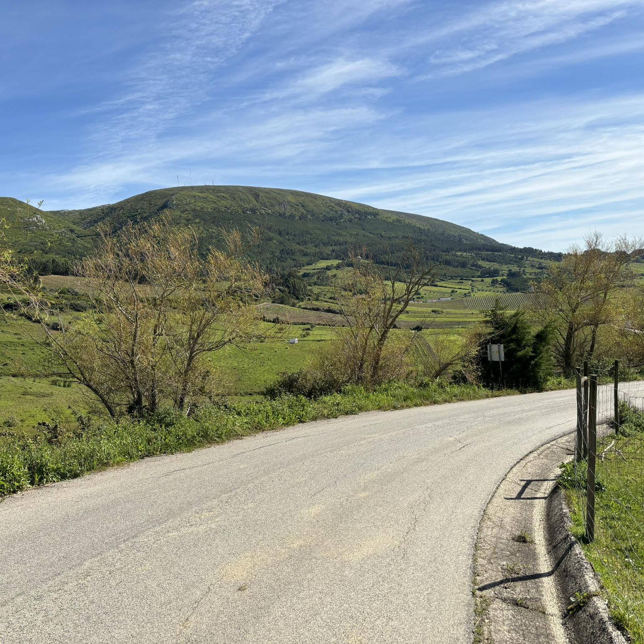
Best natural monuments around Vila Verde Dos Francos are primarily found within the Serra de Montejunto Protected Landscape, which borders the parish. This mountain range is the highest natural viewpoint in Estremadura, reaching an altitude of 666 meters. The region is characterized by diverse ecosystems and striking geological formations, including limestone cliffs and caves. It is an integral part of the Natura 2000 Network, highlighting its ecological importance.
Best natural monuments around Vila Verde Dos Francos
- The most popular natural…
Last updated: October 30, 2026
Castro de Pragança
Highlight • Historical Site
Translated by Google •
Tip by

Serra de Montejunto Watchtower
Highlight • Viewpoint
Translated by Google •
Tip by

Sign up now to discover places like this
Get recommendations on the best single tracks, peaks, & plenty of other exciting outdoor places.
Gravel Bend
Highlight • Natural Monument
Translated by Google •
Tip by
Ota River
Highlight • River
Translated by Google •
Tip by
Windmills of Serra de Montejunto
Highlight • Monument
The trail has small sections with very steep slopes, so the easiest way to do it is …
Translated by Google •
Tip by
Sign up for free to discover even more natural monuments around Vila Verde Dos Francos.
Already have an account?
Start today with a free account
Your next adventure awaits.
Tips from the Community

The area of the springs, on the Ota River, was once a leisure area for the local population, including the local bathing area in the summer. This site remained natural for a long time after the EPAL was installed, but at a certain point, the intensification of agriculture with the use of chemical fertilizers and pesticides, intensive livestock farming, and urban sewage made the flow from upstream a polluting threat to EPAL's water intakes, and EPAL paved several dozen meters of the river course near the site where it is installed with reinforced concrete.
1
0

The Ota River has its source in the Montejunto mountain range. It flows through the Ota area and empties into the Alenquer River, which in turn meets the Tagus River near Vila Nova da Rainha. At this point the river is close to the village of the same name, Ota.
1
0
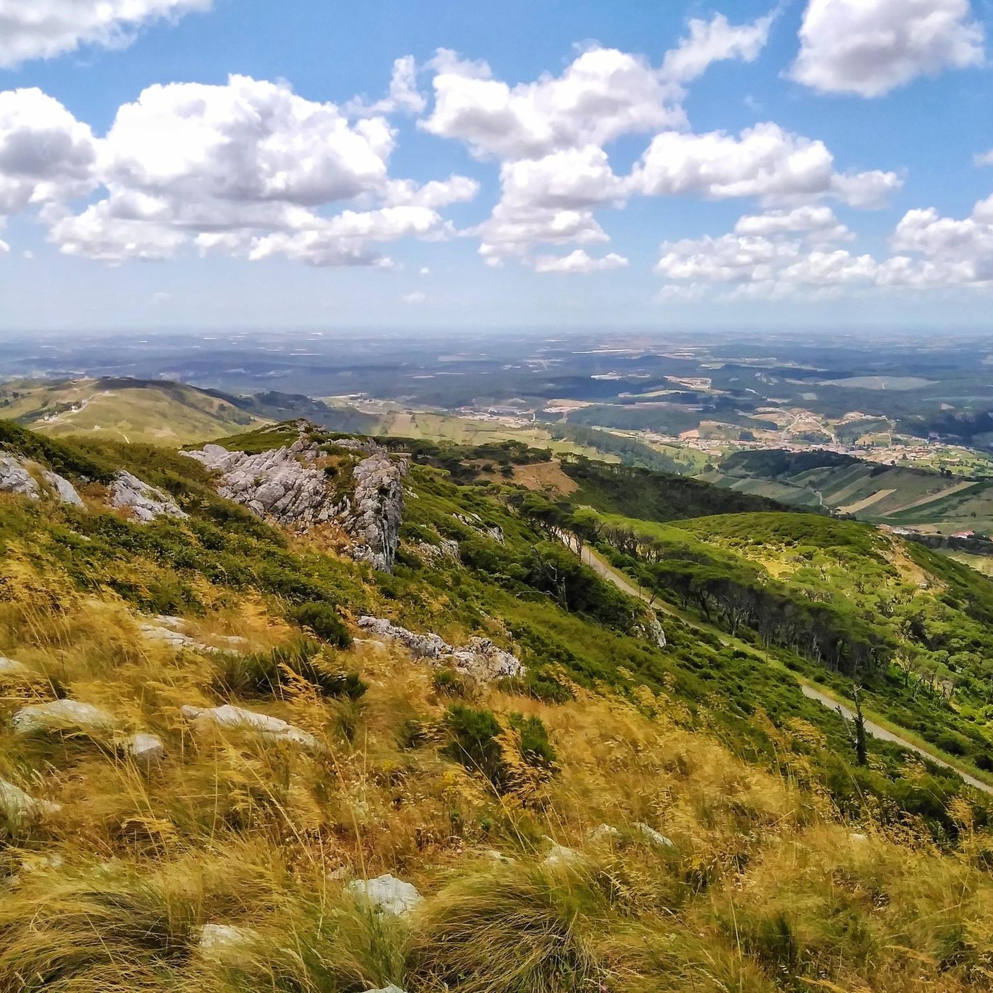
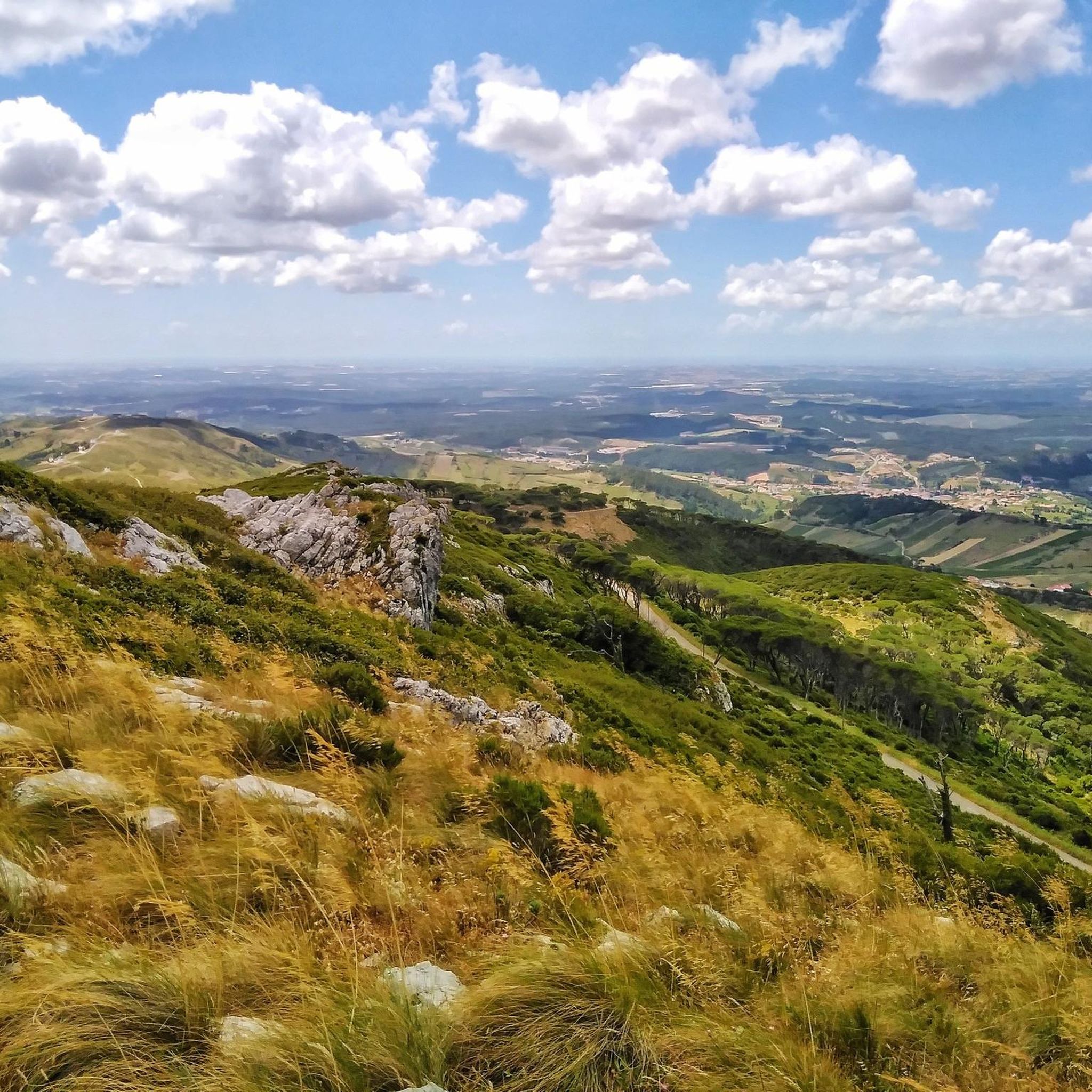
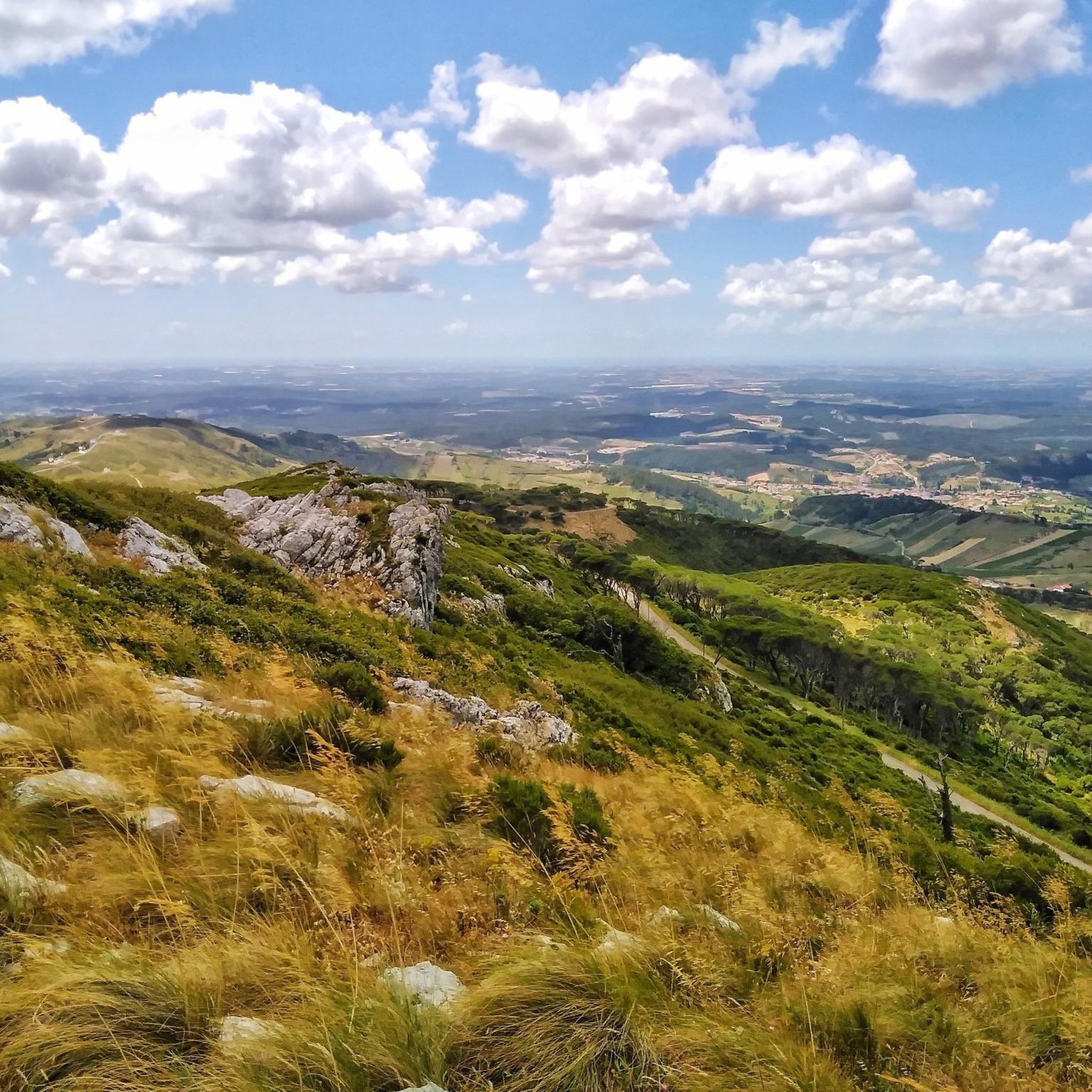
The Serra de Montejunto Forest Watch Station can be accessed via a pastoral trail from the picnic park. It offers a beautiful panorama of the region north of the Serra.
3
0
Castro de Pragança, located in Serra de Montejunto, is an archaeological site occupied from the Neolithic period to the Roman period. Discovered in 1893, its study revealed traces from various eras. Its archaeological collection is distributed across several national museums and, despite several excavation campaigns and studies, the Castro is currently in a state of abandonment. Its fortifications date back to the first half of the 3rd millennium BC, and the materials found include weights and metallic artefacts, indicating a prolonged and complex occupation.
1
0
The karst landscape of Montejunto constitutes the extreme southwest of the Estremenho Limestone Massif. Deep valleys, lakes, gravel pits and lapiás are some of the formations found here, testimonies of various geological eras. Water has been the protagonist in erosion phenomena over time. Several deposits of gravel pits result from the cracking of the outcrops caused by the expansion of the water which, when freezing, breaks the rock into small parts. Source: https://montejunto.pt/natureza/paisagens/
3
0
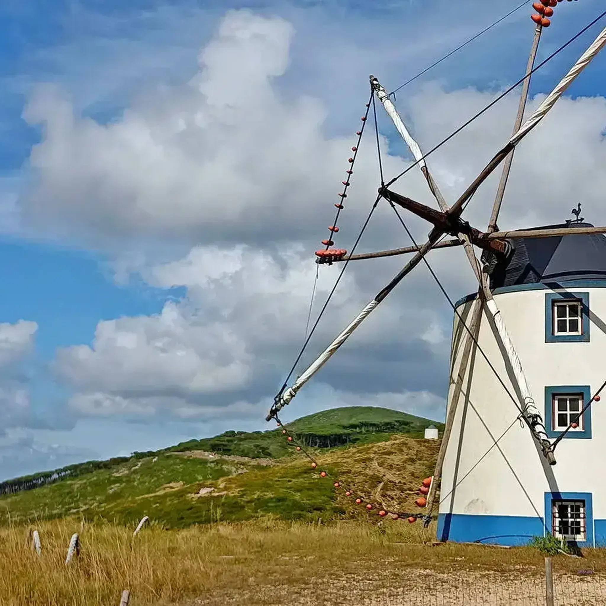
Interesting trail, which passes right next to several windmills, some of them recovered. The trail has small sections with very steep slopes, so the easiest way to do it is downhill, that is, towards Serra de Montejunto, Vila Verde dos Francos. For those who are in Vila Verde dos Francos, it is preferable to go up the Estrada de Montejunto (N-115) to the sign that says Caminho dos Moinhos, and then turn right.
1
0
It is located in Picoto do Castelo, close to Pragança, on the northwest slope of the Serra de Montejunto. It was discovered in 1893 and since then has been the subject of continued study. Traces found in the area indicate that it was a settlement occupied since the Late Neolithic, through the Copper, Bronze and Iron ages, and finally Romanized, with signs of occupation until the 1st century. several national museums, being considered very important for the study of Prehistory, Protohistory and the Romanization of the country. Castro de Pragança is currently in quite abandoned condition.
2
0
It rises in the Montejunto mountain range, passes through the clusters of Eiras, Abrigada, Atouguia, Ota and Aldeia, in the municipality of Alenquer and flows into the right bank of the Tagus river near Vila Nova da Rainha, side by side with the Alenquer river. Of its layout stands out, in particular, the “Cannon” of the Ota river valley, which presents geomorphological characteristics of the greatest relevance at a national level.
2
0
Frequently Asked Questions
What unique natural features can I explore around Vila Verde Dos Francos?
The region, particularly within the Serra de Montejunto Protected Landscape, is rich in diverse geological formations. You can discover prominent limestone cliffs, karst landscapes with deep valleys and gravel pits like at Gravel Bend, and intriguing caves such as Gruta das Tias. The area also boasts a significant river, the Ota River, known for its geomorphological characteristics.
What makes the Serra de Montejunto Protected Landscape significant?
The Serra de Montejunto Protected Landscape is the highest natural viewpoint in Estremadura, reaching 666 meters. It's renowned for its diverse ecosystems, striking geological formations, and rich biodiversity, including around 400 identified plant species and 75 bird species. It's also an integral part of the Natura 2000 Network, highlighting its ecological importance.
Are there any notable viewpoints to experience the natural beauty of the region?
Yes, the area offers breathtaking panoramic vistas. The Serra de Montejunto Watchtower provides expansive views of the region north of the Serra. Additionally, the Miradouro da Pedra do Leão is a must-visit for its stunning outlook across the valleys.
What kind of wildlife can I expect to see in the natural monuments area?
The Serra de Montejunto is a haven for wildlife, supporting a wide array of species. You might spot deer and a variety of birds, including endangered species like Bonelli's eagle and the Eurasian eagle-owl. The region's unique microclimate contributes to its rich biodiversity, making it a vibrant natural environment for observation.
Are there opportunities for rock climbing near Vila Verde Dos Francos?
Yes, for climbing enthusiasts, the region offers significant rocky outcrops. The Falhas do Cercal and da Rochaforte are notable, while Penha do Meio Dia and Escarpa do Relvio are particularly recommended for challenging and scenic climbing routes.
What hiking trails are available near the natural monuments?
There are several hiking opportunities. For easy hikes, you can explore routes like the Ota Karstic Canyon Trail or the View of Serra de Montejunto – Penha do Meio-Dia loop. You can find more details and routes in the Easy hikes around Vila Verde Dos Francos guide. The Montejunto - Squirrel Trail also offers a unique experience through stunning vegetation.
Can I find cycling routes around the natural monuments?
Absolutely. The area provides various cycling routes for different skill levels. For mountain biking, consider routes like the Moinho de Avis – Chapel of Saint George loop. Road cycling enthusiasts can explore routes such as the Forca Viewpoint – Alenquer Wine Museum loop. More options are available in the MTB Trails around Vila Verde Dos Francos and Road Cycling Routes around Vila Verde Dos Francos guides.
Are there family-friendly natural monuments or trails suitable for children?
Many of the natural areas within the Serra de Montejunto Protected Landscape are suitable for families. Easy hiking trails, such as those mentioned in the Easy hikes around Vila Verde Dos Francos guide, are generally good options. Exploring the geological formations and enjoying the viewpoints can also be engaging for children.
Are the natural monuments around Vila Verde Dos Francos dog-friendly?
Many natural areas and trails in the Serra de Montejunto Protected Landscape are generally dog-friendly, allowing you to enjoy the outdoors with your canine companion. However, it's always advisable to keep dogs on a leash, especially in areas with wildlife or near protected flora, and to follow local regulations.
What is the best time of year to visit the natural monuments around Vila Verde Dos Francos?
The region's unique microclimate, influenced by its proximity to the Atlantic, makes it pleasant for visiting throughout much of the year. Spring and autumn generally offer the most comfortable temperatures for hiking and exploring the natural monuments, with lush vegetation and active wildlife. Summer can be warm, while winter offers a different, often quieter, experience.
Are there any man-made structures that are part of the natural monument experience?
Yes, the Windmills of Serra de Montejunto are a notable example. These recovered structures are integrated into interesting trails, offering insight into local heritage while providing scenic routes through the natural landscape.
What do visitors enjoy most about the natural monuments in this area?
Visitors frequently appreciate the stunning vegetation and the unique geological formations, such as the karst landscape at Gravel Bend. The panoramic views from spots like the Serra de Montejunto Watchtower are also highly praised, offering exceptional photographic opportunities and a chance to appreciate the expansive natural beauty.
Most popular attractions around Vila Verde Dos Francos

Get inspired with the komoot mobile app


Explore more
Extend your search for the best caves by checking out these guides of the top ones around Vila Verde Dos Francos:
