Top 5 Natural Monuments around Baguer-Morvan
Best natural monuments around Baguer-Morvan are found within the Ille-et-Vilaine department of Brittany, France. This region features diverse landscapes, including distinctive hills, vast bay areas, and protected wetland ecosystems. The natural environment is characterized by its geological interest, significant biodiversity, and historical megalithic structures. These sites offer varied experiences for those exploring the natural and historical features of the area.
Best natural monuments around Baguer-Morvan
- The most popular natural monuments is The Fairies' House Dolmen, a historical site that is a megalithic complex located on the edge of the Forêt du Mesnil oak forest. This covered walkway, dating to about 2000 BC, features visible sculptures.
- Another must-see spot is Megalithic Tombs of Saint-Broladre, a historical site. Visitors can find these ancient burial structures, similar to 'Hunnebedden' in the Netherlands, alongside menhirs in Brittany.
- Visitors also love Menhir of Pierre Longue, a man-made monument. This fusiform monolith stands 6.50 m high and is notable for its size and the cross added to its summit, indicating its Christianization.
- Baguer-Morvan is known for its megalithic structures, distinctive hills, and wetland ecosystems. The area offers a variety of natural monuments to see and explore, from ancient historical sites to significant natural reserves.
- The natural monuments around Baguer-Morvan are appreciated by the komoot community, with more than 40 upvotes and 25 photos shared by visitors.
Last updated: November 4, 2026
Menhir of Champ-Dolent
Highlight • Monument
According to legend, two brothers and their armies clashed there. The celestial hand separated the warriors, a rock then fell from the sky, and penetrated heavily into the earth. Since then, this menhir sinks steadily an inch per century; the day when the stone of the Champ Dolent is completely buried, it is said that the world will end.
Translated by Google •
Tip by

The Fairies' House Dolmen
Highlight • Historical Site
Translated by Google •
Tip by

Sign up now to discover places like this
Get recommendations on the best single tracks, peaks, & plenty of other exciting outdoor places.
Megalithic Tombs of Saint-Broladre
Highlight • Historical Site
Translated by Google •
Tip by

Menhir of Pierre Longue
Highlight (Segment) • Monument
The menhir was Christianized by the addition of a cross on its summit.
In the nearby fields, several polished stone axes were found
Translated by Google •
Tip by

Menhir de la Butte
Highlight (Segment) • Monument
Translated by Google •
Tip by

Start today with a free account
Your next adventure awaits.

Tips from the Community

Numerous Breton legends surround the stone. One of the most famous tells that the menhir sinks a little deeper into the ground each year, and that its complete disappearance will signal the end of the world. Another legend sees it as a divine sign that separated two feuding brothers and gave the field the name "Champ-Dolent," or "Field of Sorrow."
1
0
South of Dol-de-Bretagne rises the Menhir du Champ-Dolent, a mighty granite block from the Neolithic period. At almost ten meters high, it is one of the largest surviving menhirs in France. Its weight is estimated at around 100 tons, and it was probably extracted from the immediate surroundings. Its original function remains unclear to this day—researchers suspect ritual or symbolic purposes, perhaps even an astronomical alignment.
1
0

A hike through sunken country paths. The highlight of the walk, the menhir, is worth the detour!
0
0

In the Netherlands we know them as 'Hunnebedden', but here in Brittany you will also find them next to the Menhirs.
1
0

Covered walkway (about 2000 BC) . You can see sculptures there.
1
0

The menhir is a fusiform monolith in small-grained granite, the nearest site of which is located 3 km1 away, which has been bush-hammered. It is 6.50 m high and 1.85 m at its maximum width. Its perimeter at the base reaches 7 m wide3. The menhir was Christianized by the addition of a cross on its summit. In the nearby fields, several polished stone axes were found
1
0

Greetings from Obelix: With a height of 9.50 meters, a circumference of 8.70 meters and a weight of around 120 tons, the Menhir du Champ-Dolent is one of the largest menhirs in Brittany. Free parking and picnic tables within sight.
1
0

It is the most imposing menhir in the region, standing almost 10 meters high. Its contour is 8.70 m on its widest part. According to legend, two brothers and their armies clashed there. The celestial hand separated the warriors, a rock then fell from the sky, and penetrated heavily into the earth. Since then, this menhir sinks steadily an inch per century; the day when the stone of the Champ Dolent is completely buried, it is said that the world will end.
4
0
Frequently Asked Questions
What are the most popular natural monuments around Baguer-Morvan?
The area around Baguer-Morvan is known for its ancient megalithic structures. Among the most popular are The Fairies' House Dolmen, a megalithic complex with visible sculptures, and the Megalithic Tombs of Saint-Broladre, ancient burial structures found alongside menhirs. Another significant site is the Menhir of Pierre Longue, a striking 6.50 m high monolith.
Are there family-friendly natural monuments to visit near Baguer-Morvan?
Yes, several natural monuments are suitable for families. Both The Fairies' House Dolmen and the Megalithic Tombs of Saint-Broladre are categorized as family-friendly, offering an engaging way to explore ancient history and natural settings together.
What kind of natural features can I expect to see in the Baguer-Morvan area?
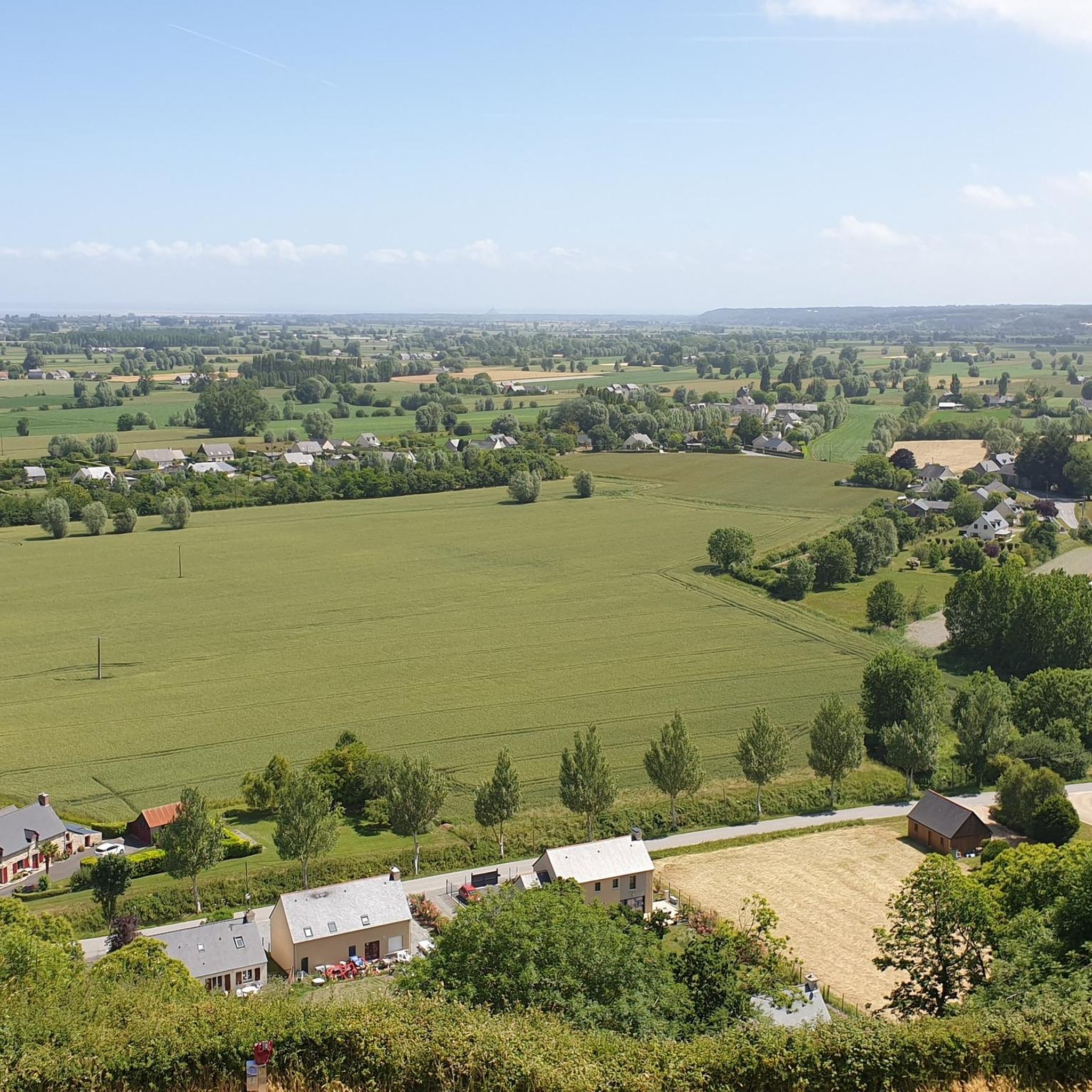
While Baguer-Morvan itself features gently rolling countryside with open fields and rural paths, its vicinity offers diverse natural features. You can explore distinctive hills, such as Le Tertre de Mont-Dol, and experience the unique environment of the Bay of Mont Saint-Michel, known for its vast mudflats and powerful tides. The area also has protected wetland ecosystems and ancient oak forests.
What outdoor activities can I do near these natural monuments?
The region offers various outdoor activities. For hiking, you can explore trails around Le Tertre de Mont-Dol, such as the Mont-Dol – Mont Dol Mill loop. There are also numerous cycling routes, including those that take you towards the Bay of Mont Saint-Michel or through the rural landscapes. You can find more details on routes for hiking, cycling, and road cycling around Baguer-Morvan.
Are there specific hiking trails near the natural monuments?
Yes, for instance, the Menhir de la Butte is reached via a hike through sunken country paths, making the journey part of the experience. The area's rural paths are generally suitable for exploring the agricultural landscape and connecting various hamlets. For more hiking options, check the hiking guide for Baguer-Morvan.
What is the terrain and difficulty level for hiking around Baguer-Morvan?
The terrain around Baguer-Morvan is generally accessible, characterized by gently rolling countryside with modest elevation changes. This makes it suitable for various fitness levels. Many paths are rural and connect hamlets, offering pleasant walks. Some highlights, like the Menhir of Pierre Longue and Menhir de la Butte, are rated as 'intermediate' for their accessibility, often involving walks through natural settings.
What historical or cultural sites are considered natural monuments in this region?
The region uniquely blends natural settings with ancient history. Many 'natural monuments' are actually megalithic structures, such as dolmens and menhirs, which are ancient man-made monuments set within the natural landscape. Examples include The Fairies' House Dolmen and the Menhir of Pierre Longue, which offer insights into prehistoric human activity in the natural environment.
What do visitors enjoy most about the natural monuments near Baguer-Morvan?
Visitors appreciate the blend of natural beauty and historical significance. The ancient megalithic sites, like The Fairies' House Dolmen, offer a glimpse into the past within serene natural surroundings. The opportunity to hike through rural paths to discover these monuments, such as the Menhir de la Butte, is also highly valued.
Is the Bay of Mont Saint-Michel considered a natural monument near Baguer-Morvan?
While Mont Saint-Michel itself is a cultural and historical marvel, the surrounding Bay of Mont Saint-Michel, located approximately 23 km from Baguer-Morvan, is indeed a significant natural environment. It's recognized as a UNESCO World Heritage site for its unique natural features, including immense mudflats and powerful tides, offering substantial natural beauty and ecological interest.
Are there any viewpoints or panoramic spots in the area?
Yes, Le Tertre de Mont-Dol, a prominent natural mound near Dol-de-Bretagne (about 5 km from Baguer-Morvan), offers panoramic views of the surrounding countryside. It's a popular spot for local hikers seeking scenic vistas.
What is the best time of year to visit the natural monuments around Baguer-Morvan?
The best time to visit is generally during the spring, summer, and early autumn months (April to October) when the weather is mild and conducive for outdoor activities like hiking and cycling. During these periods, the countryside is vibrant, and the conditions are ideal for exploring the megalithic sites and natural landscapes.
Most popular routes around Baguer-Morvan
Most popular attractions around Baguer-Morvan

Get inspired with the komoot mobile app


Explore more
Extend your search for the best caves by checking out these guides of the top ones around Baguer-Morvan:
