Top 6 Mountain Passes around Teror
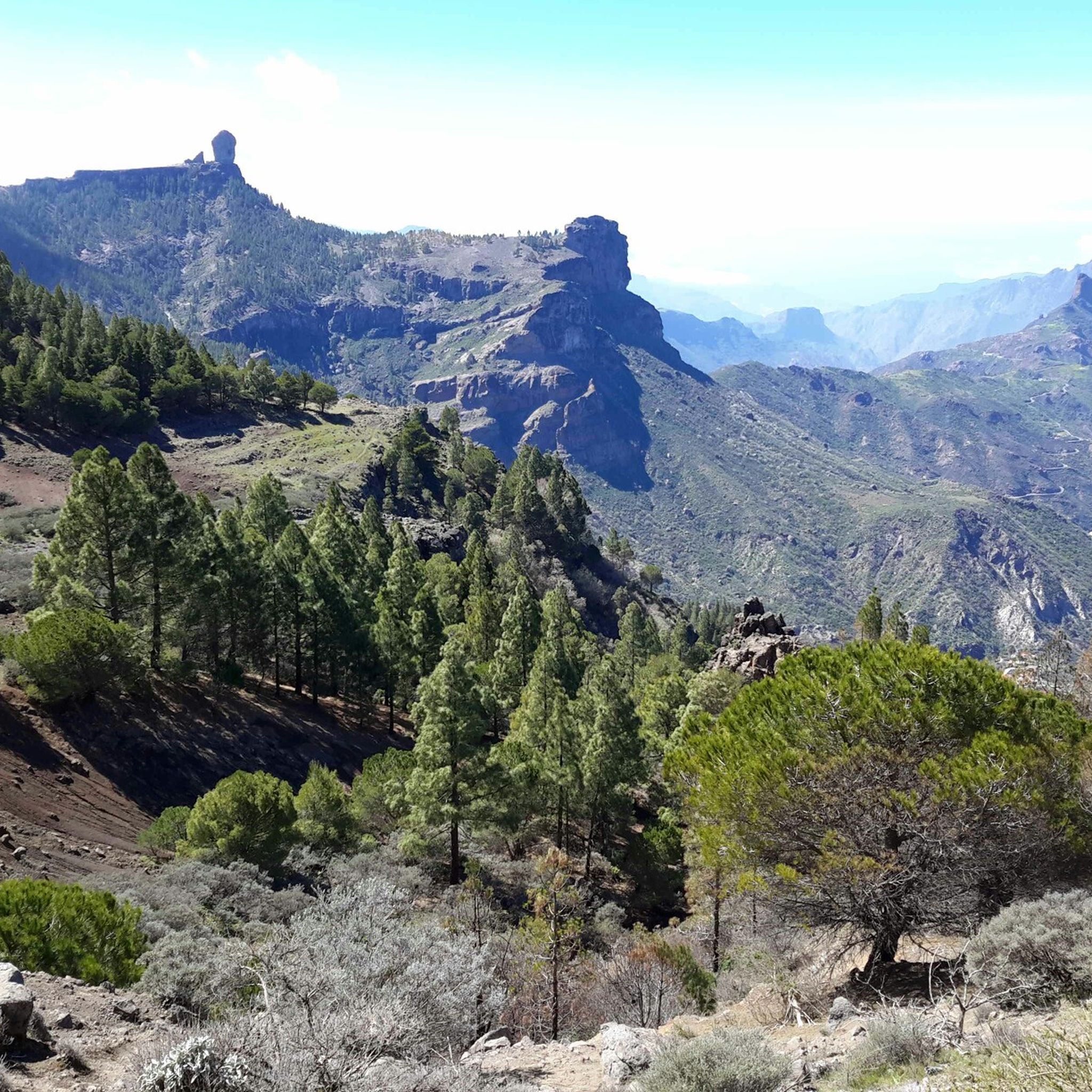
Best mountain passes around Teror are located in the mountainous heart of Gran Canaria, providing a range of scenic routes, viewpoints, and opportunities for outdoor exploration. The region features diverse landscapes, from winding roads to elevated hiking points, allowing for varied experiences. These areas offer access to the island's natural environment and panoramic vistas.
Best mountain passes around Teror
- The most popular mountain passes is San Bartolomé–Ayacata Road, a cycle way that offers scenic views. The surface is rough…
Last updated: October 4, 2026
Cruz de Tejeda
Highlight • Mountain Pass
Showing Translation
Tip by

San Bartolomé–Ayacata Road
Highlight (Segment) • Cycleway
Tip by

Sign up now to discover places like this
Get recommendations on the best single tracks, peaks, & plenty of other exciting outdoor places.
GC-130 Scenic Road
Highlight (Segment) • Mountain Pass
Translated by Google •
Tip by

Degollada de los Hornos Pass
Highlight • Mountain Pass
Showing Translation
Tip by

Risco Blanco
Highlight (Segment) • Mountain Pass
Translated by Google •
Tip by

Sign up for free to discover even more mountain passes around Teror.
Already have an account?
Start today with a free account
Your next adventure awaits.


Other adventures around Teror

Tips from the Community

In a magnificent location in the middle of pine forests, you can choose here to take the upper or lower hiking trail to climb to Pico de las Nieves.
0
0

The entire route is freshly paved. A dream.
1
0

From here you can go hiking, there is a public car park nearby. Locals offer various delicacies😊
1
0

Here you can decide whether you want to climb to the Pico de las Nieves via the upper or lower hiking trail.
4
0

Dangerous road with lots of gravel and potholes. The views are okay but not more pleasant than the main road.
0
0

you can get by on a racing bike. But more than 15kmh on the descent is not possible. In addition to the countless potholes, there is a lot of rolled gravel...
1
0

This is the first sign with directions to Ventana del Nublo, starting from the north you have to follow the signs of the "Camino de Santiago" up to this point (south) until you find the sign.
1
0
Beautiful route but difficult to descend due to poorer asphalt. Also watch the wind here
0
0
Frequently Asked Questions
What kind of mountainous experiences can I expect around Teror?
Teror, nestled in Gran Canaria's mountainous landscape, offers a variety of scenic routes, hiking trails, and viewpoints rather than traditional high-altitude mountain passes. You'll find breathtaking vistas, diverse ecosystems, and opportunities for exploration through winding roads and elevated hiking points.
Are there popular scenic drives or roads in the Teror area?
Yes, the San Bartolomé–Ayacata Road is a popular cycle way known for its scenic views, though the surface can be rough in parts. Another notable route is the GC-21, often called The Teror Road, which offers continuous panoramic views of mountains, valleys, and traditional architecture as you ascend from Las Palmas.
Where can I find the best panoramic views near Teror?
For expansive views, consider visiting Cruz de Tejeda, a well-known tourist hotspot with fantastic vistas. Another excellent spot is Cruz de Hoya Alta, which provides impressive outlooks over the village of Teror and the surrounding natural environment, often reached via moderate hiking routes.
What are some recommended hiking trails around Teror?
The El Álamo Trail, also known as Las Escaleras, is a popular hiking route through a lush natural forest, featuring distinctive metal and wooden staircases. For a rewarding outdoor experience with great views, consider the hike to Cruz de Hoya Alta. You can find more hiking options in the Mountain Hikes around Teror guide.
Are there any family-friendly mountain experiences in the Teror area?
Yes, Cruz de Tejeda is considered family-friendly, offering a settlement with facilities and views. The Finca de Osorio natural estate, which includes Pico de Osorio, also provides interesting routes for hikers and a nature classroom, making it suitable for families to explore.
What natural features can I explore in the mountainous areas near Teror?
The Finca de Osorio natural estate is a protected area covering 207 hectares, characterized by roads, mountains, ravines, farmland, and forests. The El Álamo Trail is known for its lush natural forest and diverse vegetation. These areas offer a chance to experience Gran Canaria's rich natural environment.
What outdoor activities can I do near these mountainous routes?
Besides hiking, the region around Teror is excellent for cycling. You can find various routes for gravel biking and road cycling. Explore options in the Gravel biking around Teror and Road Cycling Routes around Teror guides.
Are there places to eat or get refreshments near the mountain routes?
Yes, at Cruz de Tejeda, you'll find a few restaurants, cafes, and craft stalls. The Hotel Parador de Cruz de Tejeda also has a restaurant. Additionally, some tips mention quaint pubs in Ayacata, which can be found along the San Bartolomé–Ayacata Road.
What is the best time to visit the mountains around Teror for outdoor activities?
Gran Canaria generally enjoys a mild climate year-round. For hiking and cycling, spring and autumn offer pleasant temperatures, avoiding the peak heat of summer. Winter can also be a good time, though higher elevations might be cooler and occasionally misty. Always check local weather forecasts before heading out.
What are the difficulty levels of hiking trails near Teror?
Hiking trails around Teror vary in difficulty. For instance, the hike to Cruz de Hoya Alta is described as moderate. Some routes, like those found in the Mountain Hikes around Teror guide, range from moderate to difficult, offering challenges for different fitness levels. Always check specific route details for elevation and terrain.
Can I find viewpoints that are easily accessible by car?
Yes, the GC-21 (The Teror Road) is a scenic drive that offers continuous panoramic views directly from your vehicle. Cruz de Tejeda is also accessible by car and serves as a major viewpoint and tourist hub.
What do visitors enjoy most about the mountainous areas around Teror?
Visitors frequently highlight the fantastic views and the diverse natural beauty. The unique experience of driving through scenic roads like the GC-21, the rewarding hikes to viewpoints like Cruz de Hoya Alta, and the charm of places like Cruz de Tejeda are often praised. The opportunity to immerse oneself in the island's rural charm and explore varied landscapes is a major draw.
Most popular routes around Teror
Most popular attractions around Teror

Get inspired with the komoot mobile app


Explore more
See even more epic mountain passes by checking out these guides around Teror:
