The 20 Most Amazing Peaks around Häfelfingen
Mountain peaks around Häfelfingen offer elevated points within the Jura Mountains, providing opportunities for hiking and panoramic views. This municipality in the canton of Basel-Landschaft, Switzerland, features prominent summits that serve as excellent destinations for outdoor activities. The region is characterized by its wooded slopes and diverse terrain, making it suitable for various levels of exploration. Visitors can experience both natural viewpoints and historical sites across these elevated landscapes.
Best mountain peaks around Häfelfingen
- The most popular mountain peaks is…
Last updated: September 27, 2026
Geissflue
Highlight • Viewpoint
Translated by Google •
Tip by

Wisenberg Observation Tower
Highlight • Monument
The forest grew higher and higher, making it necessary to expand the tower.
Translated by Google •
Tip by
Sign up now to discover places like this
Get recommendations on the best single tracks, peaks, & plenty of other exciting outdoor places.
Belchenflue Summit Viewpoint
Highlight • Summit
Translated by Google •
Tip by
Lauchflue Summit and Observation Bunker
Highlight • Summit
Translated by Google •
Tip by

Geissfluhgrat — Highest point in the Canton of Aargau
Highlight • Summit
Unfortunately, from here you do not have the brilliant view as from the Geissflue.
Translated by Google •
Tip by
Sign up for free to discover even more peaks around Häfelfingen.
Already have an account?
Start today with a free account
Your next adventure awaits.
Tips from the Community

Impressive viewing point. Former tank turret - part of the First World War memorial trail
0
0

This viewpoint is located on the highest point of the Swiss Belchen on the border between Baselland and Solothurn and is best reached on foot. There are no public transport stations nearby. A car park is available 5 minutes on foot below the Chilchzimmersattel. From there it is a 15-minute hike to the Belchenfluh. Further information The famous "Belchenflue" viewpoint was used as an observation post in World War I and was blasted into its current form. The Belchensüdstrasse between Ifenthal and the Belchenflue commemorates the troops involved in the construction with numerous coats of arms, which immortalized themselves in the rock after the work was completed.
15
2
The wooded 1041.8m high Lauchflue is a somewhat independent peak in the Upper Basel area. To the north it has a rock face up to 80m high, which gives you a beautiful view of the Ergolz Valley and the Black Forest. To the southeast lies the slightly higher Schällenberg (1064m), which is separated from the Lauchflue by the Lauch saddle (1014m). The Lauchflue is easily accessible via hiking trails (T1), and on the summit there is a military observation facility from the time of the First World War (Fortification Hauenstein). Trivia: The lid of the observation post comes from the boiler of a steam locomotive. https://www.hikr.org/wiki/post10006.html
5
1

A real highlight after a hard climb, for example from the Waldenburg ruins. The climb is a level T2 with a few trial passages in T3. So be sure to bring good shoes and sufficient fitness.
1
0
Since the Wiesenberg is in the forest, this observation tower makes sense. It takes hikers above the treetops and allows a 360-degree panorama. There are panorama boards. The climb is worth it.
6
0

Romantic paths over rocky ridges invite you to climb the Belchenflue at 1,099 m with a unique panoramic view. The viewpoint is located at the highest point of Belchen on the border between Baselland and Solothurn and can be reached on foot. https://www.baselland-tourismus.ch/poi/belchenfluh
6
0

Very nice path over the Belchenflue, sure-footedness is sometimes required, especially when it is wet
8
0

During the Second World War, this tower was used as an air observation post. The forest grew higher and higher, making it necessary to expand the tower. In 1953, it was increased by 6 meters and in 1987 by a further 9.5 meters.
8
0
Frequently Asked Questions
What are the most prominent mountain peaks around Häfelfingen?
The most prominent peak directly associated with Häfelfingen is the Wisenberg, which at 1,002 meters is the highest point within the municipality and features the Wisenberg Observation Tower. Another significant elevated point in the eastern Jura Mountains, offering impressive views, is the Geissflue (963 m).
What unique features does the Wisenberg offer?
The Wisenberg is notable for its Wisenberg Observation Tower, which stands at 24.5 meters high and provides a 360-degree panoramic view. From the tower, you can see the Homburger valley, the Tabular Jura, and on clear days, even the distant Alps, Black Forest, and Vosges mountains. The area also has historical significance and a large fire pit with grilling facilities.
Are there family-friendly mountain peaks around Häfelfingen?
Yes, the Wisenberg Observation Tower is categorized as family-friendly. The area around Wisenberg is popular for hiking and walking, making it suitable for a day trip with family, especially with the grilling facilities near the tower.
What kind of views can I expect from the Geissflue?
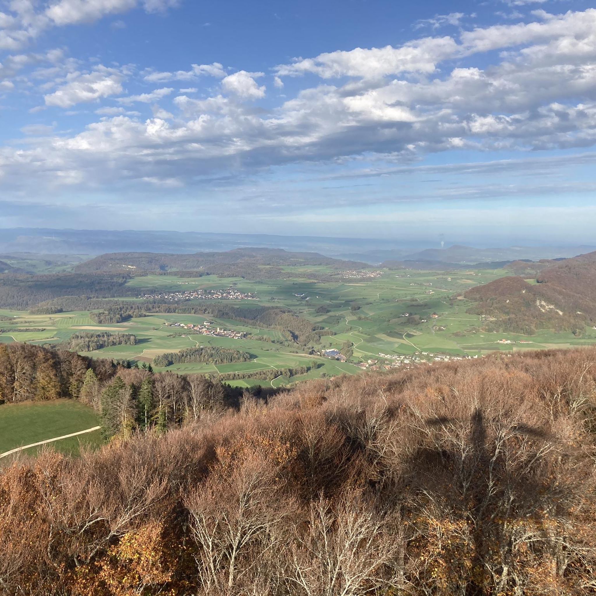
The Geissflue is renowned for its "ingenious view" of the surrounding regions. From here, you can enjoy vistas across the Baden region, Alsace, the Basel area, the Fricktal, and the Black Forest.
Are there challenging mountain climbs for experienced hikers?
For those seeking more challenging routes, the Belchenflue Summit Viewpoint and Lauchflue Summit and Observation Bunker are categorized as challenging. The path over the Belchenflue, for instance, requires sure-footedness, especially when wet.
What historical sites can be found on the mountain peaks?
Several peaks offer historical insights. The Wisenberg Observation Tower has been used as a high watchpoint for centuries and an artillery observation post. The Lauchflue Summit features a military observation facility from World War I, and the Belchenflue Summit Viewpoint was also used as an observation post during World War I.
What is the highest point in the Canton of Aargau near Häfelfingen?
The highest point in the Canton of Aargau is the Geissfluhgrat, at 908 meters above sea level. It is located right next to a hiking trail, offering a brief detour for those interested in reaching this geographical landmark.
What outdoor activities can I do near these mountain peaks?
The region around Häfelfingen offers a variety of outdoor activities. You can find numerous road cycling routes, such as the "Wasserturmplatz, Liestal – Liestal City Gate (Törli) loop from Diepflingen," or explore cycling tours like the "Chilchzimmersattel – Ober-Bölchen Mountain Inn loop from Läufelfingen." For mountain biking enthusiasts, there are trails like the "Wisenberg Observation Tower – Hupp Lodge loop from Wisen SO." You can find more details on these activities in the Road Cycling Routes around Häfelfingen, Cycling around Häfelfingen, and MTB Trails around Häfelfingen guides.
What is the best time of year to hike the mountain peaks around Häfelfingen?
The Jura Mountains, including the peaks around Häfelfingen, are generally best enjoyed for hiking from spring through autumn. During these seasons, the weather is typically milder, and trails are clear of snow, offering optimal conditions for panoramic views and outdoor activities. Always check local weather forecasts before your visit.
Is public transport available to reach the mountain peaks?
While some peaks like the Belchenflue Summit Viewpoint do not have public transport stations nearby, they are often accessible via a short hike from a car park. For the Geissflue, it can be reached from the Naturfreundehaus Schafmatt or from the Barmelweid (bus stop). It's advisable to check specific routes and access points for each peak.
What do visitors enjoy most about the mountain peaks around Häfelfingen?
Visitors particularly appreciate the rewarding panoramic views from summits like the Belchenflue and the 360-degree vistas from the Wisenberg Observation Tower. The combination of natural beauty, historical significance, and well-maintained hiking trails makes the region a popular destination for outdoor enthusiasts.
Are there places to eat or rest near the mountain trails?
Near the Wisenberg summit, there is a large fire pit with grilling facilities, making it an ideal spot for a picnic or a break during your hike. For other areas, it's recommended to check local amenities or plan to bring your own provisions.
Most popular routes around Häfelfingen
Most popular attractions around Häfelfingen

Get inspired with the komoot mobile app


Explore more
See even more amazing summits around Häfelfingen with these guides:
